Category: Premium Content (Page 256 of 452)

This content is for Premium Members only.
BoulderCAST Daily – Sun 09/13/20 | Middle 80’s with no cloud in sight

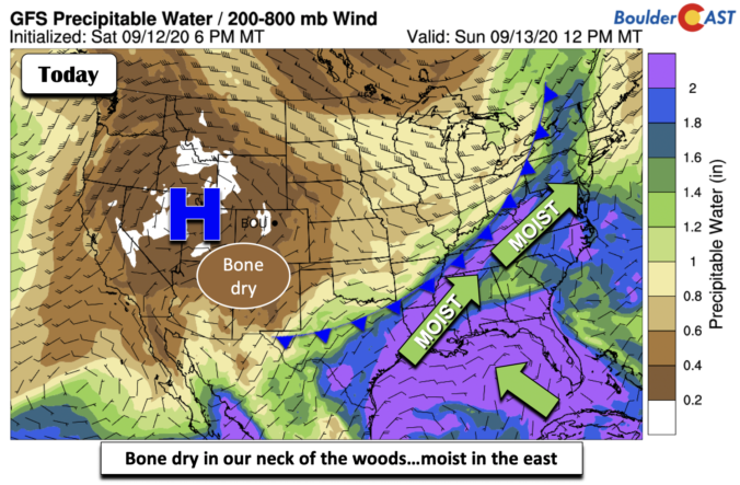
Detailed Forecast Discussion We are bone dry in Colorado and portions to the west of us (below). This is due to us being under the ridge of high pressure. However, a different picture is seen to the east over the Ohio Valley and the East Coast. High moisture there is tied to an approaching cold front and tropical cyclone Sally …

BoulderCAST Daily – Sat 09/12/20 | Beautiful weather takes hold

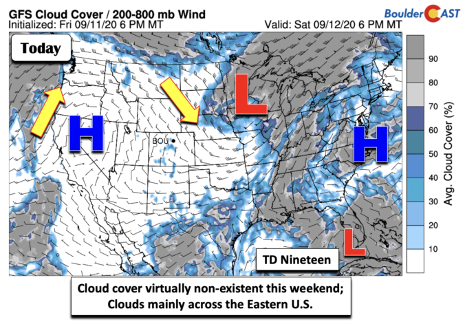
Detailed Forecast Discussion A gorgeous weekend is setting up across the state and over the Plains today and tomorrow. With the exit of the low pressure into the Midwest (below), high pressure will take over both days and lead to continued moderating temperatures. No extreme heat is expected as well, just your typical fall season weather. Tropical Depression Nineteen has …

BoulderCAST Daily – Fri 09/11/20 | Low pressure finally moving out…great weekend ahead

Detailed Forecast Discussion That pesky remnant area of low pressure, which has been with us this entire week, bringing snow to unsettled cloudy weather, will finally make its way out of the state later tonight and especially tomorrow. This morning, the center of circulation was across far northeastern Colorado and western Nebraska. Expect some clouds around for the first part …

BoulderCAST Daily – Thu 09/10/20 | Mostly cloudy with isolated flurries/sprinkles

TDetailed Forecast Discussion he pesky upper-low continues to spin across southeastern Utah and slowly fill. The term "fill" is something we use to describe a weakening storm system that is literally "filling with air" causing the pressure of the low to rise and thus weaken. GOES-East water vapor imagery shows the rather stagnant storm system to our west. This remnant …

BoulderCAST Daily – Wed 09/09/20 | Morning flurries, remaining unseasonably cold

MDetailed Forecast Discussion ost of our area ended up dodging a bullet with snow totals coming in on the lower end of the spectrum. Boulder reported nearly 5" of heavy wet snow with this wintry system. This wasn't the earliest occurrence of snow in Boulder, but it was indeed the earliest accumulation on record. The view from the webcam downtown …

*Premium* Winter Storm Update: Tue 09/08/20 7:30AM

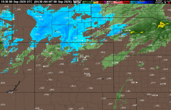
We've seen temperatures fall nearly sixty degrees over the last 14 hours (93°F to 33°F), but it still hasn't been enough to change rain fully over to snow across the lowest elevations. It looks like the delayed arrival of the cold air we talked about in our video discussion yesterday has verified to some degree. There is some lower elevation …

« Older posts Newer posts »