Category: Premium Content (Page 214 of 452)

This content is for Premium Members only.

BoulderCAST Daily – Sun 08/29/21 | Decreasing clouds with continued smoke, watching Hurricane Nora’s remnants

ADetailed Forecast Discussion: s expected, the cold front has pushed through overnight and a layer of stratus has developed across most of the Denver Metro area. The clouds won't be sticking around long though as the moisture is rather shallow and will mix out quickly this morning. Our webcam in Boulder is already showing hints of blue sky through the …

BoulderCAST Daily – Sat 08/28/21 | Smoke and a chance of severe storms approaches tonight

YDetailed Forecast Discussion: esterday's true color satellite image is shown below. There are a lot of things worth noting on the figure, but probably the most worthy candidate is the widespread wildfire smoke across northern California, Nevada, northern Utah, and Wyoming. This plume of smoke will reach the Front Range this evening as a mid-level trough brings a cold front …

BoulderCAST Daily – Fri 08/27/21 | Temperatures return to the lower 90s

YDetailed Forecast Discussion: esterday's trough axis has pushed east. However, there is another trough axis to our west today over Utah, northwest Wyoming, and central to eastern Montana. Most of the lift associated with this trough is up to our north. As a result, most of our day will feature plentiful sunshine. A warmer south-southwest flow aloft will aid our …

BoulderCAST Daily – Thu 08/26/21 | Scattered afternoon & evening thunderstorms, the smoke plume returns this weekend

WDetailed Forecast Discussion: eak large-scale lift will be on the increase through the day today as a trough approaches northern Colorado from the west. This morning the trough axis is located over Idaho and Nevada. By evening, it will be pushing into western Colorado. Water vapor imagery this morning shows the approaching trough in western Idaho and Nevada. Some early …

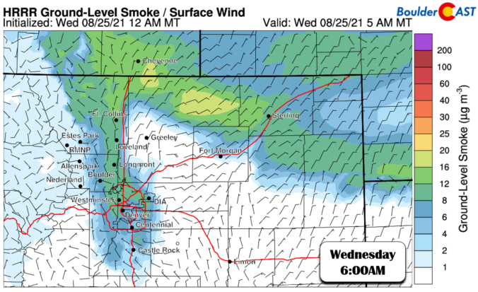
BoulderCAST Daily – Wed 08/25/21 | Smoky air returns, low confidence regarding strong evening thunderstorms

WDetailed Forecast Discussion: arm southwest flow continues to prevail across Colorado today as the pattern has changed very little thus far this week. A trough is noted across the Pacific Northwest, with a high pressure center over Oklahoma. Pinched in between, we've been experiencing dry and moderate southwest flow all week with above normal temperatures and minimal thunderstorm activity. This …

BoulderCAST Daily – Tue 08/24/21 | Sunny & continued hot in the lower 90’s

EDetailed Forecast Discussion: xtremely dry air is situated over Colorado and most of the West today. Precipitable water is very low at the moment in Denver, with values through the day expected to reside at or below 0.4". This will result in definitively sunny skies and no chance of rain for the Front Range. GOES-East water vapor imagery shows the …

BoulderCAST Daily – Sun 08/22/21 | Warmer with highs near 90

BDetailed Forecast Discussion: road southwest flow has taken over across Colorado today. Yesterday's warm front has lifted well east of us into the upper Midwest as the low pressure system sets up over eastern Montana. Behind it, drier air and warmer temperatures will ensue this afternoon with lots of sunshine. Just above the surface, the airmass warms 3-4 degrees today, …

« Older posts Newer posts »