

Category: Premium Content (Page 174 of 451)

This content is for Premium Members only.
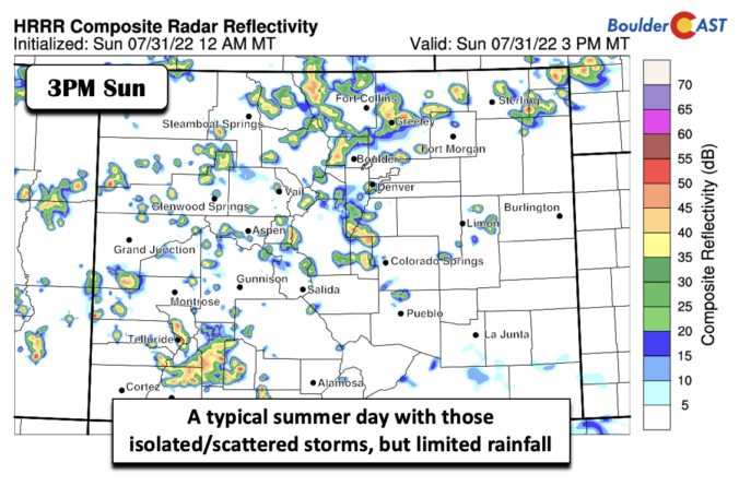
BoulderCAST Daily – Sun 07/31/22 | Slight uptick in rain chances on this last day of July

The mid-level ridge today moves ever so slightly to the west near the Four Corners. The slight movement will allow for an increase in shower/storm activity to reach the Plains from the higher terrain, as opposed to yesterday in which most storms resided over the High Country. Though, any storms will be limited rain producers given weak flow. Highs today …

BoulderCAST Daily – Sat 07/30/22 | Rain chances again reduced as 90s return

Today's pattern is very similar to Friday, except for a warmer airmass over the area. The deepest moisture and lift/forcing continues to be located over the higher terrain west of Denver and over the south/southwest part of the state. To that end, we can once again expect the best chance of any storms today over the High Country and especially …

BoulderCAST Daily – Fri 07/29/22 | Precipitation chances remain, but highest south

T  he cold front remains draped along eastern Colorado and the Front Range today and tonight. It has pushed south across the Mid-Mississippi Valley today and into the Ohio Valley, bringing much cooler temperatures there. The hottest temperatures remain anchored across the far west, near the Pacific Coast and into interior California and Nevada. As the upslope surface flow continues …

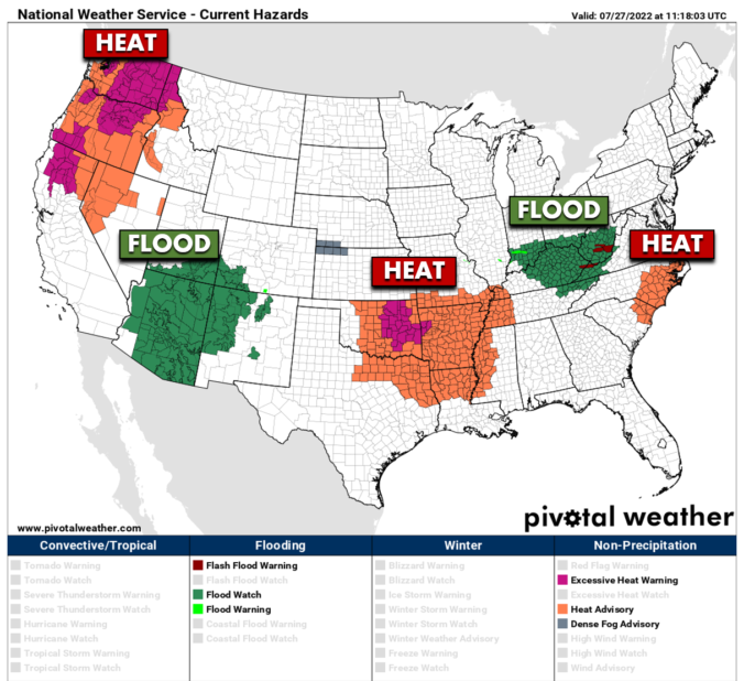
BoulderCAST Daily – Wed 07/27/22 | Storms return late this evening, the flash flood risk spikes on Thursday

Yesterday ended up being a fairly active day for slow-moving thunderstorms across the Front Range, though the storms were still hit-or-miss. Some parts of the Metro area received more than 1" of rainfall, while others gathered next to nothing. The radar animation below was from last night around 10PM as strong thunderstorms moved through the Denver area. The graphics below …

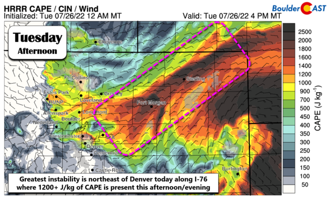
BoulderCAST Daily – Tue 07/26/22 | Slightly cooler and stormier with some severe weather northeast of Denver

Today will be one last somewhat drier day across the Front Range before monsoon moisture begins to surge and rain chances trend upward the rest of the week. GOES-East mid-level water vapor imagery this morning shows that high pressure is situated over northeast Texas. Clockwise flow around this high is currently driving a highly visible pipeline of monsoon moisture into …

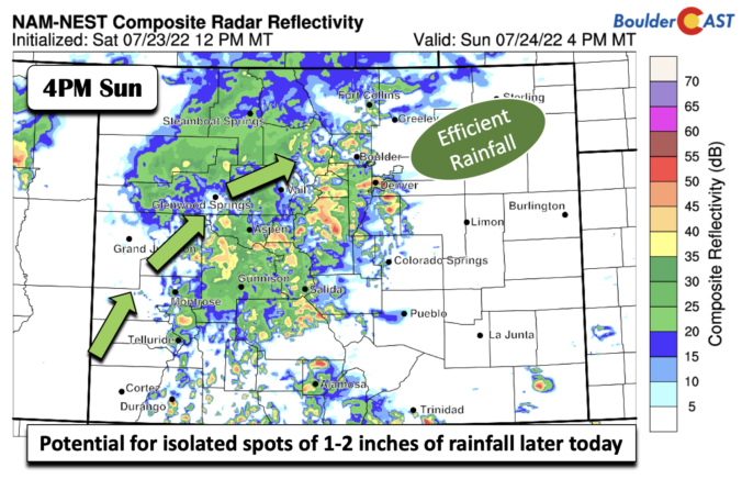
BoulderCAST Daily – Sun 07/24/22 | Widespread showers and storms capable of damaging winds and flash flooding

Aclassic setup for heavy rainfall is in place this afternoon and tonight. The image below shows the 250 mb flow today. This is a textbook pattern you would see in a meteorology textbook of heavy rainfall potential, especially for the intermountain West. At 250 mb, there is a jet streak positioned west-east from Idaho into the Dakotas. To the south, …

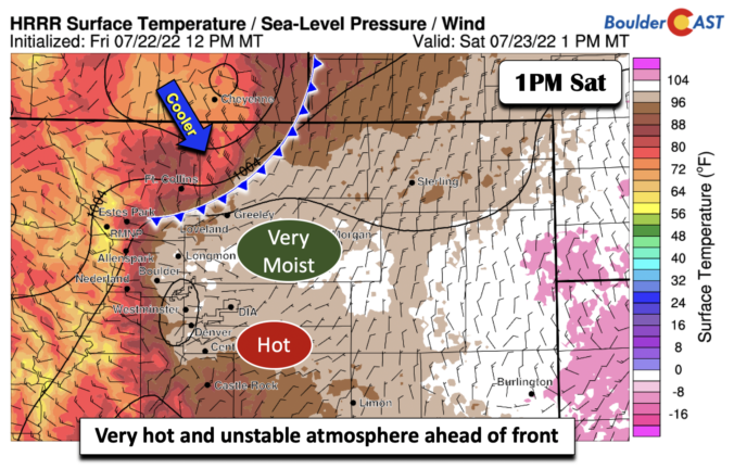
BoulderCAST Daily – Sat 07/23/22 | A cold front leads to widespread showers and storms

Aweak but noticeable cold front slides south this afternoon from Wyoming and Nebraska. Ahead of the front, temperatures will again be hot in the mid to upper 90s. The approach of the front, however, will usher in cooler temperatures on Sunday, a welcomed change, but also widespread showers/storms this afternoon/tonight. As the mid-level ridge slides east just enough today, the …

« Older posts Newer posts »