Category: Premium Content (Page 152 of 451)

This content is for Premium Members only.

BoulderCAST Daily – Wed 02/01/23 | Lots of sun as the warming trend continues

Welcome to February --- the last month of meteorological winter! Temperatures are starting out variable as bitter cold inversions remain over part of the Front Range --- mainly in areas north and east which are in the single digits and teens (and even below zero near Greeley). The cold pool has been perturbed by downslope coming off the terrain in …

BoulderCAST Daily – Tue 01/31/23 | Sunny & not as cold as we begin a slow warming trend

This last day of January will be a cold one again! Current temperatures across the area range from the positive single digits to the negative single digits. The coldest readings are in the South Platte Valley from Longmont to Greeley. Considering the wind, it actually feels colder this morning than it was yesterday, with some areas seeing -20°F wind chills. …

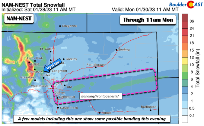
BoulderCAST Daily – Sun 01/29/23 | Morning freezing fog/drizzle trends to a second round of light snow this evening

The Arctic air is well entrenched across the Front Range today. Any light snow this morning will quickly taper off, though some lingering freezing fog or freezing drizzle could persist into the afternoon under overcast skies. Our highs will only top out in the single digits near Boulder and perhaps the lower teens in Denver. It will be very cold …

BoulderCAST Daily – Fri 01/27/23 | Highs in the lower 40s today; gusty winds tonight ahead of a cold front

An upper-low over Idaho will track to our north into Wyoming and the northern Great Plains today/tonight. This afternoon, it will be located in Idaho. This track will bring deep moisture and upslope to the mountains of north and northwest Colorado. This will bring hefty snow totals to the ski resorts like Steamboat, which we'll discuss in a minute. Downstream …

This Weekend in Colorado Weather: January 26, 2023

The final shortwave disturbance of the week is moving through the area this morning. There has been a few lingering flurries south and east of Denver with this wave, but for the most part today will be our first snow-free day of the week as somewhat drier, subsident air works into the Front Range from the northwest. A mid-level stable …

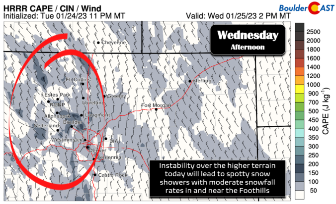
BoulderCAST Daily – Wed 01/25/23 | Staying cold with spotty snowflakes, a chance of high winds late Thursday

We're starting out in the teens and lower 20s this morning with a few flurries and snow showers across the area, mainly east of Interstate 25. Nothing is really substantial and at best you can expect a light skiff of snow to develop through the morning. Radar is just barely picking up a couple flurries over portions of eastern Boulder …

BoulderCAST Daily – Tue 01/24/23 | Flurries & light snow develop this evening, linger on-and-off into Wednesday night

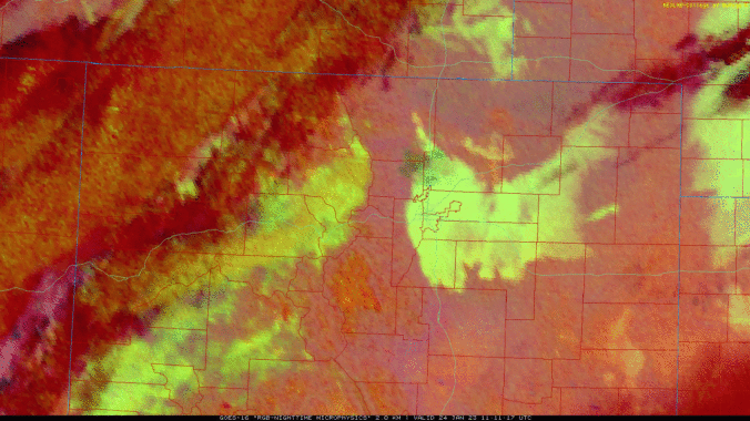
Fog was widespread across the area overnight at one point but has since diminished and is now located mainly along the base of the Foothills. Note the dissipation of the fog (white shading) in the GOES-East satellite animation below which is the nighttime cloud microphysics product. The potent cut-off low that missed Colorado remains well to our south and will …

« Older posts Newer posts »