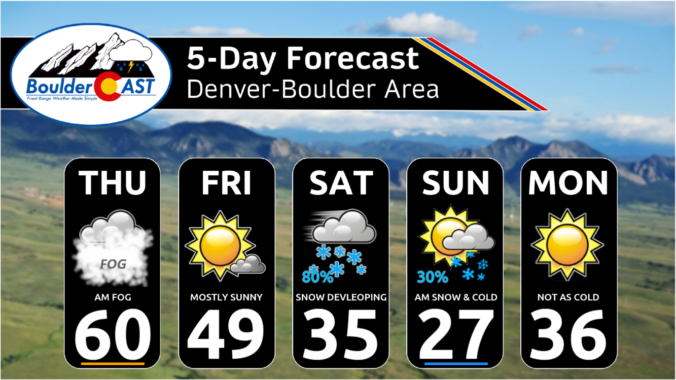
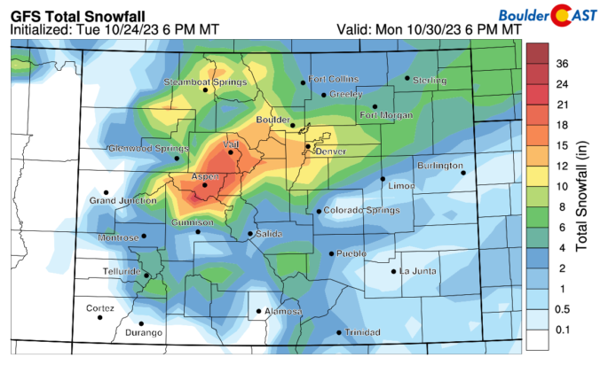
Our first snowfall of the season remains on track. The overnight model guidance solutions did not change much from what was mentioned in our snowfall forecast yesterday. As such, our forecast snow amounts are unchanged. The main things we want to convey for today is the timing of the heavy snow bands and temperatures. The high-res models are showing some …
The stalled frontal boundary across northeast Colorado is surging south and west again this morning spreading dense fog and areas of low clouds into the Metro area from the northeast. The same places that saw the fog on Wednesday will likely see it again this morning, with even more widespread coverage than yesterday. Travel with caution during the early to …
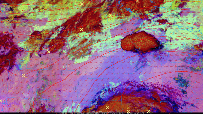
Fog has developed across portions of northeast Colorado overnight as a weak frontal boundary has backed westward towards the Front Range. You can see the fog eerily creeping westward towards Boulder and Denver in the GOES-East nighttime-microphysics animation below. The fog will continue to expand west and south during the early morning hours, but it probably won't reach everyone. Either …
The weak mid-level disturbance to our north has moved eastward into the Dakotas with its trailing cold front dropping south through eastern Colorado overnight. The main meat-and-potatoes of this front will remain well east of our area today --- these locations are seeing low clouds and fog develop this morning behind the front. Notice the white layer expanding in the …
We are under weak high pressure ridging today. We are also between systems with one over the Dakotas and a second one over northern California. Given this, we should see lots of sunshine. At the surface, weak low pressure will develop east of the Rockies near Kansas with a light WNW surface wind. Highs should be about the same as …
Aweak backdoor cold front pushed through the region. However, compared to yesterday when we thought the front would penetrate further south and west, the latest guidance is not as robust with the passage. With that, the airmass is not slated to be that much cooler compared to Friday, when we were in the mid 80s. The airmass will be a …
Acontrast in weather from one coast to the other today. Our warmth for late October continues to be in place. Meanwhile, a large trough dives southeast from the Great Lakes region and brings a cold front into the Mid-Atlantic states. Much of the eastern US has been near to somewhat below normal and that will continue into the weekend behind …