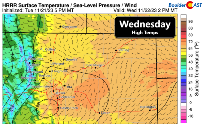
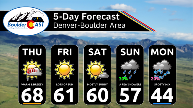
Today will be the last really nice day across the Front Range before we slump into a chilly pattern throughout the holiday weekend. The last of the warmth will unfold with sunny skies and light winds for our Wednesday. Most of us will top out in the 60s for highs, though some lower 70s may be possible on the south …
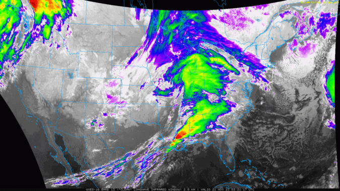
Yesterday's big, windy storm is long gone already this morning, now located in the Great Lakes region. High pressure is working in behind this departing storm with skies having fully cleared overnight back across all of Colorado. In fact, clear skies are noted across much of the West, which is of course thanks to an expansive ridge growing into the …
An area of low pressure will develop to our east tonight and track into the central Plains tomorrow (below), bringing down cooler air and northerly winds for a gusty Monday. The northerly winds will for a brief while bring some upslope to the Plains, largely south of Denver near the Palmer Divide. For today, the system will just be developing, …
Ashortwave in the southwest flow will move across the state this afternoon and evening and lead to increasing mid/high clouds through the day/evening. It will still be a mild day, however, with temperatures near the lower 60s once again. The shortwave will not produce any rainfall, but snow will develop across the higher terrain with upslope flow developing there. We …
Aridge of high pressure builds east today. The trough which brought a cold front through yesterday has pushed into the Ohio Valley. An offshore low exists west of California and could be a player for us late this weekend and early next week. The cold front also continues to push east toward the Mid-Mississippi and Ohio valleys. The lingering cool …
Skies are mostly cloudy out there this morning as high clouds stream into Colorado from the southwest, with a mixture of wave clouds sprinkled in as well. The GOES-East nighttime satellite animation is shown below with lots of clouds noted over the region. With this cloud cover and downslope gusts , we have yet another mild morning for most of …
Very little change occurs in our weather today as a weak ridge remains over the area with west-southwest flow aloft over Colorado. The NAM 500mb vorticity forecast animation below runs from this morning into Thursday night. It shows the ridging in place today, but also two different pieces of energy that will be converging on us tomorrow --- one from …