Category: Premium Content (Page 109 of 451)

This content is for Premium Members only.
Premium BoulderCAST Daily – Sat 03/09/24 | Mild weather returns this weekend

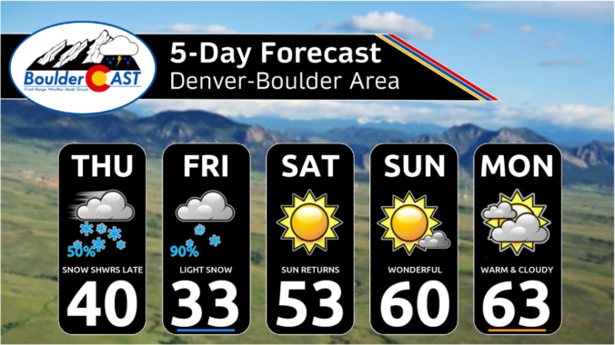
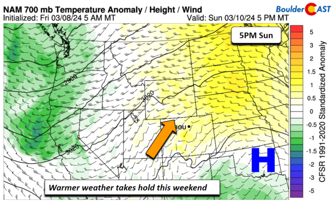
High pressure ridging takes over for our weekend and likely lingers into early next week as well. Our next shot of unsettled weather is not until the middle of next week. For today, high pressure will be anchored over Utah/Colorado and that will spread east on our Sunday to Kansas. Our highs this afternoon will generally hover in the lower …

Premium BoulderCAST Daily – Fri 03/08/24 | Light snow tapering off by mid to late afternoon

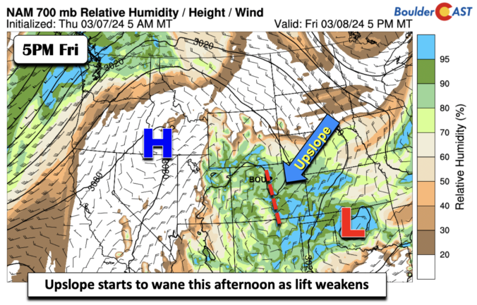
Atrough axis of low pressure over Oklahoma and Texas today is bringing light upslope flow to the Foothills and Plains today and into the early evening hours. The latest model solutions have lessened on snowfall totals for the event today. What has led to that? One reason is that the models are showing less forcing and weaker upslope flow for …

Premium BoulderCAST Daily – Thu 03/07/24 | Much colder today with snow developing this evening, but there are a few tweaks to expected snowfall amounts

Over the last several model runs, we've seen a concerning shift in the way a line of convergence is handled well east of the Front Range today through this evening. Heavy snowfall, up to 10 inches worth, is now expected to fall across the far northeast corner of the state. This is in stark contrast to what models were showing …

Premium BoulderCAST Daily – Wed 03/06/24 | Pushing towards 60 degrees today, but uncertainty abounds for potential heavy snow arriving late Thursday!

Relatively benign west-southwest flow remains draped across Colorado today as we sit between several broader storm systems --- a cold trough sliding east across southern portions of Canada and the subtropical jet stream to our south in Arizona and New Mexico. The real system to watch is a weak low pressure coming ashore in California right now --- that one …

Premium BoulderCAST Daily – Tue 03/05/24 | Increasing clouds with a stray light rain shower possible late in the day

For the most part things will be rather quiet across the Denver Metro area the next two days, but not completely quiet. The NAM 500mb vorticity forecast animation below shows flattened west-southwest flow across Colorado, with more pronounced troughs over the Pacific Northwest and moving into California. Despite this appearance, there is a very subtle shortwave expected to pass across …

Premium BoulderCAST Daily – Sun 03/03/24 | Some weak snow banding this morning

Astrong trough over the Dakotas and central Canada has brought a cold front through the region earlier this morning. Colder air will start our day in the lower 30s. However, southwest flow will persist through the afternoon and evening with the strong height gradient in place. This southwest flow will aid warming this afternoon with highs rebounding to near the …

Premium BoulderCAST Daily – Sat 03/02/24 | Red Flag Warning conditions today, followed by snow chances overnight

Astrong trough over the Pacific Northwest will track onshore and into Montana and the Dakotas by tomorrow morning. The flow over Colorado will remain out of the southwest today. The flow is certainly stronger than Friday, favoring strong and gusty winds off the higher terrain today. Gusts of 30-40 mph will be the norm on the Plains and the Denver …

« Older posts Newer posts »