
A welcomed cool-down will transpire early in the week as a strong Pacific trough moves across the Rockies. However, accompanying the cooler temperatures will be very strong winds Monday evening and night, as well as widespread rain and even some wet snow in the higher elevations. By mid-week, yet another ridge of high pressure will begin to take shape leading to a warming and drying trend for the Front Range.
Category: Forecast (Page 93 of 169)
⦁❶⦁ Hot and mostly dry with just a 10% chance of an afternoon shower or weak storm
⦁❷⦁ Due to a very dry lower atmosphere, strong gusty outflows expected but brief light rainfall
⦁❸⦁ Hot with temperatures peaking in the lower 90’s by early afternoon
⦁❹⦁ Deeper moisture arrives tomorrow from the southwest with an uptick in storm activity expected

The month of June starts out very warm with temperatures in the high 80’s to near 90 degrees each day. Along with the heat, there will be a persistent but minor threat of thunderstorms each day through the week. We also discuss the outlook for the month of June as a whole.

The week ahead is one typical for the last week of May. We have some warmer days, some cooler ones and chances for rain throughout the forecast. Let’s take a look!
It’s been a while since we provided a forecast update for a significant weather event, but here we are. A potent and surprisingly cold spring storm is taking aim on the area with quite a bit of moisture set to drop over the next 36 hours. We take a look at timing of the cold rain, potential rainfall amounts, and discuss which areas may even see a little bit of late-season snow.

Thanks to the interplay between a potent trough and ridge, our temperatures will soar into the 80’s to start the third week of May, followed by a late-week “cool” down. Weather stays overall dry but there is some severe weather potential to speak of for eastern Colorado.
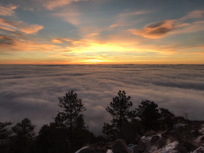
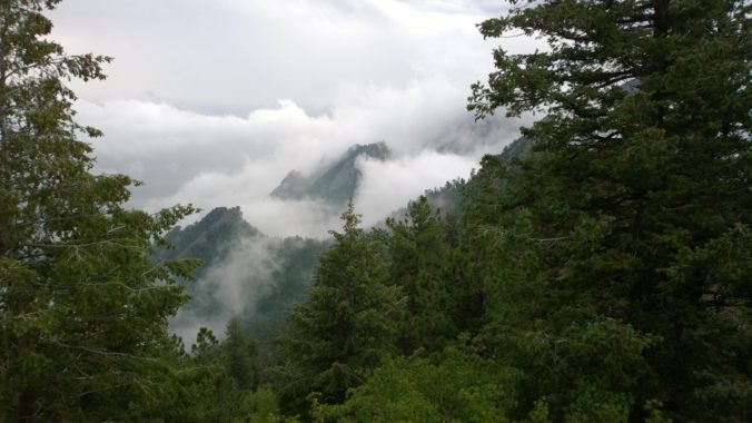
Not surprisingly, many of you are outdoor-oriented and we get asked this question a lot. If you look out the window and see low clouds or fog blanketing your area, there is a decent chance that some or all of the peaks just west of town are soaking in the sun, but not always. We walk you through the process of how to determine the elevation of the top of the cloud deck and how it relates to the hiking options near Boulder and Denver.

In typical May fashion, a rather unsettled week lies ahead with chances of rain and thick clouds expected nearly every day. Temperatures start out chilly on Monday but will moderate back closer to normal the rest of the week despite continued wet weather.

Live View of Boulder

Current Conditions

Live Radar

Latest Smoke Forecast

Recent Premium Posts

This Weekend in Colorado Weather: Several More Scorching Days Ahead Before the Long‑Awaited Monsoon Pattern Arrives
☀️ Persistent heat continues — Low to mid‑90s through Saturday, spiking towards the …
BoulderCAST Daily – Wed 07/15/26 | The Ridge Rules the Rockies as Hot, Dry Pattern Holds Firm
🔥 Heat dome setup continues — A strong, stationary 500 mb ridge keeps …
BoulderCAST Daily – Tue 07/14/26 | The Front Range Continues to Bake Under Expansive Ridge
🔥 Heat streak continues — Boulder hit 97°F for the third time in …
3-Day Forecast

Trending Content

© 2026 Front Range Weather, LLC