Category: Forecast (Page 19 of 161)

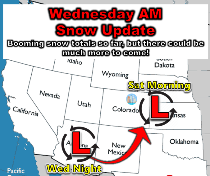
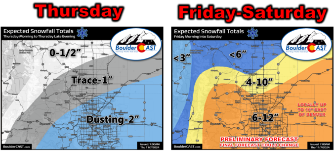
Wednesday AM Update: Booming snow totals across the region already, and the forecast doesn’t get any easier the rest of the week!
The onset of snowfall Tuesday evening was earlier and heavier than expected leading to booming overnight snow totals which range from 1 to 10″ across the Front Range already. We’re still far from done with this storm and its associated challenging forecast, with additional light snow expected today and Thursday, followed by potentially heavier snow late on Friday as the main storm system passes directly across eastern Colorado. Read on for the latest developments on what should be a cold and snowy rest of the week!
Winter Weather Update: Another round of snow moves in Tuesday night through Wednesday, worst in the southern Metro area (Updated)
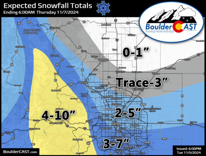
A new storm system will drop across far western Colorado Tuesday night, but it’s heading for the deserts of southern Arizona. In the process of bypassing the Front Range, it will bring light snow to the Denver Metro area starting Tuesday night as temperatures tumble below freezing. Intermittent snow showers and flurries will linger through the day Wednesday leading to minor accumulations in Boulder and Denver, but higher totals are favored further south. There is also the potential for a more impactful storm to hit our area on Saturday, but that continues to look more unlikely by the day. Read on for the latest on the chilly and unsettled days ahead.
Updated (Tue 11/5/24 7:00 PM): The higher-end outcomes we touched on in the original post have become more likely give the latest model guidance. Though some snowflakes are already flying, we have amended our snowfall forecast map with a slight increase of 1-2″ across the board for the Metro area. Remember this is a long duration (mostly light) snowfall event, lasting from Tuesday evening at least into Wednesday afternoon. Light snow may continue well into Wednesday night, but this is still uncertain. Forecast snow totals will be reached over time, not immediately.
Winter Storm Recap: First snow of the season is in the books for most western suburbs, including Boulder, but it wasn’t much…
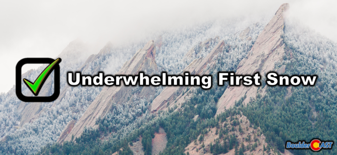
Many western suburbs of Denver experienced their first snow of the season last night, with Boulder officially recording 0.2 inches. The colder, higher elevations to the west saw a more significant dump, up to 15 inches in some areas. We briefly recap the underwhelming first snow of the season and announce the winners of our 2024 First Snowfall Contest.
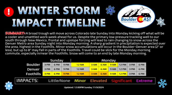
Winter Weather Update: Accumulating snow likely Sunday night and again midweek, but we’re also tracking potential blizzard conditions late week for eastern Colorado
The first two storm systems of the season capable of producing snow across the lower elevations mostly missed the mark, with only a small portion of the Denver Metro area reporting snow so far this season. Neither Boulder or Denver have officially received any snowfall since April. That will definitely change this week, perhaps as early as Sunday night as a light round of rain changing to snow is expected. Furthermore, a complicated, unsettled weather pattern will unfold the rest of the week in Colorado keeping our temperatures well below normal with almost daily chances for more rain and snow. We’re fairly confident everyone will see additional light accumulating snow Tuesday night into Wednesday, with a potential for a more impactful storm late in the week into the weekend, including possible blizzard conditions. We truly have a lot to cover in this week’s outlook, so let’s dive in!
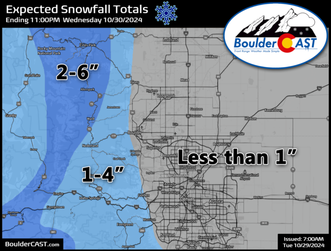
*Premium* Storm Update – Wed 10/30/24 8:00 AM | Dreary and cold with rain/snow showers around through the day, minor accumulations possible
All the ingredients are coming together this morning for a cold and dreary Wednesday in the Front Range. We discuss the latest on the approaching storm system and provide a few final details regarding the timing for what should be a widespread bout of light rain and snow today across the area followed by a hard freeze tonight.
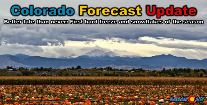
Colorado Forecast Update: Plan now for the “one-two punch” of our first snow and first hard freeze of the season!
Get ready, Colorado! The first snowflakes and a hard freeze of the season are on their way as this dramatic shift in weather across the state continues. Better late than never, right? We discuss when the snow will begin, how much could stick on the grassy surfaces, and when to expect the end to the 2024 growing season as temperatures are sure to plummet below freezing. We’re also tracking another potential snow event early next week. Here’s the latest.
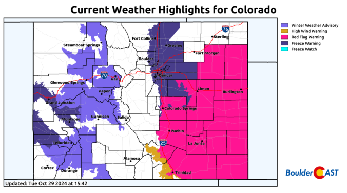
*Premium* BoulderCAST Daily – Tue 10/29/24 | Chilly & mostly dry today, but wet snow arrives Wednesday morning followed by a hard freeze Wednesday night!
© 2025 Front Range Weather, LLC


