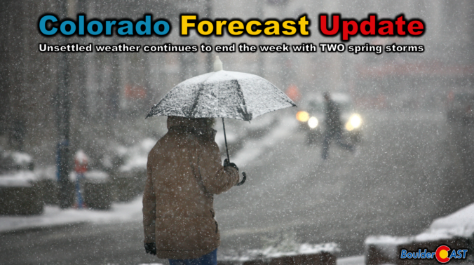
A big dip in the jet stream across the western United States will funnel two weak storm systems eastward in the coming days leading to a prolonged period of cool and gloomy weather to the Front Range that will take us right into the weekend. Our discussion here focuses mainly on the first storm set to move across Colorado on Thursday with a mixed bag of rain and snow. We’re expecting minimal travel impacts across the Boulder-Denver area due to warm temperatures, but some problems may occur in the higher terrain. Continue reading
Category: Forecast (Page 18 of 169)
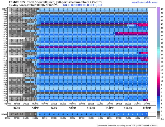
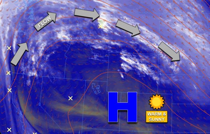
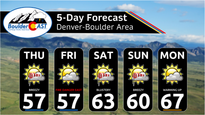
The week ahead will remain fairly active across Front Range Colorado as a series of upper-level disturbances track through the region with a broad trough of low pressure over the Four Corners and Intermountain West. Our warmest day will be Monday near 60 degrees, with cooler temperatures and unsettled weather taking over the remainder of the week. We are especially focused in on the Friday/Saturday timeframe when a strong storm system could bring several inches of spring snow to the area. Read on for more details.

Thanks to multiple rounds of steady rain, a hail-producing thunderstorm, and even a few snowflakes, Boulder has remarkably received about as much precipitation this weekend as we’ve seen in all of 2025 combined beforehand! We review the rain (and snow!) totals across the area and discuss briefly what unfolded over the last 36 hours during what was a rather atypical spring storm.
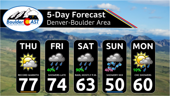
The week ahead will remain largely dry across the Front Range thanks to the slow passage of a strong ridge of high pressure aloft. Gusty downslope winds on Monday will relax and transition into a mid-week heatwave with record highs up for grabs across multiple days. However, unsettled weather is brewing for the upcoming weekend with decent rain chances for the lower elevations and a few snowflakes for the higher Foothills. Read on for all the details.

Live View of Boulder

Current Conditions

Live Radar

Latest Smoke Forecast

Recent Premium Posts

BoulderCAST Daily – Sun 07/12/26 | Hot weather for a good chunk of the coming week
🥵 🔥 Heat for a good chunk of the week: Upper 90s through …
BoulderCAST Daily – Sat 07/11/26 | Here comes the heat!
🥵 Heat start today: Upper 90s start today and continue well into next …
BoulderCAST Daily – Fri 07/10/26 | The heat builds into the weekend
⛈️ Storms around today: A weak impulse of energy favors some isolated storms …
3-Day Forecast

Trending Content

© 2026 Front Range Weather, LLC