We provide an updated forecast for the powerful spring storm currently impacting the region. Slightly colder temperatures have bumped up our snowfall forecasts in some locations. Read on for details.
We provide an updated forecast for the powerful spring storm currently impacting the region. Slightly colder temperatures have bumped up our snowfall forecasts in some locations. Read on for details.
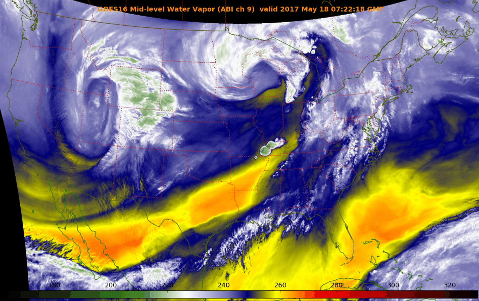
The next few days will solidify the rest of the country’s belief that our weather here is pure insanity. We provide an update on what is shaping-up to be an historic late-season winter storm for the Front Range Foothills. The potential for accumulating snow across the lower elevations is much more uncertain at this time. Read on for the latest details…
More unsettled weather is looming for the week ahead! We’ll squeeze out a few nice days to start, but temperatures will be tumbling by mid week as a formidable storm system heads towards Colorado. Thursday and Friday’s forecast is currently shrouded in a bit of uncertainty, by several models are indicating significant precipitation for the Front Range, and even the potential for accumulating snow across the Plains. Read on for all the details.
Our rainiest month has delivered this week with beneficial moisture falling across all of the Front Range. And of course, let’s not forget Monday’s insane hailstorm in downtown Denver, Lakewood, and Arvada. Here are cumulative rain totals this week through 7:00 AM Thursday:
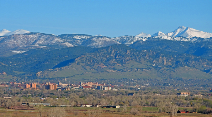
With three and a half “days of Seattle” out of the way, we’ll revert to “typical Colorado” in short order. Sunshine returns and temperatures rebound to near 80 degrees tomorrow and into the weekend.
Our weather turned quite warm to end the week, with Friday, Saturday and Sunday well above average in the 80’s across much of the Metro area. Unfortunately, this week will see a gradual drop in temperatures all thanks to a large cut-off low pressure system churning slowly across the Desert Southwest. It also looks to be a wet week overall, especially Tuesday and Wednesday. All the details can be found in our week ahead outlook, so read on…
With April come and gone, we are now fully entrenched in the Spring season here in the Front Range. We take a look at current trends, past climatology, and offer our prediction for the month of May in northeast Colorado.
This content was exclusively available to BoulderCAST Premium Members through May 2, 2017.
Happy First of May! Last week’s wintry weather will indeed be a tough act to follow. The week ahead will be quieter for sure, but the threat of rain and higher elevation snow is still a concern. We also see 80-degree temperatures and a stellar weekend on the horizon. Read on for our complete forecast of the upcoming week.
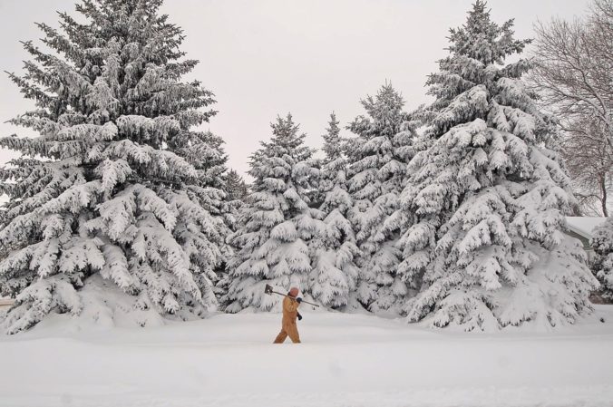
As we have been relaying to you all week, another spring snow storm is on the way this evening and will linger into Saturday afternoon. Read on as we detail our final thoughts on the storm and snow amounts for the Foothills and Plains.


© 2026 Front Range Weather, LLC


You must be logged in to post a comment.