


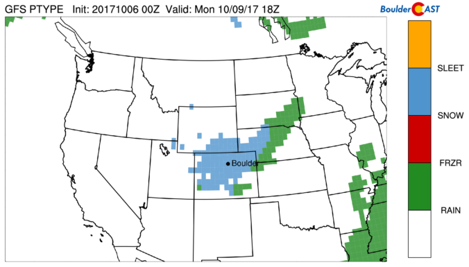
Things are about to turn white across the region as a quick-hitting storm brings freezing temperatures and snow to the Front Range. Read on for details.
Category: Forecast (Page 135 of 169)
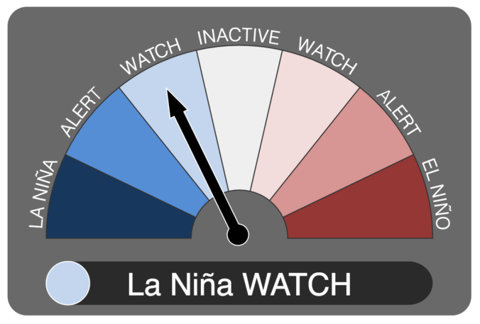
It now appears we may be headed into our second consecutive La Niña winter. We discuss the forecast, remind you what La Niña actually is, and explain potential impacts on Colorado for this winter.

The storm track has officially returned southward to Colorado! The first full-week of October will feature a swing in temperatures, starting off on the cold and wet side for your Monday. Meanwhile, the first dumping of snow in the Mountains and Foothills started yesterday and continues today. Read on for our complete outlook.

It truly felt like summer came to a close as Fall officially began last Friday. What a great reprieve these last few days have been! The large trough which began to influence our region last Friday will continue to be our main focus for much of the week ahead with below normal temperatures and unsettled weather prevailing across Colorado.
We’ve really been spoiled of late in regards to weather! Only a few raindrops have fallen in the last six weeks, with temperatures remaining warmer than normal on all but a handful of days. This changes on Saturday as a deep trough plows into the region, kicking the unending ridge of high pressure eastward. Cool and unsettled weather will linger well into next week. We’re also monitoring the potential for the first significant snowfall in the Mountains. We have a lot to discuss!

Look for a relatively quiet last week of summer across the state with warm temperatures and dry weather being the main story. However, the forecast turns much different for the upcoming weekend. We’re also watching the Tropics for a few hurricanes that may impact the Eastern US. Read on for details.
3rd Annual BoulderCAST First Snow Contest
*This contest is now closed to entries*
Are you eager for the first snow of the season? Have you already waxed your skis and purchased your Epic Pass? Our first big snow could be right around the corner! We provide a brief overview of Boulder’s first snowfall climatology and then pose a question…“When will Boulder’s first snow occur this year?” Submit your guess for not only a chance to win recognition among local weather enthusiasts, but prizes too. Those who get closest to the date of our first snow win. Read on for all the details.
Today will bring the best chance of precipitation for the week to the Front Range as a small but potent wave treks across western Colorado.
The 500 mb vorticity map below shows a autumn-like trough digging into the Pacific Northwest (big “L”), and also the small wave moving through Utah and western Colorado tonight (little “L”). Moisture in eastern Colorado, especially at the lower levels, will be fairly low today and tonight. The bulk of the precipitation will remain in western Colorado and Wyoming. However, there will be a decent chance of storms today across the Metro area…maybe 20% between 3PM and midnight this evening as the disturbance approaches. Highs will be cooler today in the low to middle 80’s with mostly cloudy skies developing by afternoon.
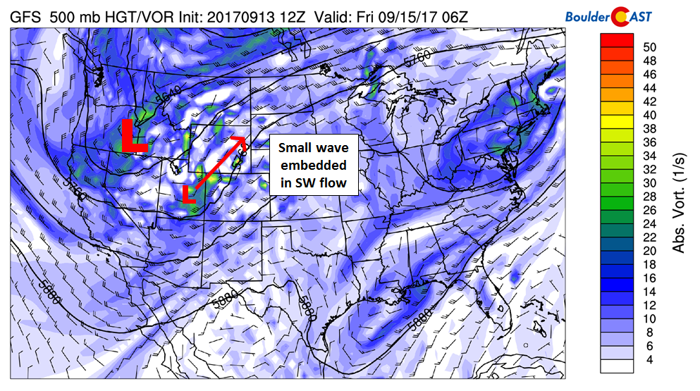
This big trough across the Northwest is actually cold enough for snow in the higher elevations of western Wyoming and Montana! Those wondering when snowfall may return to our Mountains should keep an eye on the middle of next week as ensembles are coming into agreement for an even colder and deeper trough developing across the West…
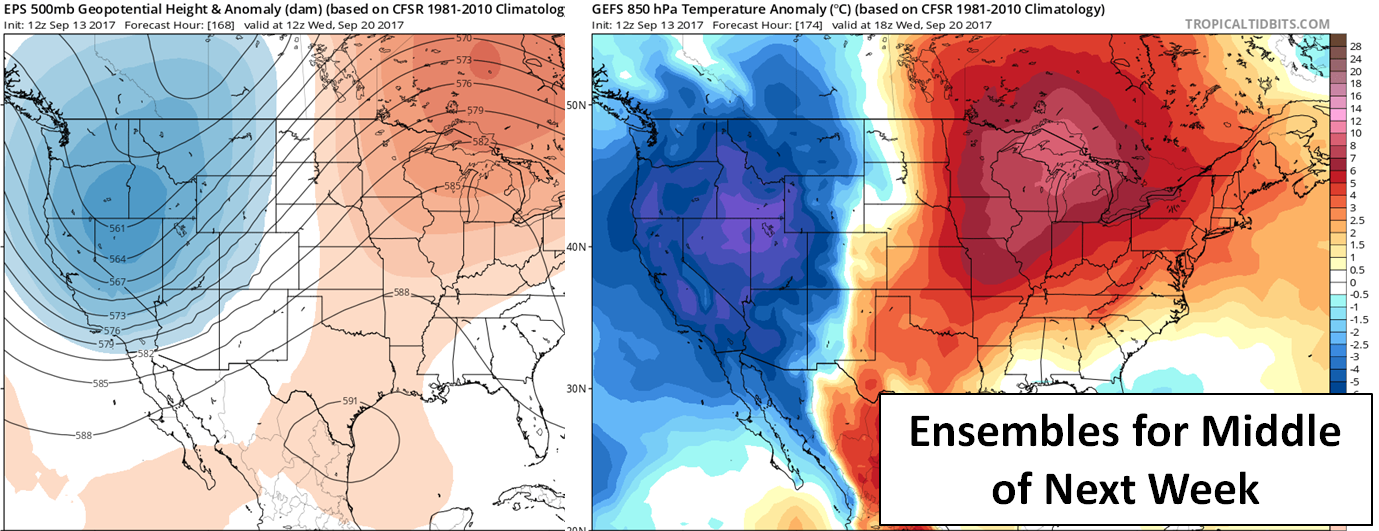
LEFT: 500 mb height anomaly for the middle of next week from the ECMWF. RIGHT: GFS ensemble 850 mb temperature anomaly
Remember, these daily forecasts are Premium content. Periodically, we open this forecast up to all of our readers. Today is one of those days!
Sign up today to get the best BoulderCAST experience, including these forecasts every day, extended and enhanced graphical forecasts, chat room and forum access, complete 6-day hiking forecasts, early viewing of select content and much more!
In celebration of the recent introduction of our SummitCAST hiking forecasts, use the promo code SUMMIT15 to receive 15% off our annual subscription. LEARN MORE


Live View of Boulder

Current Conditions

Live Radar
Latest Smoke Forecast

Recent Premium Posts

BoulderCAST Daily – Fri 07/17/26 | Hot and dry continues through the weekend
🥵 Heat tightens its grip this weekend — Ridge strengthens slightly over the …
This Weekend in Colorado Weather: Several More Scorching Days Ahead Before the Long‑Awaited Monsoon Pattern Arrives
☀️ Persistent heat continues — Low to mid‑90s through Saturday, spiking towards the …
BoulderCAST Daily – Wed 07/15/26 | The Ridge Rules the Rockies as Hot, Dry Pattern Holds Firm
🔥 Heat dome setup continues — A strong, stationary 500 mb ridge keeps …
3-Day Forecast

Trending Content



© 2026 Front Range Weather, LLC
You must be logged in to post a comment.