Category: BoulderCAST Daily (Page 252 of 465)

This page contains an index of our BoulderCAST Daily forecast updates. If you are NOT a Premium member, you will only see a tiny sample of this content below. Subscribe to BoulderCAST Premium to gain access to all of our daily forecasts which get published every morning.

BoulderCAST Daily – Sun 01/10/21 | Fresh snow cover keeps us in the lower 30’s

TDetailed Forecast Discussion: snow system is long gone, with its low pressure center as far south as the Gulf of Mexico later today (below). Weak high pressure is now taking over across western Colorado and will lead to a rather quiet day to end the weekend. The same snow storm will track east-northeast into the Carolinas over the next 24-36 …

BoulderCAST Daily – Sat 01/09/21 | Light snow develops this afternoon

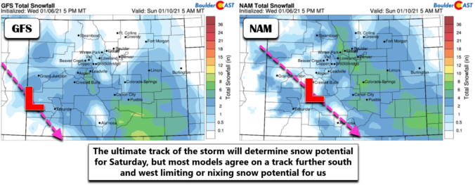
LDetailed Forecast Discussion: ight snow starting this afternoon and continuing off and on before tapering off after midnight. We continue to track a mid-level area of low pressure that will largely track well south of us. It's position as of this evening at 700 mb will be over central New Mexico. Not exactly the most favored position for snow on …

BoulderCAST Daily – Fri 01/08/21 | Quiet today before snow arrives tomorrow

QDetailed Forecast Discussion: uiet weather today ahead of our next storm system. Lots of sunshine today with temperatures in the lower 40's, just a tad cooler than yesterday. Shown below is the current water vapor satellite image as of this morning. A trough axis was positioned over NE Colorado. This is a remnant low pressure system and won't have much …

BoulderCAST Daily – Thu 01/07/21 | Not too bad today, tracking light snow for Saturday

WDetailed Forecast Discussion: e currently have our eyes watching two storm systems in the northwest portion of the country which will be moving eastward and near to our area in the coming days. Most of today will be under the influence of a short-lived ridge of high pressure, the same one which made for such a beautiful day yesterday. This …

BoulderCAST Daily – Wed 01/06/21 | Cool with sunshine

DDetailed Forecast Discussion: ue northerly flow is present in the middle atmosphere over Colorado today following the passage of yesterday's shortwave storm system. This is shown quite nicely in today's GFS 500 mb height anomaly forecast below. To the west, a ridge will build into the state today and much of tomorrow with pleasant conditions expected. Highs will be in …

BoulderCAST Daily – Tue 01/05/21 | Windy on the Plains, snowy in the Mountains

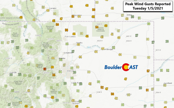
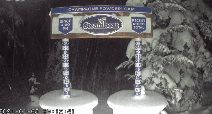
ADetailed Forecast Discussion: more active weather day lies ahead compared to the last several with the next shortwave trough sliding across the Rockies this morning. The NAM model 500 mb vorticity animation below shows the trough is located near Salt Lake City as of 6AM morning. It will push quickly eastward and into the Denver Metro area by mid-day or …

BoulderCAST Daily – Sun 01/03/21 | Gusty at times with highs in the lower 50’s

Detailed Forecast Discussion: A mixture of clouds and sunshine will give way to mostly cloudy skies later today and this evening. In the middle and upper-levels of the atmosphere, a trough axis is oriented north-south from Montana into Colorado. This trough axis will be diving through this evening. While this is happening, an upper-level jet streak will also be tracking …

« Older posts Newer posts »