Category: BoulderCAST Daily (Page 249 of 465)

This page contains an index of our BoulderCAST Daily forecast updates. If you are NOT a Premium member, you will only see a tiny sample of this content below. Subscribe to BoulderCAST Premium to gain access to all of our daily forecasts which get published every morning.
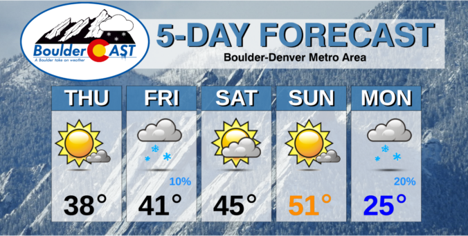
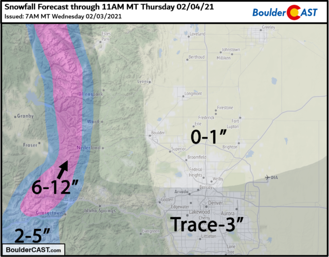
BoulderCAST Daily – Thu 02/04/21 | Cool and gusty this afternoon, tracking Arctic air next week

JDetailed Forecast Discussion: ust as expected, last night's snow bands only managed to clip the southern fringes of the Denver Metro area. The radar animation below ends at around 9:00 PM last night. The overhead jet was really cranking out some intense precipitation bands, with mainly heavy snow around southern Denver but rain further east stretching into Nebraska where it …

BoulderCAST Daily – Wed 02/03/21 | Warm & gusty, then a chance of rain/snow this evening

TDetailed Forecast Discussion: he main weather-maker for later tonight is currently on approach from the northwest. This morning's GOES-East infrared satellite animation is shown below. The actual parent low pressure system is still spinning off coast of southern Washington. This is fairly easy to see in the animation. Quite a ways ahead of the storm, a narrow stream of deep …

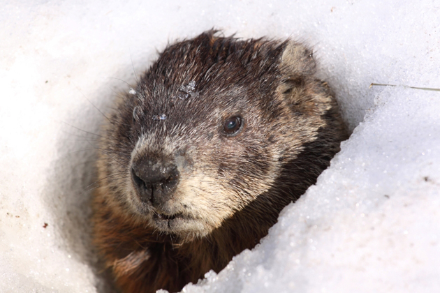
BoulderCAST Daily – Tue 02/02/21 | The Groundhog said six more weeks of winter but we have concerns about tomorrow’s snow

⦁❶⦁ Despite Phil’s wintery prediction earlier this morning, our temperatures will soar into the 60’s today and tomorrow

⦁❷⦁ A quick-hitting trough will bring a chance of snow to the Front Range Wednesday night

⦁❸⦁ Even with decent lift and a potent jet core overhead, downslope looks to be too much to overcome northwest of Denver with this system

⦁❹⦁ Expected accumulations are minimal, but as always forecasting jet snow is tricky so stay tuned!

Continue reading

BoulderCAST Daily – Sun 01/31/21 | Calm and quiet on the last day of January

Detailed Forecast Discussion: We end the month of January on a rather quiet note, with high pressure ridging over much of the western states, while a trough exists over the eastern section of the country. Ridging over us will lead to lots of sunshine, calm winds relative to yesterday, and temperatures in the upper 40's to near 50 degrees. The …

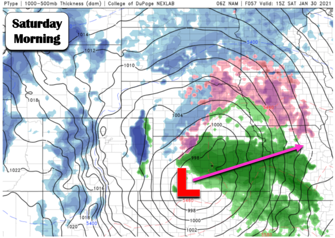
BoulderCAST Daily – Sat 01/30/21 | Last weekend of January starts out windy

SDetailed Forecast Discussion: urface low pressure has moved into the Midwest to become a very deep and strong system (below). Northwest winds on the back side of the low will create rather breezy downslope winds on the Plains and Foothills. Temperatures will more or less hold steady in the middle 40's with plenty of atmospheric mixing from the winds. As …

BoulderCAST Daily – Fri 01/29/21 | Warmer today with only a slight chance of flurries/sprinkles

Detailed Forecast Discussion: Downslope warming has taken over across eastern Colorado and Kansas today (below). Normally this would spell out very warm temperatures for the Denver Metro, potentially in the upper 50's. While we can't rule this out, temperatures will most likely reach the lower 50's. Off and on cloud cover, along with a slight upslope component to the wind, …

BoulderCAST Daily – Thu 01/28/21 | Pleasant today, some model agreement for snow in the extended

HDetailed Forecast Discussion: igh temperatures yesterday were definitely a bust for portions of the northern Metro area. While southern Denver cruised to right around our forecasted high of 40 degrees, areas from Boulder to Greeley were unable to shake the shallow cold airmass and were stuck in the 20's all day. We only reached 25 degrees at BoulderCAST Station! We …

« Older posts Newer posts »