Category: BoulderCAST Daily (Page 214 of 465)

This page contains an index of our BoulderCAST Daily forecast updates. If you are NOT a Premium member, you will only see a tiny sample of this content below. Subscribe to BoulderCAST Premium to gain access to all of our daily forecasts which get published every morning.
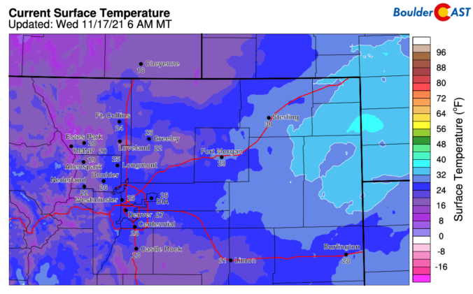
BoulderCAST Daily – Wed 11/17/21 | Morning flurries wrap up, then sunny and cold

A Detailed Forecast Discussion: few light bands of snow and flurries did develop overnight across the Denver Metro area. These bands were forced by the overhead jet stream, but in an environment with very limited moisture. The result was just a few flurries here and there, with up to a dusting of accumulation reported in isolated spots (like near Longmont). Here …

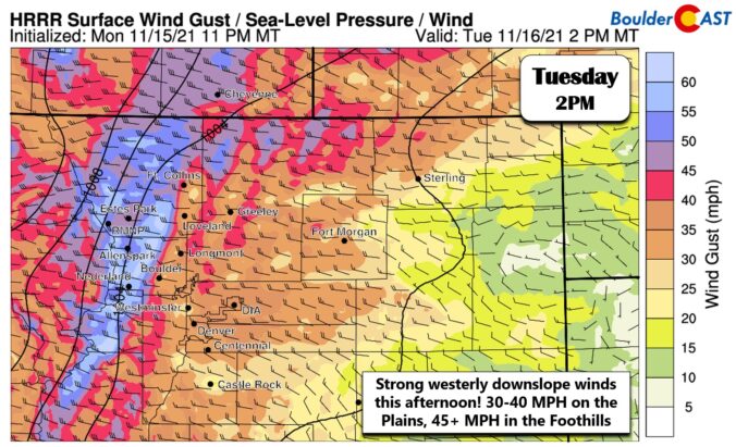
BoulderCAST Daily – Tue 11/16/21 | Warm & gusty with high fire danger

TDetailed Forecast Discussion: he main story today will be the continued unseasonably warm temperatures combined with gusty winds across the Front Range which will create high fire danger. This is all happening ahead of a cold front set to arrive later this evening. The large-scale weather setup for today is shown in the 500mb height anomaly forecast below from the …

BoulderCAST Daily – Sun 11/14/21 | Warm and breezy again

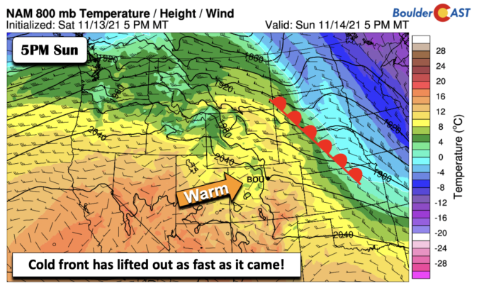
TDetailed Forecast Discussion: he cold front which passed through last night and early this morning will be on its way out this afternoon and replaced with a warm front. The warm front this evening will be roughly positioned over South Dakota and Nebraska (below). Behind it, westerly downslope flow will again be the norm for us with highs in the …

BoulderCAST Daily – Sat 11/13/21 | Breezy and warm in the middle 60s ahead of a cold front

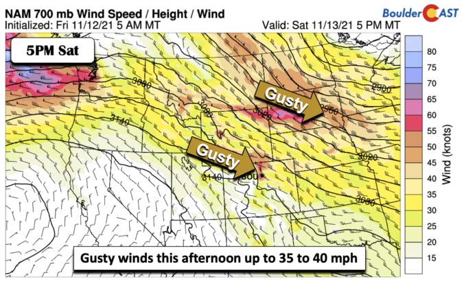
FDetailed Forecast Discussion: ast-moving shortwave over Montana and North Dakota (below) will be tracking southeast into Nebraska and Iowa tonight. While the system will remain to our east and northeast, it will help to bring a cold front through late tonight. Also, it will bring lots of mid and high clouds across the Front Range today so expect less sunshine …

BoulderCAST Daily – Fri 11/12/21 | Highs a tad warmer in the mid to upper 50s

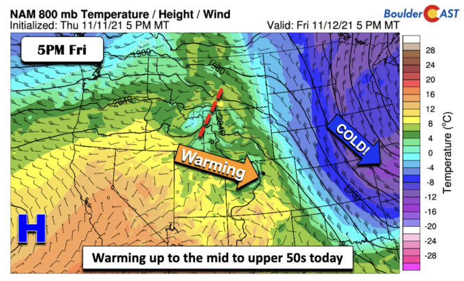
DDetailed Forecast Discussion: ownslope surface warming will slowly develop this afternoon as a result of ridging building in across the California coast. The real cold air that was over us earlier this week is moving off the east over Missouri and eventually the east coast. Westerly surface winds should develop this afternoon to allow high temperatures top out a few …

Weekend Weather Snapshot: November 11, 2021

PDetailed Forecast Discussion: ersistently gusty conditions were reported much of the day yesterday as strong winds aloft were able to mix down to the surface during the daylight hours. The graphic below shows the peak gusts observed across the Front Range on Wednesday. Generally 30 to 40 MPH gusts were common, but the usual windy spots along Highway 93 in …

BoulderCAST Daily – Wed 11/10/21 | More sun but breezy with temperatures in the 50’s

HDetailed Forecast Discussion: appy Wednesday! The quick-moving trough axis is already about to depart Colorado to the east this morning. The backside of this trough has notably drier and subsident air which will lead to more sunshine but also more wind today for the Front Range. Can't win them all right? The departing trough brought a wave of light to …

« Older posts Newer posts »