Category: BoulderCAST Daily (Page 201 of 465)

This page contains an index of our BoulderCAST Daily forecast updates. If you are NOT a Premium member, you will only see a tiny sample of this content below. Subscribe to BoulderCAST Premium to gain access to all of our daily forecasts which get published every morning.
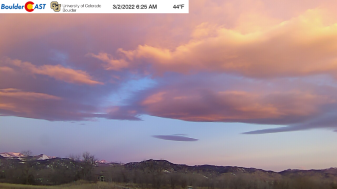
BoulderCAST Daily – Wed 03/02/22 | Lower 70’s & beautiful, but tracking rain/snow for much of the weekend ahead

The mid-level ridge continues to hold strong over the Rockies with an axis just to our west near Salt Lake City this morning. This will lead to continued warm conditions across the Front Range today through Friday as the ridge slowly shifts eastward. There are a few wave clouds around this morning as noted on our webcam: However, mostly sunny …

BoulderCAST Daily – Tue 03/01/22 | The spring-like warmth intensifies the next few days

The most substantial ridge we've seen in months is moving towards Colorado right now from the west. It will be with us the next few days spurring continued spring-like temperatures across the Front Range. The ridge axis will move overhead Thursday morning and then exit the area on Friday eventually allowing for a series of storm systems to come ashore …

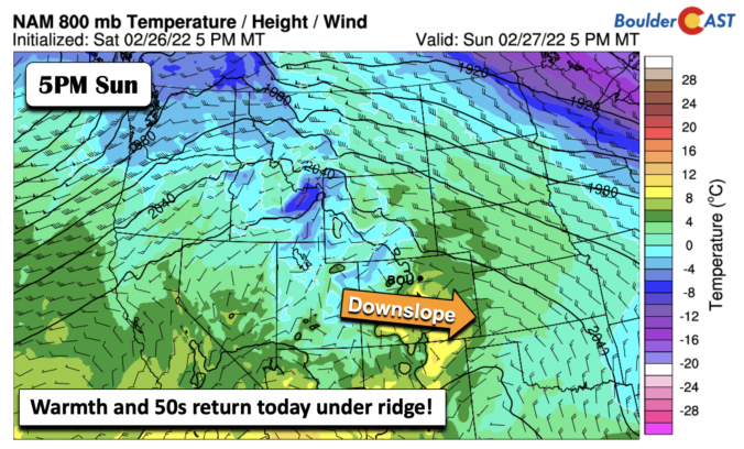
BoulderCAST Daily – Sun 02/27/22 | The 50s return!

Aglorious ridge of high pressure will take over today, stretching all the way into the Dakotas by this afternoon. There is a weak shortwave moving through Idaho and Montana this afternoon but it will stay well to our north. At the surface, the ridge will allow downslope flow to take shape, pushing our highs into the 50s under lots of …

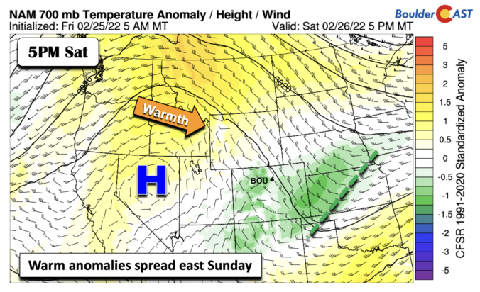
BoulderCAST Daily – Sat 02/26/22 | Great weather returns this weekend

Yesterday's weak system is pushing into Kansas today, with northwest flow still present over much of Colorado. However, that pattern is about to change, with high pressure building over Nevada, and which will spread east into our neck of the woods tomorrow. The figure below better highlights the change in our pattern for the next 24-36 hours. The ridge building …

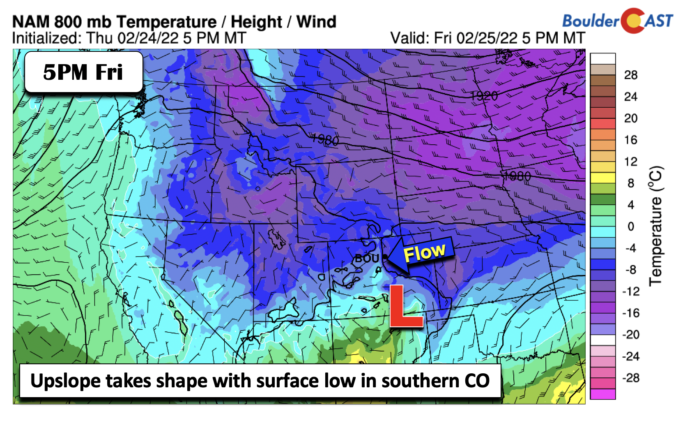
BoulderCAST Daily – Fri 02/25/22 | Upper 20s with spotty snow showers later today and evening

The mid-level pattern below shows one last trough set to move through the area, located over northwestern Colorado by this evening. Ahead of the trough, weak lifting will be in place. However, one deterrent with this pattern is the fact that the trough more or less gets sheared out with time, weakening the overall lift for the Front Range. At …

Weekend Weather Snapshot: February 24, 2022

The axis of the upper-level trough will move across our area today bringing an end to the unsettled weather it has caused all week long for the time being. After this wave kicks east into the Great Lakes, another weak trough dropping out of western Canada will clip Colorado on Friday bringing a slight chance of snow, mainly in the …

BoulderCAST Daily – Wed 02/23/22 | Record-setting cold continues with another couple inches of snow to go

Intermittent light snow was around through much of the evening and overnight period, and still continues this morning across portions of the Front Range. An early look at snowfall amounts over just the last 24 hours is shown below. 1-3" fell through the overnight with the highest totals around Lakewood, Golden and Estes Park. We measured around 1.5" in Boulder …

« Older posts Newer posts »