Category: BoulderCAST Daily (Page 185 of 465)

This page contains an index of our BoulderCAST Daily forecast updates. If you are NOT a Premium member, you will only see a tiny sample of this content below. Subscribe to BoulderCAST Premium to gain access to all of our daily forecasts which get published every morning.

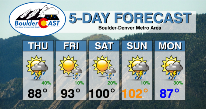
BoulderCAST Daily – Sun 07/10/22 | Storm chances increase to 30% as temperatures stay hot in the upper 90s

Yesterday's highs across the Front Range ranged from 99 degrees to the low 100's. Boulder tied the daily record high of 99, previously reached in 1954 and 1976. Sterling, CO, reached a whopping 102! Temperatures today will be more or less the same, topping out in the upper 90s. Clouds will develop in the afternoon as monsoonal flow brings storm …

BoulderCAST Daily – Sat 07/09/22 | Heat Advisory in effect for triple digit heat

Ahot and very anomalous ridge of high pressure will be positioned over eastern Colorado today and through much of tomorrow, ahead of a cold front. In addition to what was shared in our recent post, below shows how anomalous the heat is, stretching over much of the intermountain West and across the Great Plains. Meanwhile, wet weather and a trend …

BoulderCAST Daily – Fri 07/08/22 | Today starts a buildup of heat

Ahot mid-level ridge of high pressure will move slowly westward over the Front Range and over Colorado today. The result of this will be rising mid-level heights over the area, providing a more stable atmosphere in general, especially the central and western part of the state. High temperatures today will rise to the lower 90s in the western suburbs of …

Colorado Weekend Weather Outlook: July 7, 2022

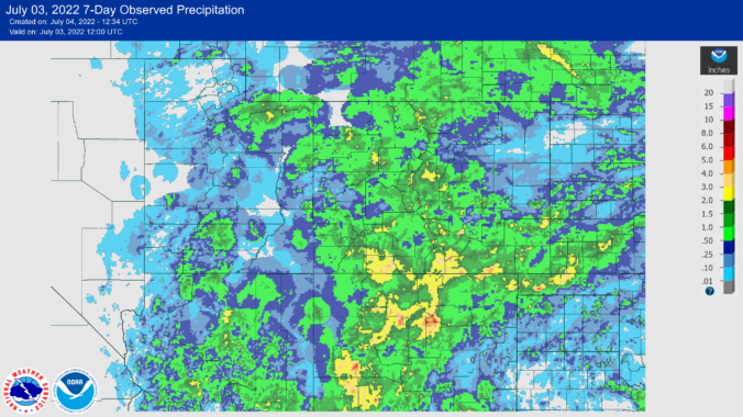
Rain showers and thunderstorms ended up completely engulfing the Front Range yesterday, though precipitation totals were on the lower side across the region (see below). Most areas picked up less than 0.1" of rain, but lucky spots in the Foothills, the Palmer Divide and areas way east saw more. It was also an active day for the eastern Plains where …

BoulderCAST Daily – Wed 07/06/22 | Morning showers followed by late-day storms capable of producing heavy rainfall

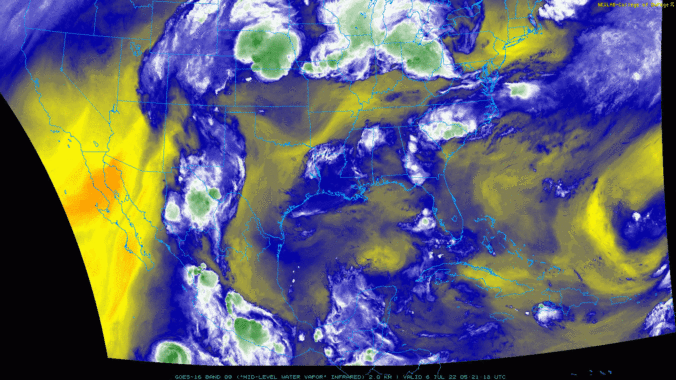
Low clouds and some rain showers are present early this morning across the northern Front Range. We've see a few raindrops here in Boulder already this morning. The current regional radar animation is shown below. The continuation of the showers overnight and early this morning is the result of a healthy monsoonal moisture plume staying directly over the area, plus …

BoulderCAST Daily – Mon 07/04/22 | Very warm with widely scattered thunderstorms ending before sunset

⦁❶⦁ A favorable monsoonal flow continues today with another chance of showers and thunderstorms across the area, though storms will be less intense and less widespread

⦁❷⦁ Best chance of storms between 2PM and 8PM with things shifting east before sunset — little to no impacts expected to any fireworks displays

⦁❸⦁ High temperatures will be in the lower to middle 90s

⦁❹⦁ Warm weather with decent monsoon moisture sticks around for a few more days before changes come later this week

Continue reading

BoulderCAST Daily – Sun 07/03/22 | Amplified monsoonal flow will enhance storm coverage, especially over the higher terrain

Alarge trough situated over the Pacific Northwest will lead to a more amplified pattern over the region today and tonight. Southwest winds at mid to upper levels will bring in moisture from Arizona and New Mexico, this time helping to focus that energy into the western and central part of the state. High temperatures this afternoon should reach the upper …

« Older posts Newer posts »