Category: BoulderCAST Daily (Page 117 of 465)

This page contains an index of our BoulderCAST Daily forecast updates. If you are NOT a Premium member, you will only see a tiny sample of this content below. Subscribe to BoulderCAST Premium to gain access to all of our daily forecasts which get published every morning.
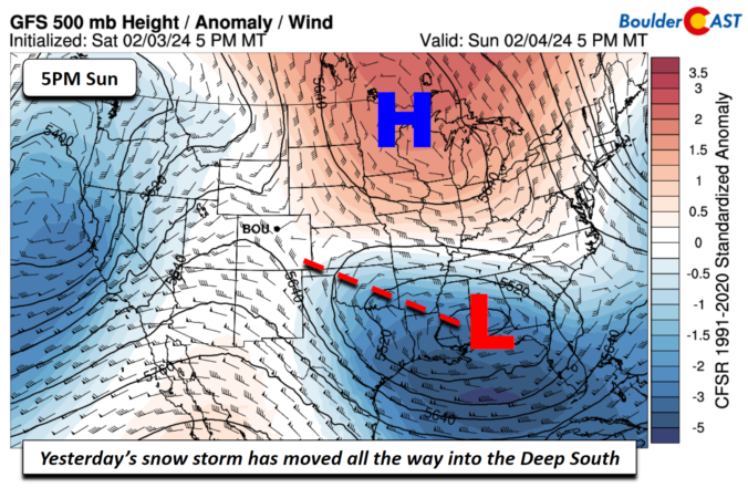
Premium BoulderCAST Daily – Sun 02/04/24 | Drying out after yesterday’s snow

Yesterday's snow event brought some surprises and also something we expected. Most of the Front Range saw between 4 and 6 inches, especially along and east of I-25. Denver Airport, for example received some 5.5 inches. A swath of 6-10 inches fell just west of I-25 between Louisville/Lafayette and Arvada. Boulder looks like it ended up with about 6-8 inches. …

Premium BoulderCAST Daily – Thu 02/01/24 | Final 60-degree day before things turn sloppy this weekend, plus our preliminary snowfall forecast map

The few remaining patches of clouds overnight have mostly cleared out this morning across the Front Range, as seen from the current GOES-East infrared satellite animation below. The Pacific storm we've been eyeing all week is about to make its way into California with deep subtropical moisture already spreading ashore now. We have one more really nice day on tap …

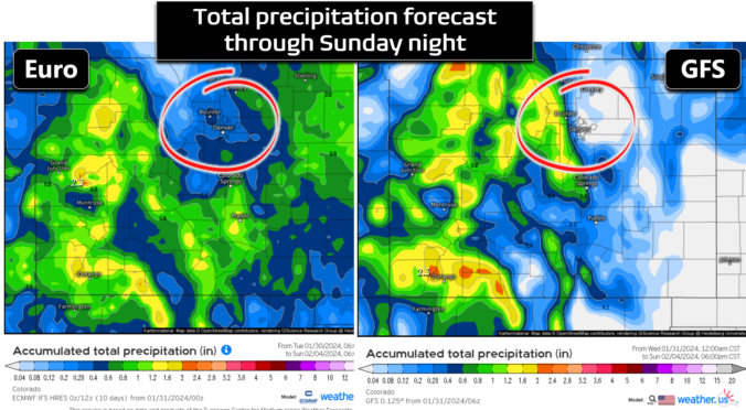
Premium BoulderCAST Daily – Wed 01/31/24 | A warm end to January, the weekend rain/snow forecast continues to be a messy one

On this glorious last day of January, another outing of spring-like weather is expected across the Front Range as broad ridging sits across the West through the day. The primary ridge axis has now passed east of our area with southwest flow ensuing aloft. The greatest warm anomalies under this persistent ridge pattern have been well north of Colorado all …

Premium BoulderCAST Daily – Tue 01/30/24 | Warmth & sunshine continue, plus our initial thoughts on snow amounts for the weekend

Happy Tuesday,  everyone! We've got another warm and beautiful day lined up as a ridge of high pressure continues to dominate the weather across the western United States, with that generalization definitely including Colorado. The high pressure center is located almost squarely over the Four Corners point today with the Front Range under weak but (surprisingly) warm northerly flow aloft. …

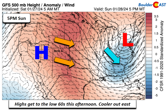
Premium BoulderCAST Daily – Sun 01/28/24 | We reach the lower 60s today!

Warmth continues to build east into our area today. The warmest day of the weekend will be today with lower 60s across the Front Range. Meanwhile, cooler air is present over the east coast and along the Mid-Atlantic and southeast states with a trough of low pressure. The low-levels continuing to favor downslope warming are the reason for the rise …

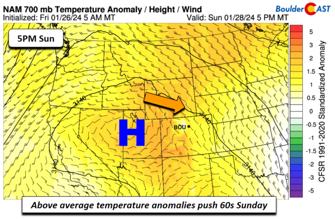
Premium BoulderCAST Daily – Sat 01/27/24 | Warmth returns this weekend

Alarge and anomalous ridge of high pressure will dominate our weather this weekend. Today, that ridge will be near southwest Utah and tomorrow it will be basically right over western Colorado. High heights aloft and above normal temperature anomalies at mid-levels will support highs in the 50s and 60s. Today we should see a rebound to near 50 degrees this …

Premium BoulderCAST Daily – Fri 01/26/24 | Spotty light rain/snow this morning but little fanfare

Aweak mid-level shortwave trough will take a southeastward track this afternoon as it reaches Texas by midday. The track of the low is not favorable for accumulating snow on the Plains, but weak upslope and somewhat cooler air will touch off some light rain/snow showers during the morning hours. Highs will top out in the mid 40s. Little if any …

« Older posts Newer posts »