Category: BoulderCAST Daily (Page 114 of 465)

This page contains an index of our BoulderCAST Daily forecast updates. If you are NOT a Premium member, you will only see a tiny sample of this content below. Subscribe to BoulderCAST Premium to gain access to all of our daily forecasts which get published every morning.

Premium BoulderCAST Daily – Sun 03/03/24 | Some weak snow banding this morning

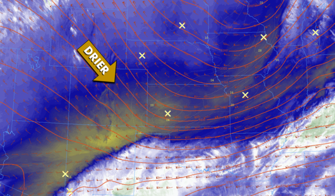
Astrong trough over the Dakotas and central Canada has brought a cold front through the region earlier this morning. Colder air will start our day in the lower 30s. However, southwest flow will persist through the afternoon and evening with the strong height gradient in place. This southwest flow will aid warming this afternoon with highs rebounding to near the …

Premium BoulderCAST Daily – Sat 03/02/24 | Red Flag Warning conditions today, followed by snow chances overnight

Astrong trough over the Pacific Northwest will track onshore and into Montana and the Dakotas by tomorrow morning. The flow over Colorado will remain out of the southwest today. The flow is certainly stronger than Friday, favoring strong and gusty winds off the higher terrain today. Gusts of 30-40 mph will be the norm on the Plains and the Denver …

Premium BoulderCAST Daily – Fri 03/01/24 | A little gusty with highs in the low to mid 60s

Astrong trough off the Pacific Northwest will bring a fairly strong southwesterly flow over the state today but also for our Saturday. Southwest winds will bring another mild and pleasant day with low to middle 60s. The flow at the low-levels is not overly strong over Colorado, but it is to our west, with gusts over 40 mph. These higher …

Premium BoulderCAST Daily – Wed 02/28/24 | Dry & mostly sunny the rest of the week with temperatures on the rise

Following yesterday's cold and snow, all of the exciting weather for the week is now behind us. There's nothing but sunshine and moderating temperatures in the pipeline across the Front Range through Saturday. The Pacific trough has exited our area to the east with drier air and clear skies sweeping in from the northwest overnight. Temperatures have dropped into the …

Premium BoulderCAST Daily – Tue 02/27/24 | A Pacific storm is racing through today with gusty winds and a chance of spotty snow showers

The leading edge of the trough and strong cold front are working south and east across Colorado this morning. The best lift is shown to be just north of our area and up across the Mountains. As of writing, the cold front is closing in quickly on the Denver Metro area --- it's probably already through by the time you …

Premium BoulderCAST Daily – Sun 02/25/24 | Dangerous red flag conditions once again

Astrong jet will once again be overhead for our Sunday, promoting another day of dangerous fire concerns across the Front Range. Red Flag warning conditions have once again been hoisted for the Front Range. Below shows the 700 mb flow, with very intense winds to our northwest over Washington, Montana, and Idaho. These winds are in tight connection with a …

Premium BoulderCAST Daily – Sat 02/24/24 | Red Flag Warning Conditions Today

Astrong jet overhead will promote gusty west-northwest winds this afternoon, at times exceeding 40-45 mph in portions of the Front Range. Below shows the jet orientation, roughly from northwest to southeast. In addition to highs getting into the upper 50s to lower 60s, the jet atop us will promote strong, gusty downslope winds that will at times reach speeds of …

« Older posts Newer posts »