Category: BoulderCAST Daily (Page 111 of 465)

This page contains an index of our BoulderCAST Daily forecast updates. If you are NOT a Premium member, you will only see a tiny sample of this content below. Subscribe to BoulderCAST Premium to gain access to all of our daily forecasts which get published every morning.

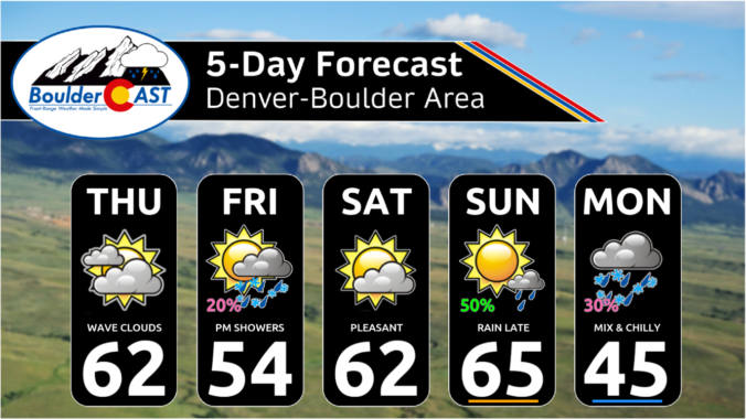
Premium BoulderCAST Daily – Sat 03/30/24 | Warm and quiet this Easter weekend but cooler with snow on Monday

Well, our Easter weekend will largely be dry and mild, at least through early Sunday evening. We will be under high pressure ridging today and most of tomorrow. Meanwhile, a deep trough will be off California today and will interact with a northern stream trough in Montana to influence us late Sunday night through Monday. Highs today and tomorrow will …

Premium BoulderCAST Daily – Fri 03/29/24 | Cooler with a chance of showers today, the best chance comes afternoon/evening

Ajet streak will be overhead today tied to an area of low pressure off northern California. We will be in the left-exit region of this jet streak, putting us in a favorable lift for some precipitation chances on the Plains through the day into the early overnight hours. Before that happens, we'll see a partly to mostly cloudy day with …

Premium This Weekend in Colorado Weather: Seasonal & pleasant ahead of our next spring storm late Sunday

Anice, quiet Thursday is in store across the Front Range as a ridge of high pressure sits overhead today bringing warming aloft and subsidence to the region --- two things that, of course, suppress precipitation. The chillier, northwest flow that we've been dealing with most of the week has finally exited towards the Great Lakes. This minor pattern shift will …

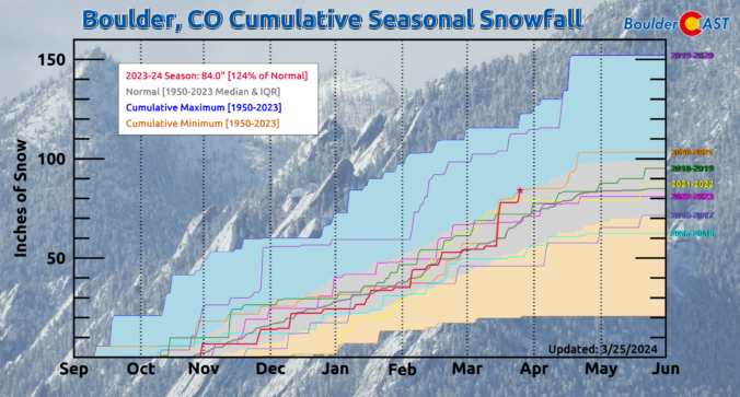
Premium BoulderCAST Daily – Wed 03/27/24 | A largely quiet day in the 50s and yes we still have a chance at 100″ of snowfall this season!

Today will be another fairly tame day across the Front Range as we start to see the large-scale weather pattern change for the good. The big trough that was left behind by our weekend storm system will finally scoot off to the east through the day, with chilly northwest flow transitioning to drier westerly flow as a shortwave ridge slides …

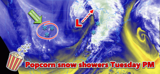
Premium BoulderCAST Daily – Tue 03/26/24 | Staying chilly with a chance of late-day popcorn snow showers, drier & warmer for tomorrow

The big storm system which brought us the thunderstorms and snow Sunday night has now pushed off into Iowa as of Tuesday morning, as seen in the water vapor satellite animation below. Back across Colorado, things are much quieter, but moisture remains over the entire state under a northwest flow regime. Notice how the area around Colorado is a milky …

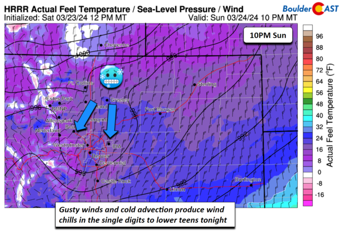
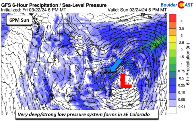
Premium BoulderCAST Daily – Sun 03/24/24 | Snow and blizzard-like conditions on-track for this evening

We have been advertising tonight's snow storm for the past several days, so we won't belabor the issue with talking about specifics on the pattern. A strong area of low pressure will form over eastern Colorado tonight, bringing down a strong cold front and ushering in a brief (6 hours or less) period of strong upslope and gusty winds on …

Premium BoulderCAST Daily – Sat 03/23/24 | Mild today but potential blizzard-like conditions Sunday afternoon/evening

Awarm front will be lifting north today as an area of low pressure forms and tracks into central/eastern Colorado later today and overnight tonight. While we cannot rule out a stray shower or storm, mainly east and northeast of Denver, most of our afternoon will be dry with mild temperatures. You'll want to take advantage of this great weather as …

« Older posts Newer posts »