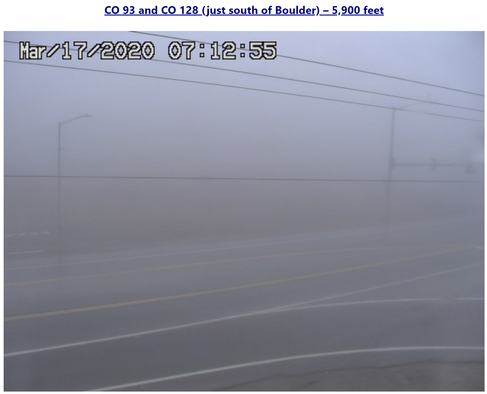
⦁❶⦁ Shallow upslope this morning produces widespread low clouds, patchy fog/drizzle
⦁❷⦁ Mostly cloudy through the day, highs in the low to middle 50’s
⦁❸⦁ The weather models remain consistent for the rain to snow event later this week
⦁❹⦁ Increasing confidence for heavy snow across Front Range, but several inhibiting factors will limit accumulation
Remember, these daily forecasts are Premium content. Periodically, we open this forecast up to all of our readers. Today is one of those days!
Sign up today to get the best BoulderCAST experience, including these daily forecasts every morning, complete 6-day skiing and hiking forecasts, access of all our Front Range specific weather models, additional storm updates and much more!
Detailed Forecast Discussion:
Low-level winds have flipped to southeasterly across the lower elevations overnight following a weak frontal passage. This has helped to develop low clouds over most of eastern Colorado with some patchy fog and drizzle mixed in as well. This will facilitate a cool and moist morning for us. Cloud base will lift through the morning into early afternoon, but mostly overcast skies will linger through much of the day. There could be a few peaks of sunshine later on, but don’t count on it. Highs will be a little cooler today resulting from the clouds…just low to middle 50’s.
In general though, the large-scale pattern remains largely unchanged from yesterday. Just above the cool/moist surface layer, mild and dry southwesterly flow is present and this will work into our area later today into tonight. Well to our west, the main upper-low near California is expanding into three weaker lows with yet another system dropping south out of the Pacific Northwest. By mid-day today, four distinct lows will be present at 500mb (shown below).
By mid-day tomorrow, the medley of low pressure systems within the larger trough in the western United States become quite evident (see below). The southern-most storm system will be the first to swoop in and impact Colorado Wednesday night, followed by the central low on Thursday and then the remnants of the western-most storm on Friday.
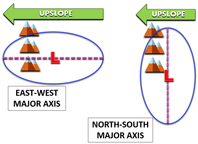
There is also some indication that the southern three systems may basically merge back into a single closed-low by Thursday. The way it’s looking, this low would have a major axis (the longer axis) oriented east-to-west.
This scenario has the potential to be more devastating for the Front Range due to the longer fetch of upslope resulting from the counter-clockwise flow. A simplified diagram comparing an east-west major axis orientation to a north-south axis orientation is shown below.
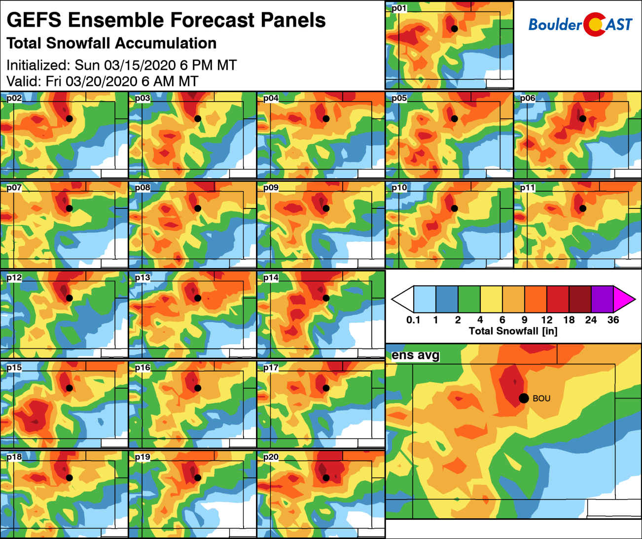
The setup on Thursday continues to look probable that our area will get slammed with between 0.50″ to 1.5″ of liquid Wednesday night into Thursday night. There is good agreement between the GFS, Euro and Canadian models for this. With continued forecast consistency this morning, our confidence has inched ever-higher for significant accumulating snowfall across the Front Range, but admittedly remains somewhat tempered at this time. We’re still pinpointing the change-over timing from rain to snow Thursday morning. We’re also not happy that the best lift and moisture will unfortunately overlap during the daytime Thursday. Potential accumulations will be fighting the mid-March sun and pre-existing warm ground temperatures. Nonetheless, there is so much liquid on the table that it’s hard to imagine a scenario where everyone doesn’t get at least several inches of wet slushy snow. We’ll continue to monitor the evolving storm and keep you updated in the coming days. We hope to issue our official forecast and snowfall map sometime Wednesday afternoon.
Finally, if you haven’t done so already, don’t forget to submit your guess to the most recent Premium Weather Quiz. We’ll post the results and correct answer tomorrow.


You must be logged in to post a comment.