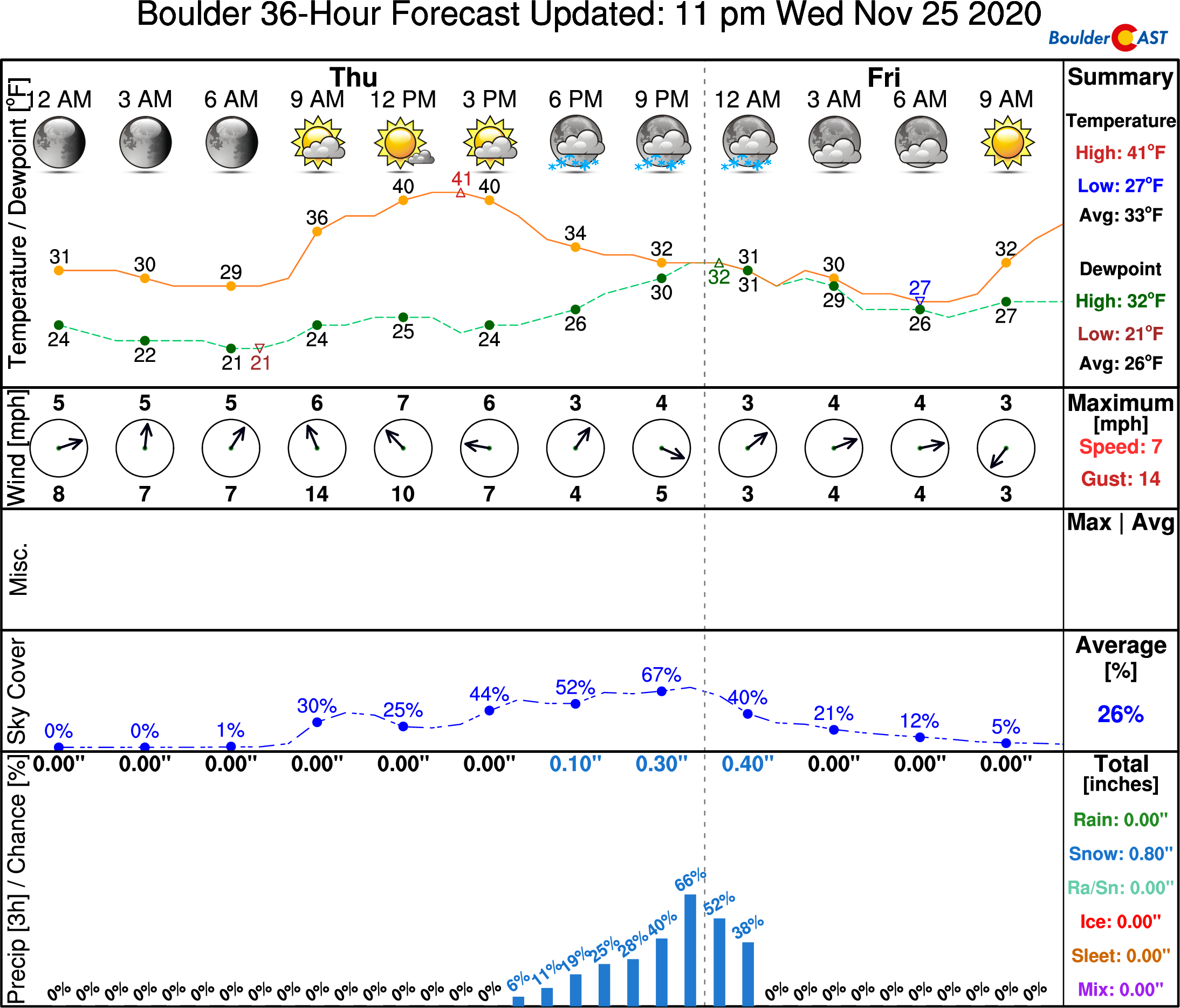
⦁❶⦁ A cold front moved through overnight with cooler temperatures expected today, near 40°F
⦁❷⦁ A slight chance of snow showers this evening for mainly the Foothills and far western suburbs, a dusting of accumulation possible
⦁❸⦁ Temperatures up and down over the weekend into early next week, but no more snow
Do you want the latest BoulderCAST forecast discussion delivered to your inbox every single day? If so, join BoulderCAST Premium where we talk Boulder and Denver weather every single day.
BLACK FRIDAY SALE ENDS MONDAY: Use promo code “BF” to save 37% on our annual subscription. Join now.
Detailed Forecast Discussion:
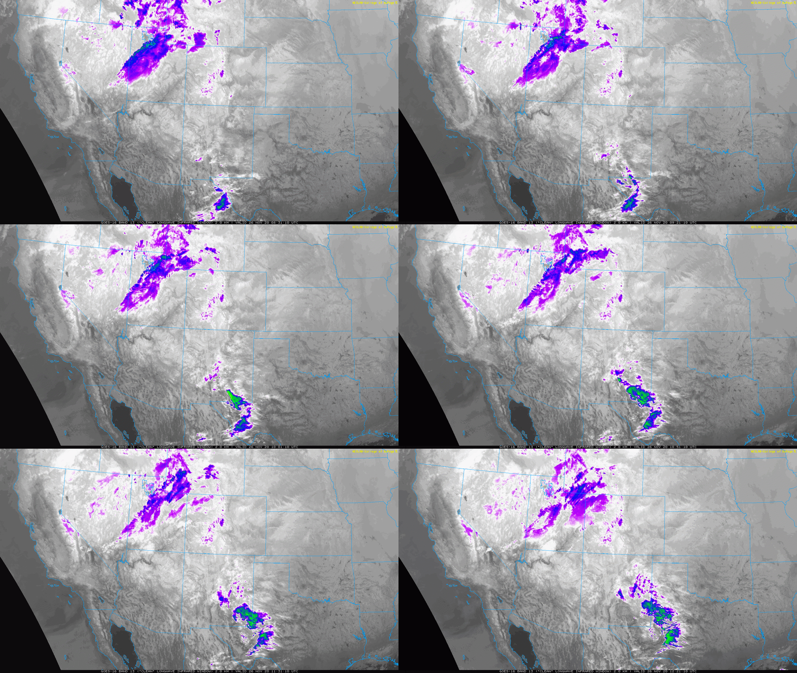
Somewhat quiet weather is expected for Thanksgiving Day, but as always, there are a few things to discuss! That southern storm we mentioned yesterday is still in the process of cutting off into Arizona this morning, as seen in the GOES-East infrared satellite animation below. Some of the elevated moisture and cloud cover from this system will work into our area later today leading to increasing clouds through the day. Otherwise it will be a sunny morning.
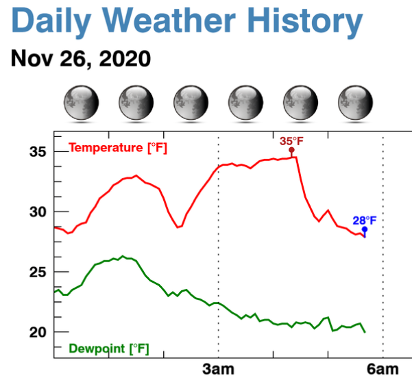
At the surface, a weak cold front has moved through the area overnight. Observations from BoulderCAST Station show the front passing through around 4:15AM this morning.
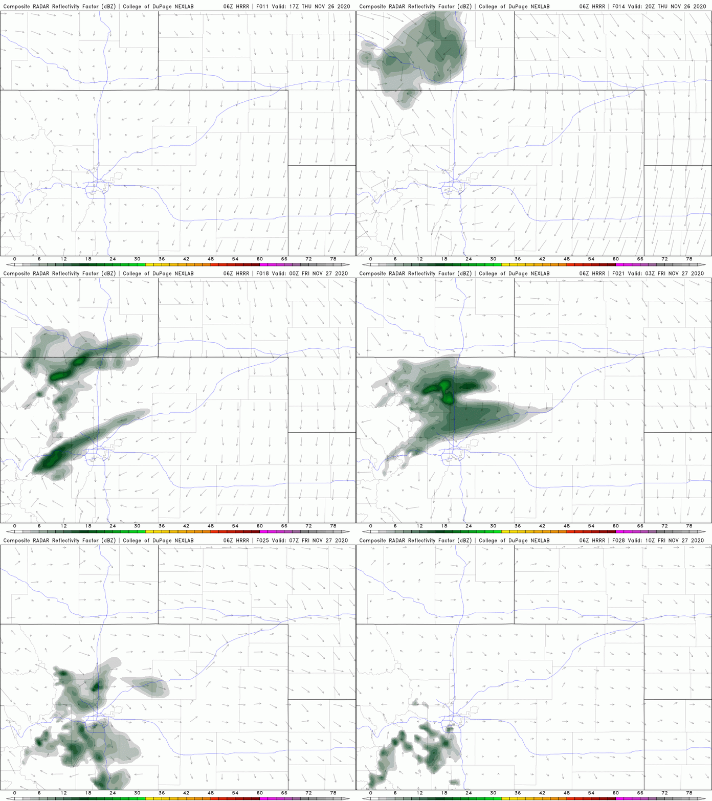
Behind this front, highs today are expected to be around 40 degrees…a tad cooler than yesterday. Interestingly, we must also include a small chance of snow showers in the forecast for later this evening as the models are now showing this potential due to upslope flow at the surface and very weak large-scale lift moving through from the Arizona storm. The HRRR model simulated radar animation below shows the developing snow showers drifting southward across primarily the higher terrain and the far western Denver Metro area.
Overall impacts will be minor from these snow showers with perhaps a dusting of accumulation, though some areas could see up to 1″ or so in the most fruitful of scenarios. The NowCAST timeline is shown below with snow chances existing between sunset and midnight. Note that this forecast is for the immediate Boulder area. Snow chances will be lower this evening along and east of Interstate 25 where the weak upslope won’t be as impactful. For other city forecast timelines, check our NowCAST page.
Any light snow showers that do develop this evening will taper off around midnight. Shown below are two high-resolution model snowfall forecasts. Not much to look forward to, but again, watch for a dusting or so in some areas with perhaps an inch or two in the Foothills.
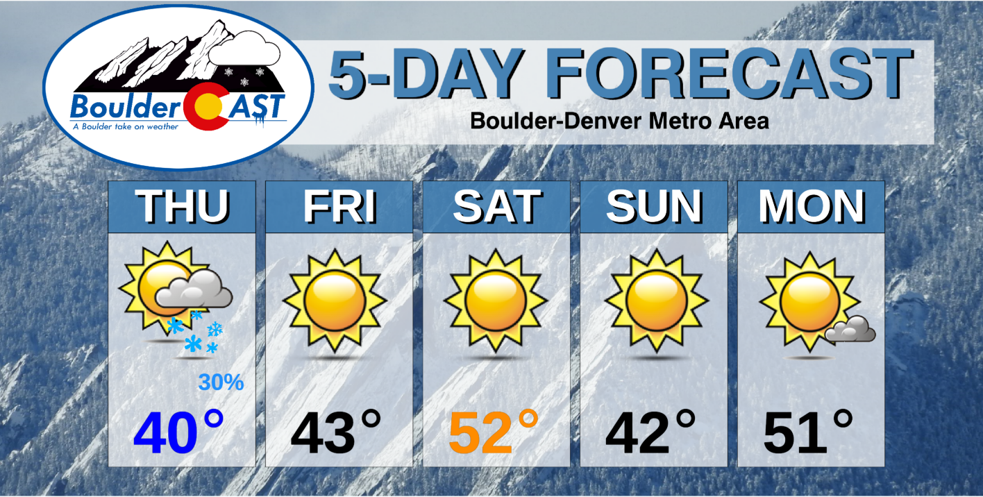
Beyond today, the weather pattern will remain somewhat active across the Rockies with a series of weak and mostly dry cold fronts lining up to impact the Front Range over the weekend into next week. While temperatures will be up and down, we don’t expect any additional snowfall through Monday. Here’s a look ahead to the next five days.
Do you want the latest BoulderCAST forecast discussion delivered to your inbox every single day? If so, join BoulderCAST Premium where we talk Boulder and Denver weather every single day.
BLACK FRIDAY SALE ENDS MONDAY: Use promo code “BF” to save 37% on our annual subscription. Join now.
From all of us at BoulderCAST, we wish you a safe and happy Thanksgiving!





You must be logged in to post a comment.