⦁❶⦁ A favorable monsoonal flow continues today with another chance of showers and thunderstorms across the area, though storms will be less intense and less widespread
⦁❷⦁ Best chance of storms between 2PM and 8PM with things shifting east before sunset — little to no impacts expected to any fireworks displays
⦁❸⦁ High temperatures will be in the lower to middle 90s
⦁❹⦁ Warm weather with decent monsoon moisture sticks around for a few more days before changes come later this week
Do you want the latest BoulderCAST Daily forecast discussion delivered to your inbox every single morning? If so, join BoulderCAST Premium where we talk Boulder and Denver weather every single day.
A
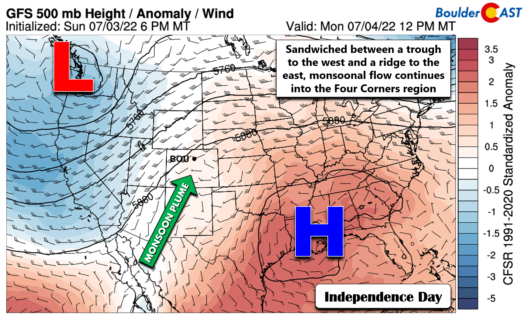
nother round of afternoon and evening thunderstorms are expected to pop across the Front Range for this Fourth of July. Little change in the overall weather pattern has occurred since the weekend, with a deep trough parked across the Pacific Northwest and a ridge in the Southeast. South-southwest flow between the two continues to funnel a broad plume of monsoonal moisture into the Four Corners region.
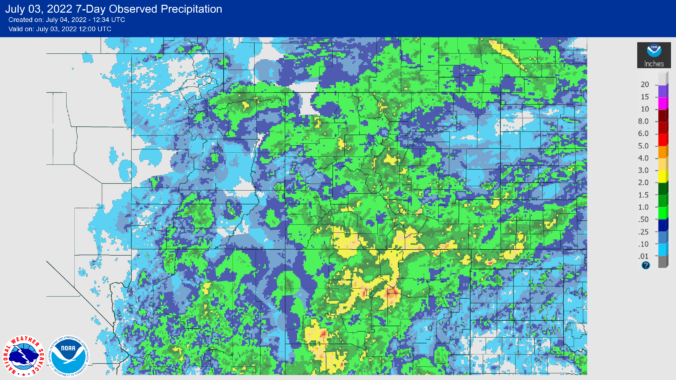
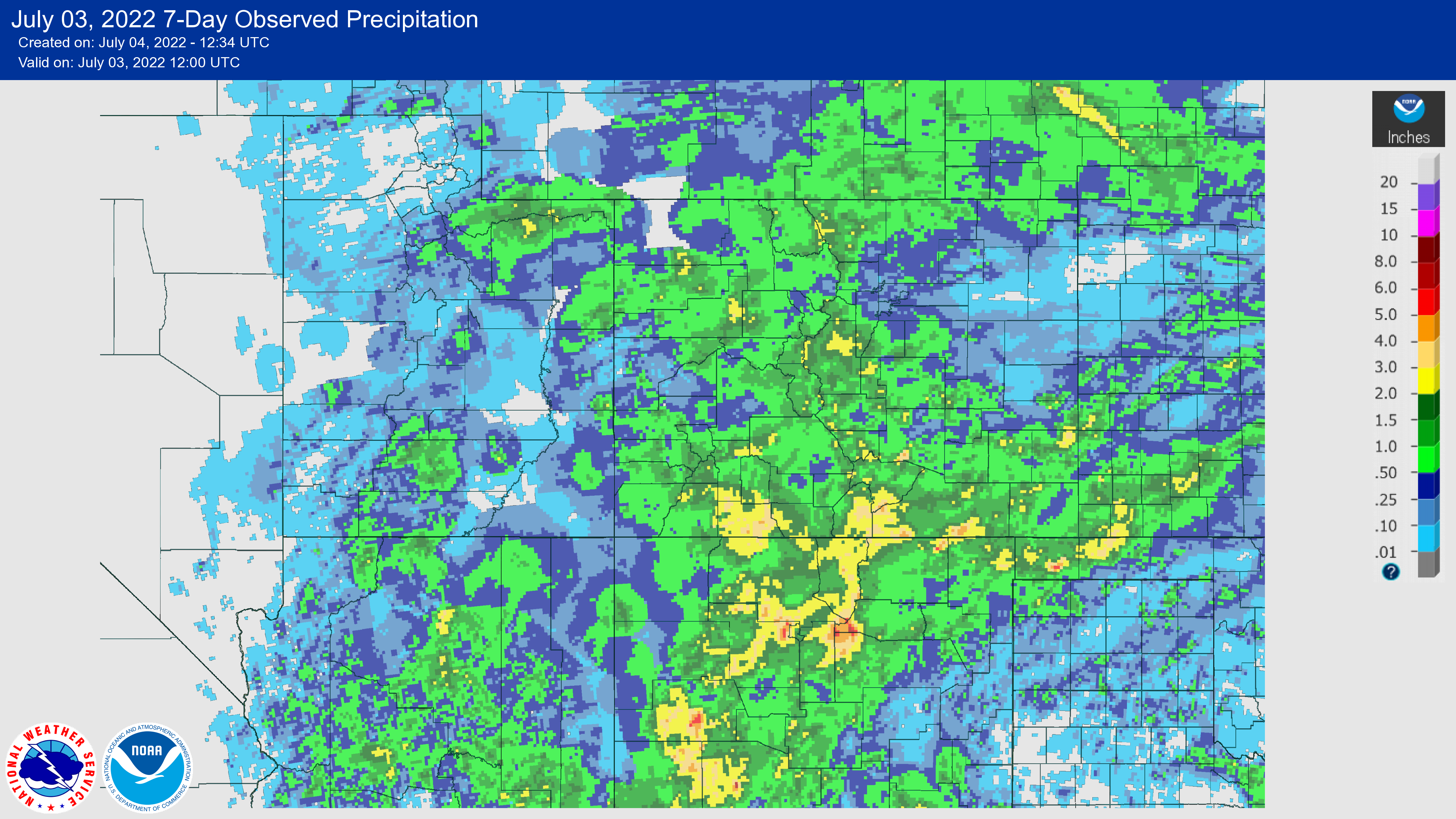
With the monsoon in full-swing, Colorado has seen plentiful rainfall over the last week in general, but the precipitation totals across the Denver Metro area in particular have been far from impressive. Despite seeing rainfall five out of the last seven days, Boulder has reported just 0.03″ of rainfall in the last week. Denver has done a little better at 0.21″, but still not great for the time of year. Totals across the higher terrain (Foothills, Palmer Divide, Cheyenne Ridge, Continental Divide) have been better.
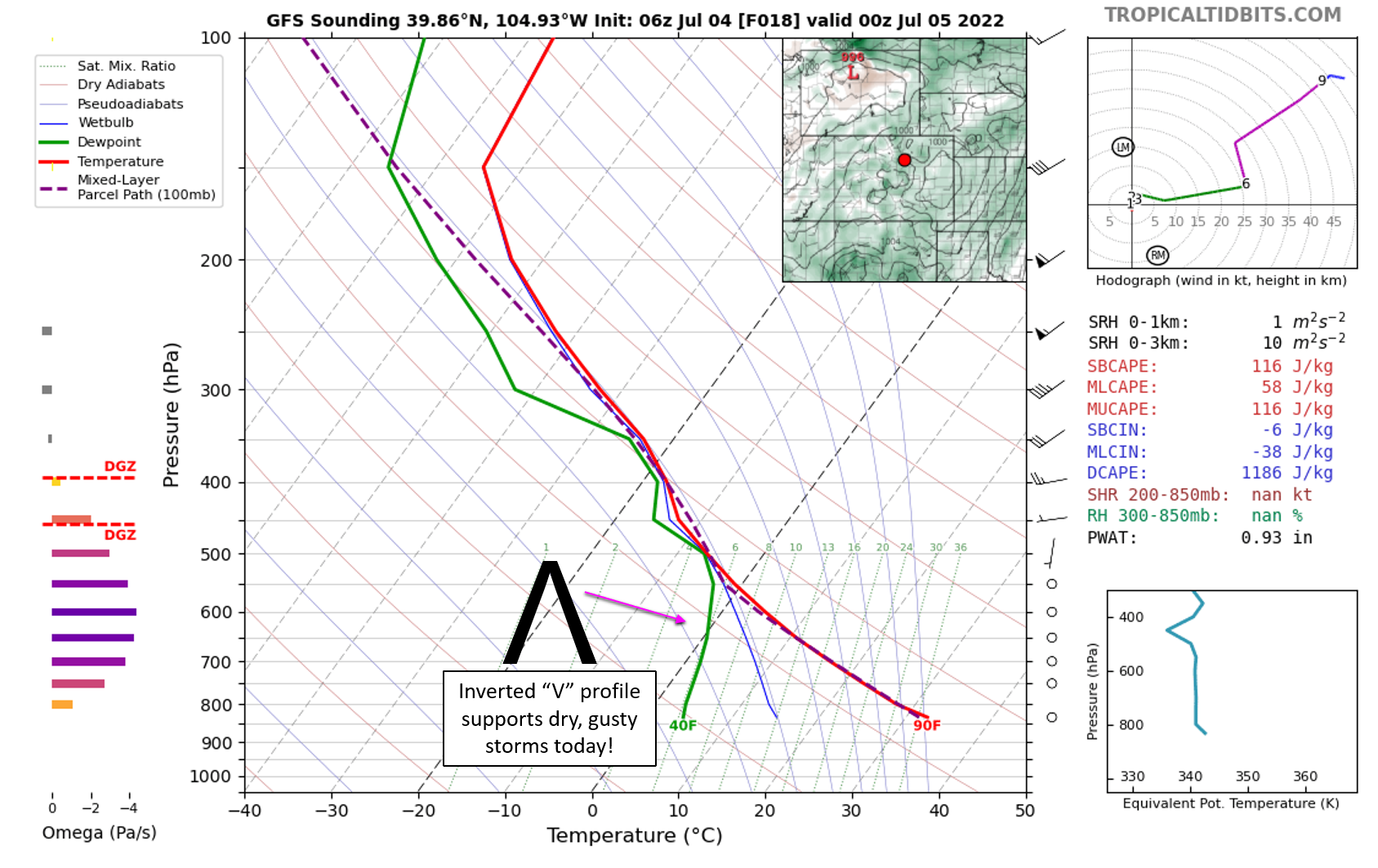
There will be another chance of late-day thunderstorms in the forecast for today, though the moisture availability has decreased slightly. While we saw widespread rain activity on Sunday, the coverage should be more scattered today during the afternoon and evening. Model soundings, like the GFS one below for Denver, show a clear “inverted-V” signature indicating storms today will be falling into a dry lower atmosphere. This means they will pack gusty outflow winds but only light to moderate rainfall at best.
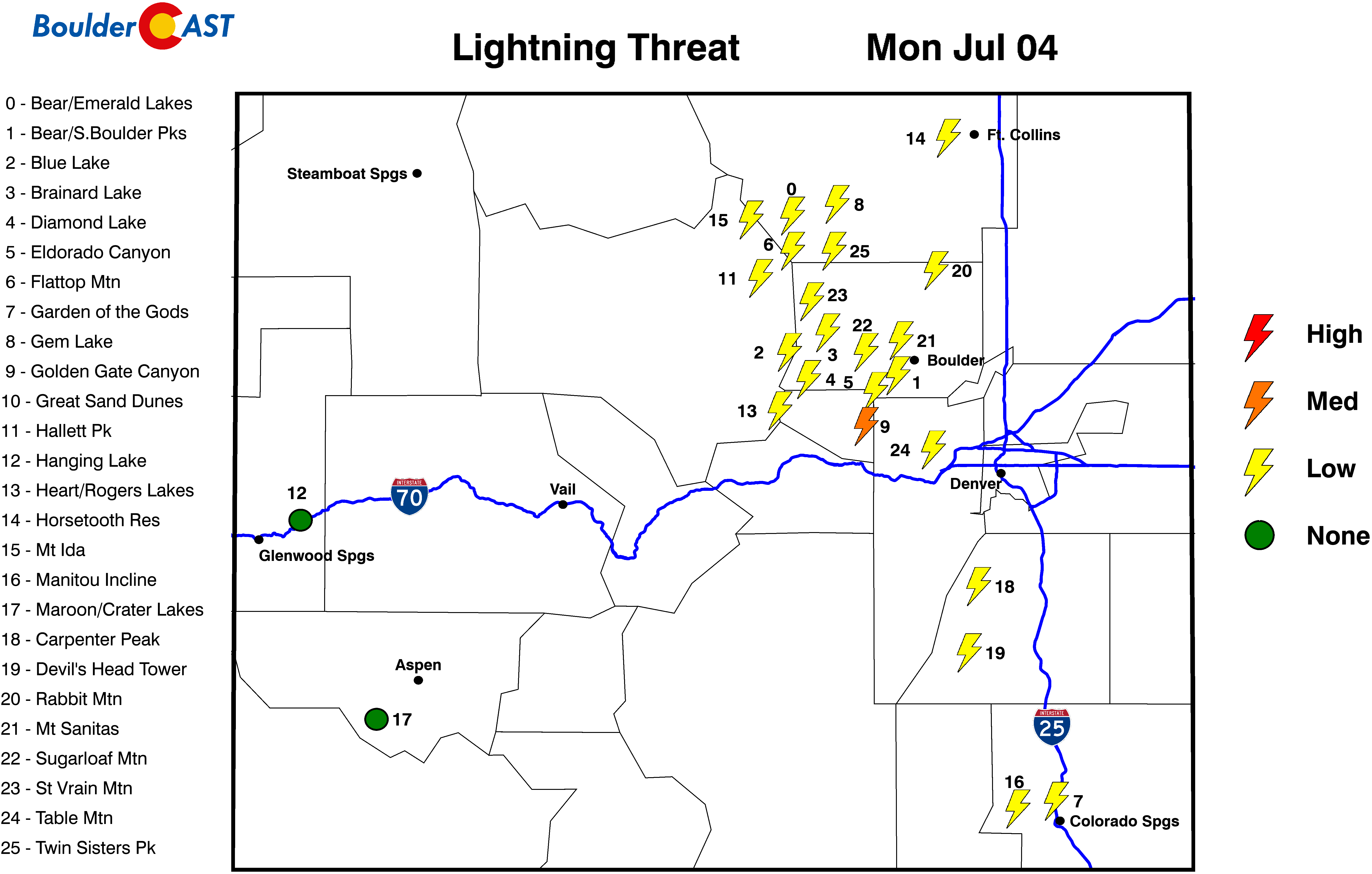
Don’t cancel any outdoor plans today, but do be aware of the lightning threat and minor rain potential later on, especially if you are heading up in elevation.
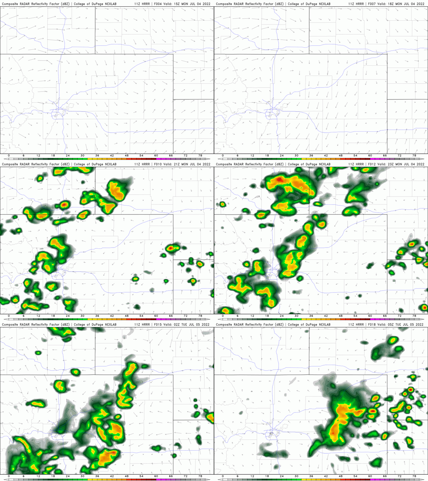
The animation below shows the HRRR model’s simulated radar forecast. Storms begin popping early to middle afternoon around the Boulder-Denver area but thankfully shift eastward by 8PM or 9PM this evening. This will bode well for any fireworks displays — they are not likely to be impacted! For those planning home pyro endeavors, be very careful of the fire risk. While conditions are not good for rapid fire spread today, it’s barely rained in the last month and our vegetation is starting to really dry out again. It wouldn’t be hard at all to start small grass fires almost anywhere in the Metro area!
For high temperatures, expect a hot day in the lower to middle 90s across much of the area, with locations closer to the Foothills like Boulder clouding up earlier and possibly settling in right around the 90-degree mark.
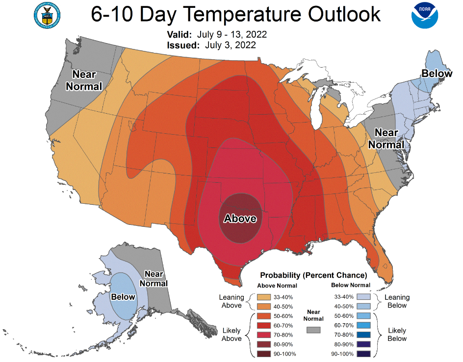
The monsoon will stick around for a couple more days, but a major pattern shift will cut it off at the source late in the week bringing a drier and eventually a very hot stretch of days to our area. We’re seeing mid 90s to low 100s for the weekend ahead. We’ll talk more about this in our weekly outlook tomorrow.
From the entire BoulderCAST team, we wish you a safe and enjoyable Fourth!
Remember, our daily forecasts are Premium content. Periodically, we open this forecast up to all of our readers. Today is one of those days!
Help support our team of Front Range weather bloggers by joining BoulderCAST Premium. We talk Boulder and Denver weather every single day. Sign up now to get access to our daily forecast discussions each morning, complete six-day skiing and hiking forecasts powered by machine learning, first-class access to all our Colorado-centric high-resolution weather graphics, bonus storm updates and much more! Or not, we just appreciate your readership!






You must be logged in to post a comment.