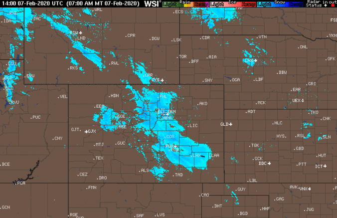
We take a quick peek at snowfall totals as of Friday morning, check the latest from the models, and let you know how much snow is still to come.
Author: BoulderCAST Team (Page 34 of 45)
This post had major contributions from at least two members of our team. The more meteorologists the better, right?
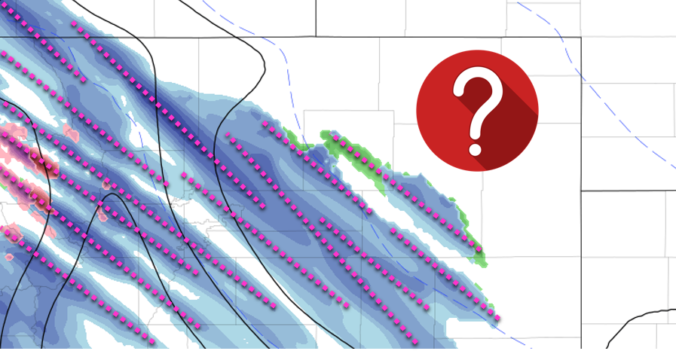
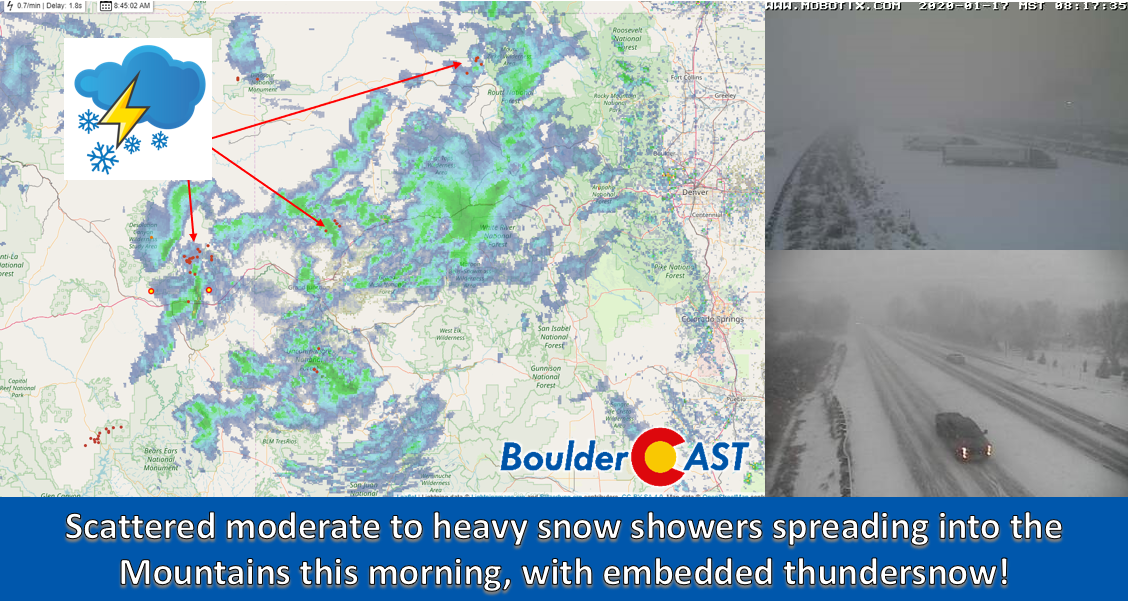
Following hot on the heels of the snowstorm earlier this week, another round of winter weather is expected Thursday evening into Friday evening across the Front Range. This one however will be a different beast, defined almost exclusively by a long window of scattered jet-forced heavy snow bands. Extreme uncertainty in the exact location and timing of the banding means potential snowfall amounts are not quite known. We discuss the setup and give our thoughts on what is sure to be a difficult forecast to end to the work-week.
Our first widespread snowfall of 2020 is winding down, but the cold will linger for most of the week ahead. We’re also tracking our next potential chance of heavy snow resulting from the overhead jet stream in just a few days time. Read on for all the details.
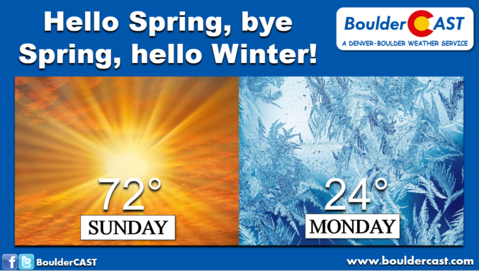
We hope you didn’t change out your winter tires already! Despite the very warm temperatures expected this weekend, bitter cold and snow are on the way! We discuss how and when record-warmth will transition back to the winter we haven’t seen in nearly two months. We also take a peek at potential snowfall amounts.
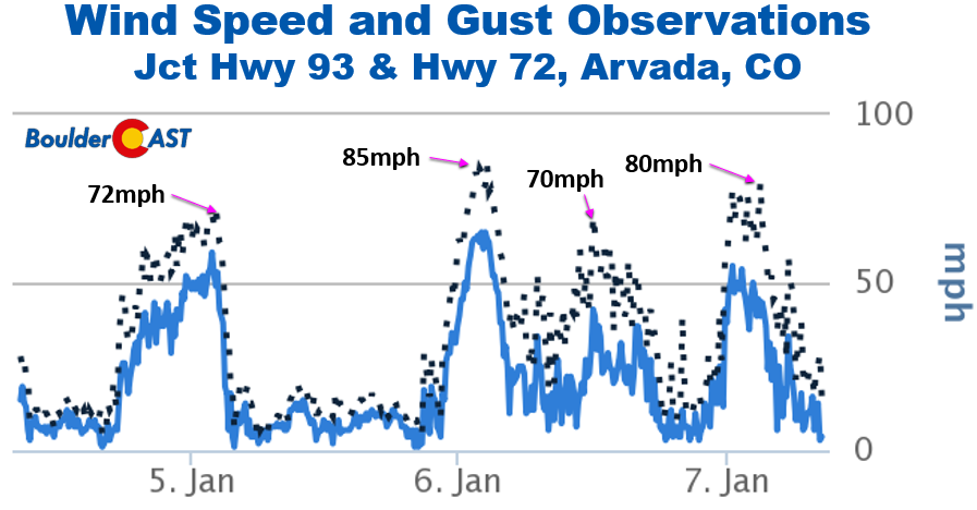
Time series of winds from west Arvada at the junction of Hwy 93 & 72
After a rather quiet month of December, our first “major” snow event in four weeks is taking shape for late Friday night into early Saturday. The bulk of the snow will bypass the Denver area, but we’re still looking at some accumulation. Read on for details on the falling temperatures, when the snowfall will begin and end, and how much white stuff to expect.
FORECAST UPDATE (Friday Dec 27 3:00 PM): Models are still having trouble with this storm, and so are we. Read our latest forecast and get our latest snowfall forecast map.
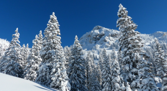
Skiers rejoice! A persistent influx of sub-tropical moisture associated with a developing atmospheric river event will bring a prolonged period of light to moderate snow to the Mountains in the coming days.

Live View of Boulder

Current Conditions

Live Radar

Recent Premium Posts

BoulderCAST Daily – Sun 12/14/25 | A warmup after the chilly yesterday afternoon
🌡️ Warmth Returns with no sight of snow: Highs return close to 60 …
BoulderCAST Daily – Sat 12/13/25 | Highs in the 60s this weekend!
🌡️ October Warmth in December: Highs typical for late October will be in …
This Weekend in Colorado Weather: The December that has felt like October continues with bone dry warmth persisting into next week
🌬️ Two more breezy days ahead with gusts 15–25 MPH before the jet …
3-Day Forecast

Trending Content

© 2025 Front Range Weather, LLC
You must be logged in to post a comment.