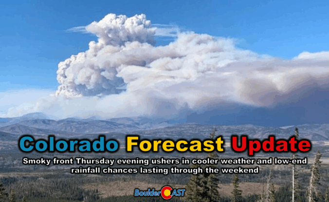
Thursday’s shaping up to be a busy weather day across the Front Range. We’re looking at hot temperatures, gusty winds, and a cold front arriving by evening that’ll bring a noticeable drop in temps — along with a wave of wildfire smoke. We’ll walk through what to expect today, how the weekend is shaping up, and whether any moisture from Hurricane Lorena might sneak into the region.
Author: BoulderCAST Team (Page 3 of 45)
This post had major contributions from at least two members of our team. The more meteorologists the better, right?
Thursday marks the final chapter of our late-summer heatwave, with record-challenging highs expected across the Front Range — but big changes are on the horizon. A cold front arrives tonight, ushering in cooler temps, a return of thunderstorms, and a wetter, more active pattern that could stick around well into next week. From sizzling heat to damaging hail, monsoonal moisture, and a long stretch of below-normal highs, today’s forecast update has a little bit of everything.
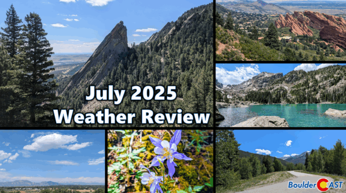
July 2025 was our second consecutive hot and dry month. The summer monsoon has been very stingy so far, leaving Boulder and much of the Denver region parched with drought conditions returning to parts of the Front Range. July didn’t hold back on extremes either: record-breaking heat at times scorched the region, plowable hail hammered Gunbarrel, and a rare funnel cloud spun up over the Foothills of Boulder County. Here’s a quick and colorful graphical recap of our weather during July and how it relates to climatology.
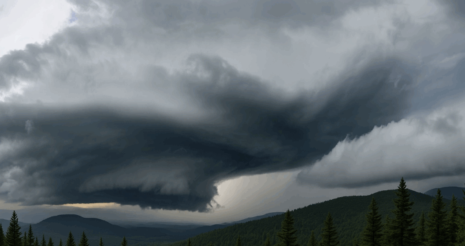
Wednesday may have felt underwhelming across the lower elevations of the Front Range, where lingering low clouds kept things calm and cool for much of the day — but just west of Boulder, up in the sunshine-soaked Foothills, something rare and striking took shape Wednesday afternoon. A graceful funnel cloud twisted above the mountain peaks in a spot where such phenomena almost never occur. We explore why tornadoes (and their funnel-shaped precursors) are so uncommon in Colorado’s higher terrain, and take a closer look at what makes broader Boulder County particularly adverse to tornado development.

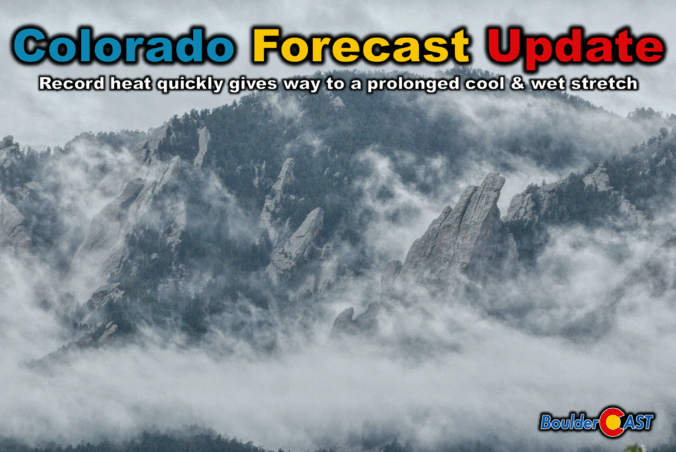
Wednesday brought historic heat across the Front Range, with Boulder hitting a record high of 101°F—the city’s hottest day in over a decade. A weak cold front has since cooled things off slightly, ushering in a good chance of storms the next few days as well. Sunday into Monday turn drier and hotter again as reverse monsoonal flow sets up, potentially stifling our typical summer storm pattern for a bit.
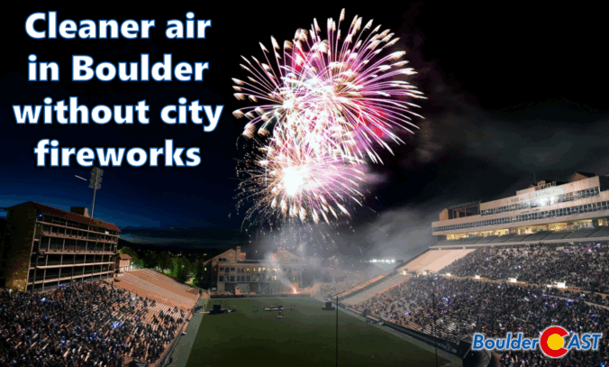
While fireworks once lit up Boulder’s Fourth of July, the city has moved on from the tradition due to rising fire risks, noise concerns, crowd issues, and high costs. But there’s another reason to consider: air quality. This year’s air quality data from across the Denver Metro area revealed that Boulder’s lack of a city-run fireworks show resulted in noticeably lower pollution levels compared to neighboring cities.

A shifting weather pattern is on the way as we head into the holiday weekend along the Front Range. Thursday will bring the heat and mostly dry skies, but things could get a bit more unsettled as we head into the Fourth of July and the weekend. If you’ve got outdoor plans in the coming days, here’s what to keep an eye on.

Front Range Colorado is bracing for a scorching stretch ahead as a powerful heat dome settles in, sending daily highs into the 90s and even near 100°F come Friday. Fire danger is also set to rise with bone-dry downslope winds ramping up in the days ahead. But there’s relief on the horizon: a cold front will finally break the heatwave by Monday, bringing much cooler temps, a shot at rain, and the kind of weather we’ll certainly be ready for!

Live View of Boulder

Current Conditions

Live Radar

Recent Premium Posts

BoulderCAST Daily – Thu 01/08/26 | Snow develops today but still some uncertainty, amounts have been lowered
❄️ Snow develops today: Snow develops today, but uncertainty still lingers with two …
BoulderCAST Daily – Wed 01/07/26 | Quiet today but snowflakes are on the horizon tomorrow
⛅ Quiet Weather Today: Highs will be mild in the upper 50s in …
BoulderCAST Daily – Tue 01/06/26 | Critical Fire Conditions Today
🔥Critical Fire Conditions: Fire Weather conditions could be critical today with gusty winds …
3-Day Forecast

Trending Content

© 2026 Front Range Weather, LLC