Author: Ben Castellani (Page 93 of 301)
Ben grew up in southwestern Pennsylvania and holds both a bachelor's and a master's degree in Meteorology, the latter being from CU Boulder. His hometown received nearly three feet of snow from the Storm of the Century back in March of 1993, sparking his initial interest in impactful weather. Ben currently works on remote sensing and data analysis software at NV5 Geospatial Software in Boulder.
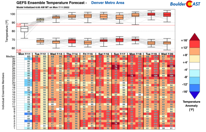
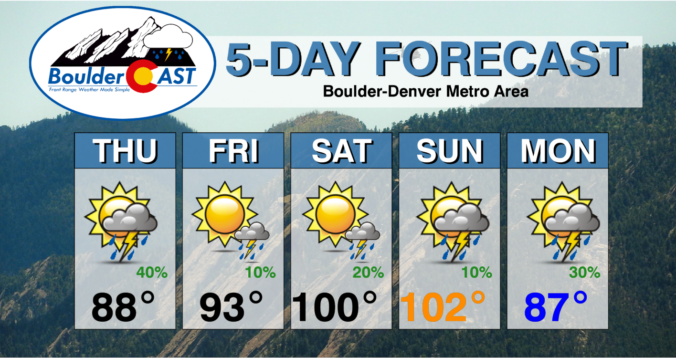
We hope you had a great Fourth! The Southwest monsoon remains active through the middle part of the week with good chances for rain in Boulder and Denver, especially Tuesday and Wednesday. Unfortunately, the pattern shifts late in the week suppressing the flow of monsoon moisture into Colorado. This will cause drying for us, but also a spike into triple-digit temperatures for the weekend. Read on for our full outlook of the week and weekend ahead.

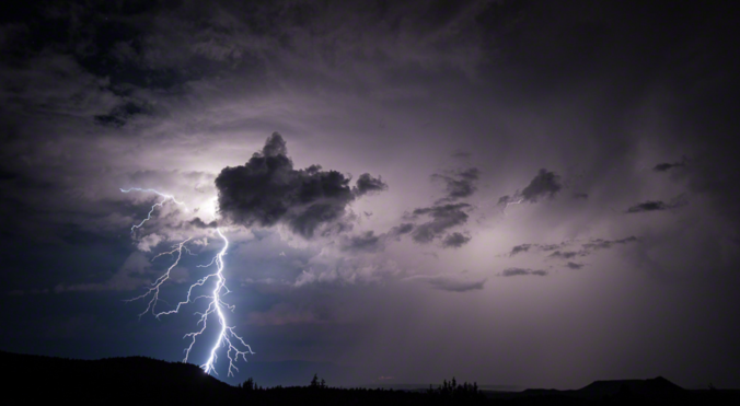
⦁❶⦁ A favorable monsoonal flow continues today with another chance of showers and thunderstorms across the area, though storms will be less intense and less widespread
⦁❷⦁ Best chance of storms between 2PM and 8PM with things shifting east before sunset — little to no impacts expected to any fireworks displays
⦁❸⦁ High temperatures will be in the lower to middle 90s
⦁❹⦁ Warm weather with decent monsoon moisture sticks around for a few more days before changes come later this week

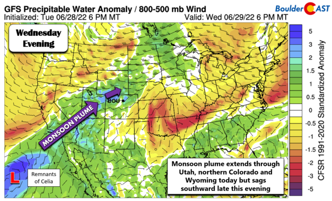
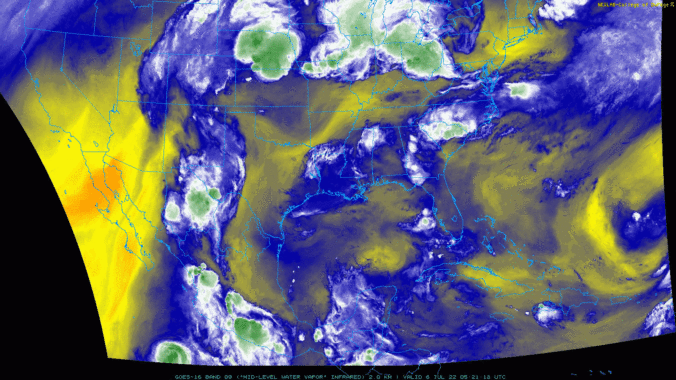
The arrival of the North American summer monsoon varies substantially from year to year, depending greatly on the weather patterns of Mexico, the southeast USA, and the tropical eastern Pacific Ocean. We don’t have to wonder anymore — the monsoon has already commenced in the last few days, about two weeks ahead of schedule. Hooray! We discuss the current state of the monsoon, what’s happening with that pesky La Niña, and what to expect in the coming months across Front Range Colorado.

Live View of Boulder

Current Conditions

Live Radar

Recent Premium Posts

BoulderCAST Daily – Tue 04/28/26 | Staying cool with a couple showers, the late-week storm is still the main event despite trending south
🌧️ Morning wave = main show, with light rain showers and Foothills wet …
BoulderCAST Daily – Sun 04/26/26 | Showers and some storms later today and this evening
🌧️ A wet afternoon and early evening, with showers and a few rumbles …
BoulderCAST Daily – Sat 04/25/26 | Cooler today and wet Sunday into early next week
🌧️ A wet latter part of the weekend, with showers and a few …
3-Day Forecast

Trending Content

© 2026 Front Range Weather, LLC