
As if last week’s record‑smashing heatwave wasn’t enough, the atmosphere has decided to double down this week. After a brief cooldown, we’re gearing up for another round of exceptional warmth—with Colorado’s snowpack plunging to levels more typical of early summer than March. In today’s update, we break down the new records already in the books, the alarming snowpack decline, and what to expect as a second pulse of historic warmth takes aim at the Front Range.
Author: Ben Castellani (Page 9 of 306)
Ben grew up in southwestern Pennsylvania and holds both a bachelor's and a master's degree in Meteorology, the latter being from CU Boulder. His hometown received nearly three feet of snow from the Storm of the Century back in March of 1993, sparking his initial interest in impactful weather. Ben currently works on remote sensing and data analysis software at NV5 Geospatial Software in Boulder.

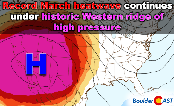
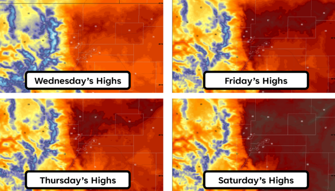
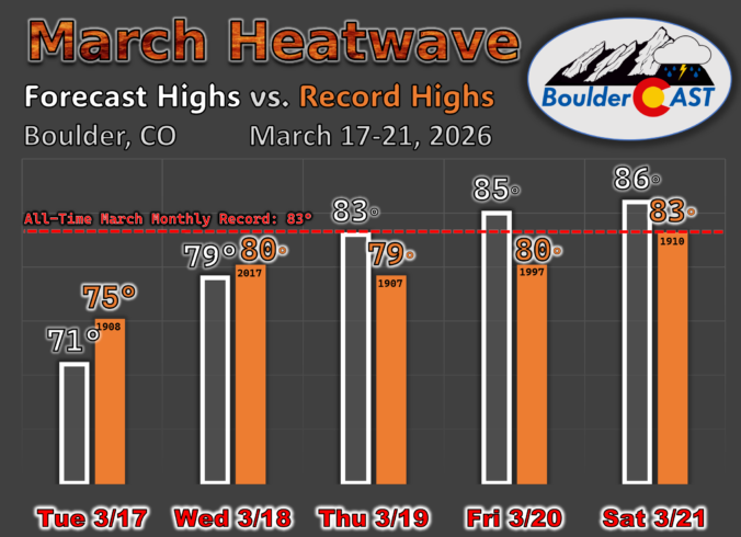
Wednesday’s remarkable 80° warmth marked the start of a stretch that’s far more reminiscent of early summer than mid‑March here in Colorado. An unusually strong ridge of high pressure is now locked over the region, setting the stage for several more days of exceptional heat with widespread record temperature destruction and increasing fire concerns. A brief cooldown will arrive over the weekend, but the broader pattern remains firmly tilted toward above‑normal temperatures the rest of the month, including a secondary heatwave already brewing for next week. Here’s a look at how this historic heatwave setup will unfold across the Front Range in the many days ahead.

Saturday’s storm didn’t quite live up to its wind hype, but it still delivered a sharp overnight front and a quick burst of convective snow before sunrise on Sunday.
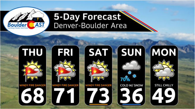
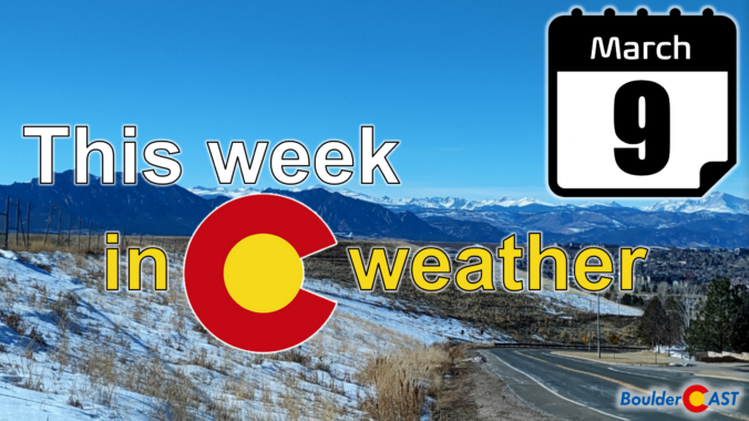
Warmth, wind, and a whole lot of déjà vu are back on the menu along the Front Range this week. After Sunday’s near‑record heat wiped out most of Friday’s snow, the pattern ahead looks suspiciously like the one we’ve been stuck in all winter — breezy downslope days, a meaningless cold front, and another surge of unseasonable warmth waiting in the wings. Fire danger, early Mountain snowpack melt, and record high temperature records will all come into play as we head deeper into the week and the month of March. Read on for all the details.

Live View of Boulder

Current Conditions

Live Radar

Latest Smoke Forecast

Recent Premium Posts

BoulderCAST Daily – Fri 07/31/26 | Marginal Risk of Severe Storms with Smoke and Haze
🌧️ Isolated Storms — This afternoon and evening, with a marginal risk of …
BoulderCAST Daily – Wed 07/29/26 | Final Storm‑Filled Afternoon Before an Expanding Desert Southwest Heat Dome Takes Over
🌧️ Lingering Monsoon Moisture — Lingering Tap One last day of beneficial rainfall …
BoulderCAST Daily – Tue 07/28/26 | Front Range Primed for Widespread Thunderstorms as Monsoon Reloads
🌩️ Monsoon moisture surge — Deep moisture availability today, both aloft and at …
3-Day Forecast

Trending Content

© 2026 Front Range Weather, LLC