Author: Ben Castellani (Page 85 of 358)

Ben grew up in southwestern Pennsylvania and holds both a bachelor's and a master's degree in Meteorology, the latter being from CU Boulder. His hometown received nearly three feet of snow from the Storm of the Century back in March of 1993, sparking his initial interest in impactful weather. Ben currently works on remote sensing and data analysis software at NV5 Geospatial Software in Boulder.
Premium This Weekend in Colorado Weather: Autumn technically begins but Mother Nature is stuck in summer-mode

Alarge closed-low pressure is currently spinning in eastern Oregon --- this is the primary weather player across the west right now. Here's the latest GOES-East infrared satellite imagery of this impressive system from early this morning. Out ahead of this trough, yet another shortwave system is passing through this morning into midday (notice the vorticity maximum in southeast Utah above), …

Premium BoulderCAST Daily – Wed 09/20/23 | Isolated late-day thundershowers continue, mainly for northern areas

Things will be largely quiet today across the Front Range as shortwave energy passes by just to our north and west. This energy, as well as additional waves the next few days, are rotating around a brough trough across the Pacific Northwest right now. This trough is forecast to stall out near Idaho and eventually does move east, but latest …

Premium BoulderCAST Daily – Tue 09/19/23 | Widely scattered PM storms today, the late-week system likely misses north

Westerly flow will be situated over Colorado today with a weak embedded shortwave progressing through the area this afternoon and evening from west to east. Increased moisture in this flow will lead to more clouds and a better chance of storms today, two factors that will keep our temperatures a few degrees cooler as well (relative to Monday). The best …

Premium This Weekend in Colorado Weather: Soggy Thursday evening and staying gloomy Friday, but a wonderful weekend lies ahead

GOES-East satellite imagery this morning shows a line of clouds and showers approaching Colorado from the northwest. This is the Pacific trough we have been anticipating all week long! Over the next 24 to 36 hours, this trough will move in slowly and rake across our area. The vorticity forecast animation below spans now through Saturday afternoon. Notice how the …

Premium BoulderCAST Daily – Wed 09/13/23 | Afternoon skies turn ominous but minimal rainfall is expected

Yesterday's maximum temperature was quite comfortable at 75°F across most of the area. Combined with the mostly sunny skies and it sure was a glorious Tueday! Temperatures will remain below normal today as well, but it will be a few degrees warmer in the upper 70s as weak warm air advection reaches Colorado from the west ahead of our next …

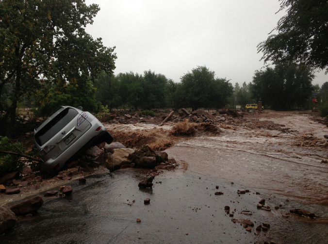
The 2013 Boulder Flood: Ten years and three billion dollars later

Ten years ago this week, torrential rains fell across the Front Range, triggering one of the worst floods in Colorado’s short recorded history, accompanied by a staggering repair bill now approaching $3 billion. With Boulder County at the epicenter of the disaster, the road to recovery has been long and arduous, and still continues today. We take a look back at this historic event, explain how it happened, and provide an update on related analysis performed since.

Continue reading

Premium BoulderCAST Daily – Tue 09/12/23 | Today will be excellent, but rain is still on-track for Thursday

Very dry air sits over northern Colorado right now as we reside in the northwest flow behind the departing shortwave that brought the rain early Monday. This parched airmass is visible in the GOES-East water vapor animation below for early Tuesday. The drier air will be over the area through the morning and afternoon hours leading to bountiful sunshine. Later …

« Older posts Newer posts »