Author: Ben Castellani (Page 7 of 358)

Ben grew up in southwestern Pennsylvania and holds both a bachelor's and a master's degree in Meteorology, the latter being from CU Boulder. His hometown received nearly three feet of snow from the Storm of the Century back in March of 1993, sparking his initial interest in impactful weather. Ben currently works on remote sensing and data analysis software at NV5 Geospatial Software in Boulder.

Premium This Weekend in Colorado Weather: Record Highs Possible Friday as Monsoon Moisture Stages a Slow Return

High pressure across the Southwest has nudged a bit farther north over the last 24 hours, now centered near the Four Corners. With the ridge closer to the Front Range, we’re tapping into a warmer, drier airmass today, reinforcing a noticeable drying trend we've seen the last couple days in Boulder and Denver. Through the weekend, the ridge will gradually …

Premium BoulderCAST Daily – Wed 08/19/26 | Only Isolated Showers Today Ahead of Hotter, Drier Weather Late-Week

It's a crisp, quiet morning in Boulder and all of the Front Range. Yesterday’s evening convection delivered plenty of lightning and outflows, but not much actual rainfall. https://twitter.com/BoulderCAST/status/2089928215330766942 Most spots logged only a trace to a few hundredths of an inch, continuing the summer‑long trend. A few pockets — Greeley, Castle Rock, and scattered zones across eastern Colorado — managed …

Premium BoulderCAST Daily – Tue 08/18/26 | 90° with Late-Day Storms Back in the Mix, Including Severe Weather North and East

After a relatively quiet and dry Monday across the Boulder-Denver area, the forecast gets a bit more interesting today. A couple of surface boundaries, some upper-level energy, and an uptick in monsoonal moisture will come together to bring scattered showers and thunderstorms back to the Front Range. GOES-East water vapor imagery shows the high pressure ridge still positioned to our …

Premium BoulderCAST Daily – Wed 08/12/26 | Today’s Heat Is the Finale — Cooler, Wetter, & Less Smoky Days Lie Ahead

Today is the day we've all be waiting for! A much‑needed pattern shift— one that's been six sizzling, bone‑dry weeks in the making — is finally beginning to take shape across Colorado. The atmosphere has been locked in a stubborn ridge pattern since early July, suppressing moisture, amplifying the heat, and leaving the Front Range with little more than passing …

Premium BoulderCAST Daily – Tue 08/11/26 | Cooler, Wetter Weather Takes Over Through the Extended

High pressure remains parked to our south and west this morning, basically centered right over the Four Corners. That placement is giving us a textbook monsoon setup on GOES-East water vapor: subtropical moisture surging north into the Desert Southwest, then hooking east across Utah and into the Western Slope. It’s the long‑way‑around route into Colorado, and as usual, upstream terrain …

Premium BoulderCAST Daily – Sat 08/08/26 | Clouds, Virga Breezes and Thick Smoke May Keep Us Just Shy of 100°

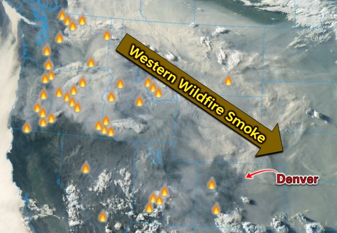
Hot, smoky, and stubborn — that’s the theme again today as the Four Corners heat dome tightens its grip over Colorado. Near‑record highs are still on the table, but the atmosphere is throwing us just enough curveballs to keep the forecast interesting. GOES-East imagery continues to show west–northwest flow pouring into the Front Range, with a subtle uptick in mid‑level …

Premium BoulderCAST Daily – Fri 08/07/26 | Smoke‑Soaked Heat Dome Intensifies Heading Into the Weekend

The persistent Four Corners heat dome will remain firmly entrenched through the weekend, keeping our synoptic pattern effectively locked in place. Under this stagnant ridge, broad subsidence continues to dominate the area, compressing the lower troposphere, warming the boundary layer, and suppressing vertical motion. For the Front Range, that translates to two main impacts: heat and smoke, both of which …

« Older posts Newer posts »