Author: Ben Castellani (Page 64 of 358)

Ben grew up in southwestern Pennsylvania and holds both a bachelor's and a master's degree in Meteorology, the latter being from CU Boulder. His hometown received nearly three feet of snow from the Storm of the Century back in March of 1993, sparking his initial interest in impactful weather. Ben currently works on remote sensing and data analysis software at NV5 Geospatial Software in Boulder.
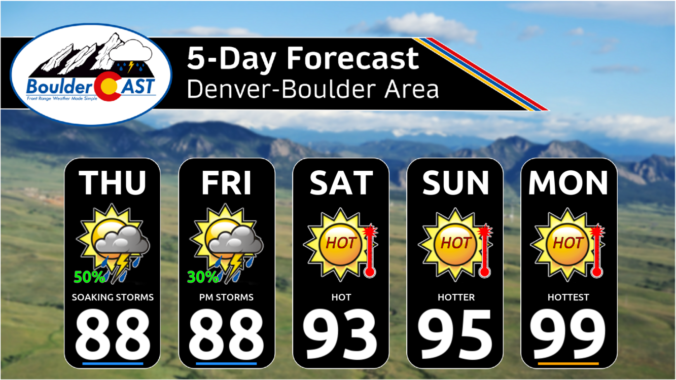
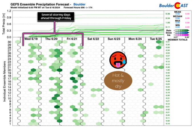
Premium BoulderCAST Daily – Fri 06/21/24 | Staying pleasant with one last chance of decent rain before we turn hot & dry

Most areas received much-needed rainfall on Thursday, but amounts were generally less than 0.25" for most. A few spots where stronger storms hit from Longmont to Greeley saw greater than 0.5" of rain. Today will be similar in many regards to Thursday, including: Rainfall chances (30-50%): A shortwave disturbance will pass across the area, well timed with the afternoon period. …

Premium This Weekend in Colorado Weather: Celebrating the summer solstice with soaking thunderstorms, but the oven dial slowly ramps up through the weekend!

The good news is Boulder County received the most rainfall out of anywhere yesterday! The bad news is it was only a few hundredths of an inch in most cases: Let's not worry too much yet as the chance of rain will amplify further today into Friday as the deepest fetch of subtropical moisture arrives to Colorado from the south. …

Premium BoulderCAST Daily – Wed 06/19/24 | Unseasonably chilly with scattered late-day rain; warmer but still stormy the rest of the week

The storm system that brought chilly rain and some snow to parts of Montana and Idaho has pushed off into the Great Lakes. The unseasonably strong cold front trailing this system moved into Colorado Monday night with temperatures yesterday struggling, but eventually succeeding, to get out of the 60s. High temperatures across the area were generally in the low to …

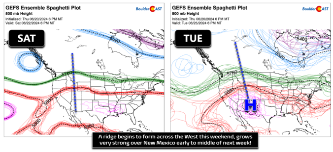
Colorado Weather Update: A busy weekend forecast as near-record heat, ozone pollution, severe thunderstorms, and Mexican wildfire smoke are on the way!

As the Front Range races towards near-record high temperatures on Thursday, the weather pattern is evolving to offer a short-lived reprieve on Friday with a chance of severe thunderstorms and cooler temperatures accompanied by well-mixed smoke blowing in from Mexico. While the blistering heat will ramp back up again over the weekend, we are tracking a potential dip towards more comfortable temperatures next week. Here’s the latest!
Continue reading

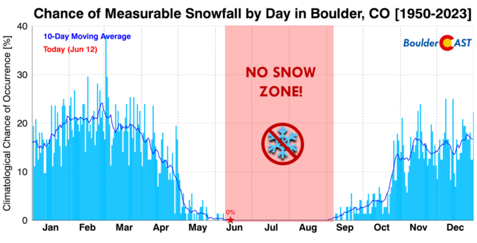
Premium BoulderCAST Daily – Wed 06/12/24 | Back into the scorching 90s today & tomorrow, but climatologically snow may be closer than you think!

Lots of dry (and also hot) air is present over the southwestern United States today, as seen from GOES-East water vapor imagery. The mid-latitude jet stream is well north across Canada, while the subtropical jet is well to the south. In between, we have largely quiet conditions across most of the West right now and most of northern Mexico. This …

Premium BoulderCAST Daily – Tue 06/11/24 | Mostly dry with seasonal temperatures, but brace for a push deep into the 90s the next couple days

The shortwave disturbance which brought a wave of weak showers and storms to the area yesterday has exited off to our south and east, just barely clinging to the far southeast corner of Colorado as of early this morning. Behind this system, a fetch of drier air is working into the region from the northwest and this will lead to …

This Week in Colorado Weather: June 10, 2024

This week in the Front Range will feature two scorchingly hot days sandwiched between chances for thunderstorms. For the most part, the severe risk looks to be low throughout the extended, but we will need to monitor things late in the week as a surge of subtropical moisture may support more numerous storms and torrential rainfall rates. Read on for all the details.

Continue reading

« Older posts Newer posts »