The weather pattern over the next several days is relatively zonal. However, embedded quick-moving shortwaves will keep things interesting until the arrival of our next major storm system on Tuesday.
Ben grew up in southwestern Pennsylvania and holds both a bachelor's and a master's degree in Meteorology, the latter being from CU Boulder. His hometown received nearly three feet of snow from the Storm of the Century back in March of 1993, sparking his initial interest in impactful weather. Ben currently works on remote sensing and data analysis software at NV5 Geospatial Software in Boulder.
The weather pattern over the next several days is relatively zonal. However, embedded quick-moving shortwaves will keep things interesting until the arrival of our next major storm system on Tuesday.
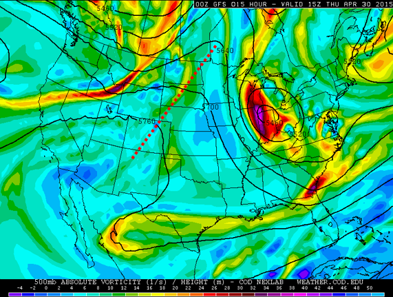
The storm is beginning to ramp up across our region, though it is now following a slightly more southern track. How will this impact the forecast?
Another potent cut-off low is eying the region once again, bringing much-needed rain and snow Sunday into Tuesday.
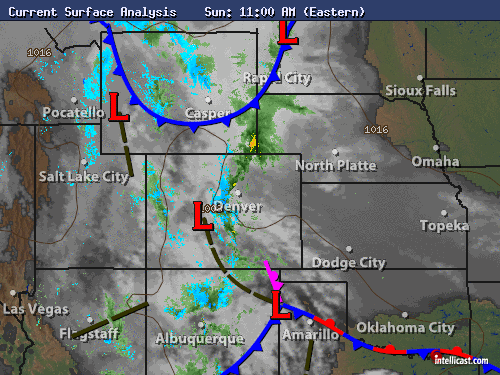
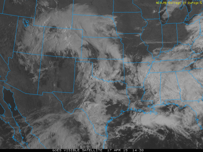
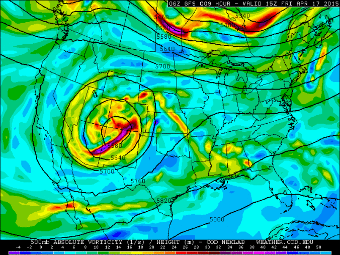
With the legendary storm system responsible for the rain, tornadoes, wind, hail, snow, graupel, and thunderstorms having finally departed from NE Colorado, it is a great time to take a look back at a storm we’re all sure to remember (for a few years at least)!
Don’t be fooled by the sun’s appearance this afternoon – the storm that has been plaguing the area since Wednesday has one last gasp left before exiting our region tomorrow.
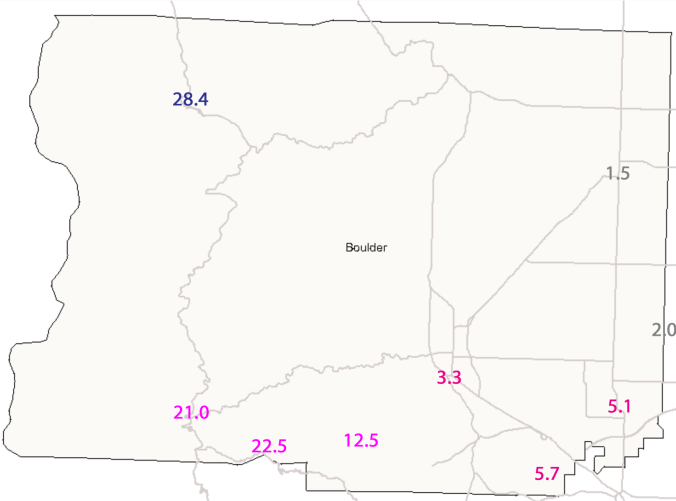
Snowfall amounts in Boulder County through 8am MT Friday range from 2 to 24”. Where does your neighborhood fall?
What has proven to already be a messy storm will only get messier heading into Friday, as Boulder will experience its most significant precipitation event since the Boulder Flood in September 2013, alongside a potential historic snowfall event unfolding in the Foothills.
The latest computer models are indicating the storm could pack a bit more moisture that previously expected. Depending on your stance on snowfall, this could either be great or horrible news to you.


© 2026 Front Range Weather, LLC