Author: Ben Castellani (Page 256 of 358)

Ben grew up in southwestern Pennsylvania and holds both a bachelor's and a master's degree in Meteorology, the latter being from CU Boulder. His hometown received nearly three feet of snow from the Storm of the Century back in March of 1993, sparking his initial interest in impactful weather. Ben currently works on remote sensing and data analysis software at NV5 Geospatial Software in Boulder.

Find Your Next Snow Day…It’s Still Winter in the Mountains!

PowderCAST 2.0 is now available

Prior to this winter, we completed a major upgrade to our PowderCAST suite of ski forecasts! Here are some of the NEW features we’re most excited about:

  • MORE Days: Track powder for the next SIX days
  • MORE Resorts: All of Colorado’s 22 ski resorts are included
  • MORE Weather: New forecast parameters, such as wind chill and probability of precipitation
  • MORE Elevations: Forecasts cover the base, mid mountain, and top of each resort
  • MORE Maps: More than 35 forecast maps are included
  • MORE Accuracy: Machine learning and frequent updates give you the most accurate forecasts possible
  • MORE Accessible: All of our forecasts are accessed from a single webpage

As a special bonus for our fellow skiers, use the promo code SKI to save 15% on an annual subscription.

Finding the next “POW Day” is now easier than ever with PowderCAST 2.0. We hope you enjoy!

DayCAST: Wed 03/21/18

Yesterday was the spring equinox. Though the word equinox is derived from a Latin phrase meaning "equality of night", we don't actually experience exactly 12 hours of day and 12 hours of night on the equinox. The table below show that in Denver, the date with the closest split between 12-and-12 for day and night was March 17th. We explained the reasoning …

DayCAST: Tue 03/20/18

The tightly-wound storm system that brought snow to our region on Sunday raced eastward yesterday and prompted the issuance of the first PDS (Particularly Dangerous Situation) Tornado Watch of 2018 from the Storm Prediction Center! These advisories are the "crème de la crème" of tornado advisories and are only issued when multiple violent and long-track tornadoes are expected with near-certainty to …

DayCAST: Sun 03/18/18

Good morning everyone! It's a tricky forecast for tonight's storm and we are still going through the morning run of weather models before we issue our final forecast and snowfall map. Ingredients are coming together to produce 0.3 to 0.8" of precipitation across the Metro area. However, it looks like the Plains will see mainly rain from this event, as we …

*Premium Storm Update* A wetter evening than expected?

The NAM model was showing heavier precipitation across the Denver Metro since yesterday. However, our thought was that downslope, cloud cover (hasn't showed up yet), and a dry lower atmosphere would limit the convection for us. Instead we sided with a forecast closer to the GFS, thinking the NAM model may have been overdoing the convection, which is typical in …

DayCAST: Thu 03/15/18

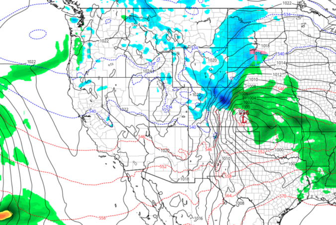
The complicated forecast is on track for rain and snow to form across the Front Range as a surface low deepens in eastern Colorado this evening. We expect mostly cloudy skies today with temperatures reaching into the 60's by early afternoon. After 3:00PM, rain showers will be possible across the Plains and Foothills. The best forcing will generally be north of …

« Older posts Newer posts »