


Author: Ben Castellani (Page 190 of 358)
Ben grew up in southwestern Pennsylvania and holds both a bachelor's and a master's degree in Meteorology, the latter being from CU Boulder. His hometown received nearly three feet of snow from the Storm of the Century back in March of 1993, sparking his initial interest in impactful weather. Ben currently works on remote sensing and data analysis software at NV5 Geospatial Software in Boulder.


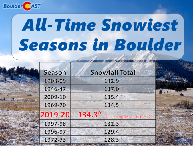
Boulder picked up nearly 19″ of snow from the cluster of storms earlier this week and now has a very good chance of breaking its century-old seasonal snowfall record. We discuss why Boulder has seen so much more than Denver this snow season, and also comment on our next winter storm knocking on the door Wednesday night into Thursday.


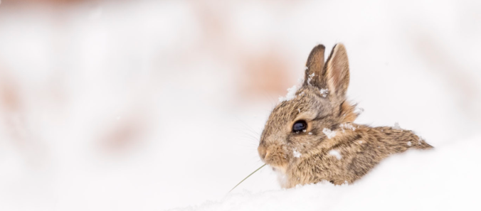
Around a foot and a half of fluffy snow fell in Boulder for Easter, while many areas saw much less. We take a look at snow totals from around the region. We also discuss our next wave of snow coming Monday afternoon into the evening, as well as the outlook for the rest of the week (spoiler: there will be more snow). Let’s get to it!
Live Radar

Trending Content


Recent Premium Posts

This Weekend in Colorado Weather: The Quiet Pattern Ends as Storm Activity Picks Up Across the West
After weeks of sunshine, mild afternoons, and storm systems repeatedly missing Colorado to …
BoulderCAST Daily – Wed 11/11/26 | Mild Days Ahead, But There Are Signs of a More Active November Soon
☀️ Warm & Quiet — Sunshine dominates through Thursday with highs rising from …
BoulderCAST Daily – Tue 11/10/26 | Clouds Increase Today, But Colorado’s Dry Pattern Rolls On
🌤️ A Few More Clouds Today – Mountain wave clouds are developing along …
© 2026 Front Range Weather, LLC