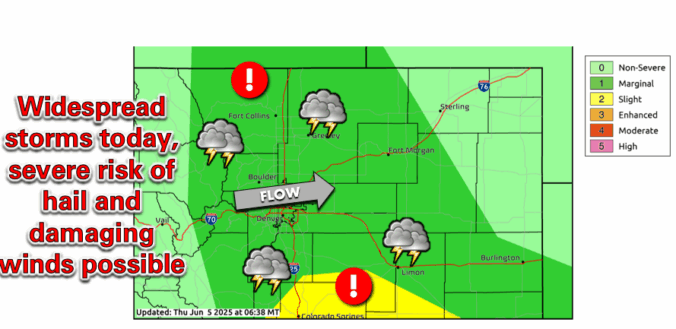
Record-breaking temperatures will be the story this week in the Front Range, though there’s plenty more to discuss. While a brief cooldown is on the way Tuesday, it comes with a catch—a chance for severe storms, depending on how quickly low clouds clear up. Then, just as we get a break, another scorching heatwave arrives on Thursday through the upcoming weekend, with several days of triple-digit temperatures that will shatter records. Let’s dive into the details.
Author: Ben Castellani (Page 14 of 294)
Ben grew up in southwestern Pennsylvania and holds both a bachelor's and a master's degree in Meteorology, the latter being from CU Boulder. His hometown received nearly three feet of snow from the Storm of the Century back in March of 1993, sparking his initial interest in impactful weather. Ben currently works on remote sensing and data analysis software at NV5 Geospatial Software in Boulder.
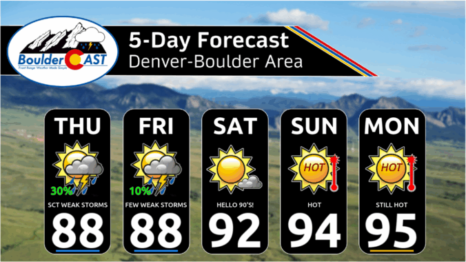
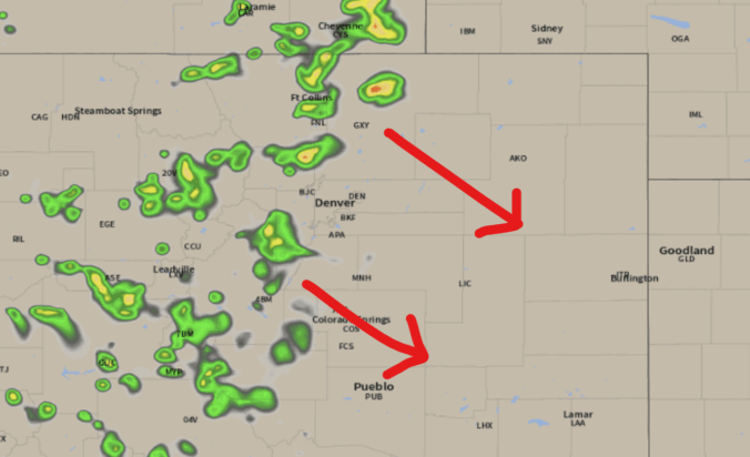
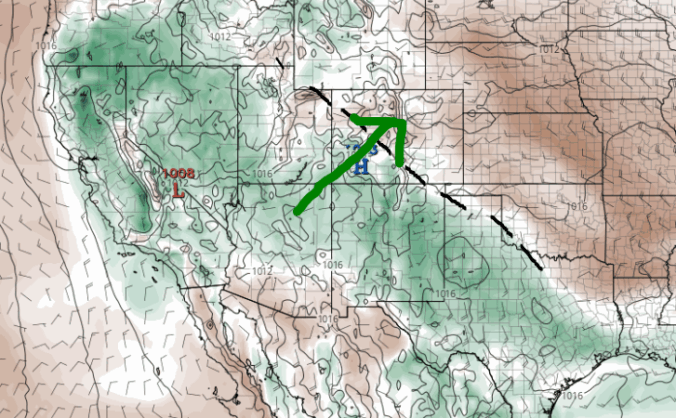
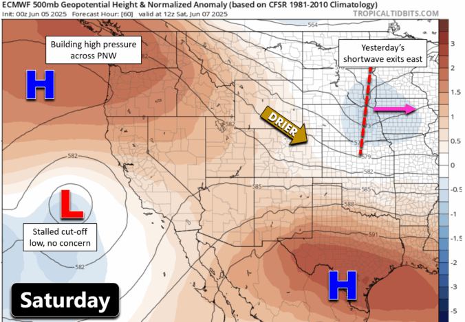
Get ready for a classic early summer setup—plenty of warmth, a hint of storm potential, a bit of wildfire smoke, and maybe even the year’s first 90-degree day(s) for the Front Range. While the week starts off dry and sunny, a few scattered storms will make an appearance midweek, adding a little variety to the forecast. By the weekend, the heat cranks up as a strong ridge sends hot air northward into Colorado.


Live View of Boulder

Current Conditions

Live Radar

Recent Premium Posts

BoulderCAST Daily – Sun 01/11/26 | A mild Sunday with readings reaching the 50s
🌤️ Mild & Melty Sunday: Light winds and patchy clouds, with lingering snowpack …
BoulderCAST Daily – Sat 01/10/26| Widespread sunshine and moderating temperatures this weekend as our recent snow melts off
🌤️ Calm Saturday: Winter storm systems have departed the state, leaving behind a …
BoulderCAST Daily – Fri 01/09/26| Snow ends quickly this morning with a quieter weekend in store
❄️ Overnight snow bands: A second push of upslope after midnight sparked narrow …
3-Day Forecast

Trending Content

© 2026 Front Range Weather, LLC