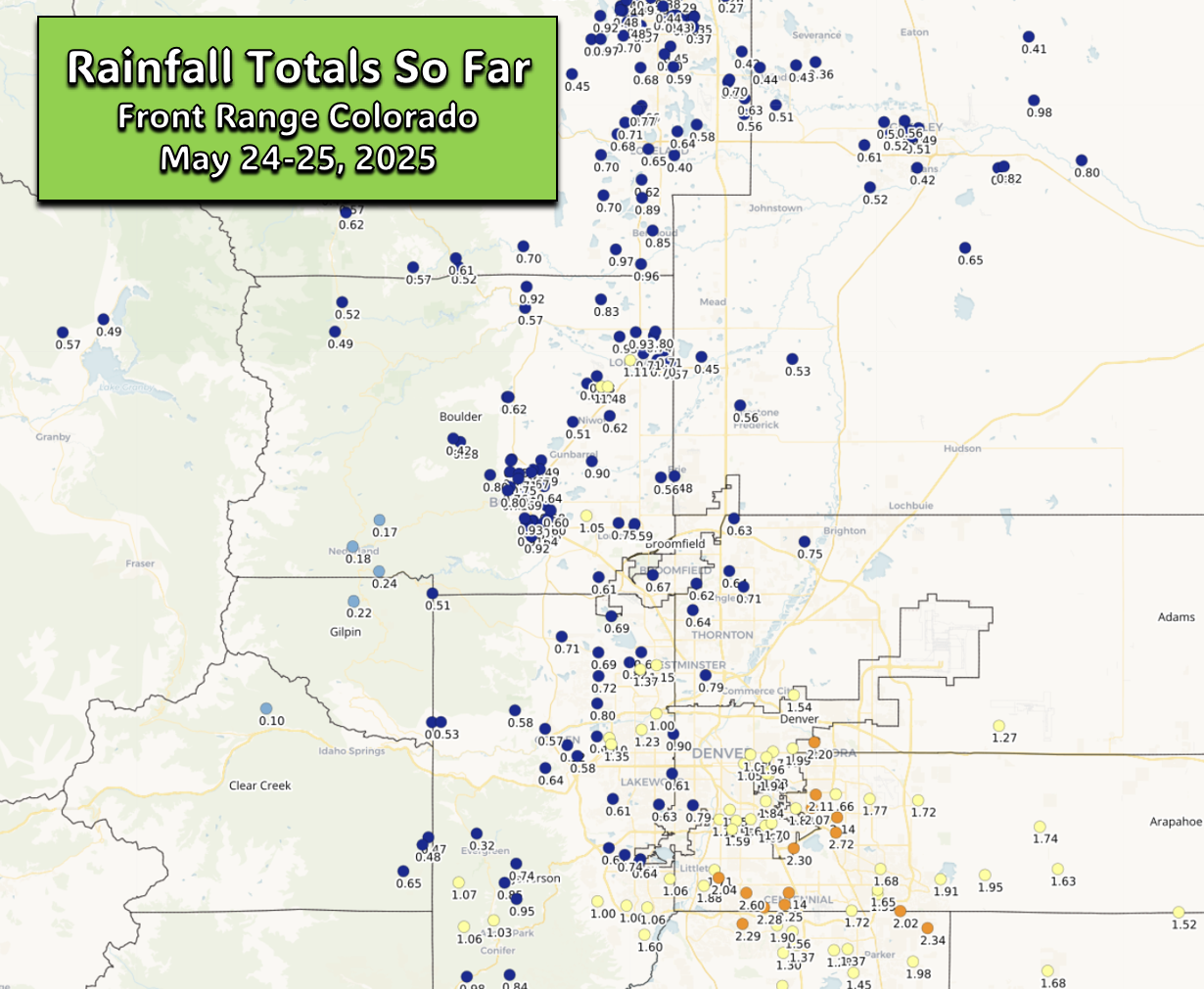
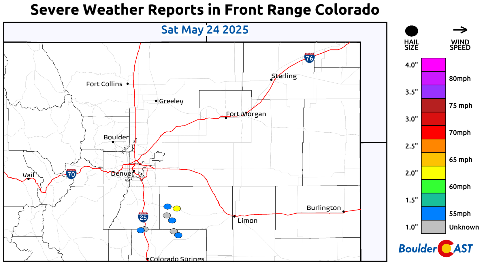
So far this Memorial Day Weekend has brought a mix of welcomed rainfall and intense thunderstorms across the Front Range, with some areas seeing over two inches of rainfall and even hail. While the first half of Monday should be dry for holiday festivities, scattered showers and storms will develop in the afternoon with brief downpours, gusty winds, and lightning. The unsettled pattern continues throughout the week ahead, with Wednesday and Thursday offering the highest storm chances, fueled by lingering atmospheric energy. However, as we approach the weekend, a shift toward warmer and drier conditions is expected, with highs climbing into the lower 80s and fewer storms impacting the region.
This week’s highlights include:
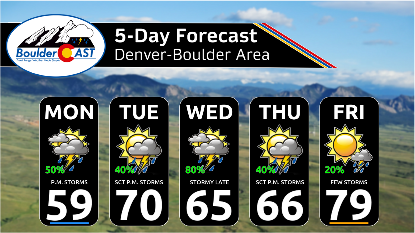
- Memorial Day brings another around of widespread showers and storms, centered on the late afternoon through late evening hours. Heavy rainfall will be possible within slow-moving storm cells. Most areas remain dry before 2PM.
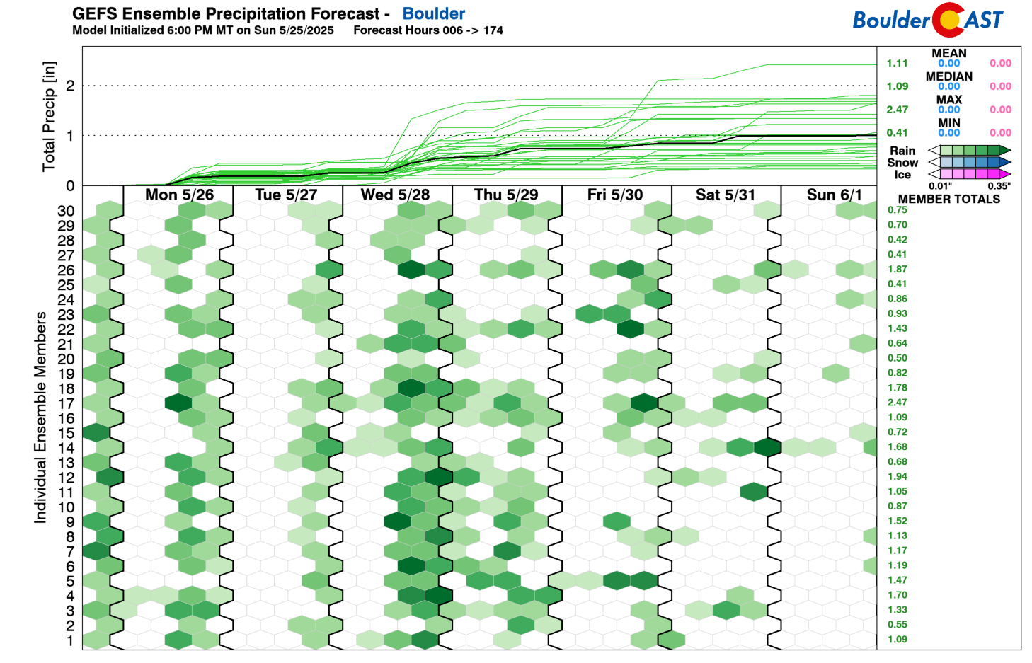
- Daily diurnal shower and storm chances will stick around each day this week. The greatest chances are centered on Monday, Wednesday, and Thursday, where lift and instability are highest.
- Temperatures will hover near to slightly below normal for much of the week, mostly in the 60s. A warming trend to above normal highs is favored by week’s end and into the upcoming weekend.
DISCLAIMER: This weekly outlook forecast is created Monday morning and covers the entire upcoming week. Accuracy will decrease as the week progresses as this post is NOT updated. To receive daily updated forecasts from our team, among many other perks, subscribe to BoulderCAST Premium.

Go Premium, get all the perks.
Daily Forecast Updates
Get our daily forecast discussion every morning delivered to your inbox.
All Our Model Data
Access to all our Colorado-centric high-resolution weather model graphics. Seriously — every one!
Ski & Hiking Forecasts
6-day forecasts for all the Colorado ski resorts, plus more than 120 hiking trails, including every 14er.
Smoke Forecasts
Wildfire smoke concentration predictions up to 72 hours into the future.
Exclusive Content
Weekend outlooks every Thursday, bonus storm updates, historical data and much more!
No Advertisements
Enjoy ad-free viewing on the entire site.
Memorial Day unsettled again, but dry to start
TDespite some heavy rainfall, the holiday weekend hasn’t been a total washout across the Front Range—though your experience may vary depending on location. Most of the Denver Metro area has seen over half an inch of much-needed rain in the past two days, but areas hit by repeated thunderstorms—particularly from Centennial to Aurora—have accumulated up to 2.5 inches.
There were also reports of damaging hail on Saturday well south of Denver.
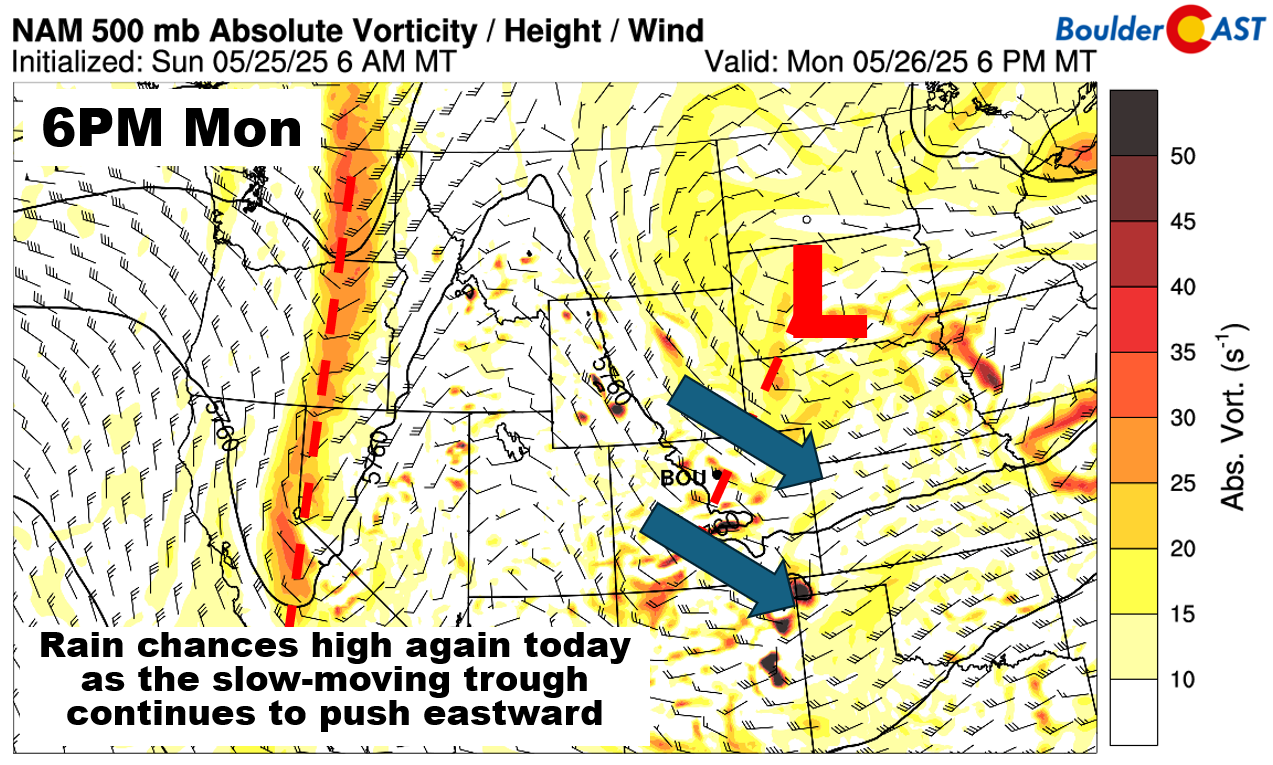
Looking ahead to Memorial Day Monday, expect another unsettled day, similar to Sunday. However, the morning will likely be dry, with showers and storms developing later. The culprit behind the recent storm activity is a lingering mid-level trough rotating across the region.
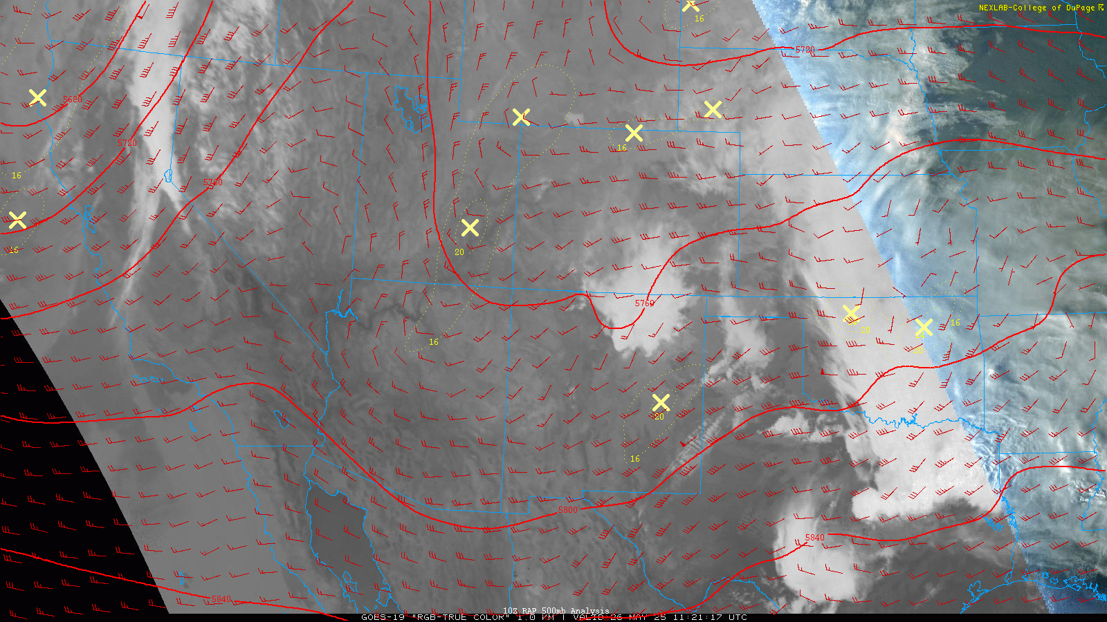
By Monday afternoon, its core will be over the Dakotas, but its influence will still fuel scattered showers and storms across Colorado.
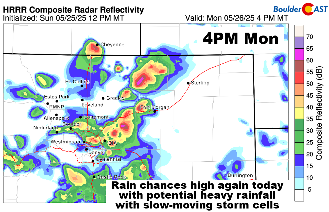
Forecast models, including the HRRR below, show storms forming Monday afternoon and tapering off by late evening. Weak winds at lower levels may result in slow-moving storms that could dump heavy rainfall leading to isolated street flooding. While widespread severe weather isn’t expected, occasional lightning, brief gusty winds, and small hail can’t be ruled out.
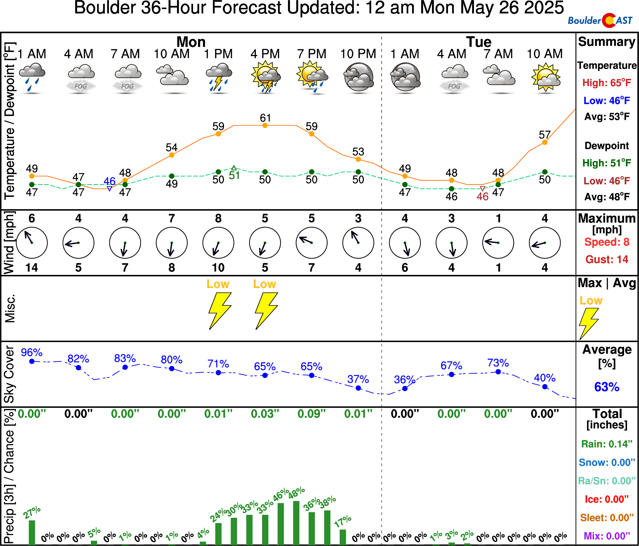
If you’re participating in the BolderBoulder 10k run Monday morning, expect low clouds and patchy fog to start the day. Skies may clear slightly by midday, with temperatures reaching the upper 50s to lower 60s in Denver and Boulder. Showers and storms are likely after 2 PM, but the Memorial Day celebrations at Folsom Field should proceed smoothly before lightning risks increase later in the afternoon.
Daily diurnal showers and storms all week
As May comes to an end, daily afternoon showers and thunderstorms remain in the forecast. The GEFS ensemble model suggests rain chances every day this week, but we believe the highest storm risk will fall on Wednesday and Thursday.
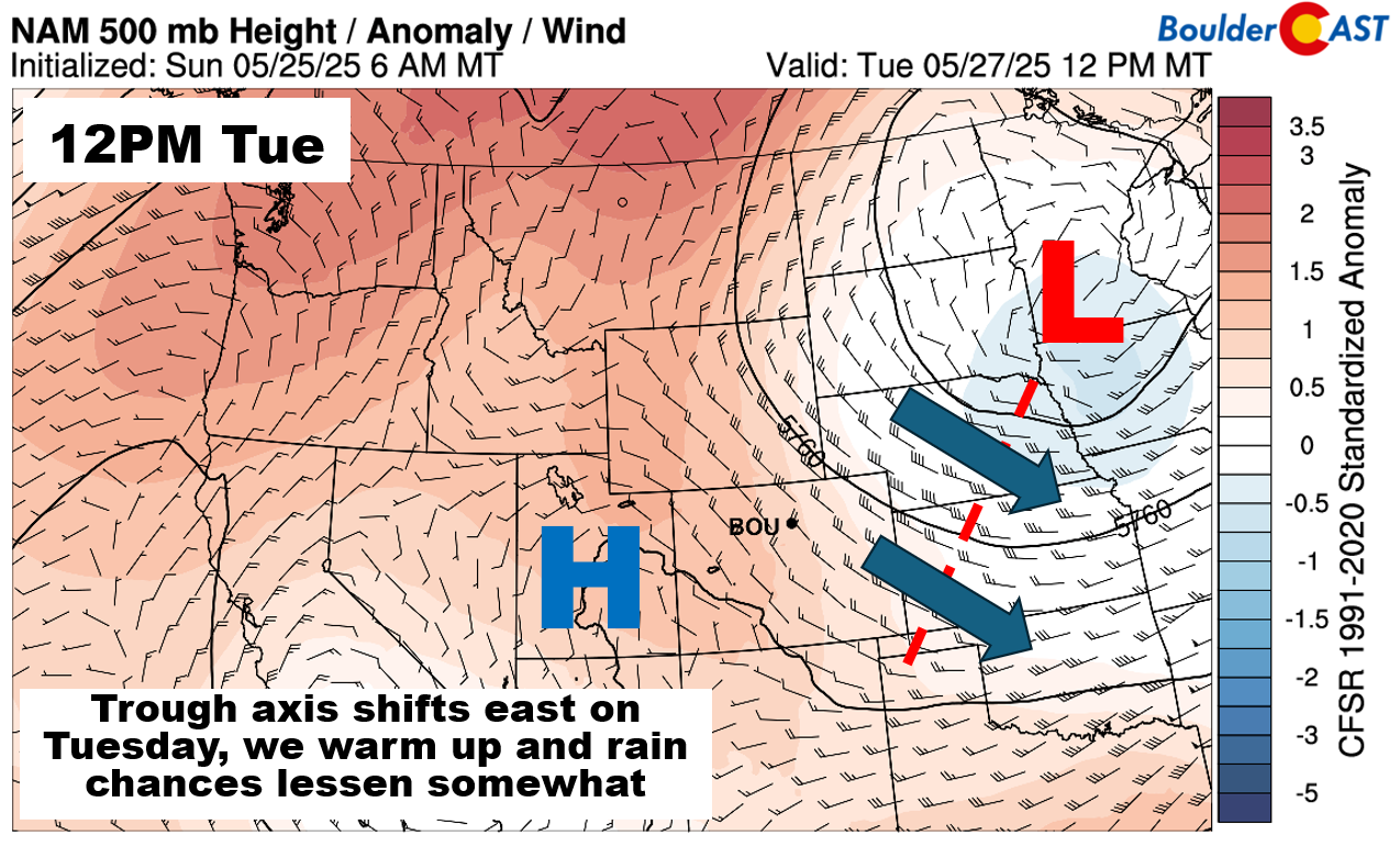
On Tuesday, the trough moves east toward Minnesota and Iowa, bringing slightly warmer temperatures to our area. Highs will reach the lower 70s, with a 40% chance of afternoon and evening storms.
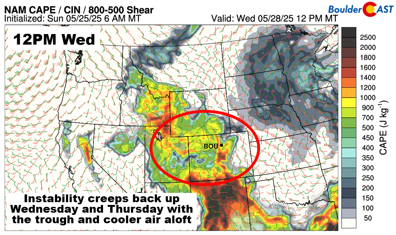
On Wednesday and Thursday, the trough actually retrogrades a little. Energy on the western flank of the trough will extend into eastern portions of Colorado. That is partly why we believe that our storm chances should ramp up again Wednesday and Thursday with this added lift in the atmosphere. Rain chances at this time will be in the 50 to 80% range, highest in the afternoon and evening hours. Temperatures should reach the upper 60s to lower 70s under a mixture of clouds and sunshine.
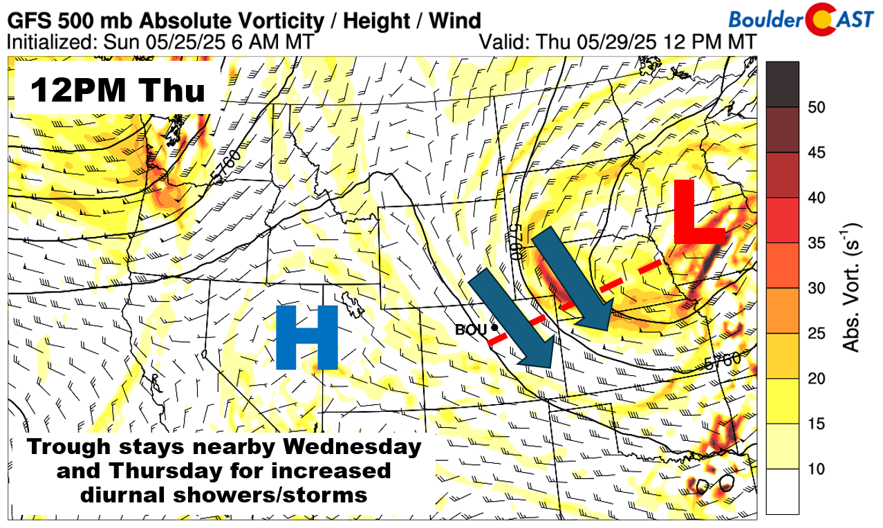
The lift on Wednesday and Thursday will combine with cool temperatures aloft. The cool temperatures will favor steeper lapse rates in the low to mid-levels of the atmosphere which would favor greater instability to fuel thunderstorms.
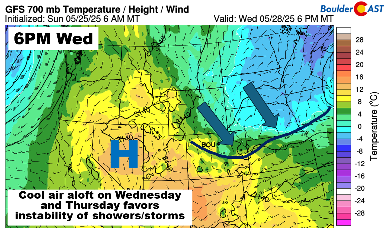
Thus, not surprisingly, the NAM and other models show the higher CAPE values of up to 1500 J/kg in place for us on Wednesday. A similar value can be expected on Thursday, favoring those increased storm chances. While a severe weather threat isn’t strong at this time, conditions will be monitored closely.
A quieter weekend with highs trending above normal
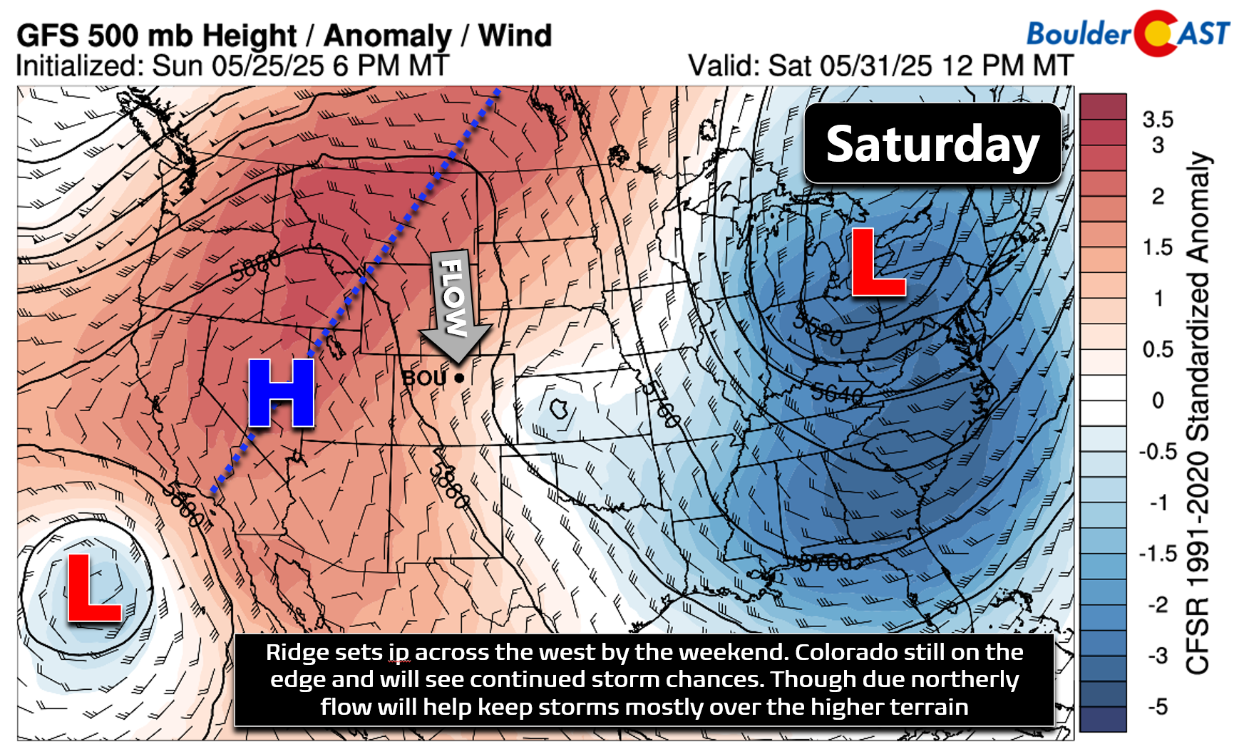
By Friday, the trough moves further east, reducing its influence over Colorado. Some afternoon showers will still be possible, but rain will be more concentrated in the Mountains rather than the Denver Metro.
Heading into the weekend, ensemble models suggest a ridge forming over the western U.S., bringing warmer and drier weather our way. Highs should climb into the lower 80s. Storm chances won’t go away entirely, but due northerly steering flow over Colorado should help keep most of the storms over the Mountains/Foothills, rather than spreading them eastward into the Metro area like usual.
Enjoy the rainy weather to wrap-up the month of May — at least it’s not snowing like it was six years ago this week!
Forecast Specifics:
Memorial Day: Partly to mostly cloudy with areas of showers and storms developing after 2PM. Highs reach the upper 50s to low 60s on the Plains and lower 50s in the Foothills. Storms could bring an isolated urban flood threat.
Tuesday: Partly cloudy and warmer with scattered late-day showers and storms. Highs near 70 degrees on the Plains and lower 60s in the Foothills.
Wednesday and Thursday: Partly sunny with afternoon and evening showers and storms likely. Highs in the mid to upper 60s on the Plains and 50s in the Foothills.
Friday: Mostly sunny with a low-end chance of afternoon and early evening isolated showers or storms, mainly over the higher terrain. Highs in the upper 70s on the Plains and upper 60s in the Foothills.
Weekend: Drier and above normal weather is favored with highs in the upper 70s to lower 80s on the Plains and low 70s in the Foothills. Rain chances are possible but should mainly be limited to the higher terrain, with just widely scattered to isolated coverage for Boulder and Denver.
DISCLAIMER: This weekly outlook forecast is created Monday morning and covers the entire upcoming week. Accuracy will decrease as the week progresses as this post is NOT updated. To receive daily updated forecasts from our team, among many other perks, subscribe to BoulderCAST Premium.
Go Premium, get all the perks.
Daily Forecast Updates
Get our daily forecast discussion every morning delivered to your inbox.
All Our Model Data
Access to all our Colorado-centric high-resolution weather model graphics. Seriously — every one!
Ski & Hiking Forecasts
6-day forecasts for all the Colorado ski resorts, plus more than 120 hiking trails, including every 14er.
Smoke Forecasts
Wildfire smoke concentration predictions up to 72 hours into the future.
Exclusive Content
Weekend outlooks every Thursday, bonus storm updates, historical data and much more!
No Advertisements
Enjoy ad-free viewing on the entire site.
Enjoy our content? Give it a share!


You must be logged in to post a comment.