An anomalously hot ridge will remain over the region through the week favoring above normal temperatures in the 90s each day, with the hottest stretch coming the first few days of the work week. We likely won’t reach any record highs but will get close! Come mid to late-week, the ridge will edge a tad southward allowing monsoonal moisture to become further entrenched across the Front Range. This uptick in moisture will increase our chances of late-day showers and storms and cool temperatures by several degrees.
This week’s highlights include:
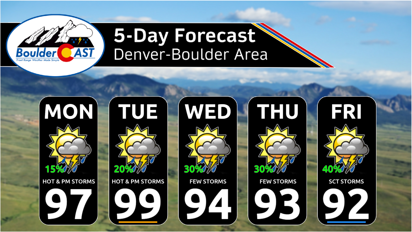
- Highs in the upper 90s Monday and Tuesday with low-end chances of storms — temperatures will likely fall a few degrees short of record highs
- Showers and storm chances increase mid to late-week as minor monsoonal moisture builds back in
- Temperatures decline mid to late-week but still stay above normal in the 90s
DISCLAIMER: This weekly outlook forecast is created Monday morning and covers the entire upcoming week. Accuracy will decrease as the week progresses as this post is NOT updated. To receive daily updated forecasts from our team, among many other perks, subscribe to BoulderCAST Premium.

Go Premium, get all the perks.
Daily Forecast Updates
Get our daily forecast discussion every morning delivered to your inbox.
All Our Model Data
Access to all our Colorado-centric high-resolution weather model graphics. Seriously — every one!
Ski & Hiking Forecasts
6-day forecasts for all the Colorado ski resorts, plus more than 120 hiking trails, including every 14er.
Smoke Forecasts
Wildfire smoke concentration predictions up to 72 hours into the future.
Exclusive Content
Weekend outlooks every Thursday, bonus storm updates, historical data and much more!
No Advertisements
Enjoy ad-free viewing on the entire site.
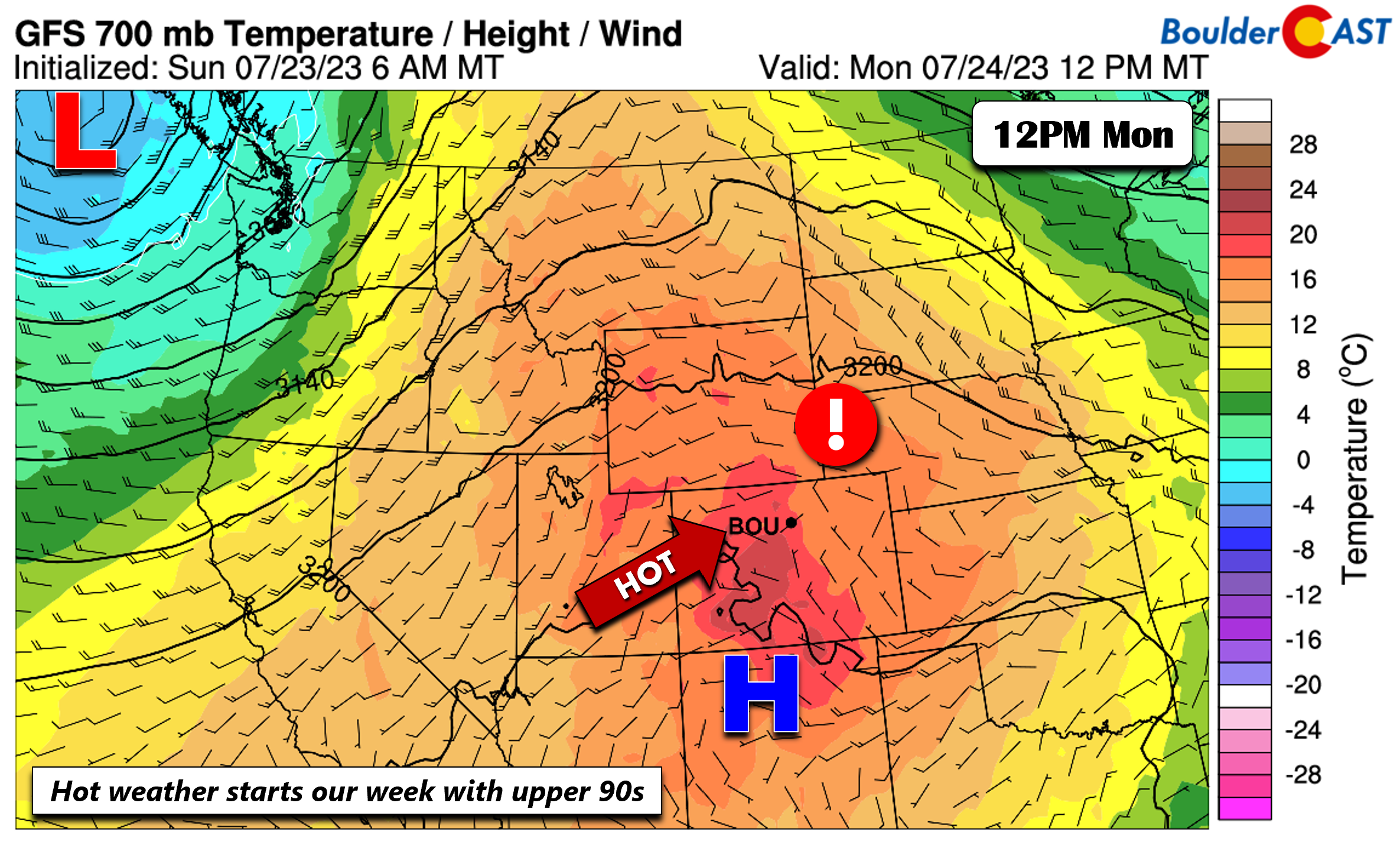
Anomalous ridge brings upper 90s to start
An anomalously hot ridge has been over the Four Corners area this past weekend and will remain to dominate our weather for much of our upcoming week. On Monday that ridge will slide a tad east over northeast New Mexico. It will be another day of very warm temperatures in the upper 90s in the Front Range.
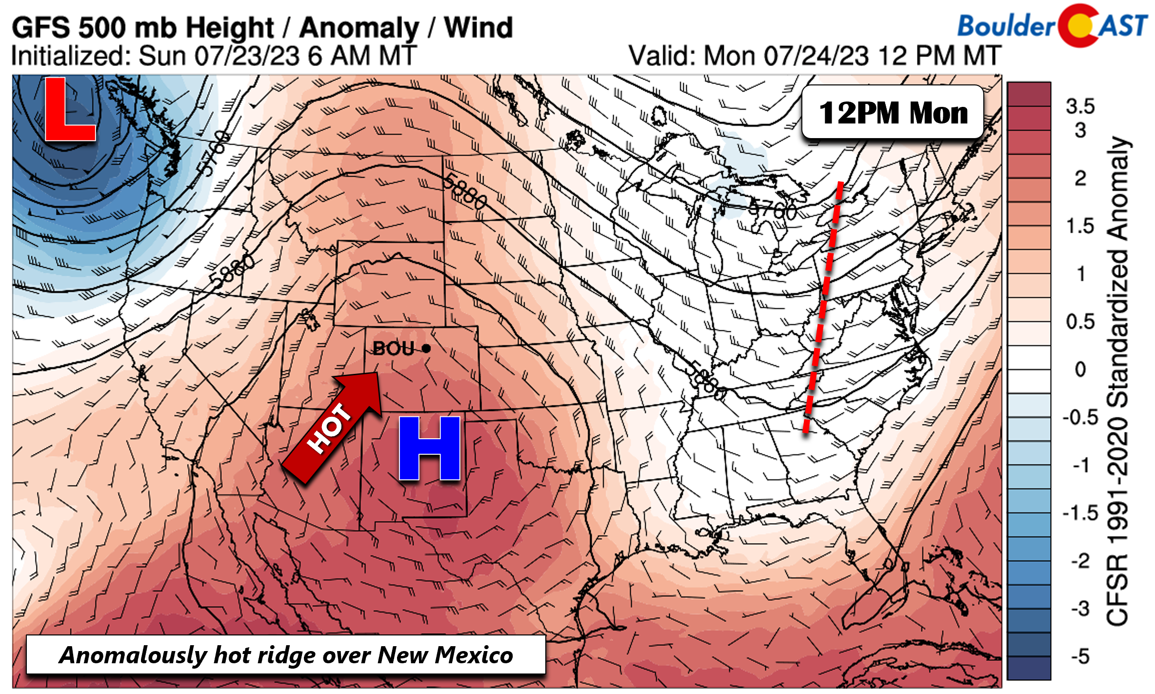
The low-level temperature airmass is similar — roughly one degree Celsius or so higher than Sunday, so status quo is the forecast. We likely won’t reach record highs on Monday as those are in the low 100s, but we certainly will get close. A few widely scattered storms may move toward the Plains Monday afternoon/evening, but only a 20% chance is forecast given a fairly dry airmass in place.
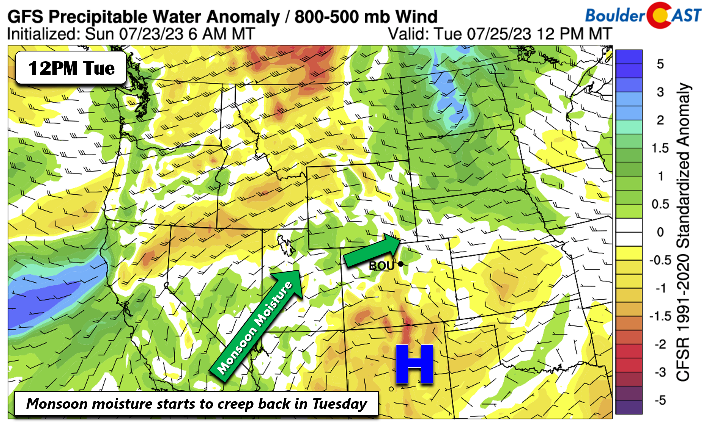
There will be a better chance of a few storms on Tuesday. A weak disturbance to our north over Wyoming and the Dakotas will force the ridge to flatten and slide ever so slightly south. Along with that energy, some monsoonal moisture will advect around the ridge over east-central and west-central Colorado for a 20-30% chance of late-day storms.
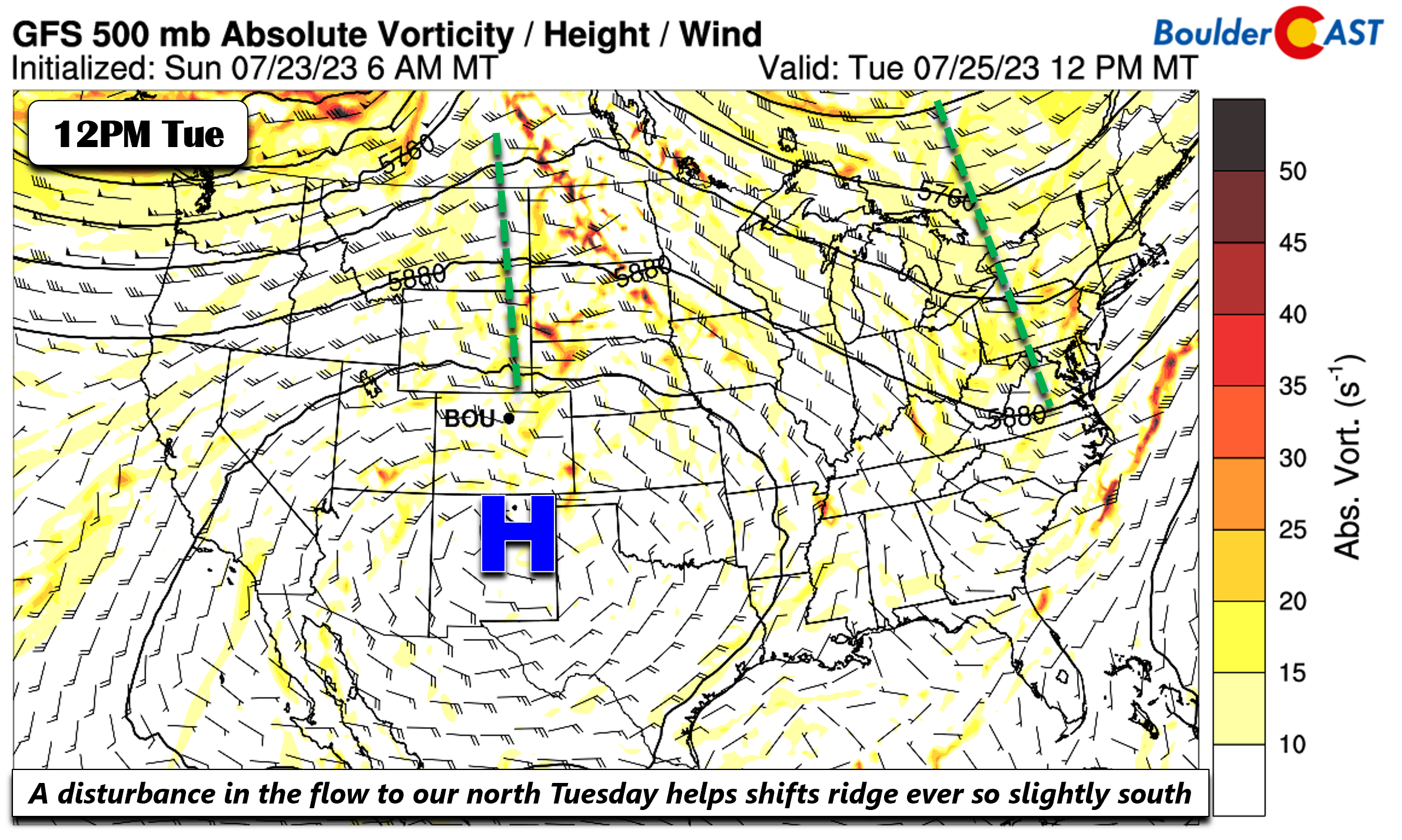
This moisture is probably better noticeable on the precipitable water anomaly plot below. Note here that moisture is NOT well above normal, but it is noticeably higher than the past few days. Any storms will be capable of gusty winds, but all in all expect a fairly dry day with mid to upper 90s again for Tuesday.
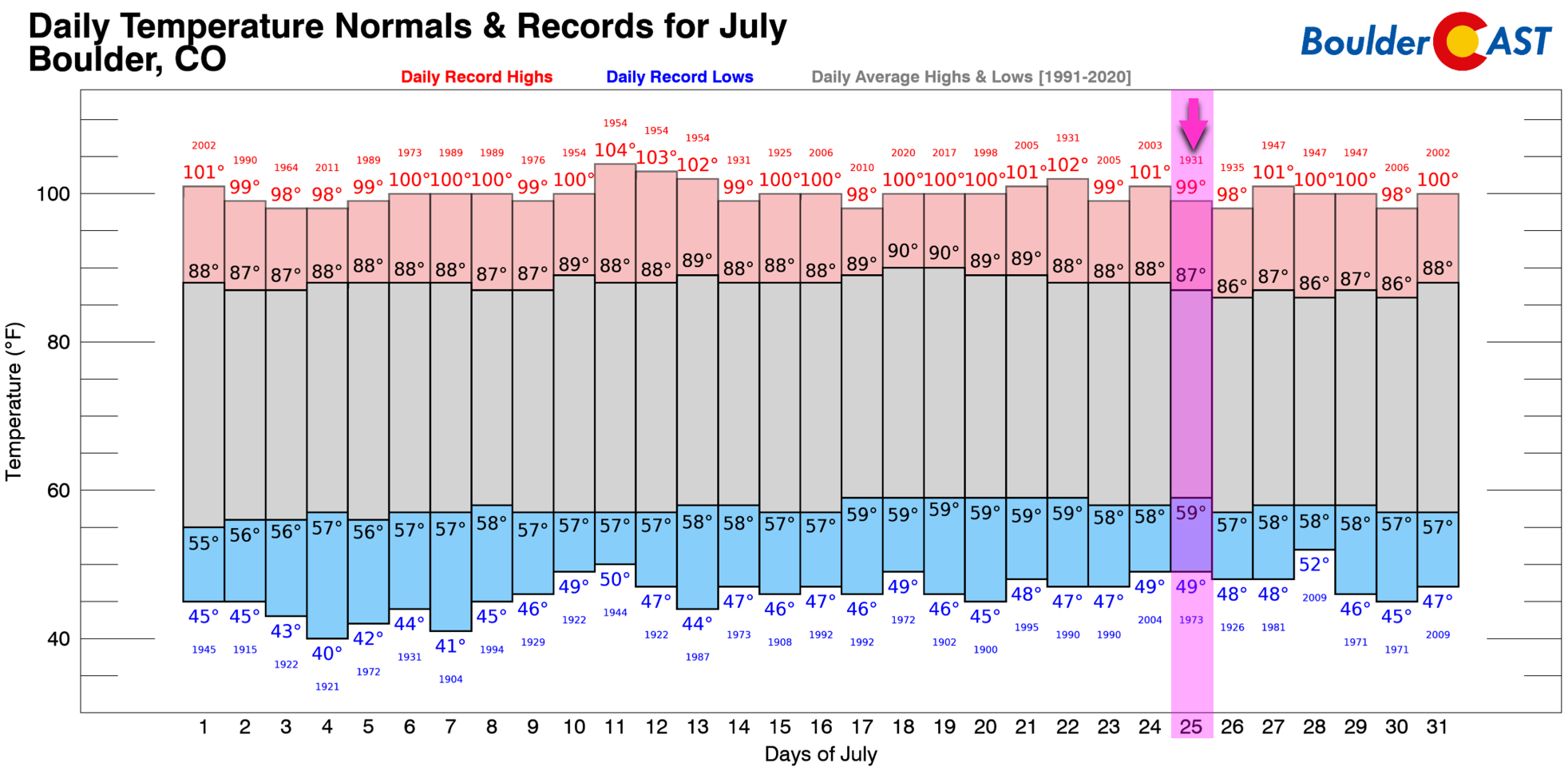
Our current forecast high temperature of 99°F on Tuesday would tie an existing record high in Boulder for the date. This is just one of a few remaining summer heat records from the 1930s!
Monsoon moisture increases Wednesday & beyond
By midweek on Wednesday, the disturbance from Tuesday slides east. The hot ridge will further shift south into east-central New Mexico. It will still be another hot one in the Boulder-Denver area but well shy of record highs with temperatures in the low to middle 90s expected.
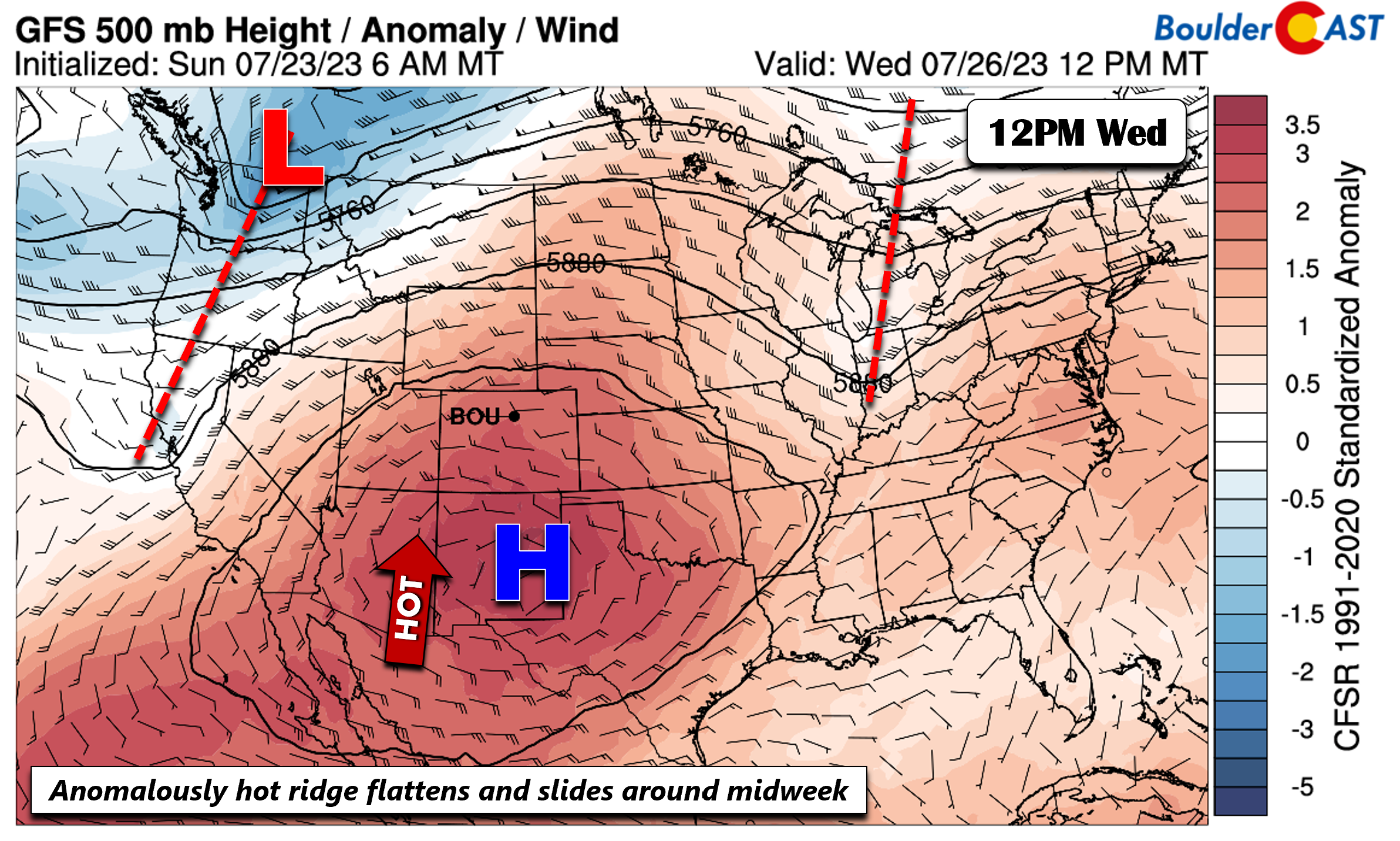
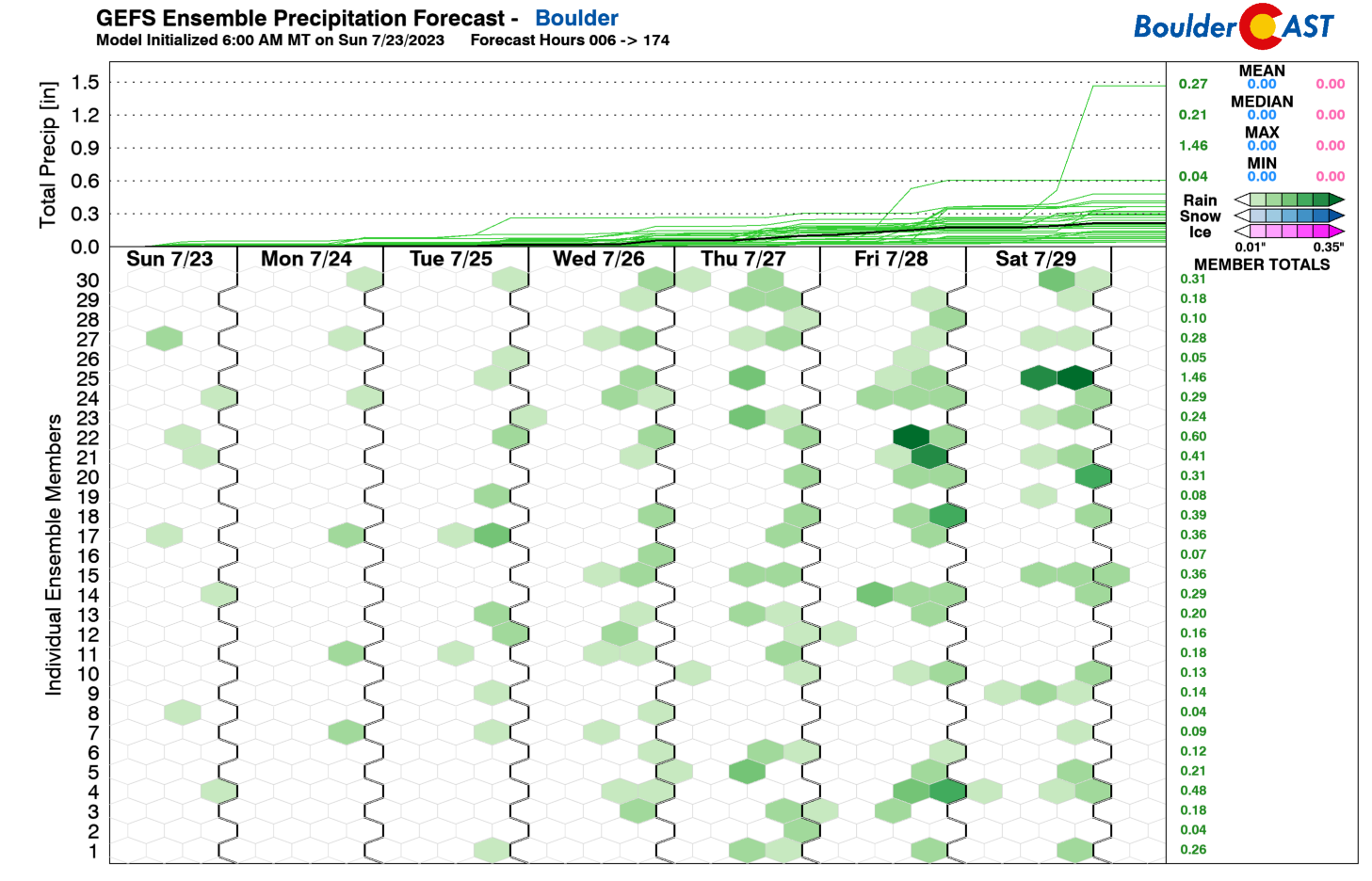
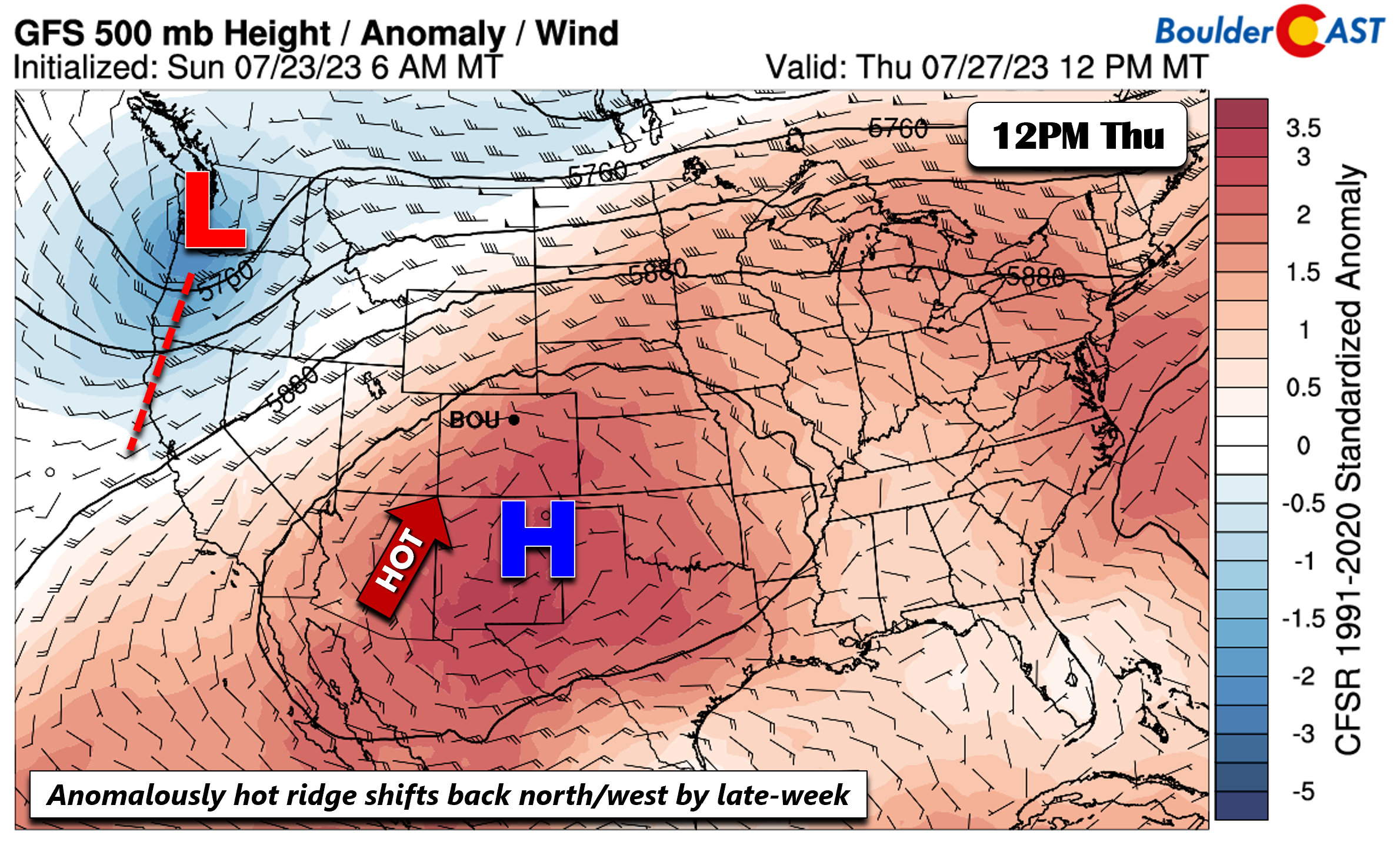
The ridge will largely remain in place as shown above through the remainder of the week, though slightly shift back north and west by Friday. To that end, its placement will allow for monsoonal moisture to encroach further into the area each successive day Wednesday through Friday. That will favor the 20-30% chance of afternoon/evening storms during this period, well evident in the GEFS below — showing more members with some rainfall towards the latter part of the week.
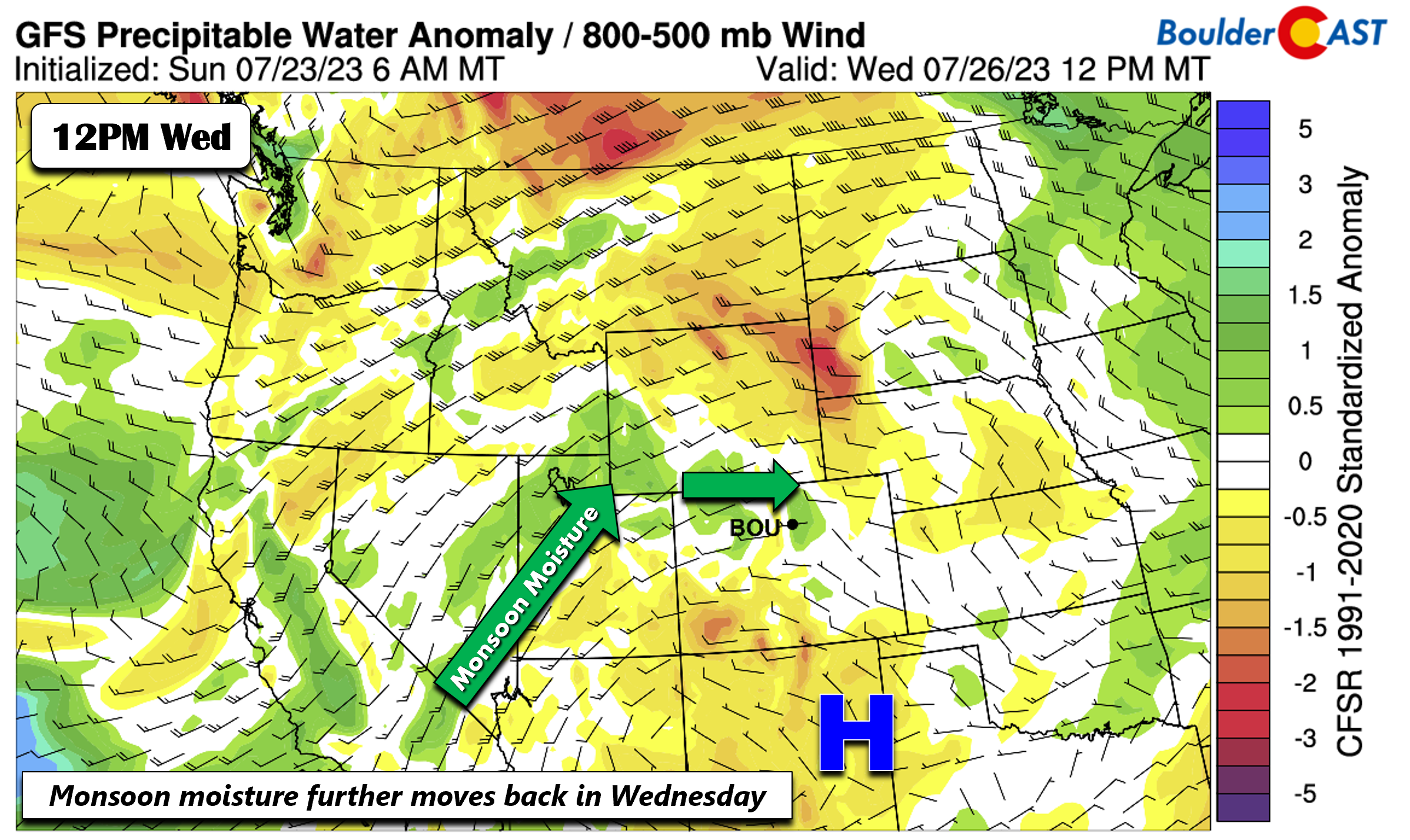
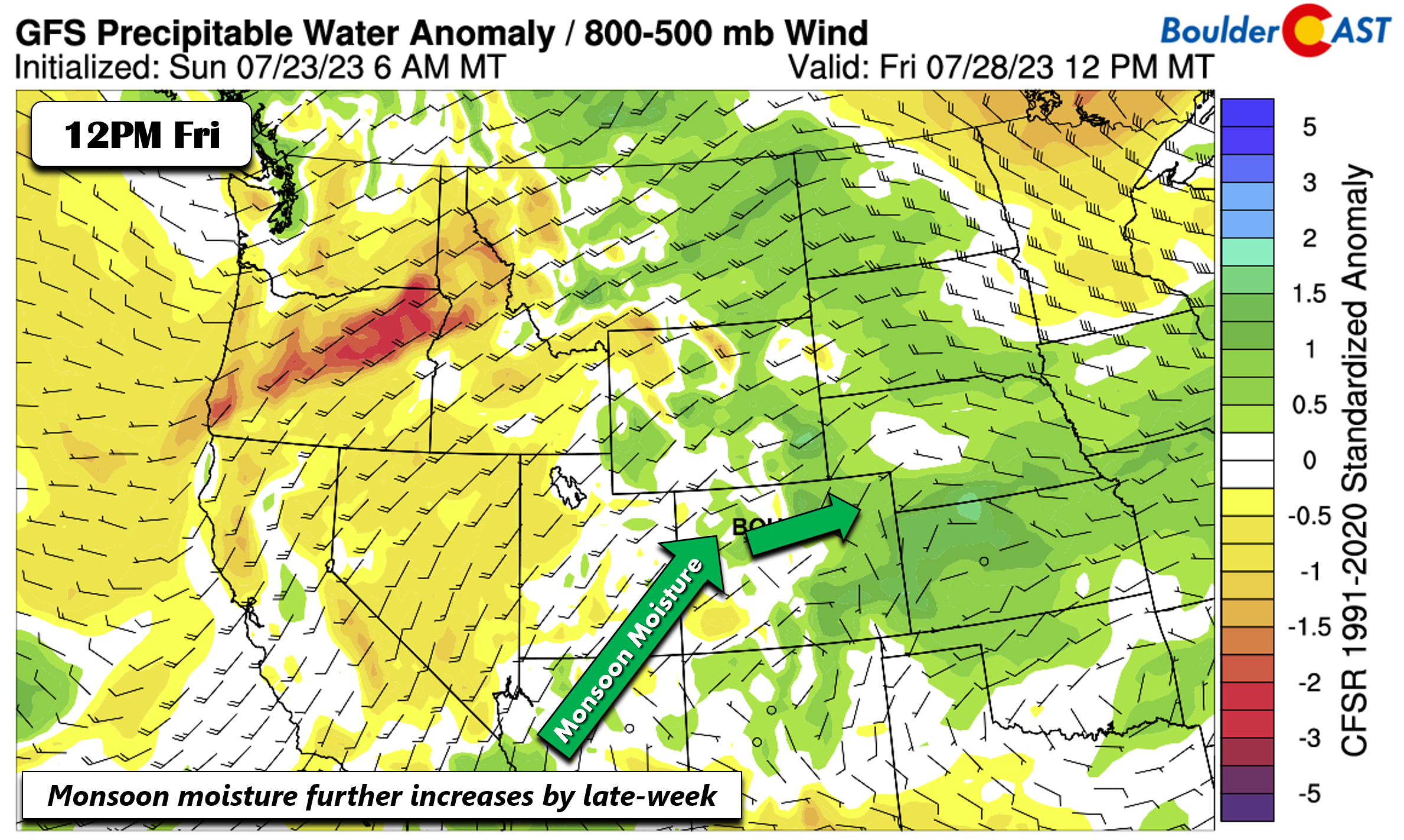
Another way to look at it is via the precipitable water anomaly plots. The figure below is for Wednesday, showing the anomalous moisture over northern Utah and north-central Colorado.
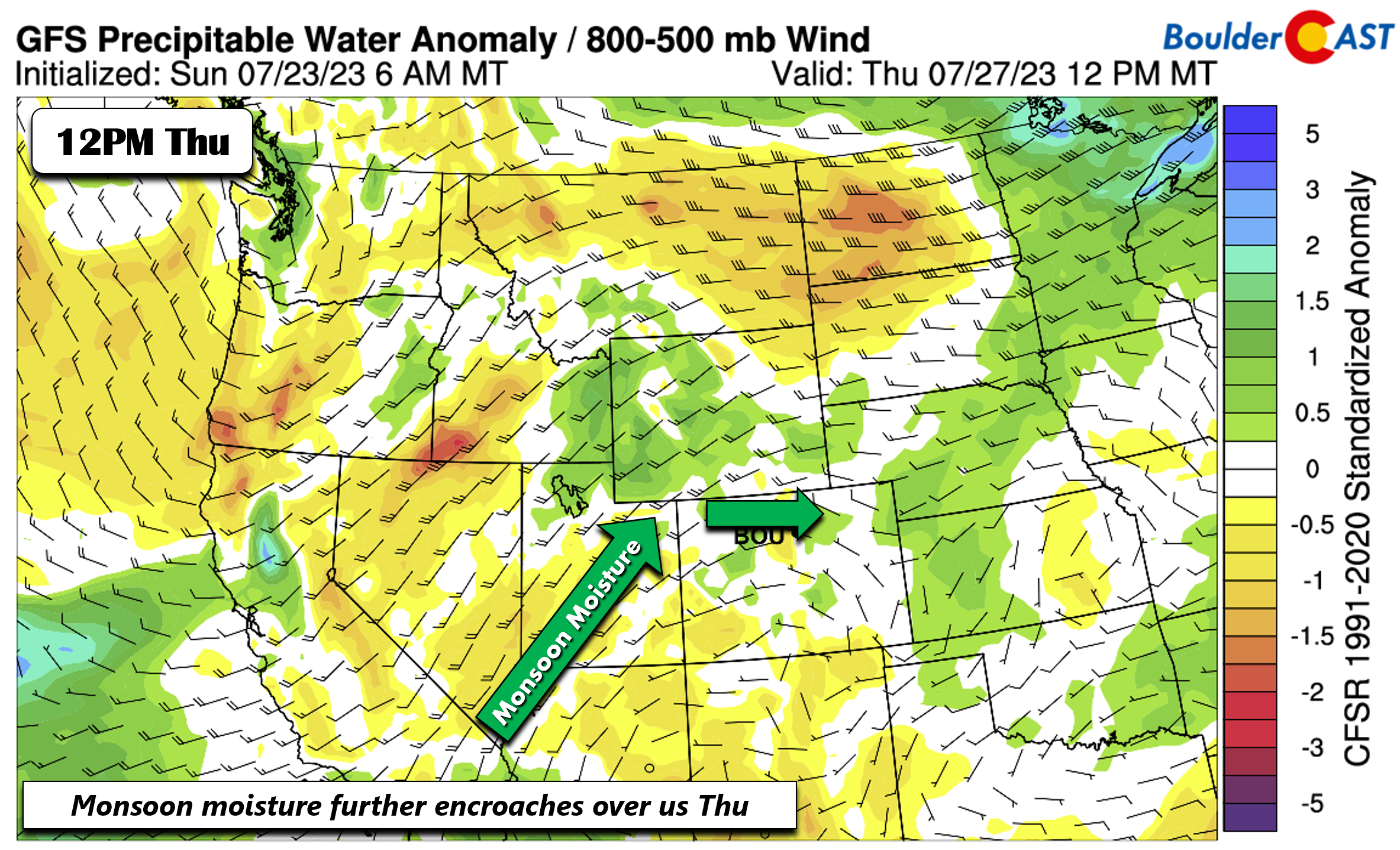
By Thursday, the moisture slides a tad further south into central Colorado, with deeper moisture over eastern Utah too.
All in all, the placement of the ridge being “flatter” and moisture at mid-levels increasing by mid-late week will mean slightly lower high temperatures in the low to mid 90s from increased cloud cover and storm chances (~30%).
It looks like monsoonal moisture will further increases to its highest levels on Friday, though some models do differ. Thus, storm chances will continue into week’s end.
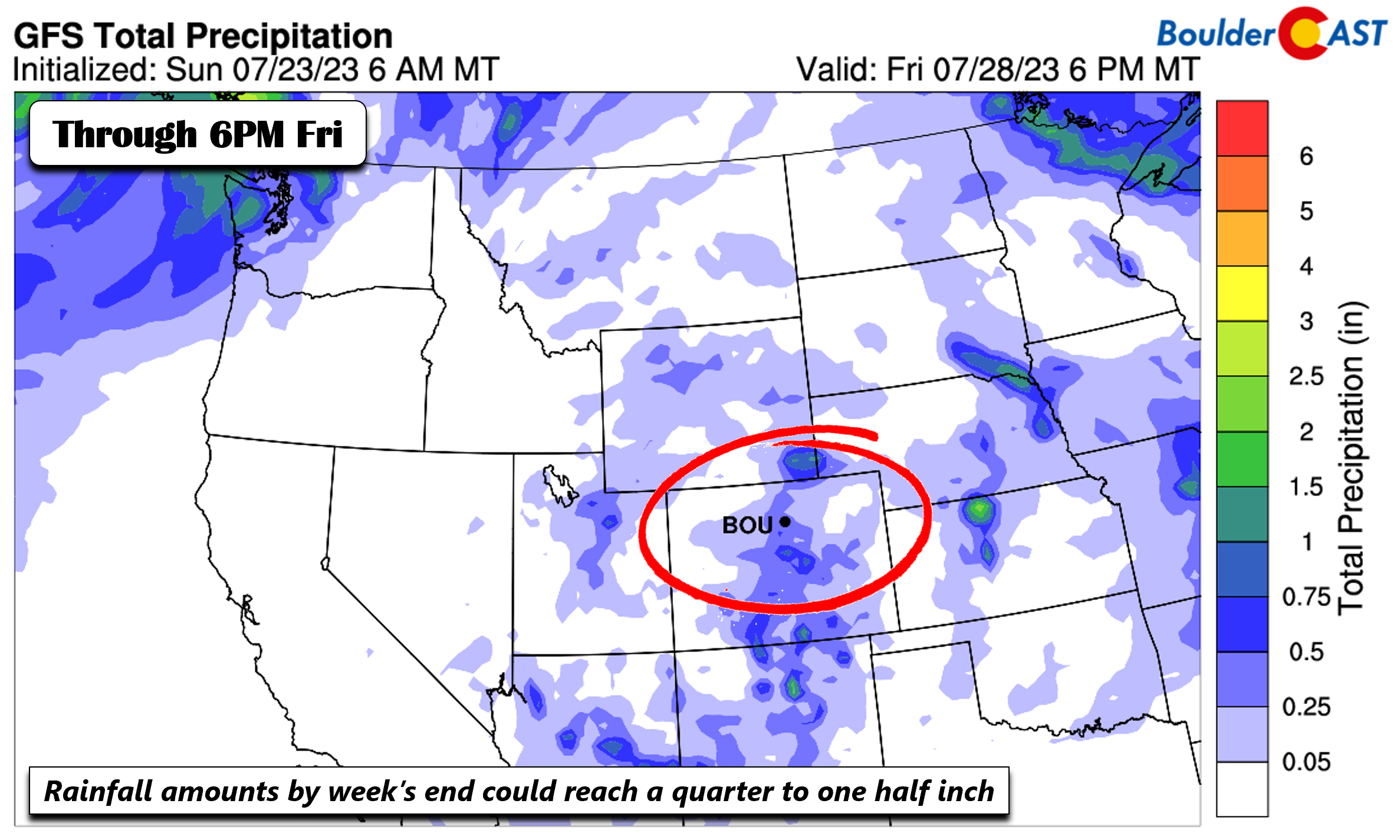
Note that we are not expecting a total wash out any day of the week. This is just your typical monsoonal flow for the mid-late week period. All told, the GFS total precipitation forecast only ranges from a quarter to one half inch over much of the Denver Metro. That is not much, though of course locally higher amounts may occur in isolated storms.
Stay safe, stay cool and enjoy this week’s toasty weather!
Forecast Specifics:
Monday: Mostly sunny becoming partly cloudy with isolated to widely scattered late-day gusty storms. Highs hot in the upper 90s on the Plains and middle 80s over the Foothills.
Tuesday: Partly cloudy with widely scattered afternoon-evening gusty storms. Hot with mid to upper 90s on the Plains and middle 80s in the Foothills.
Wednesday: Increasing clouds with scattered afternoon/evening storms. Highs still warm to hot in the low to middle 90s.
Thursday: Partly sunny skies with a chance of afternoon/evening storms. Highs in the low to mid 90s.
Friday: Sunny skies giving way to increasing clouds and chance of afternoon/evening storms. Highs in the low to middle 90s.
DISCLAIMER: This weekly outlook forecast is created Monday morning and covers the entire upcoming week. Accuracy will decrease as the week progresses as this post is NOT updated. To receive daily updated forecasts from our team, among many other perks, subscribe to BoulderCAST Premium.
Go Premium, get all the perks.
Daily Forecast Updates
Get our daily forecast discussion every morning delivered to your inbox.
All Our Model Data
Access to all our Colorado-centric high-resolution weather model graphics. Seriously — every one!
Ski & Hiking Forecasts
6-day forecasts for all the Colorado ski resorts, plus more than 120 hiking trails, including every 14er.
Smoke Forecasts
Wildfire smoke concentration predictions up to 72 hours into the future.
Exclusive Content
Weekend outlooks every Thursday, bonus storm updates, historical data and much more!
No Advertisements
Enjoy ad-free viewing on the entire site.
Get BoulderCAST updates delivered to your inbox:
Enjoy our content? Give it a share!


You must be logged in to post a comment.