A large Omega Block pattern will be in place through much of the week ahead with ridging over the central Plains and troughs on either side — one along the West Coast and another over the Northeast. Above normal temperatures with highs in the 70s are expected for the Front Range under this setup, but it will come with the threat of afternoon showers and storms more typical of summertime. Read on for the details on when we think the best chance of wet weather will be along with our predictions for the weekend.
This week’s highlights include:
- An omega blocking pattern will be in place through much of the week but slowly weakens by Friday
- A cut-off low over the West Coast will usher a series of weak disturbances into the region along with moist southwest flow bringing daily chances of scattered showers/storms — Tuesday and Thursday look to offer the best chances
- Warm temperatures will keep snow levels quite high with light accumulation only possible above treeline — all rain for the lower elevations and even the Foothills
- Largely above normal temperatures are expected through the week with 70s every day
DISCLAIMER: This weekly outlook forecast is created Monday morning and covers the entire upcoming week. Accuracy will decrease as the week progresses as this post is NOT updated. To receive daily updated forecasts from our team, among many other perks, subscribe to BoulderCAST Premium.
Daily Forecast Updates
Get our daily forecast discussion every morning delivered to your inbox.
All Our Model Data
Access to all our Colorado-centric high-resolution weather model graphics. Seriously — every one!
Ski & Hiking Forecasts
6-day forecasts for all the Colorado ski resorts, plus more than 120 hiking trails, including every 14er.
Smoke Forecasts
Wildfire smoke concentration predictions up to 72 hours into the future.
Exclusive Content
Weekend outlooks every Thursday, bonus storm updates, historical data and much more!
No Advertisements
Enjoy ad-free viewing on the entire site.
An Omega Block dominates the week with a series of disturbances
The week will largely be dominated by an Omega Block ridge pattern over the central Great Plains. On the western side of the ridge, there will be a deep closed low over the West Coast which will slowly propagate eastward and advect a series of disturbances and deep moisture into Colorado this week. The system is forecast to move into the Colorado region by the end of the week, though uncertainty still remains on how that evolves. One thing is for certain though — the influx of moisture will aid in afternoon showers/storms typical of the summer season, even though we’re just now reaching the first week of May!
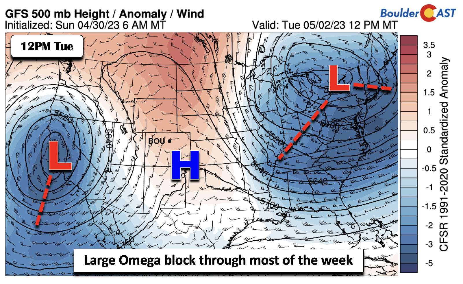
The image below shows the nationwide pattern on Tuesday, clearly depicting the omega block pattern. Notice the ridging over the Plains and a large trough over the Northeast and a secondary one over California.
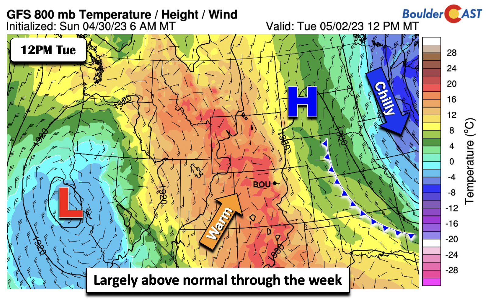
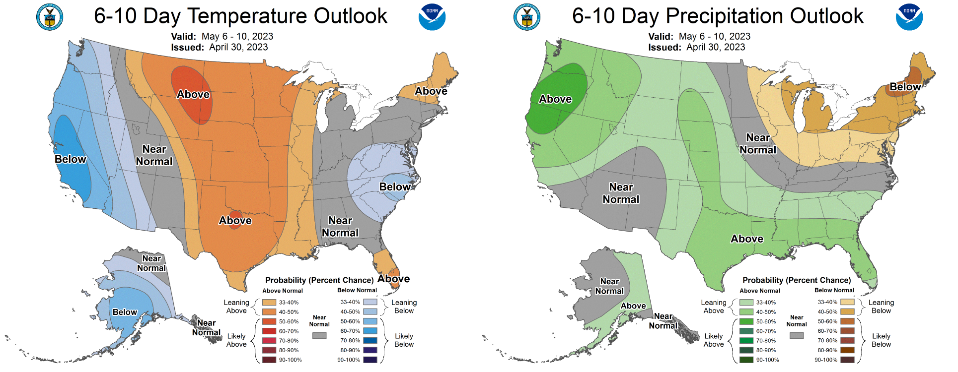
With ridging setting up here, we should remain warmer than average through the week (5 to 10 degrees or so each day) outside of the isolated/scattered afternoon/evening storm chances, as evident by warm low-levels over the region. The chilly air remains off to our east in the Midwest and Great Lakes.
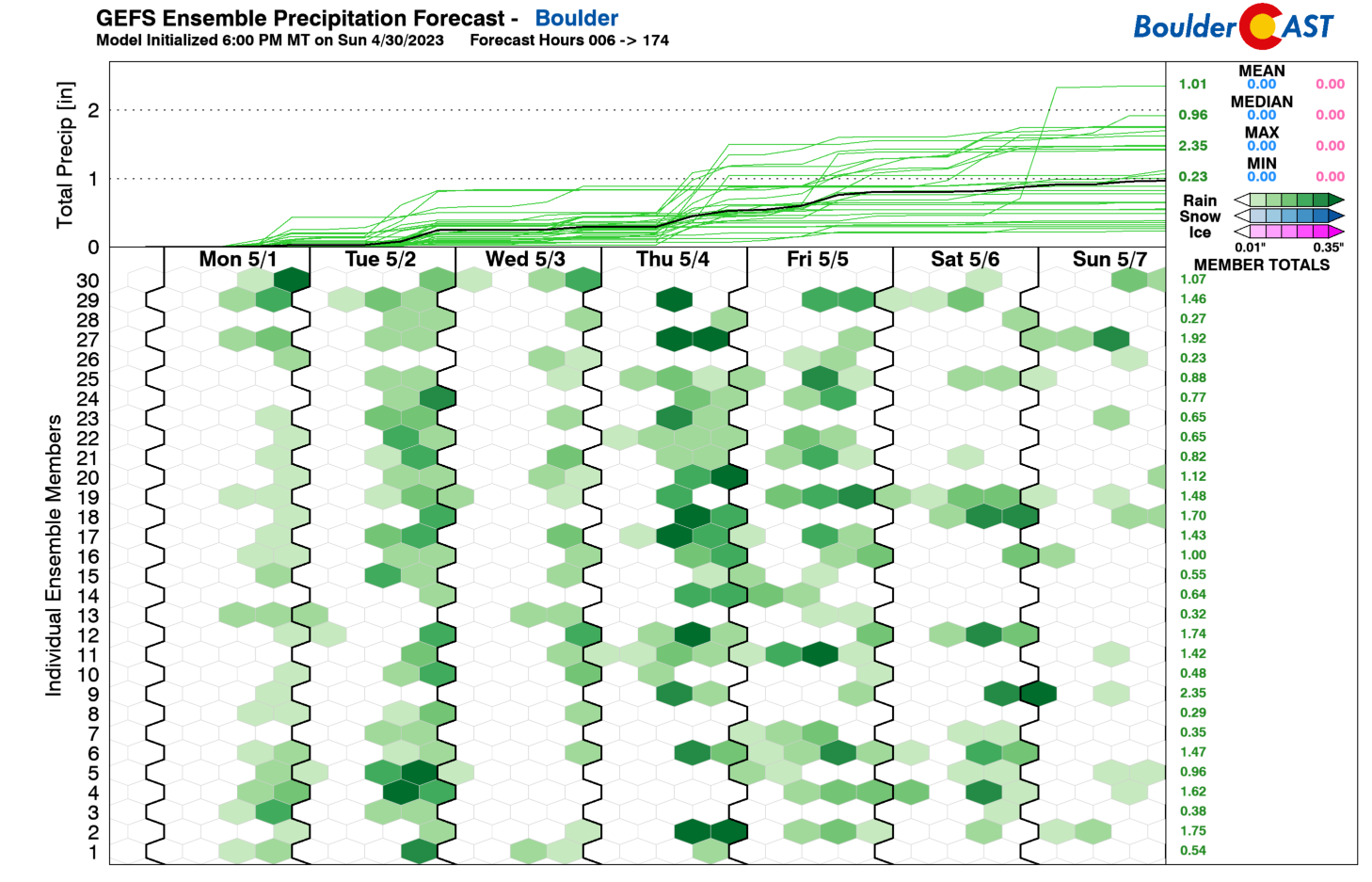
By looking at the GEFS precipitation outlook for the week, we can easily see the chances of showers/storms each day, but there is some difficulty in discerning which days will have the best chances!
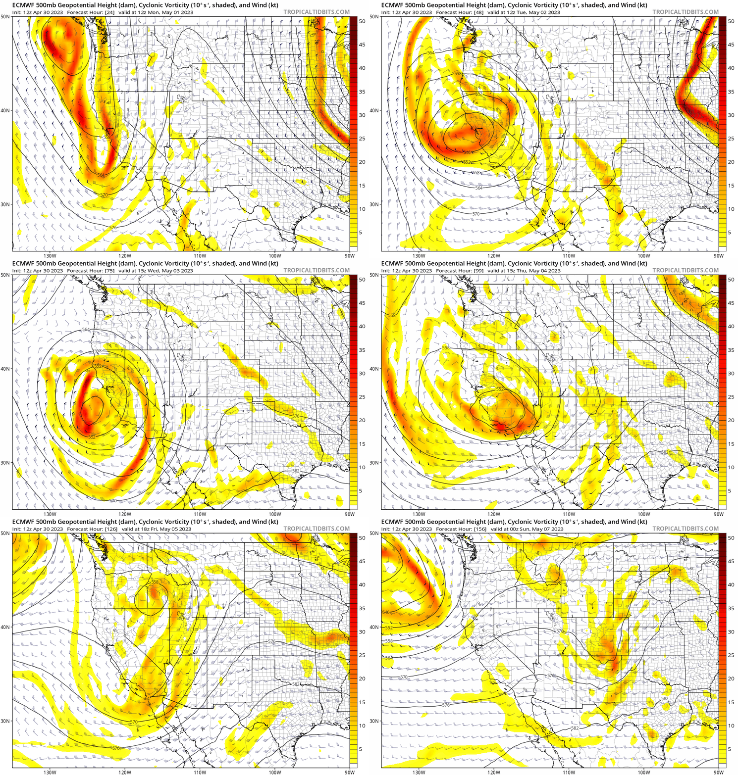
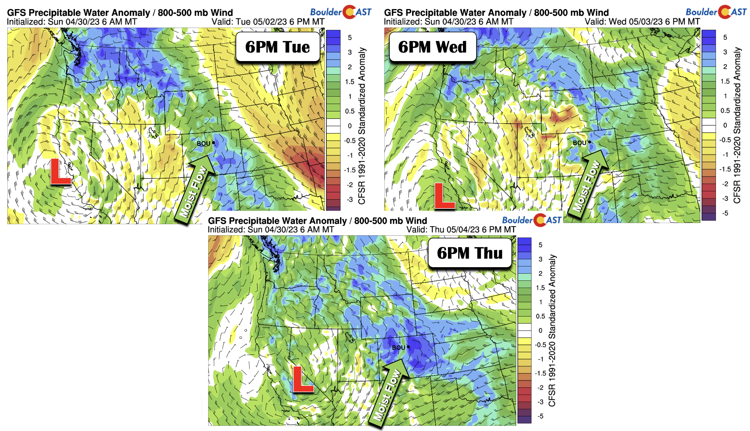
However, when we take a look at the mid-level pattern and precipitable water anomalies, we can see that while we have chances each afternoon, the best days appear to be Tuesday, Wednesday, and Thursday. Most especially, Tuesday and Thursday could bring the best odds of possible heavy rainfall as deeper moisture transport and stronger shortwave energy advects into the area. The ECMWF is roughly in agreement with this timing as seen in the GFS below.
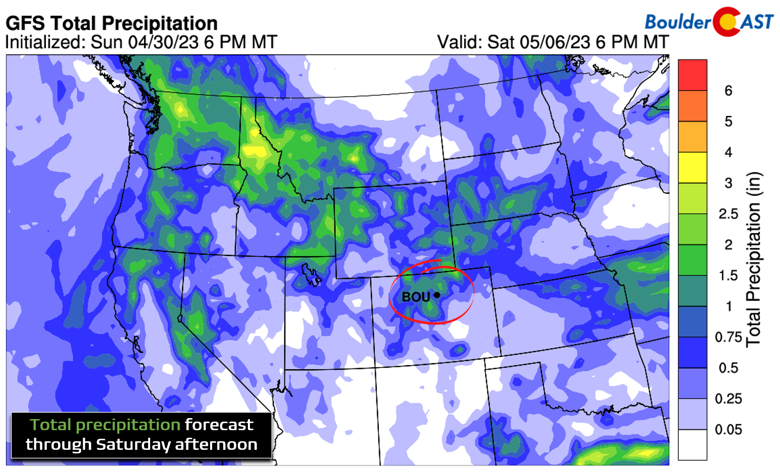
The GFS precipitation forecast through Saturday below shows that more than 1″ of combined moisture is possible from all of the popcorn shower and storm activity this week across the Front Range. However, as you might expect, due to the convective nature of the action, there will undoubtedly be some winners and some losers across the area. Finally, it’s worth mentioning that temperatures will be warm enough throughout the extended to keep all the precipitation in the form of rain. This is true even for the Foothills. There could be light snow accumulations above treeline, however.
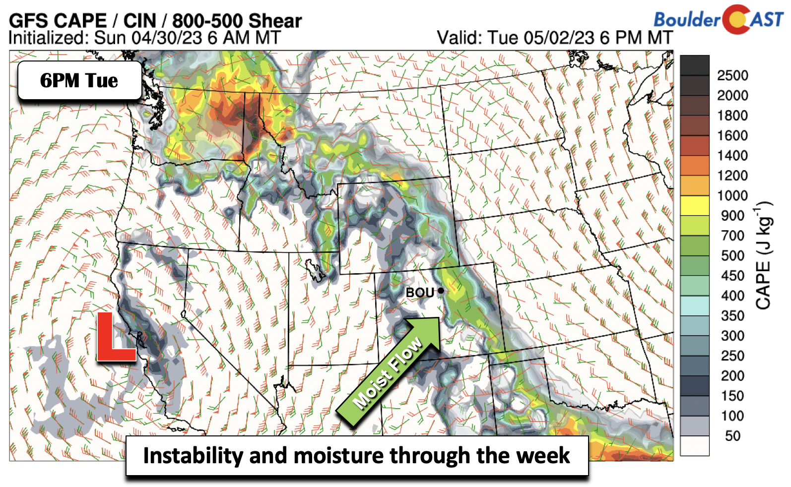
In addition to the moisture, instability will also be on the rise this week. While uncertainty remains, some severe potential may be warranted toward the latter part of the week with increased shear developing across eastern Colorado.
The evolution of the cut-off low as it moves into the Intermountain West by the end of the week will be critical in our forecast, but this is still uncertain. However, ensemble data hints that the pattern will remain active into at least the first part of the weekend, along with a trend toward possibly more seasonal (i.e. cooler) temperatures with rain chances and cloud cover sticking around.
Forecast Specifics:
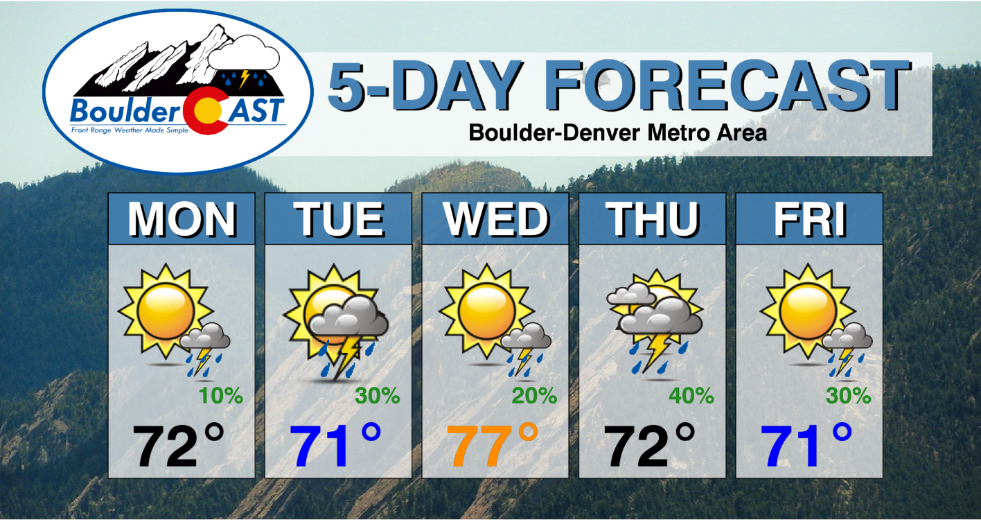
Monday: Morning sun, then partly cloudy skies with a 10% chance of afternoon/evening isolated showers or storms. Highs in the low to middle 70s on the Plains and lower 60s in the Foothills.
Tuesday: Sunny skies becoming mostly cloudy with a 30% chance of afternoon/evening showers and storms capable of heavy rainfall. Highs in the low to middle 70s on the Plains and lower 60s in the Foothills.
Wednesday: Partly cloudy skies with a 20% chance of afternoon/evening isolated storms. Temperatures will be the warmest of the week reaching into the upper 70s on the Plains and middle 60s in the Foothills.
Thursday: Increasing clouds with a 40% chance of afternoon/evening showers/storms capable of heavy rainfall. Highs in the lower 70s on the Plains and upper 50s in the Foothills.
Friday: Partly sunny skies with a 30% chance of afternoon/evening scattered storms, some of which may be severe across eastern Colorado. Highs in the low to mid 70s on the Plains and low to lower 60s in the Foothills.
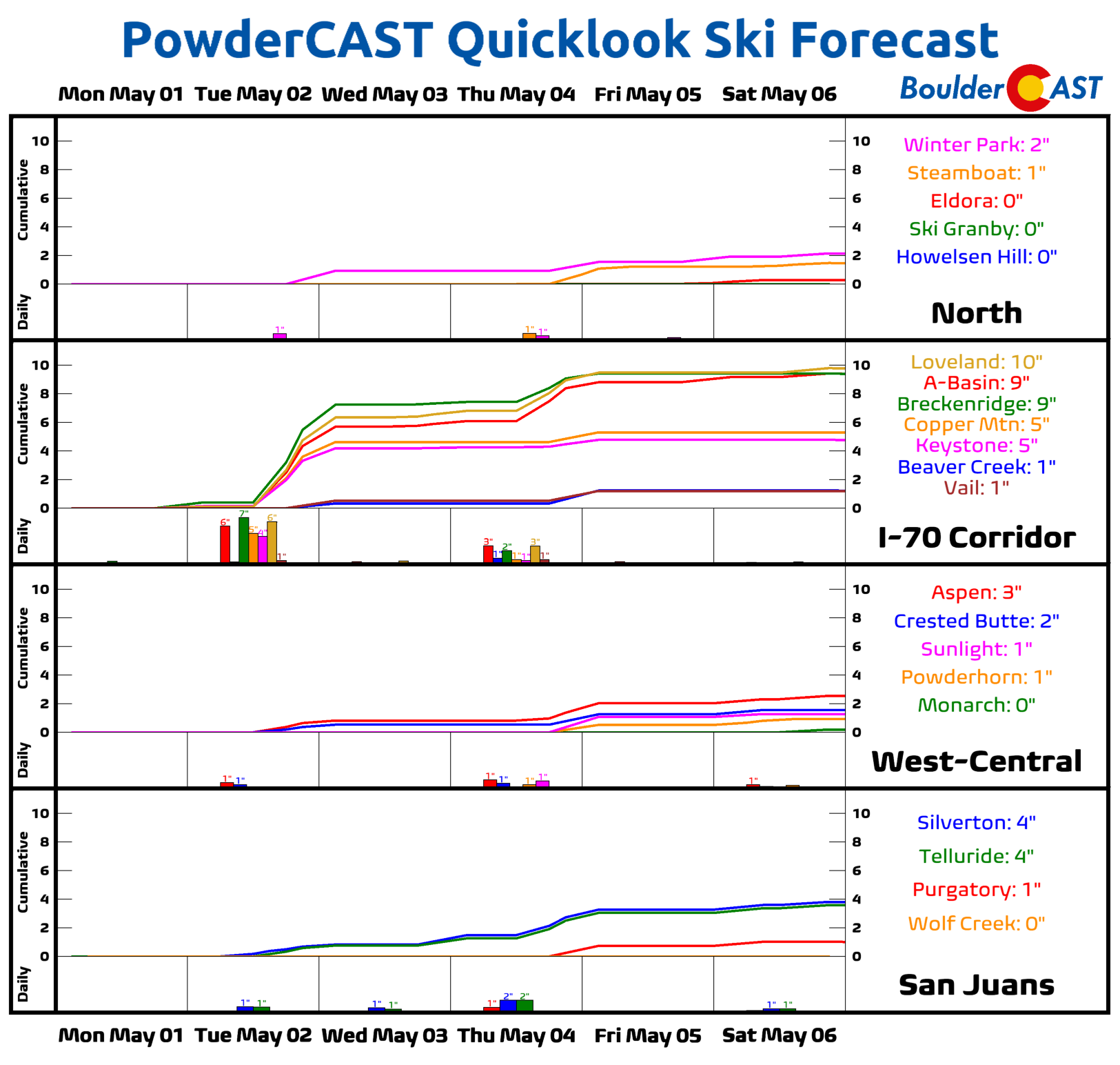
Mountains: The skies will be active this week across the Mountains as a monsoon-like southwest flow pattern develops across the state in response to the deep cut-off low in California. This uptick in moisture will lead to daily chances of instability showers and storms in the higher terrain, though Tuesday and Thursday look to be the wettest days. For the most part it will be rain even at elevation, but some light snow accumulation will be possible above 10,000 feet which would help skiers at the few resorts which remain open (A-Basin, Copper, Loveland, Winter Park, Breck).
DISCLAIMER: This weekly outlook forecast is created Monday morning and covers the entire upcoming week. Accuracy will decrease as the week progresses as this post is NOT updated. To receive daily updated forecasts from our team, among many other perks, subscribe to BoulderCAST Premium.
Daily Forecast Updates
Get our daily forecast discussion every morning delivered to your inbox.
All Our Model Data
Access to all our Colorado-centric high-resolution weather model graphics. Seriously — every one!
Ski & Hiking Forecasts
6-day forecasts for all the Colorado ski resorts, plus more than 120 hiking trails, including every 14er.
Smoke Forecasts
Wildfire smoke concentration predictions up to 72 hours into the future.
Exclusive Content
Weekend outlooks every Thursday, bonus storm updates, historical data and much more!
No Advertisements
Enjoy ad-free viewing on the entire site.
Spread the word, share the BoulderCAST forecast!




You must be logged in to post a comment.