A cold northwest flow persists through the extended period which will favor well below normal temperatures all week long in the Front Range. We are watching a few shots of snow in this flow as well, with the best chance coming late in the week as upslope and potential jet-forced snow bands come together. Read on for more details and what weather we can expect this week.
This week’s highlights include:
- Well below normal temperatures throughout the week under a cold west-northwest flow
- Highs in the 30s to start the week and possible upper 20s to end the week
- A brief warm-up midweek under weak mid-level ridging — but only in the 40s
- Watching for a few chances of snow — one Monday night and another Thursday night
- The better chance is the late-week one with upslope and potential jet-forced snow bands producing accumulating snow
DISCLAIMER: This weekly outlook forecast is created Monday morning and covers the entire upcoming week. Accuracy will decrease as the week progresses as this post is NOT updated. To receive daily updated forecasts from our team, among many other perks, subscribe to BoulderCAST Premium.
Cold through the week with one mini-warmup
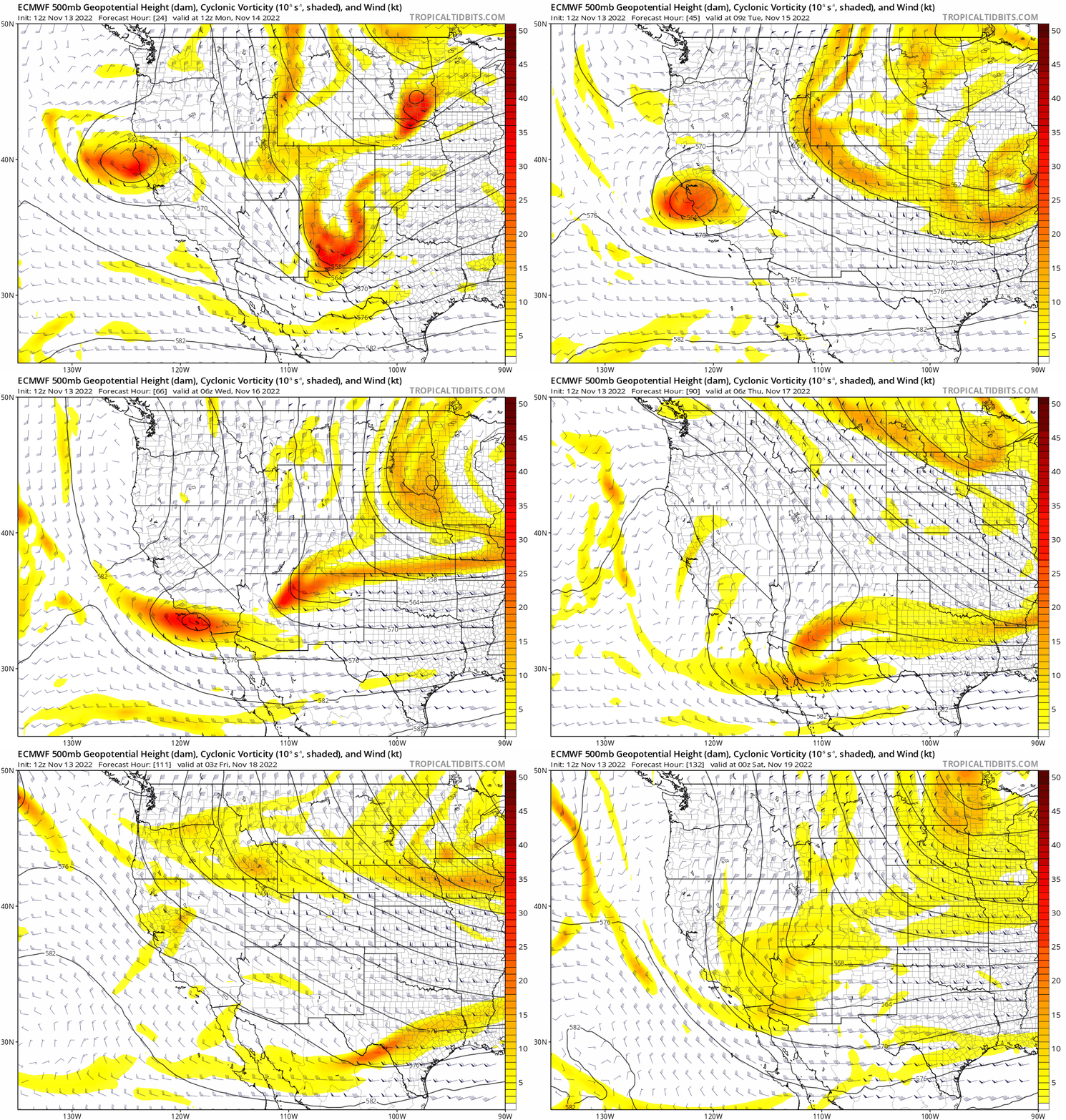
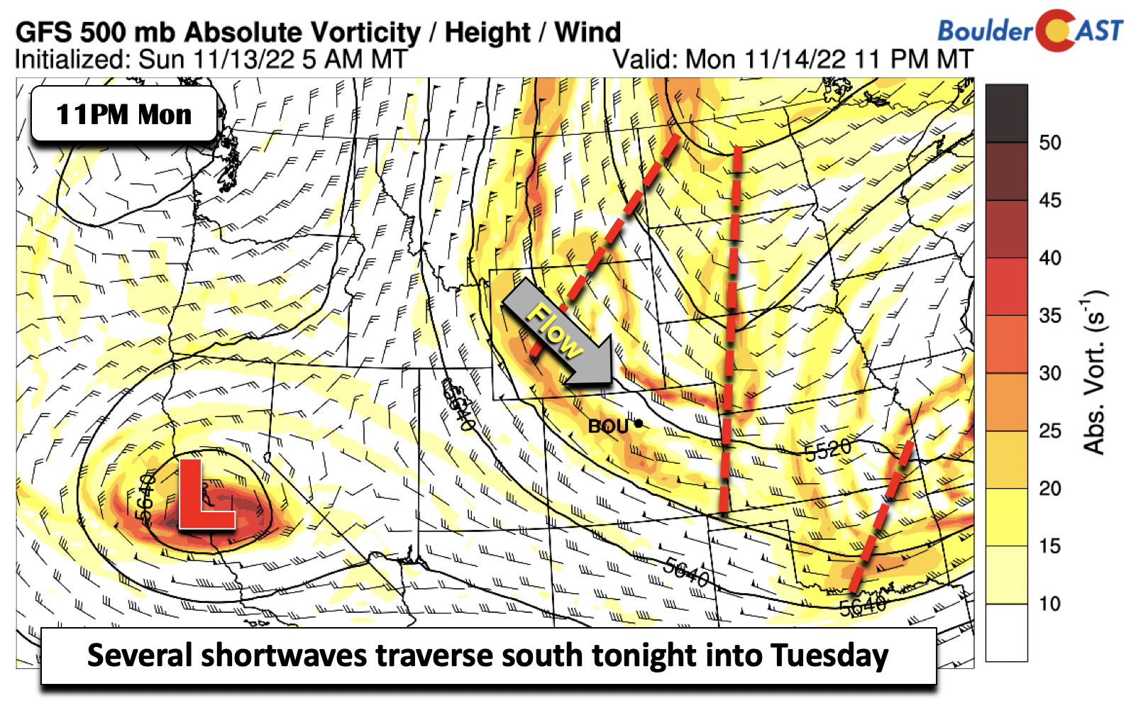
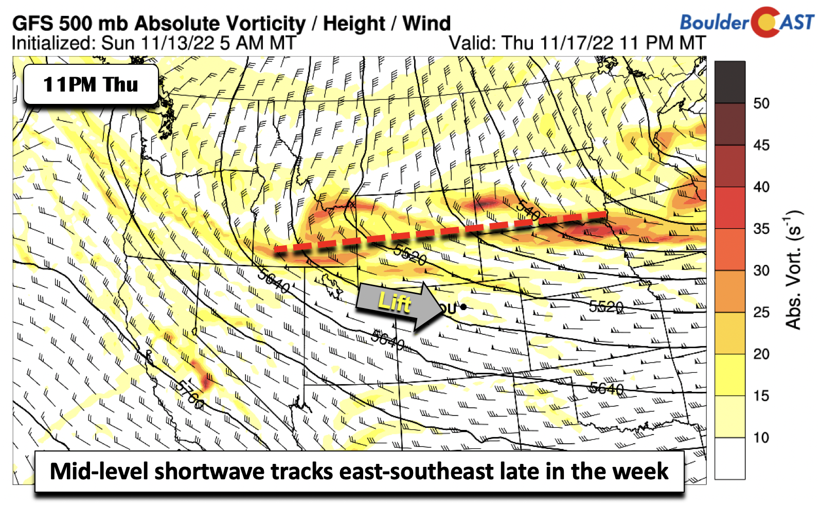
Apersistently cold west-northwest flow will be in-place across the Intermountain-West and across the central to northern Plains through the week. The animation below is the forecast from the ECMWF of mid-level vorticity, showing several weak to strong shortwaves traversing from northwest to southeast in the broader flow. One decent shortwave moves through Monday night into Tuesday, while a second arrives late Thursday into Friday. The latter is the more prominent one, where accumulating snow is increasingly favored for the Front Range. We’ll discuss all of these detail in our weekly outlook, so do continue on!
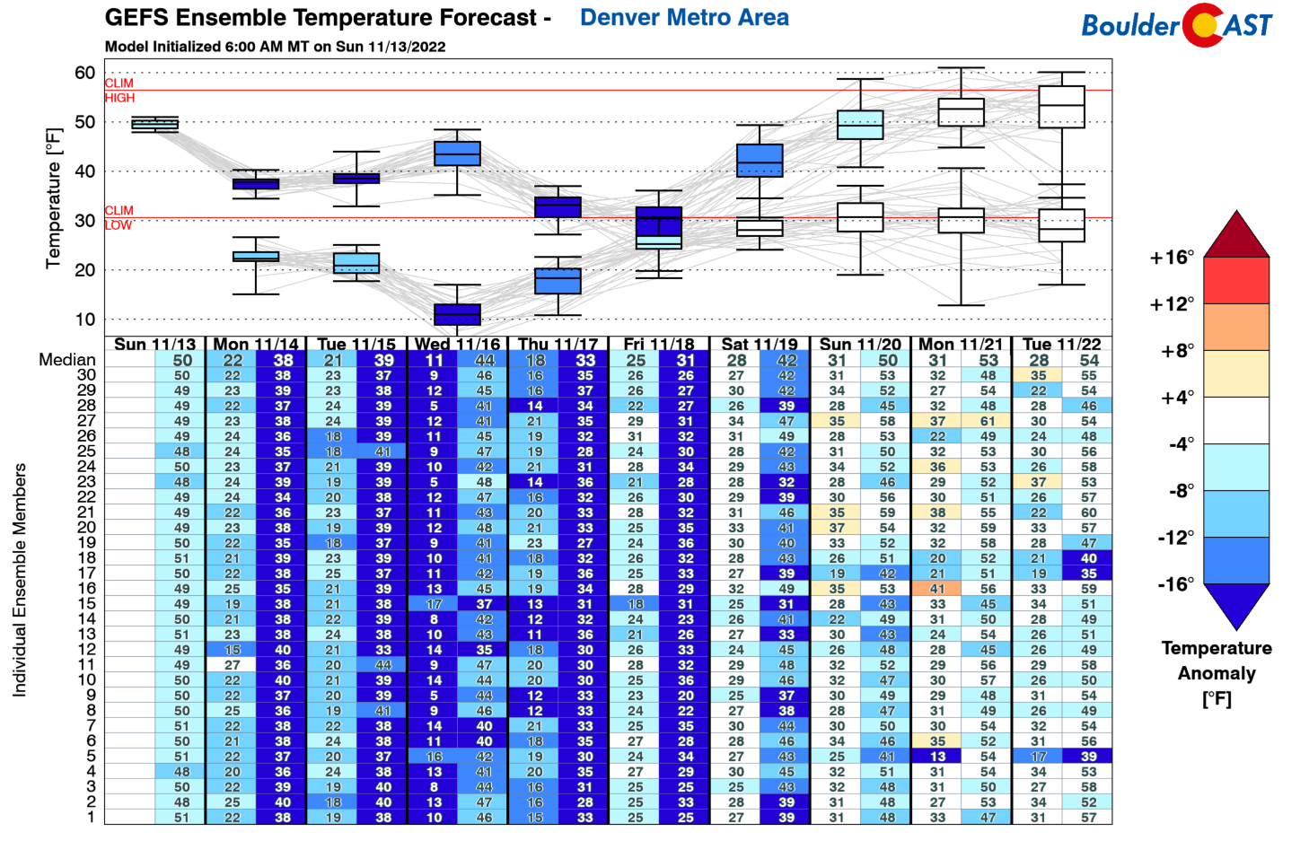
As a result of this cold northwest flow in place through much of the week, you guessed it — temperatures will be running well below average, with middle 30s to start the first few days of the week. Our average highs in mid November are in the middle 50s. Our warmest day, though still below normal, is Wednesday in the lower 40s. A stronger surge of cold air behind a more potent cold front could usher in highs only in the 20s by Friday.
For Monday and Monday night, as we discussed a little bit ago, there are a few weak subtle shortwaves moving into the area from Wyoming through midday Tuesday. While the shortwave is rather moisture starved, it should produce a few snow showers or flurries Monday night into Tuesday morning. Minimal accumulation is expected — generally 1″ or less. The better chance of snow will be over the High Country, where a few inches are possible resulting from the weak orographics there, and up to 2″ in the Foothills.
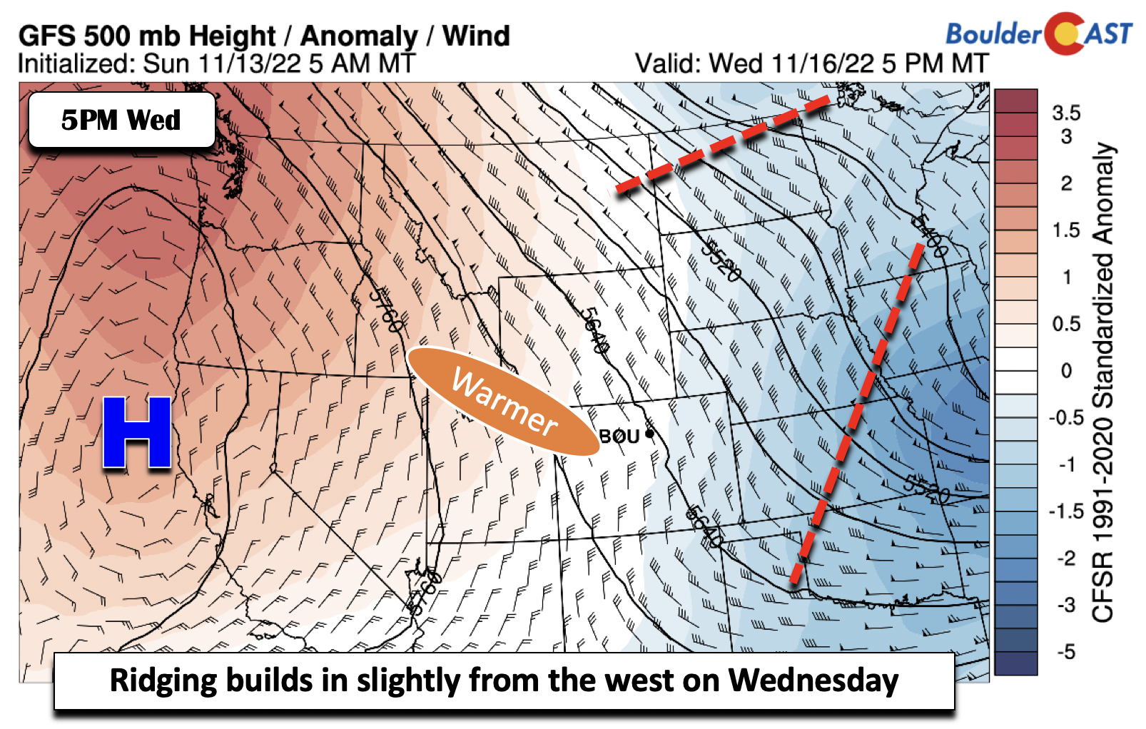
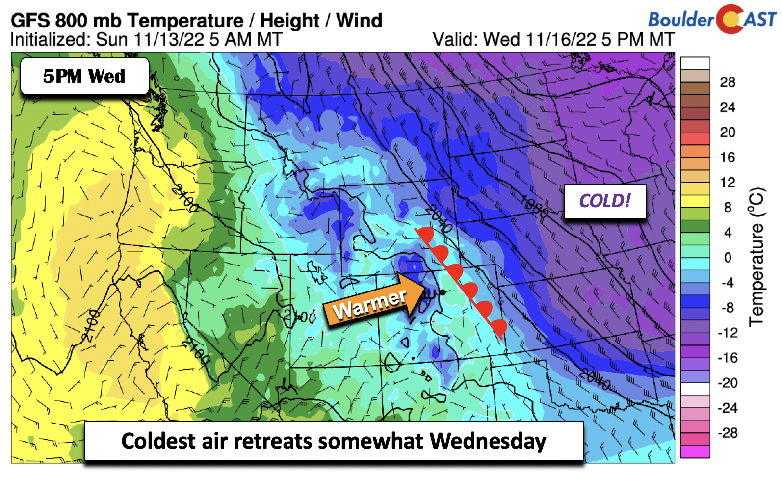
The main impact from this shortave Monday and Tuesday will be partly to mostly cloudy skies from mid and high-level moisture. Otherwise, expect cold temperatures in the mid to upper 30s. There will be a weak warmup come Wednesday as a strong ridge centered along the California coastline will shift eastward. The actual center of this ridge will not reach Colorado, but its position will be enough to shift the coldest air to our east.
That pattern change will allow weak downslope flow to ensue on the Plains and for temperatures to reach the lower 40s under increasing sunshine. Keep in mind, this is still some 15 degrees below normal so it certainly won’t be a good pool day!
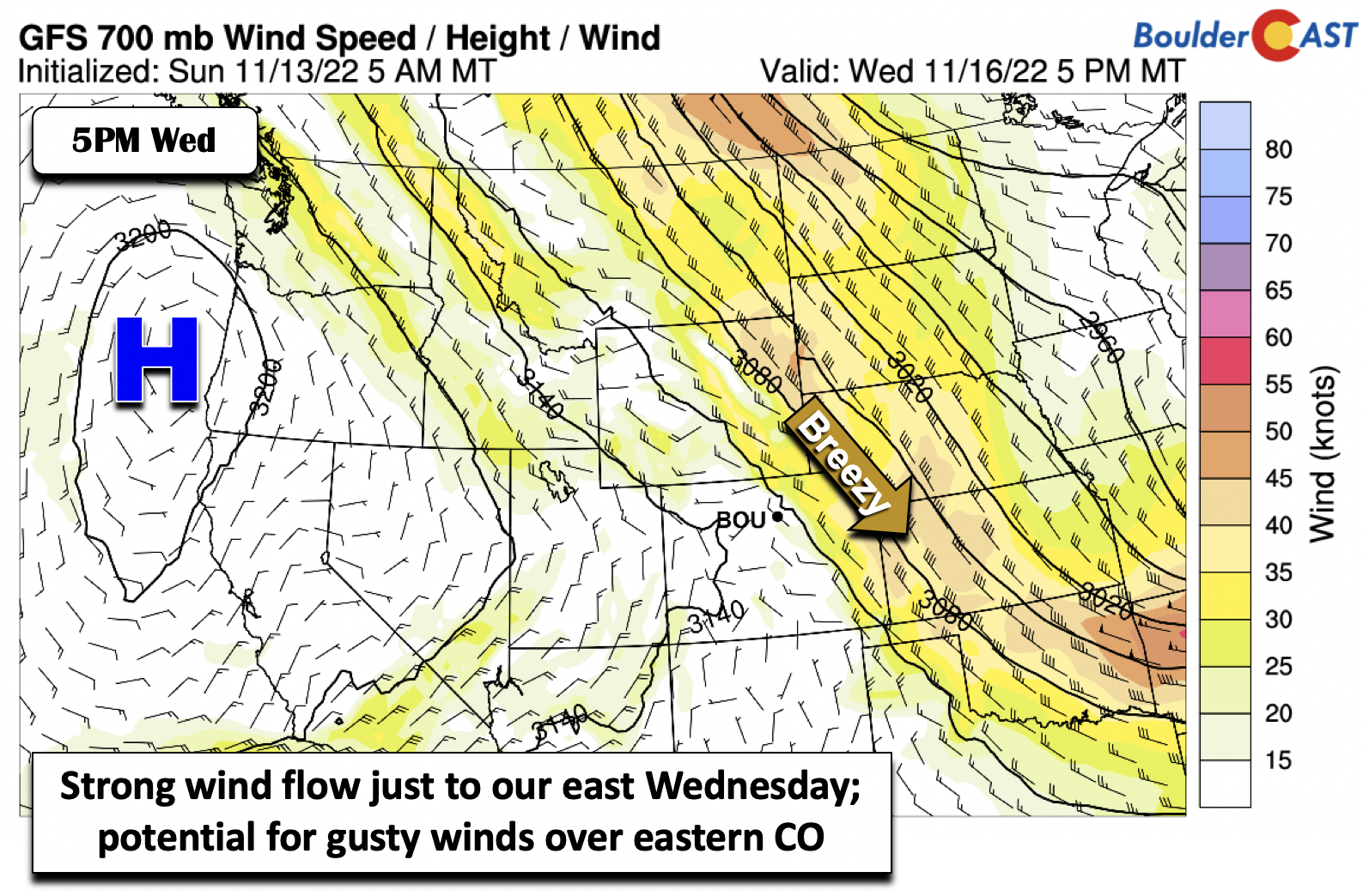
While not expected to impact the Denver Metro area directly, strong winds aloft will be just to our east on Wednesday, creating some gusty surface winds over eastern Colorado during this time. We cannot rule out a potential gusty day on Wednesday, but confidence on these higher winds reaching the Boulder/Denver area is low at the moment. We will monitor it as the week progresses.
Watching a good chance of snow by late-week
Probably the main story for the week ahead is the potential for accumulating snow late Thursday into Friday. The GFS/ECMWF/GEFS are in fairly good agreement with the pattern. These models show another northern stream shortwave diving down in the northwest flow. This one has more moisture with it, as well better upper-level jet dynamics to make things a tad more interesting…
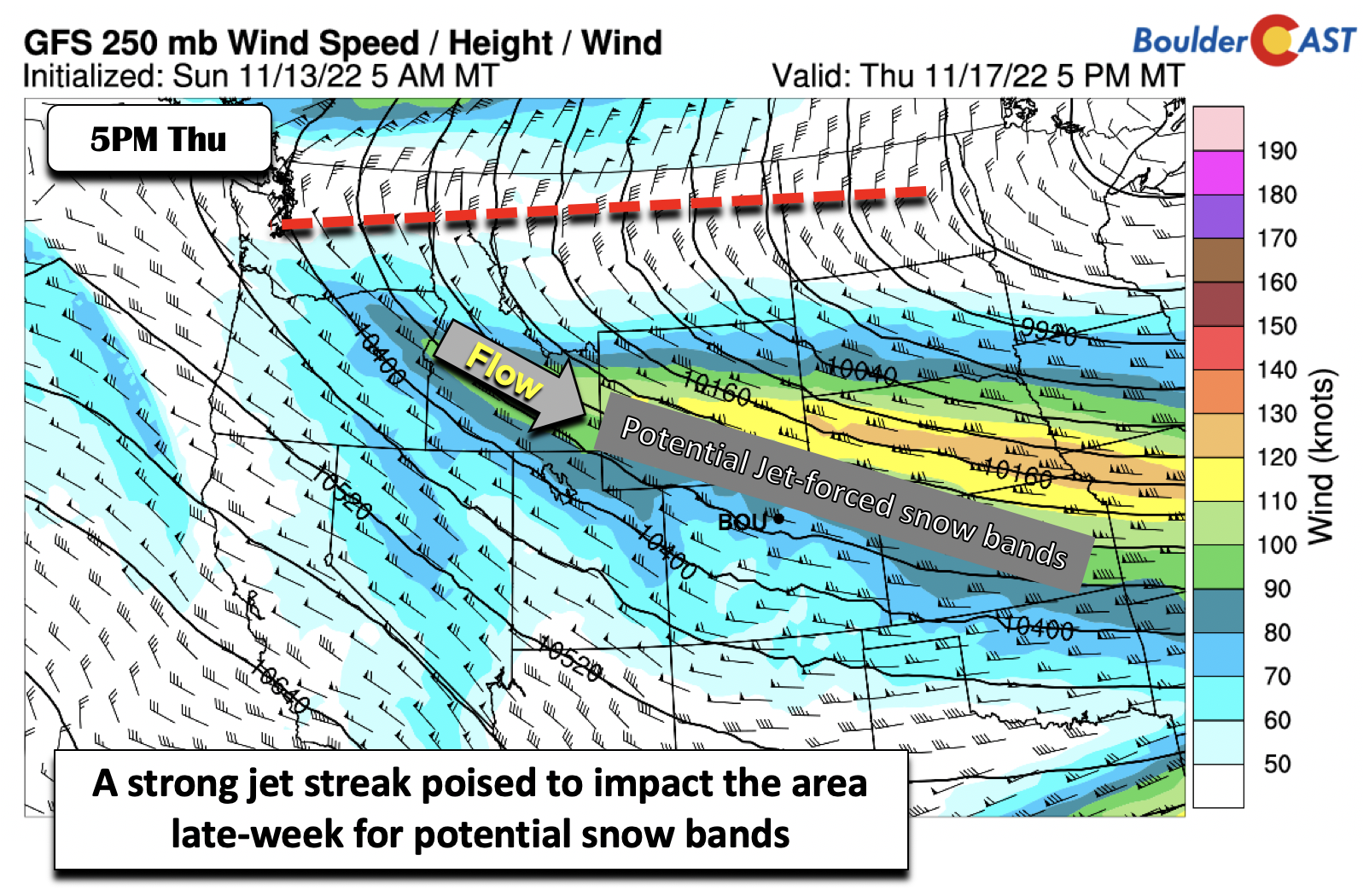
While the jet position of the late-week system is likely to change between now and Thursday, models are in fairly good agreement of a northwest-to-southeast oriented jet streak stretching from Wyoming into Missouri. This pattern is very typical for La Niña winters and usually favors jet-forced heavier snow bands in some capacity.
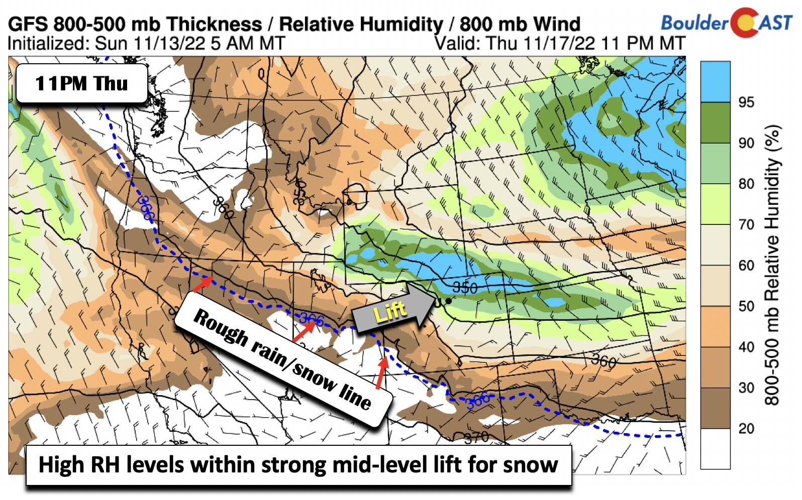
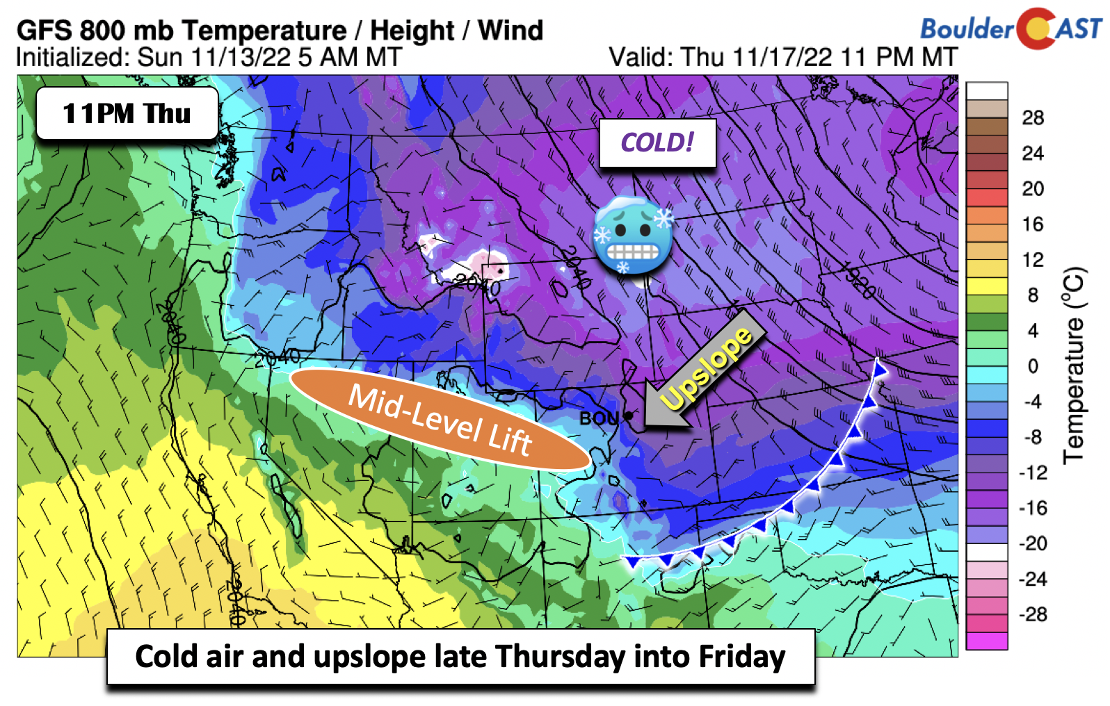
Forecasting these snow bands four days out is difficult to near-impossible, but there are hints if you look at it in the data. The GFS mid-level relative humidity fields indicate high moisture content embedded along/south of the jet streak late Thursday into Friday. Along with this, there is surface upslope, extending up to about 5,000 feet above the surface. The airmass is certainly cold enough, with our projected rain/snow line south in New Mexico.
Putting it all together, there is plenty of cold air, surface upslope, mid-level forcing and frontogenesis from the jet streak, and just enough moisture. We will be monitoring this system as we get closer so stay tuned.
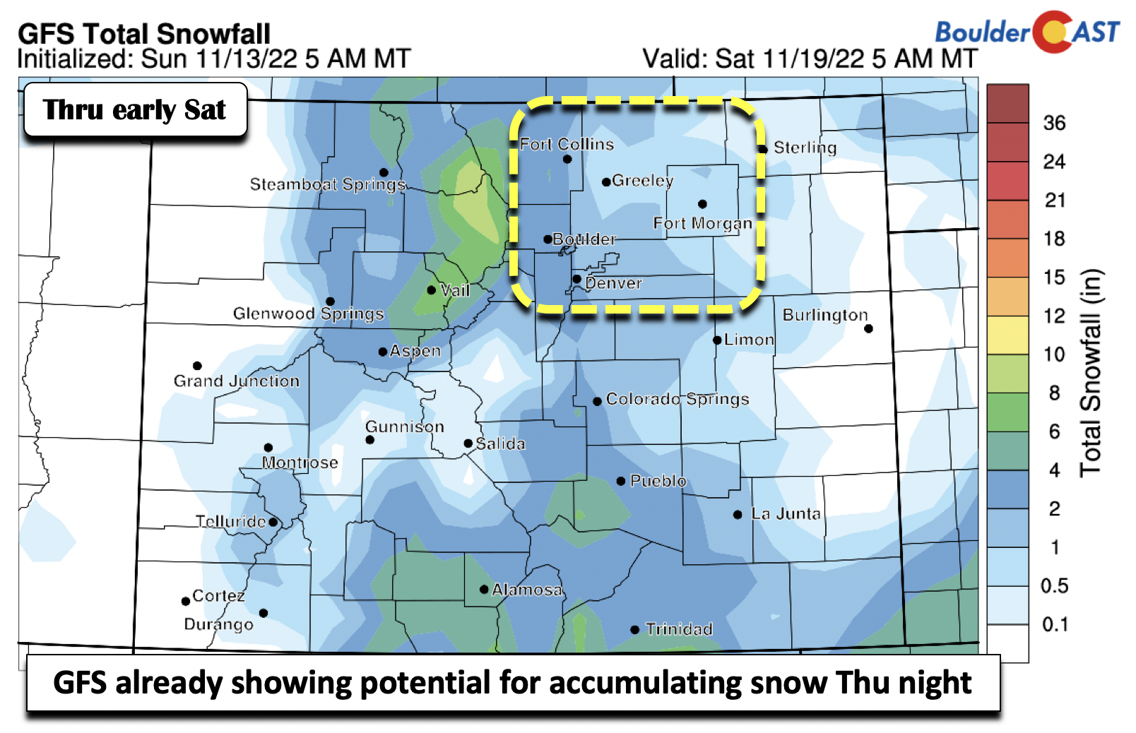
Early indications from the GFS would suggest 1 to 4 inches of snow, though any jet-forced snow bands could lead to localized higher amounts. We will have to wait for the HRRR/NAM-NEST later in the week to get a better handle on these. In the absence of snow banding, Boulder is favored for more snow than Denver anyways due to the upslope. But as we’ve seen many times in the past, snow bands can be small and vary in space/time such that the higher amounts can be found around Denver, too.
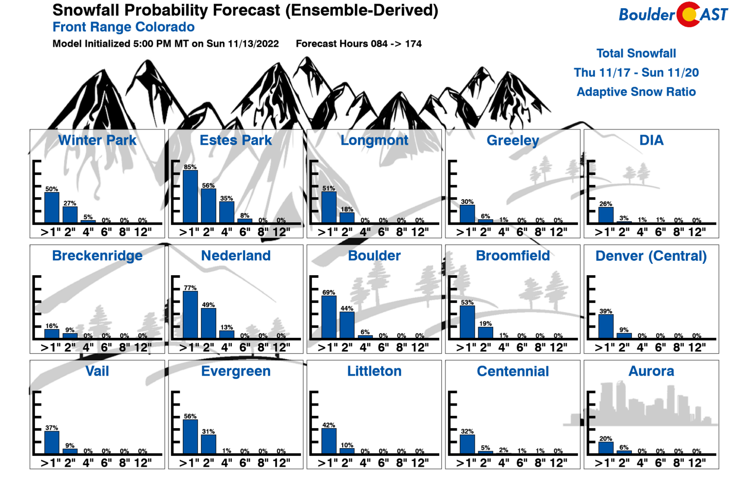
Let’s take one final look at our Snowfall Probabilities for the late-week period. They are not extraordinarily excited for a moderate snow event. The probabilities as of now suggest a broad brush of 1-2 inches over the Denver Metro. If the pattern we see at mid-levels persists for late in the week, we would anticipate these probabilities to increase a tad. The ensembles would have a difficult time simulating snow bands this far out. On the other hand, if the jet shifts just a tiny bit, our amounts could be less than anticipated. Stay tuned and think snow if that’s your fancy!
Late-Week Snow Summary:
- A much stronger cold front moves through Thursday with temperatures dropping into the 20s for highs on Friday
- The front will favor a period of upslope late Thursday into Friday
- A jet streak nearby could spawn jet-forced snow bands in addition to the upslope
- Current indications favor a good possibility for accumulating snow late in the week, but amounts are still somewhat uncertain (but likely remain light)
Forecast Specifics:
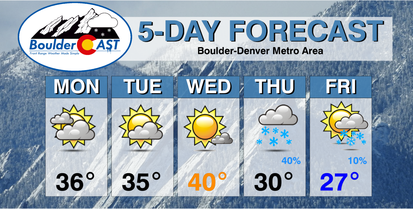
Monday: Partly to mostly cloudy skies with chance of flurries or light snow showers Monday night. 1″ or less of accumulation is expected with up to 2″ in an near the Foothills. Highs in the middle 30s on the Plains and upper 20s in the Foothills.
Tuesday: Partly sunny with a chance of snow flurries in the morning. Highs in the middle 30s on the Plains and upper 20s in the Foothills.
Wednesday: Increasing sunshine with warmer temperatures around 40 degrees. Some gusty winds are possible in eastern Denver during the afternoon. Highs in the Foothills will reach the middle 30s.
Thursday: Becoming mostly cloudy with a good chance of snow Thursday evening into early Friday. Accumulating snow is looking increasingly likely but amounts are uncertain at this point. They should be generally light, however. Highs colder around 30 degrees with temperatures dropping into the teens overnight into Friday.
Friday: Light snow may linger in the early morning, but skies clear and turn mostly sunny. High temperatures remain cold in the mid to upper 20s on the Plains and lower 20s in the Foothills.
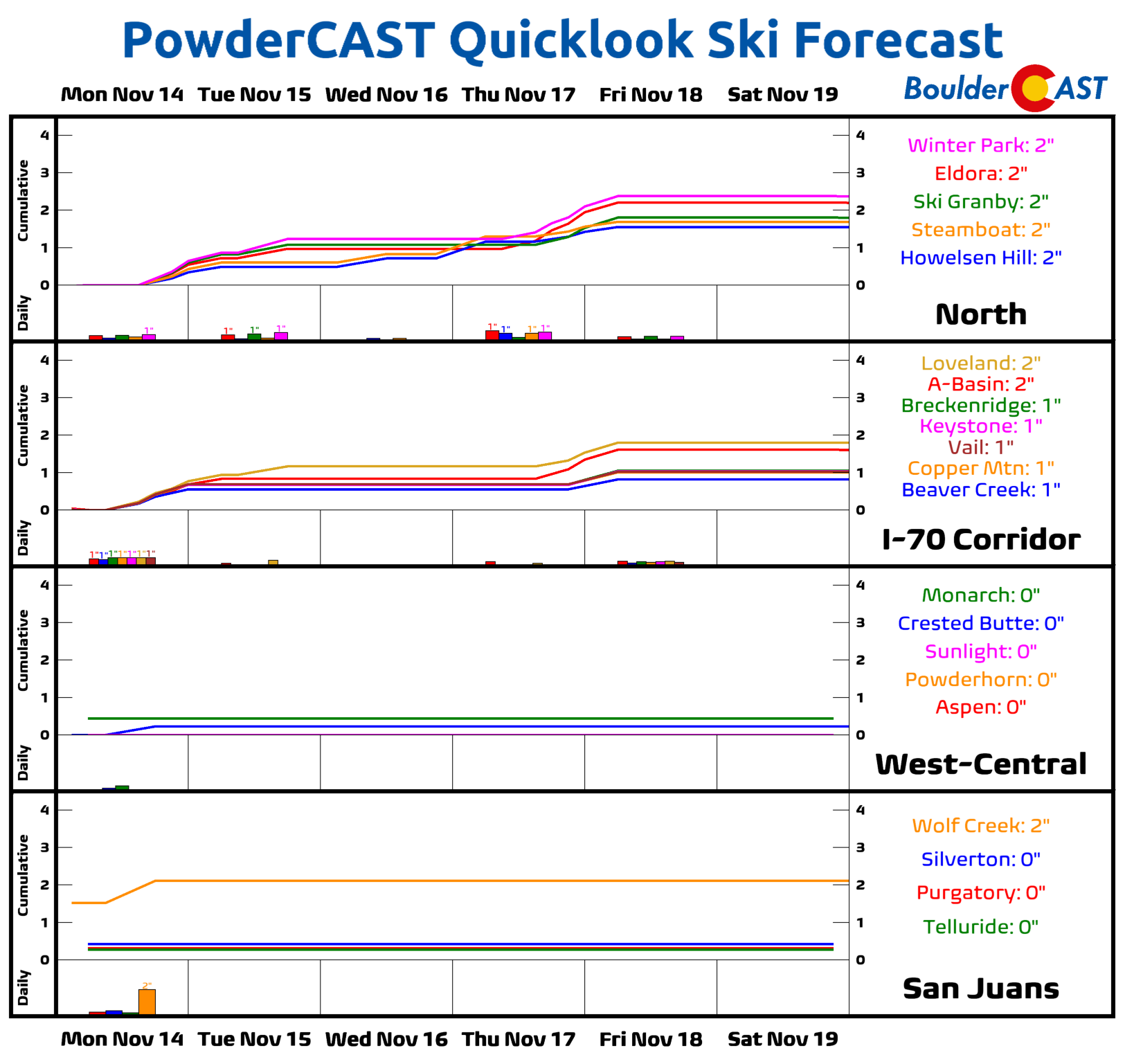
High Country: Several mid-level systems will track from northwest to southeast across the state this week. Light snow will be possible Monday into Tuesday, with light accumulations of 1-3 inches across northwest facing slopes in north-central Colorado. Another chance of snow will be favored across central and northern Colorado late Thursday into Friday, with moderate snowfall amounts possible in the 3-7 inch range over northwest facing slopes. Overall, don’t expect too much powder to accumulation in the ski resort this week. Despite the active pattern, there is not a lot of moisture to go around!
Help support our team of Front Range weather bloggers by joining BoulderCAST Premium. We talk Boulder and Denver weather every single day. Sign up now to get access to our daily forecast discussions each morning, complete six-day skiing and hiking forecasts powered by machine learning, first-class access to all our Colorado-centric high-resolution weather graphics, bonus storm updates and much more! Or not, we just appreciate your readership!
Spread the word, share the BoulderCAST forecast!




You must be logged in to post a comment.