Unfortunately, we’ve got another dry stretch this week across the Front Range. Temperatures will trend warmer each day as a ridge of high pressure to our northwest remains in place through much of the week, possibly getting close to 80 degrees by Thursday and Friday. However, there are strong hints in the guidance that much cooler weather will rear its ugly head late in the upcoming weekend into early next week. This pattern shift may result in a chance of snow for our area, though that remains uncertain for now. Read on for more details.
This week’s highlights include:
- A ridge over Idaho/Montana will remain in place through midweek, resulting in temperatures trending above normal
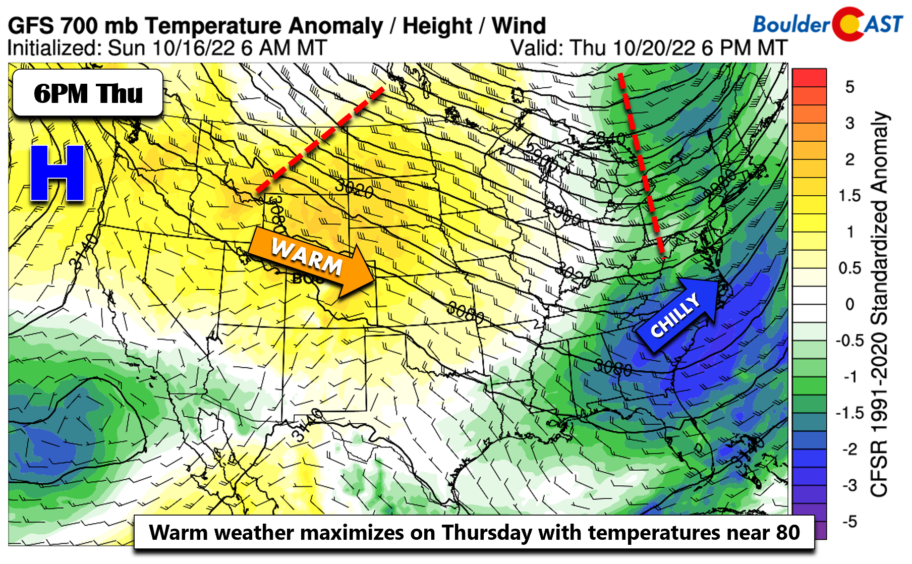
- A zonal flow will set-up late in the week with downslope helping to boost our temperatures into the mid to upper 70s
- Some signs of a weak cold front early Friday, but otherwise we remain fairly warm into the first half of the weekend
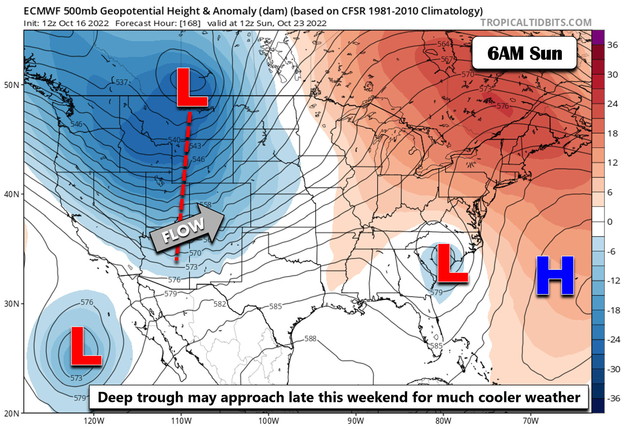
- Watching a trend towards much cooler weather late in the upcoming weekend into early next week with possibly a chance of snow
DISCLAIMER: This weekly outlook forecast is created Monday morning and covers the entire upcoming week. Accuracy will decrease as the week progresses as this post is NOT updated. To receive daily updated forecasts from our team, among many other perks, subscribe to BoulderCAST Premium.
The first widespread frost
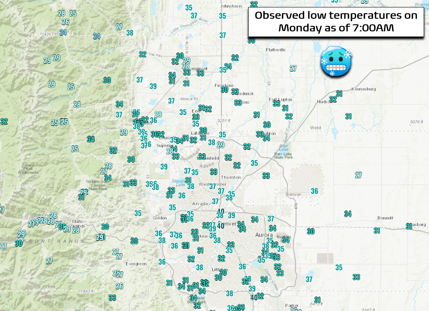
The season’s are changing! Despite the lack of a particularly cold airmass or strong storm system, temperatures Monday have dropped into the lower to middle 30s across the entire Denver Metro area under clear skies. Some of the coldest spots are in the upper 20s. This has resulted in the first widespread frost of the season. It’s about time…
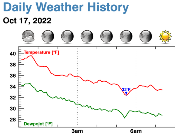
Early this morning before sunrise, we dropped down to 32°F briefly at our weather station. We’ll have to wait to see the official low for Boulder, but if today is the first 32-degree reading, it will have come about 11 days later than average in what has been a definitively warm autumn thus far.
Trending above normal through much of the week
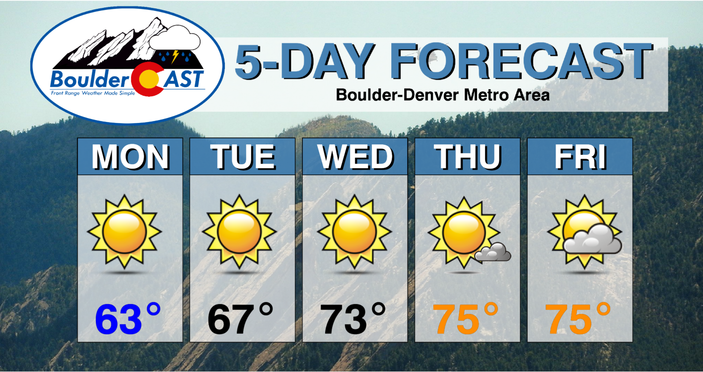
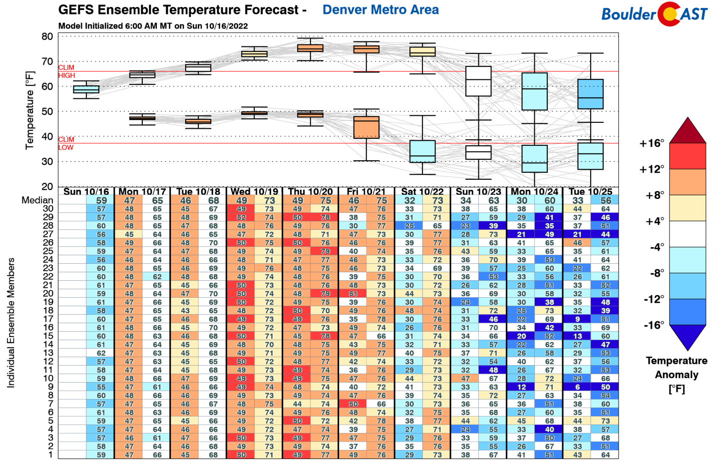
Temperatures this week will continue that above normal trend. This is all due to a strong ridge of high pressure situated to our northwest that will remain in place through mid to late-week. Our highs, though, will start off below normal in the lower to middle 60s today and tomorrow. Our warmest day will come towards the end of the week where it is possible some places could reach 80 degrees. Let’s discuss this in more detail below!
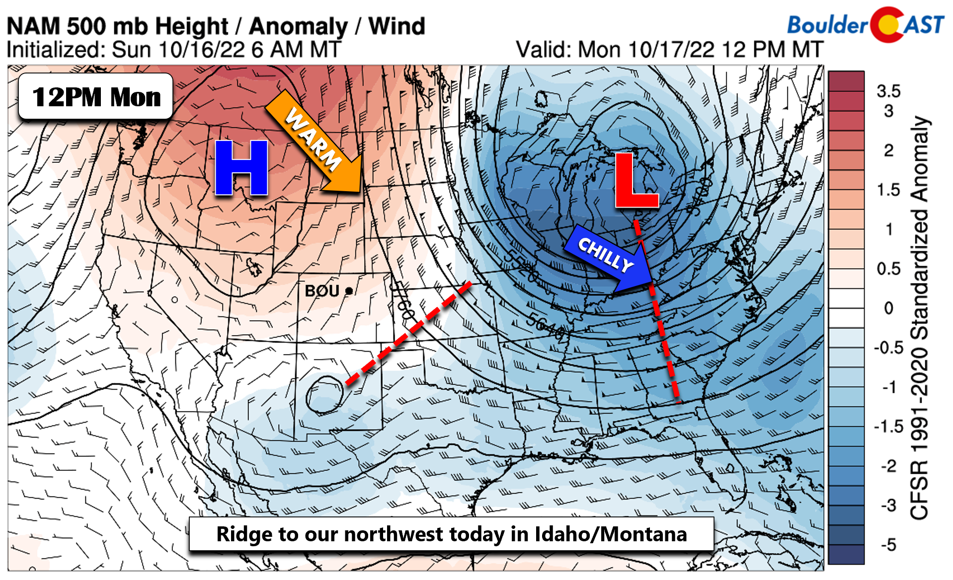
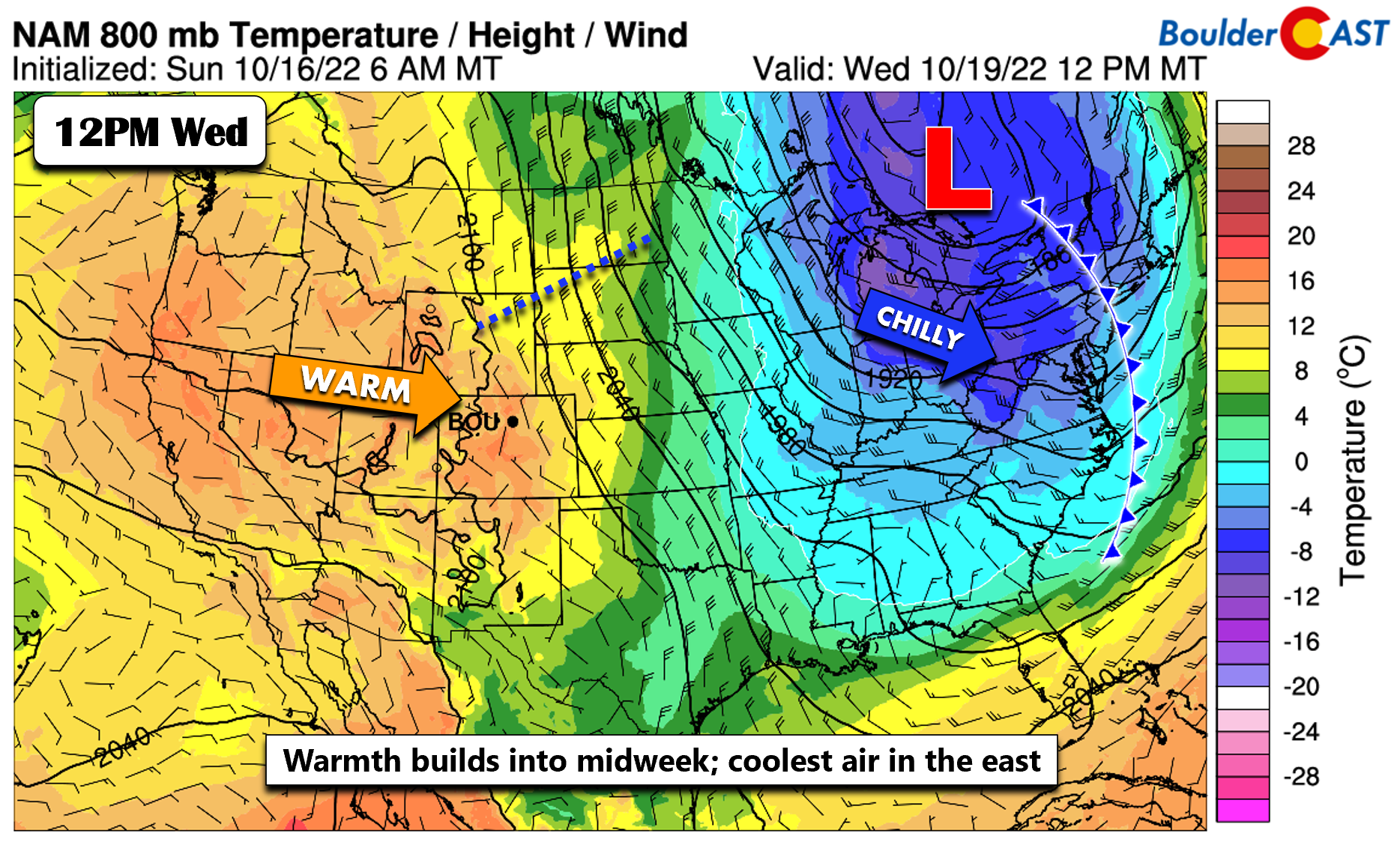
Monday’s weather setup is characterized by a ridge over Idaho/Montana and a trough to our east in the Great Lakes — the same pattern which has been locked over the nation much of the last week. The trough in the east and the ridge over us and to our west will be the story for much of the week, separating the chilly and below normal out east from the above normal weather reaching us this week.
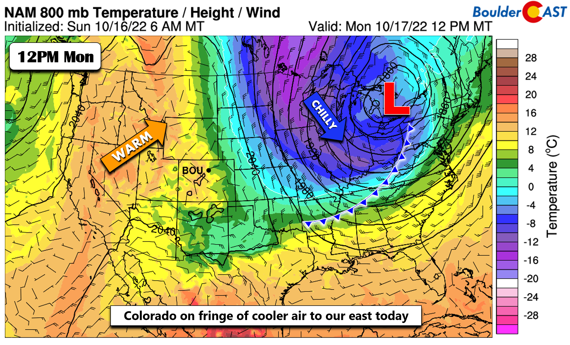
Colorado will be on the fringe of the chillier weather over Kansas Monday as a lingering frontal boundary sits over eastern Colorado.
We should top out in the lower to middle 60s Monday and Tuesday afternoons under completely sunny skies.
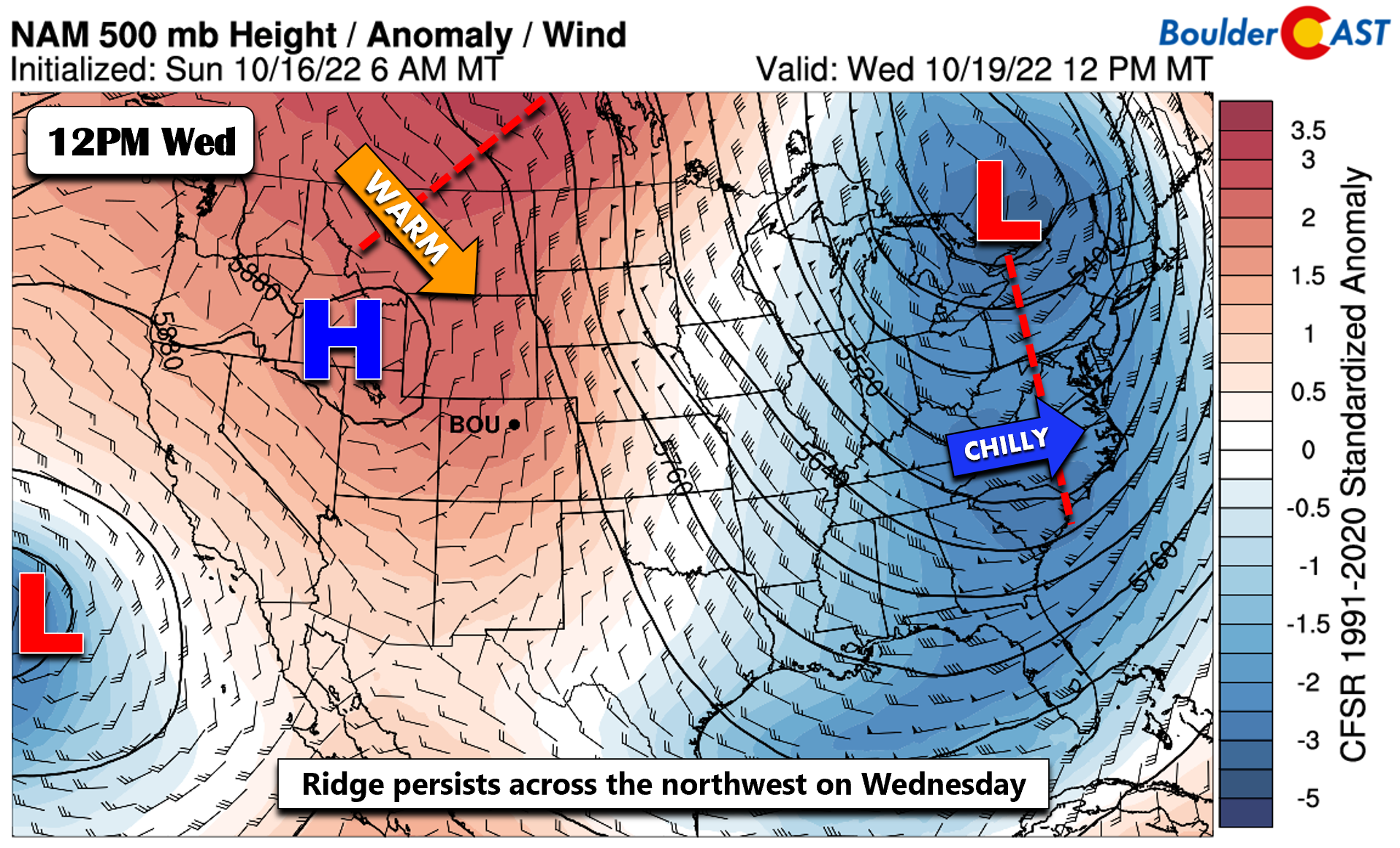
As the week progresses into Wednesday, the trough in the East will shift a bit into New England, while the ridge to northwest shifts over southern Idaho. Increasing warmth will be the trend for us through midweek.
Relative warmth will setup across Front Range Colorado as the cooler air migrates eastward with the trough. High temperatures will reach the low to middle 70s on Wednesday.
It looks like our warmest day across the Front Range will be Thursday (but Friday will be similar) as flow shifts to a more zonal pattern. That will spell out a warm downslope wind. Could we touch 80 degrees? We think it is certainly possible, though the more likely situation will be in the mid to upper 70s.
There are some hints in the guidance that a weak cool front may move through early Friday, which could drop highs in the lower 70s by week’s end. That is somewhat uncertain, though, with Friday possibly being just as warm than Thursday. No precipitation is expected throughout the entire week.
Watching some much cooler weather late this weekend
We are watching for a likely change in the pattern by late in the upcoming weekend. Finally! The global models are showing a deep trough pushing into the northwest US come Sunday. However, the models disagree on placement and timing — not surprising given how far out we are currently. The ECMWF is further north with the trough, which would favor a dry and chilly pattern, while the GFS model is further south/west, favoring a chilly and possibly wet pattern into early next week. This leads to uncertainty, though we cannot rule out a chance of snow for the Boulder-Denver area if the trough tracks just right. Stay tuned!
Forecast Specifics:
Monday: Sunny and cool with highs in the low to middle 60s on the Plains and low to middle 50s in the Foothills.
Tuesday: Sunny and warmer with highs in middle 60s on the Plains and middle 50s in the Foothills.
Wednesday: Sunny, mild and breezy with temperatures in the low to middle 70s on the Plains and low to middle 60s in the Foothills.
Thursday: Our warmest day under mostly sunny skies. Highs in the middle 70s to possibly near 80 degrees on the Plains and upper 60s in the Foothills.
Friday: A mix of clouds and sun. Pleasant with temperatures reaching into the middle 70s on the Plains and lower 60s in the Foothills.
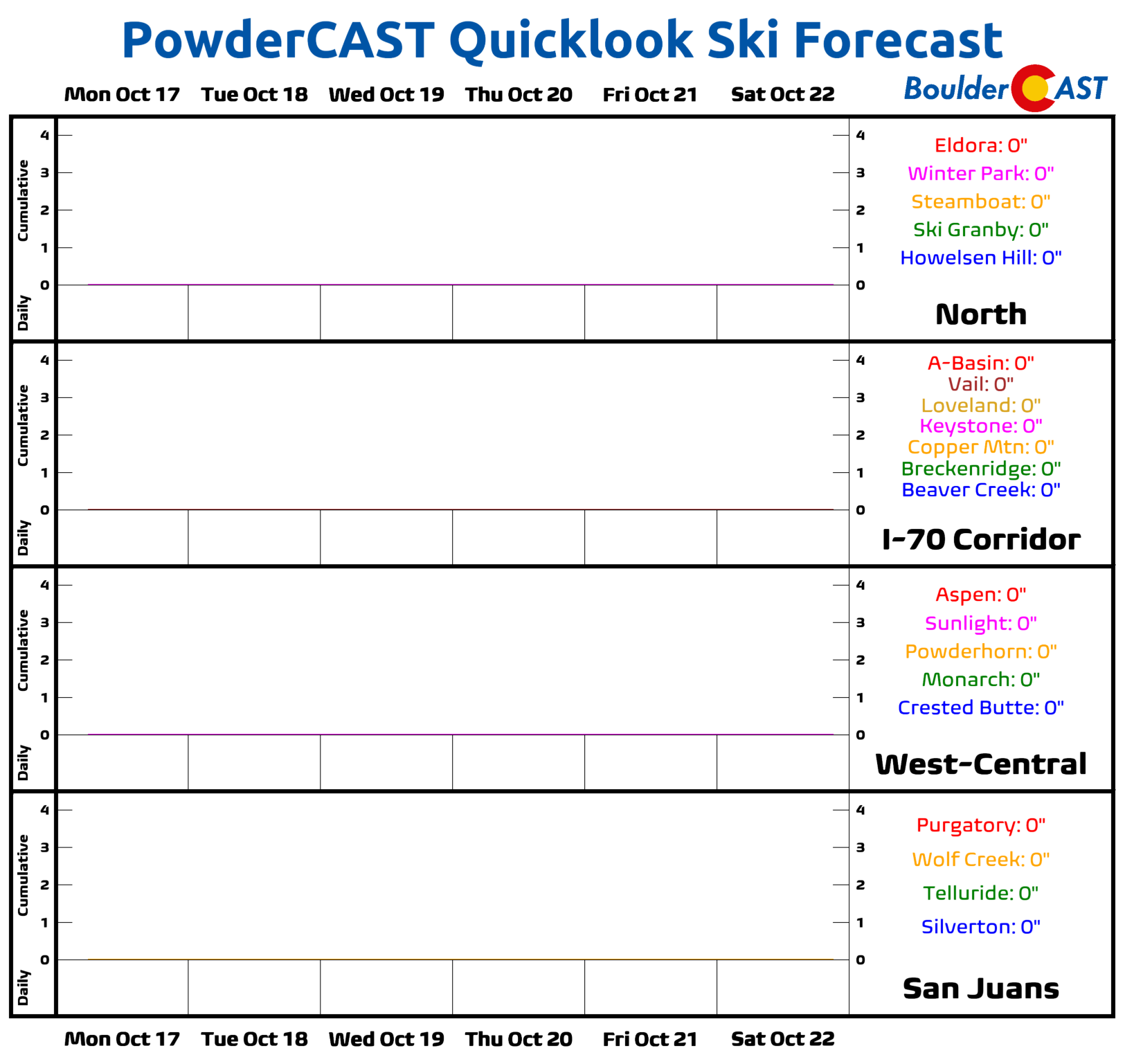
High Country: Dry weather will persist across the Mountains for the entire week. It will also be relatively warm during the afternoon hours. Hiking the high mountain peaks remains attainable this year due to the lack of any major snow events in the High Country.
Help support our team of Front Range weather bloggers by joining BoulderCAST Premium. We talk Boulder and Denver weather every single day. Sign up now to get access to our daily forecast discussions each morning, complete six-day skiing and hiking forecasts powered by machine learning, first-class access to all our Colorado-centric high-resolution weather graphics, bonus storm updates and much more! Or not, we just appreciate your readership!
Spread the word, share the BoulderCAST forecast!





You must be logged in to post a comment.