The week starts off unsettled, cloudy, and chilly as a series of mid-level systems keep the Front Range in a persistent upslope flow. Showers, and at times, thundershowers, will be isolated to scattered over the Plains and Foothills through Tuesday. Temperatures may get cold enough for some flakes to fall in the Foothills. Drier conditions with temperatures rising into the 80s and 90s take hold by late week.
This week’s highlights include:
- The week starts off unsettled, cloudy, and chilly in the 50s and 60s
- Upslope flow remains in place through early Wed, with off and on isolated/scattered showers
- Rain may mix with snow in the Foothills Tuesday, with only light accumulations expected
- Drier and much warmer by late week with highs well into the 80s
- Possible increased fire danger Friday, but confidence is low at the moment
DISCLAIMER: This weekly outlook forecast is created Monday morning and covers the entire upcoming week. Accuracy will decrease as the week progresses as this post is NOT updated. To receive daily updated forecasts from our team, among many other perks, subscribe to BoulderCAST Premium.
Unsettled, cloudy, and chilly to start
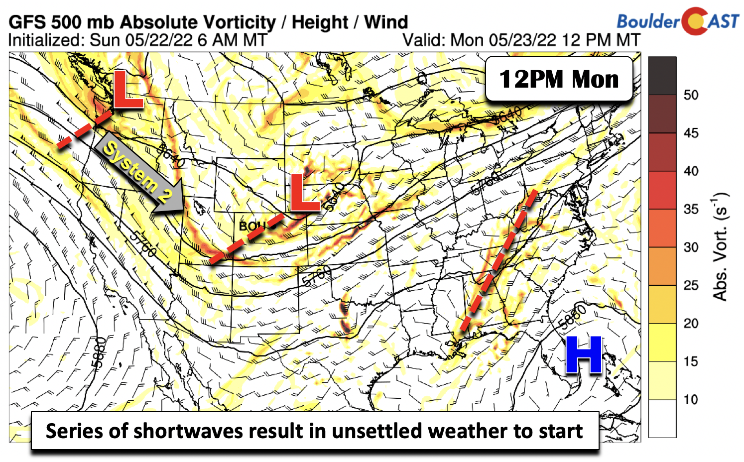
The nation has a lot going on to start the week. While high pressure sits off near southern Florida, a trough axis over the southeast US will continue to spark afternoon/evening showers/storms through midweek. To the west, a series of mid-level shortwave troughs will impact us into midweek. The first system is currently over western Nebraska, with its trough axis extending into southwest Colorado and southeast Utah. The second system is currently out over the Pacific Northwest and will track southeast and help deepen the system today by Tuesday. These two systems will keep the Front Range in a chilly, unsettled, and cloudy start to the week.
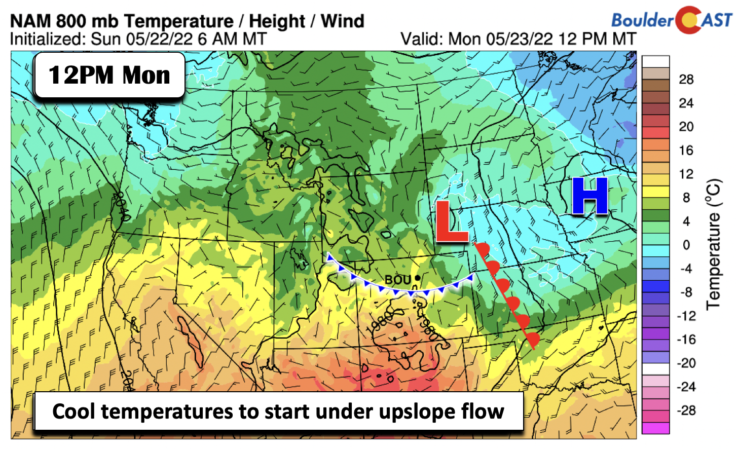
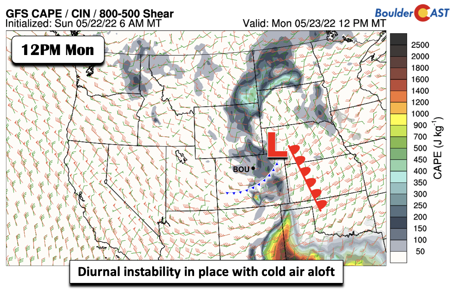
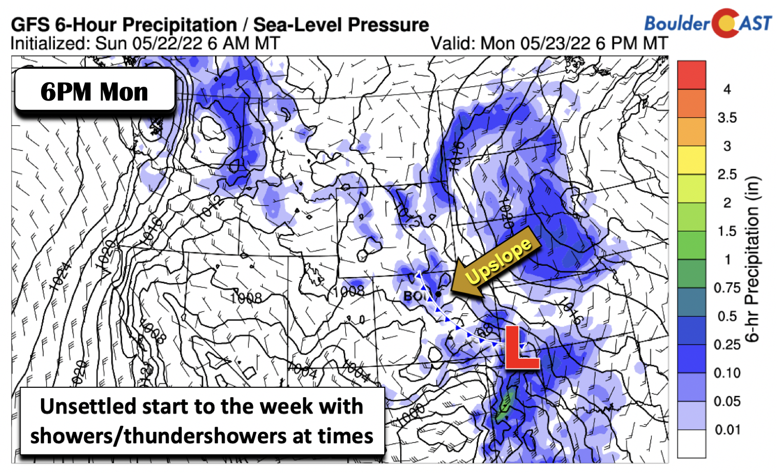
At the surface Monday, with the trough off to our north and east, a surface low is over western Nebraska, with a warm front extending south into western Kansas. A lingering cold front is positioned along central Colorado, with upslope flow in place over the Front Range. Cool air continues in the wake of the front today. Although clouds will largely fill the skies on Monday, temperatures should still get into the lower 60s with some afternoon partial sunshine and heating.
As the mid-level system and surface low track east-southeast Monday afternoon/evening, daytime instability, although weak, will form from the Foothills into the Plains.
Weak forcing from the trough and upslope flow, along with steep lapse rates with cold air aloft, will force isolated showers or thundershowers. These showers will be most likely east of Denver and across the Palmer Divide. That activity should wane after sunset, though another round of showers will be possible overnight into early Tuesday as the second mid-level system churns toward the area amid consistent upslope moist flow. The best chance overnight tonight will be over the Foothills and western suburbs of Denver/Boulder.
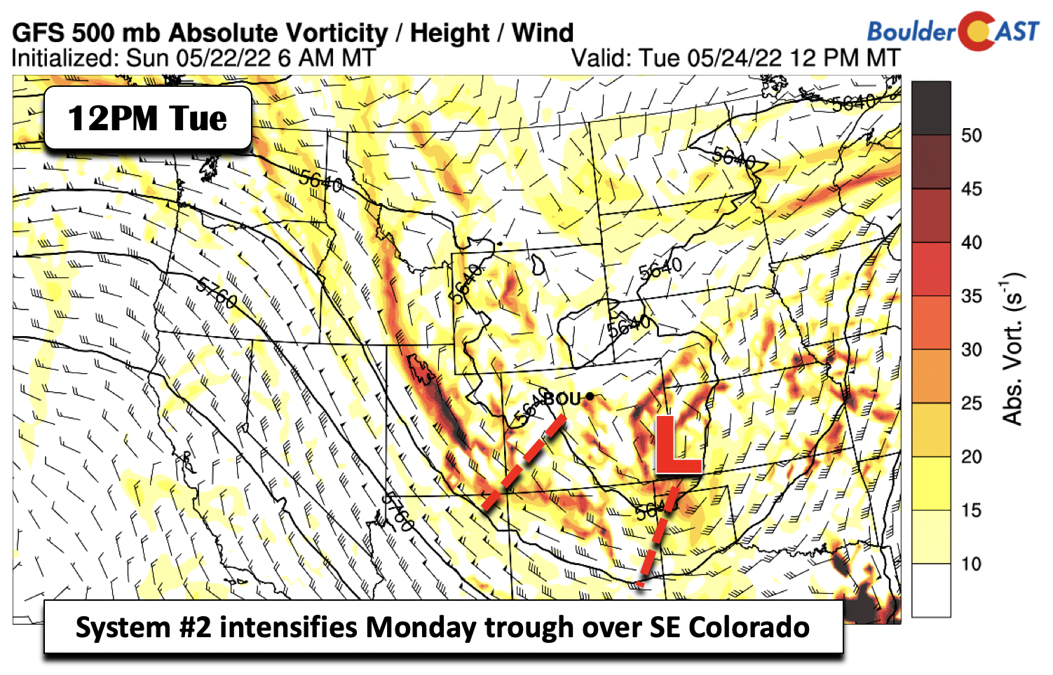
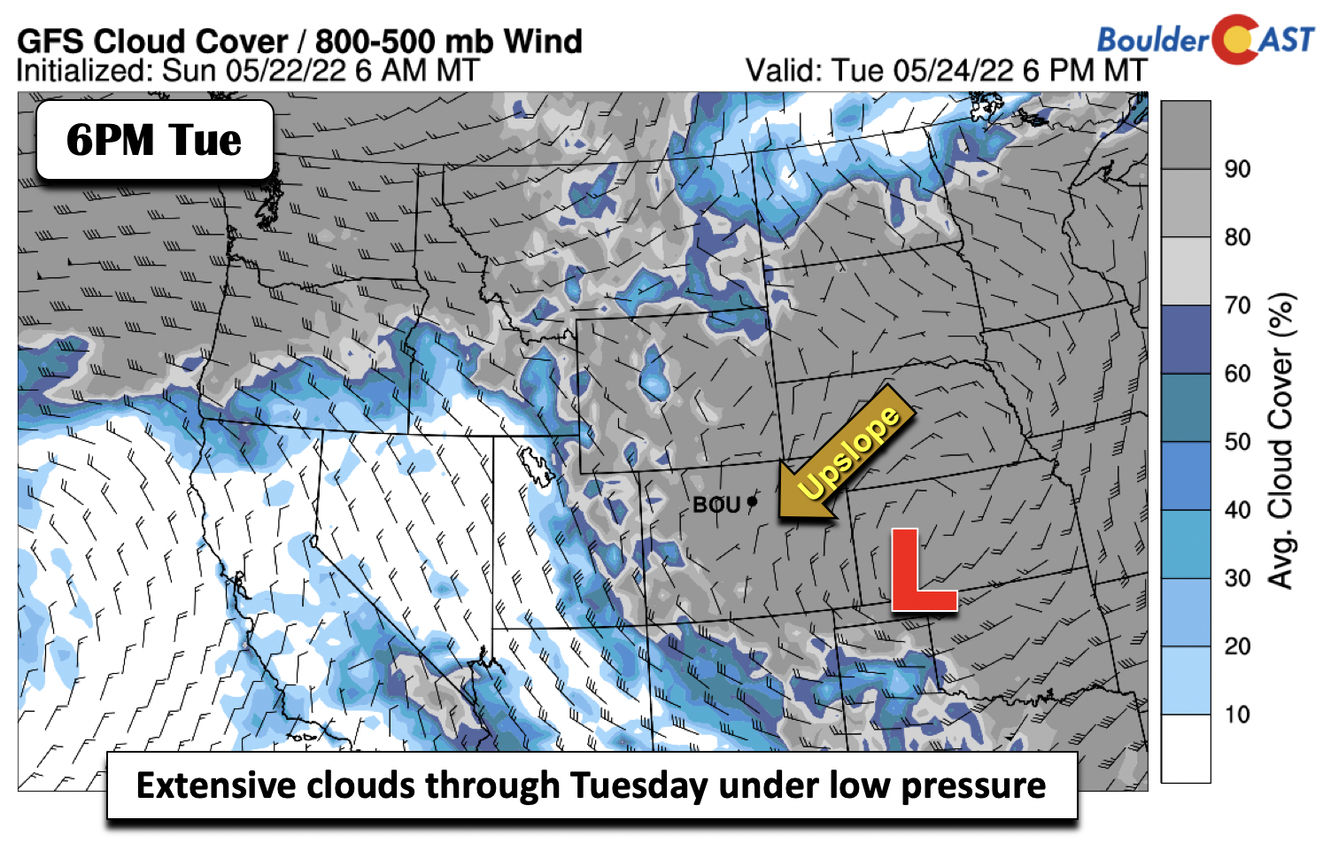
On Tuesday, the system out over the Pacific Northwest will reach eastern Utah and southwest Colorado. The initial system from Monday will get amplified by the second system and remain circulating over southeast Colorado. The effect will be a continued upslope pattern at the surface.
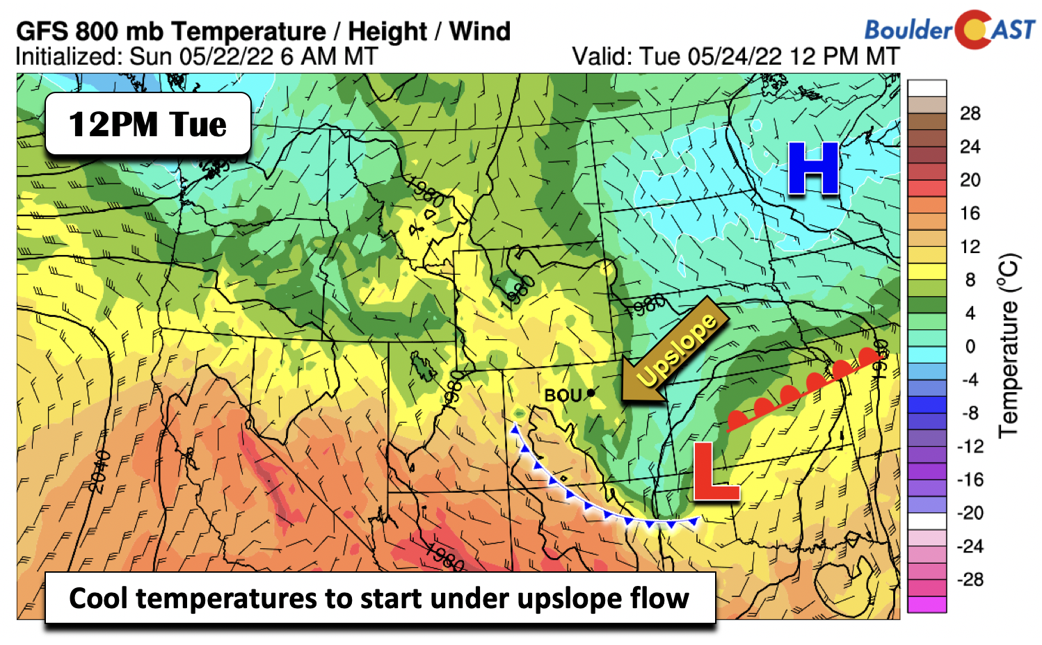
Temperatures will likely be some degrees cooler relative to Monday under extensive low clouds/morning fog, in the middle to upper 50s, coolest near the Foothills. The surface low is forecast to settle over the panhandle of Oklahoma/Texas midday Tuesday, with the cold front as far southwest as southwest Colorado, with upslope persisting over the Front Range.
The low clouds will extend over much of the state and as far east as the Mississippi Valley. The NAM is a tad faster than the GFS/ECMWF in the movement of the surface low — but we have trended slower given high pressure in the eastern US preventing it from exiting faster.
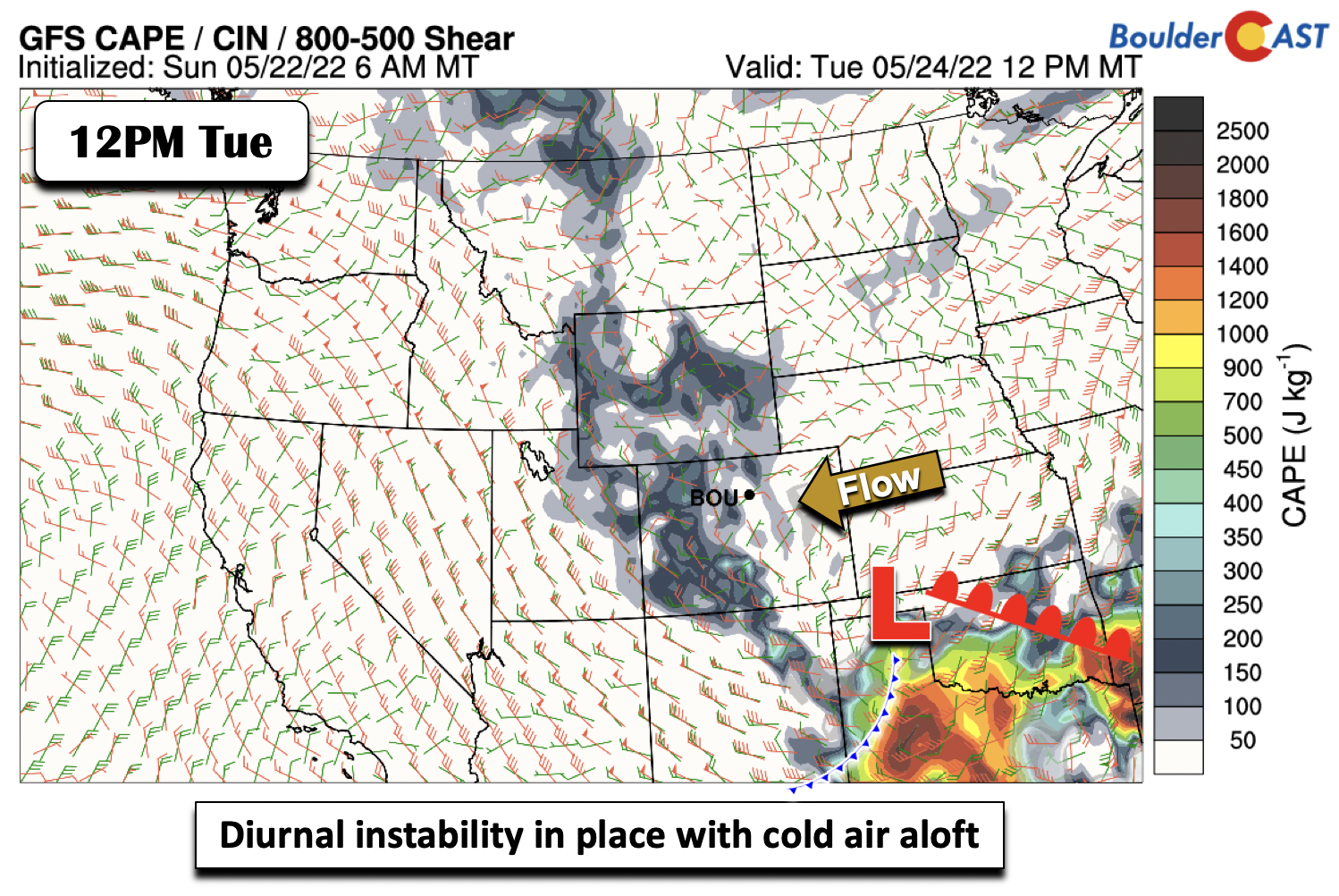
Like Monday, afternoon heating, even amid clouds, will allow weak instability (aided by steep lapse rates from cold air aloft) to further aid shower development (in addition to the upslope flow and shortwave forcing) and maybe a few rumbles of thunder. The best chance of thunder may be over the Foothills and High Country, where instability is greater. Nevertheless, shear is weak so severe weather is not in the cards.
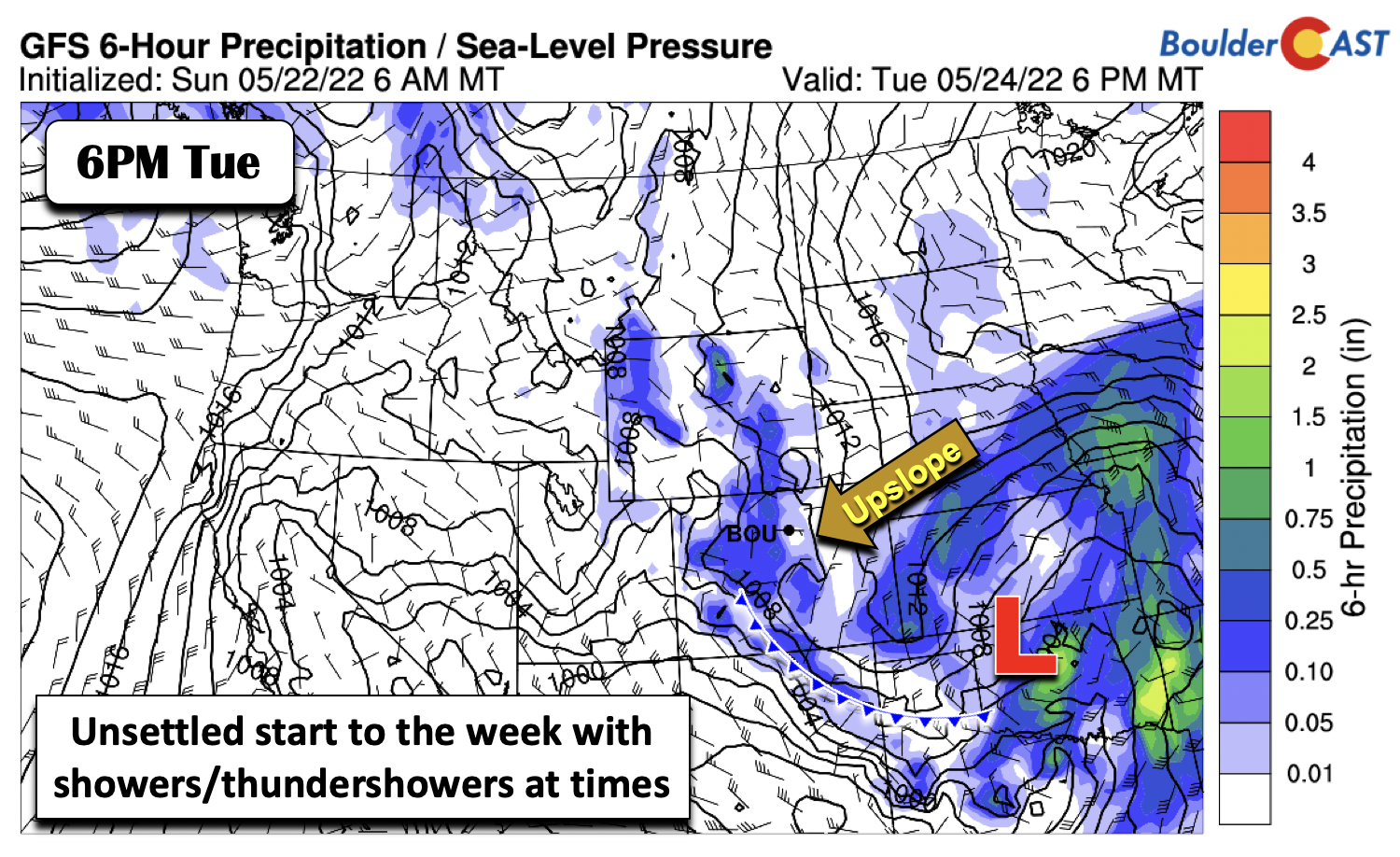
Expect another smattering of showers and embedded thundershowers Tuesday, with a focus again closer to the western portions of the Plains and nearby Foothills. Precipitation should wane Tuesday night to early Wednesday as the trough slowly shifts toward the central Plains.
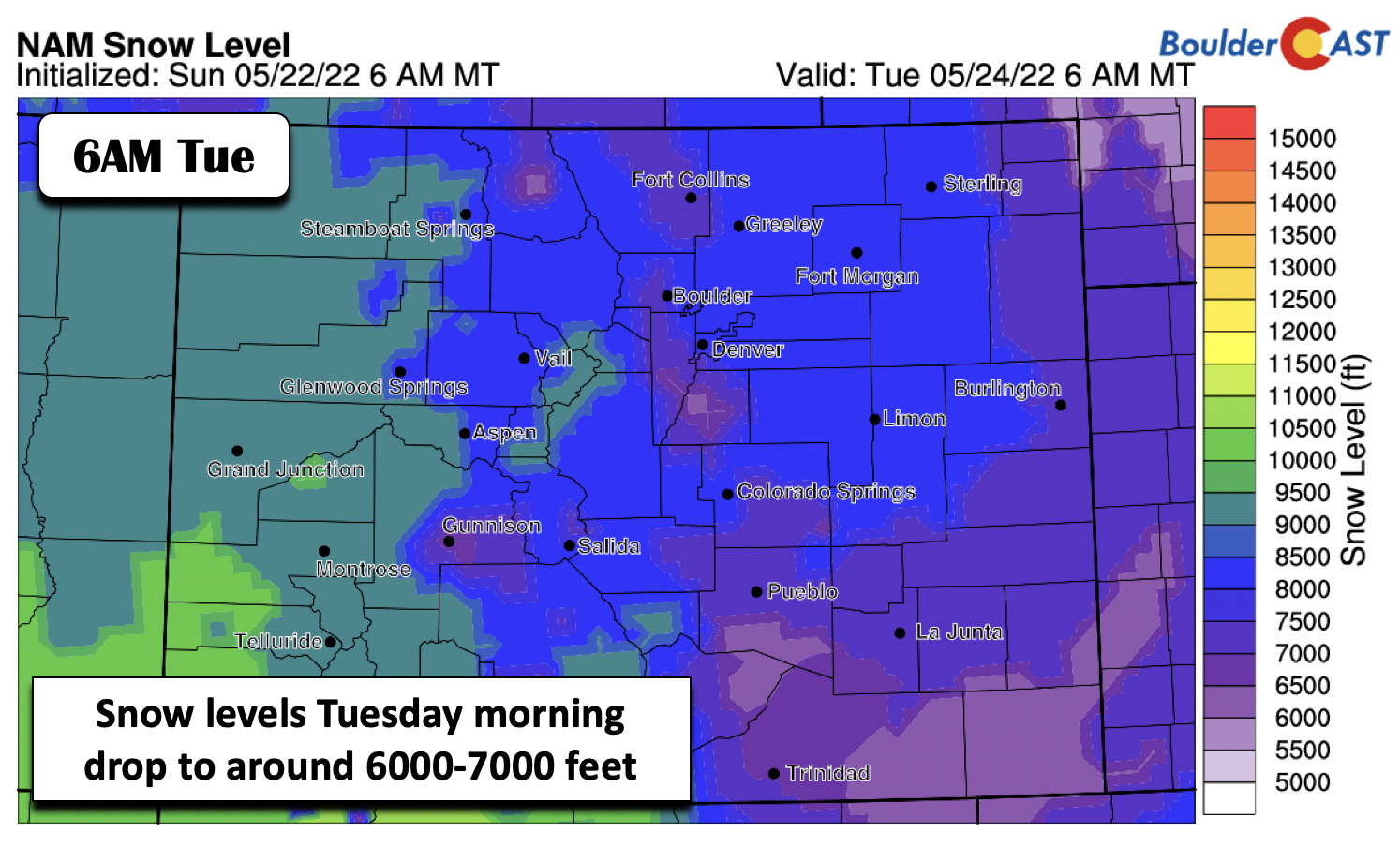
Snow levels early Tuesday as the trough moves through drop to between 6000 to 7000 feet. While this is certainly close to some areas of Boulder/Denver where elevations are between 5000-5700 feet, this should be an all-rain event for us on the Plains with above freezing 800mb temperatures.
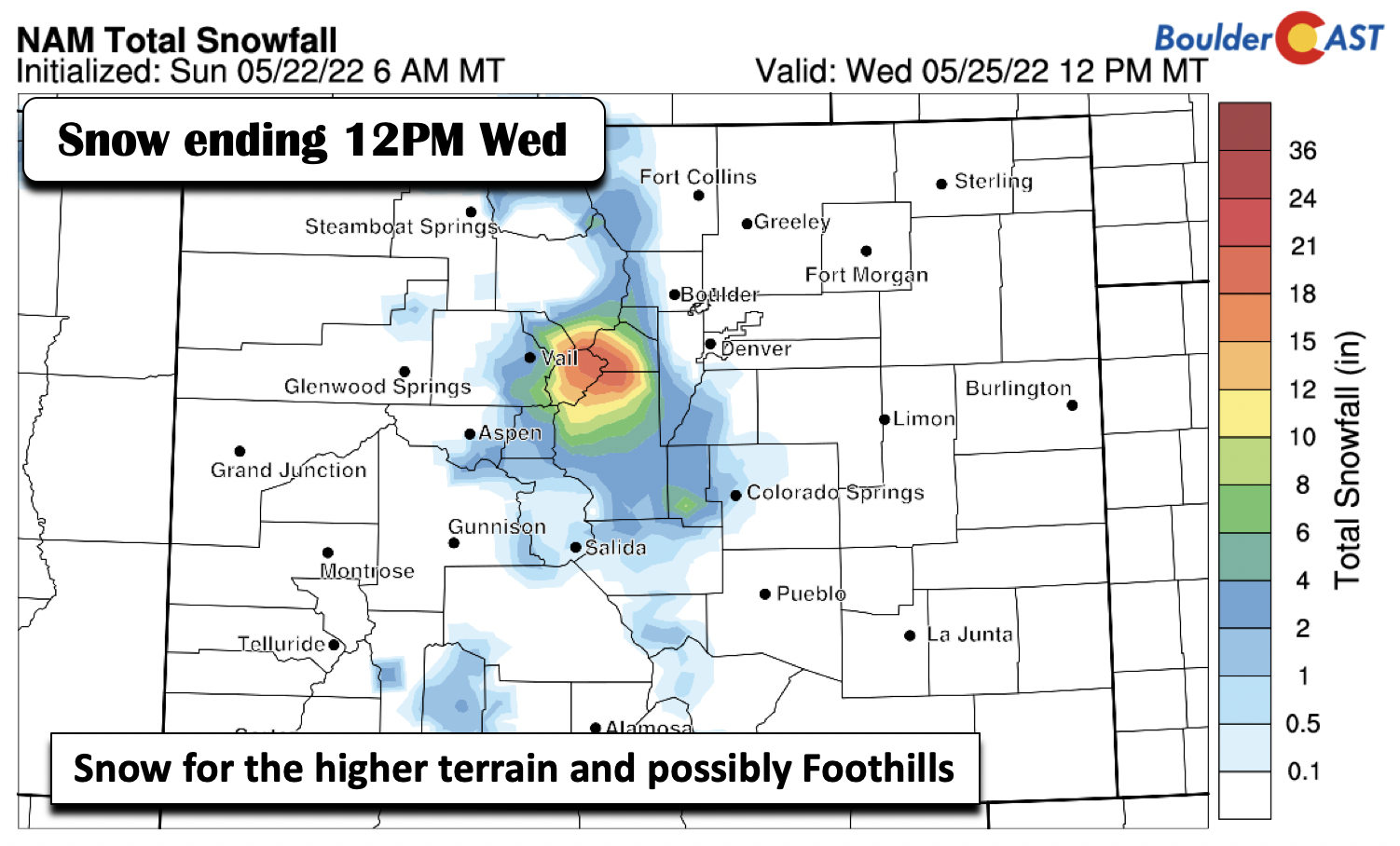
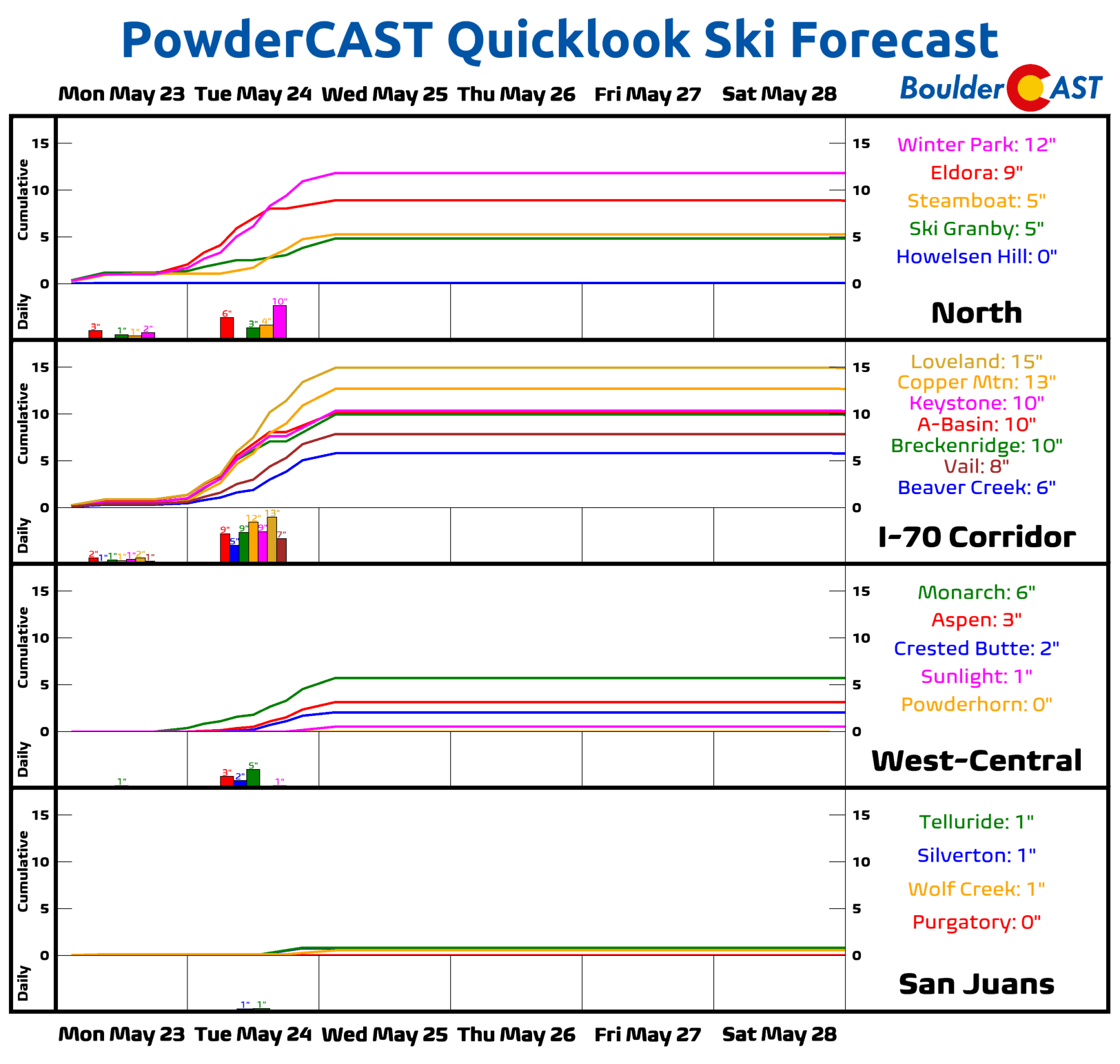
A light accumulation of snow is not out of the question for the Foothills, likely less than a few inches. The better chance will be out over the Divide, where the GFS/NAM indicate better forcing coupled to colder air aloft. Several inches of snow will be possible along I-70 but details on coverage/location still remains to be seen.
Drier and above average by late week…increased fire danger?
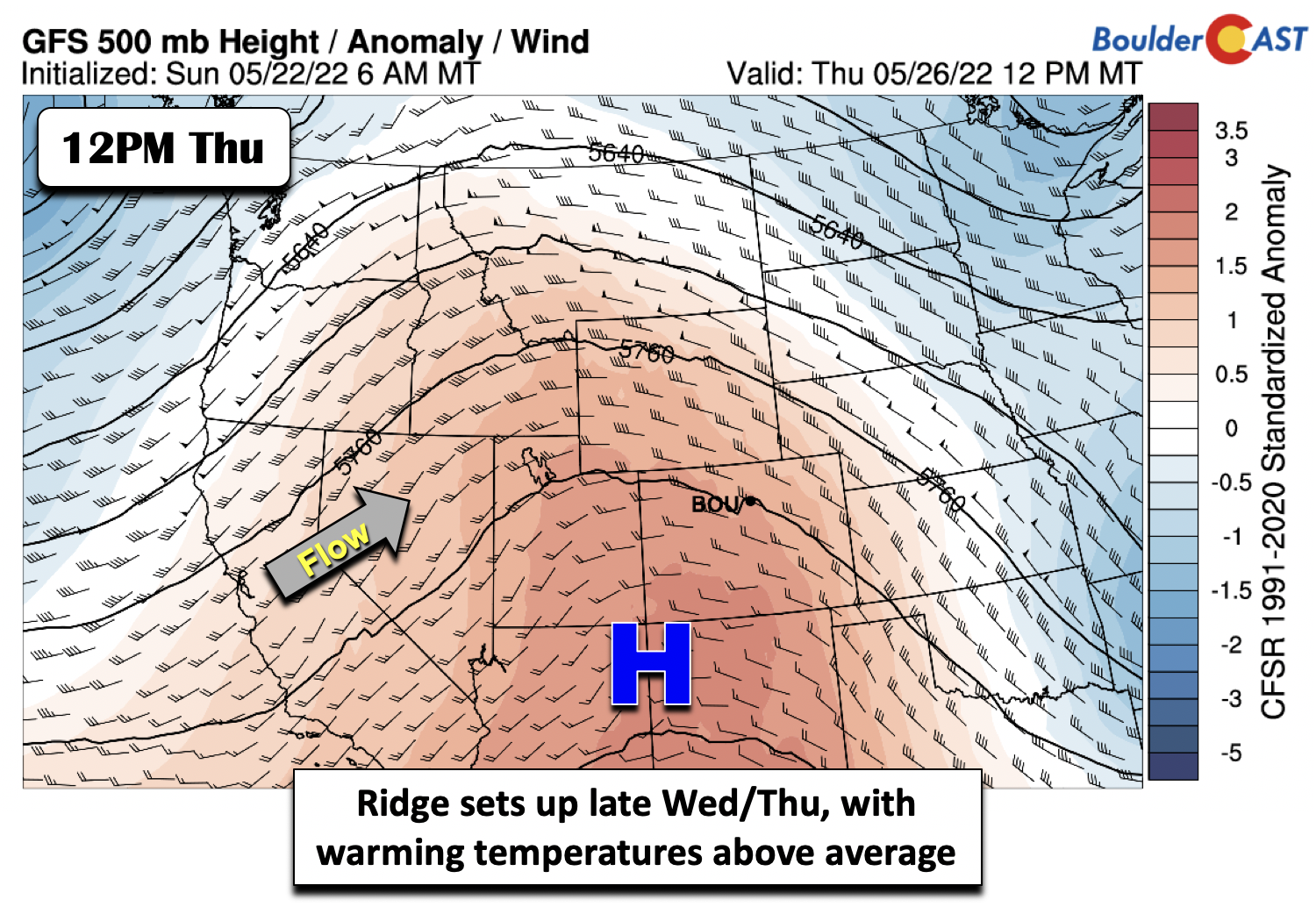
By Wednesday, most guidance indicates that the trough will move into the Mid-Mississippi valley, with ridging start to push in late Wednesday and Wednesday night. Warming temperatures aloft and growing subsidence should lead to a drier day and temperatures rising into the upper 60s under returning sunshine. By Thursday, most models are in good agreement that the ridge will strengthen and set up shop over the Intermountain West. This will set the stage for a warm end to the week — say goodbye to the cool temperatures for now! We see no reason why we won’t reach the low 80s come Thursday.
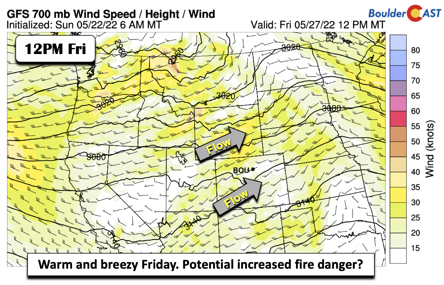
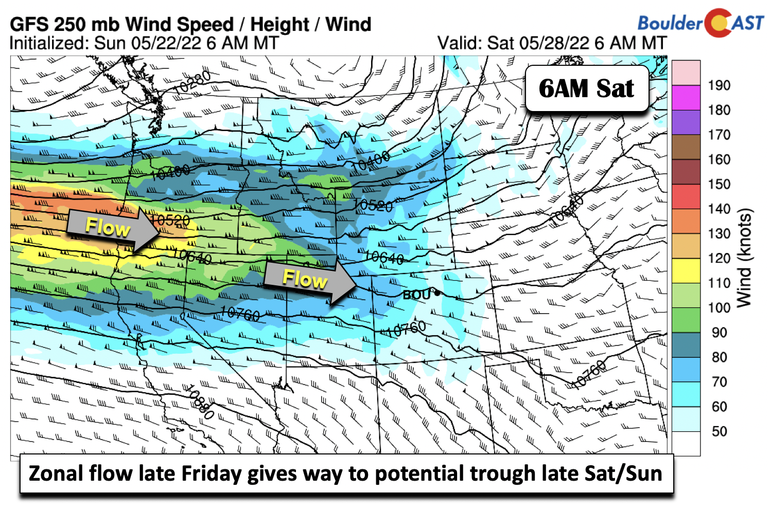
On Friday, the ridge is expected to slide east, though it will still dominate the area as it does so. The column will continue to warm under southwest flow taking over, thanks to a quasi-zonal flow developing as a trough sets up offshore of the West Coast. Highs in the upper 80s to near 90 degrees are likely to end the work week. Although our confidence is low, with the dry southwest flow expected Friday, this could lead to an increased fire danger for portions of the state. Wind speeds are not expected to be overly strong but considering low humidity levels and dry fuels, it could be a concern. There a very small chance a few widely scattered storms may develop in the southwest flow but don’t expect it to ruin your day.
The quasi-zonal flow should give way to a west-northwest flow pattern as the trough offshore of the West Coast slowly builds inland over the weekend. It looks like our next shot of precipitation may be sometime Sunday into early next week as the trough moves into our area and a surface boundary moves through. Thus, expect a gradual downturn in temperatures from the 80s Saturday into the 70s early next week. This is still quite a ways out, so nothing to get too worried about yet — just a heads up for the time being.
If you missed our detailed recap of the late-season snowstorm last week, check the link below. Have a good week!
Stay up to date with Colorado weather and get notified of our latest forecasts and storm updates:
Forecast Specifics:
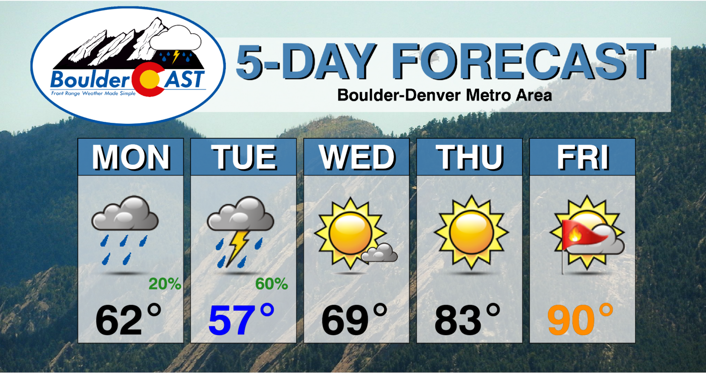
Monday: Partly sunny to mostly cloudy with chilly temperatures in the lower 60s on the Plains and middle 50s in the Foothills. Afternoon/evening isolated/scattered showers/thundershowers are expected, which may continue off and on overnight, especially over the Foothills.
Tuesday: Chilly, cloudy, and dreary with isolated/scattered showers, with a few rumbles of thunder also possible. Highs in the middle to upper 50s on the Plains and middle 40s in the Foothills. Light snow may mix in over the Foothills, with minor accumulations possible.
Wednesday: Mostly sunny with temperatures reaching the upper 60s on the Plains and middle to upper 50s in the Foothills.
Thursday: Sunny and warmer, with lower 80s on the Plains and near 70 in the Foothills.
Friday: Well above average temperatures under partly cloudy skies. Fire danger will be elevated. Highs in the upper 80s for the Plains and middle 70s in the Foothills.
Mountains: Off and on rain/snow showers/thundershowers will exist into early Wednesday morning. The best chance of accumulating snow will be along and west of the Divide in central and western Colorado. Temperatures will be cool and cloudy as well during this period. From about midday Wednesday through Friday, drier weather takes hold under high pressure, with rising temperatures and gusty southwest winds.
Help support our team of Front Range weather bloggers by joining BoulderCAST Premium. We talk Boulder and Denver weather every single day. Sign up now to get access to our daily forecast discussions each morning, complete six-day skiing and hiking forecasts powered by machine learning, first-class access to all our Colorado-centric high-resolution weather graphics, bonus storm updates and much more! Or not, we just appreciate your readership!
Spread the word, share the BoulderCAST forecast!




You must be logged in to post a comment.