Temperatures will remain well above average throughout the week as the Front Range remains under favorable downslope warming. Gusty winds may be possible at times given this setup but overall a pleasant week lies ahead. Heavy mountain snow is expected by the end of the week with a strong and moisture-rich storm system. Read on to find out if there are any snow chances in the works for the lower elevations as well.
This week’s highlights include:
- Dry and much warmer than average throughout most of the week
- Downslope surface flow may at times become breezy Tuesday, Wednesday, and Friday
- Temperatures are highest into midweek, then trending cooler by Friday
- An intense storm system late in the week will bring Mountain snowfall just in time for skiers this upcoming Christmas weekend
- There is a small chance of rain/snow on the Plains Christmas Eve
DISCLAIMER: This weekly outlook forecast is created Monday morning and covers the entire upcoming week. Accuracy will decrease as the week progresses as this post is NOT updated. To receive daily updated forecasts from our team, among many other perks, subscribe to BoulderCAST Premium.
Dry and above average all week with possible precipitation Christmas Eve
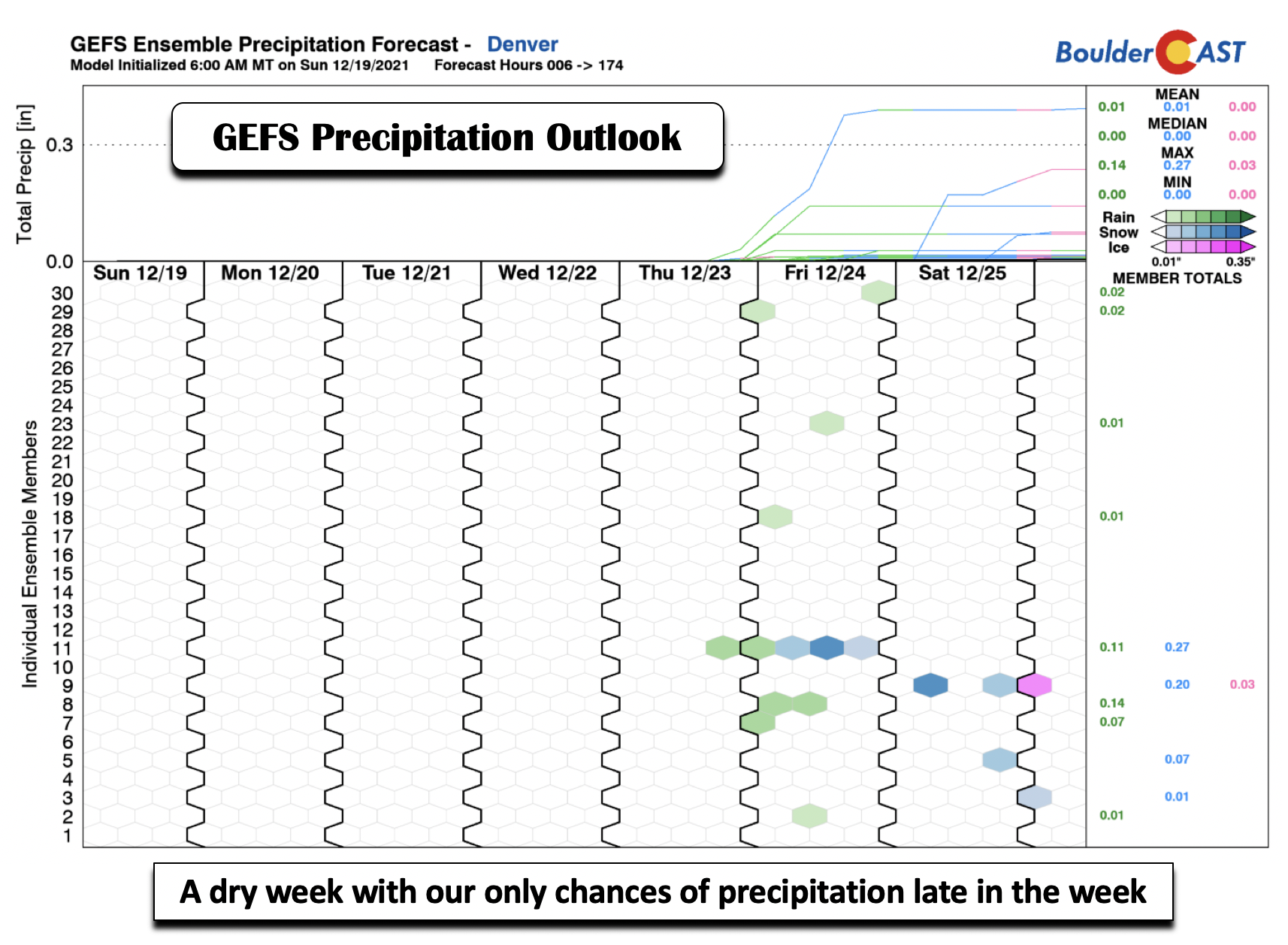
Dry and above average temperatures sums up our week ahead for the most part in the Denver Metro area. However, as seen in the GEFS precipitation outlook below, there are hints of a potential late week rain/snow chance. We’ll discuss what this signal is related to and our odds of seeing a “white Christmas”. Overall, though, the pattern favors dry weather for the Plains.
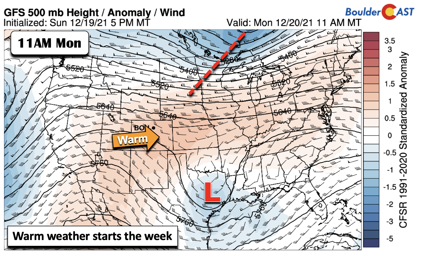
The mid-levels of the atmosphere today (below) show that Colorado remains situated between the jet stream to our north over the upper Midwest and a cut-off low pressure system in Texas. Anomalously high mid-level heights remain present over the area today.
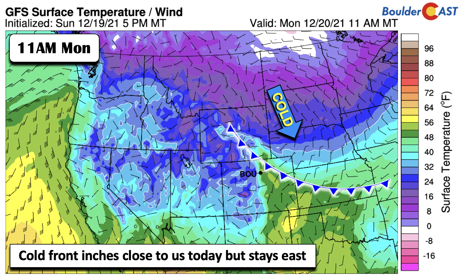
Looking closer to the forecast at the surface, a cold front is very close to the Front Range, with cold air penetrating southward behind high pressure over the Dakotas. The cold front is progged in all model guidance to stay east of the Denver metro area today, but we’ll see some influence in terms of southeasterly flow later in the day Monday. Highs should top out in the upper 50s this afternoon with a mixture of clouds and sunshine.
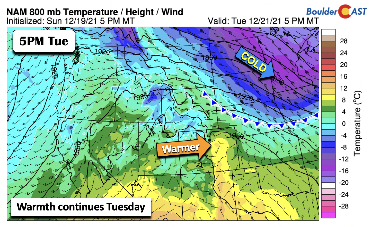
The warmth continues Tuesday and Wednesday! On Tuesday, the cold front slides off to our northeast, allowing a good downslope flow to take shape. This cold front will meander back and forth into midweek but largely stay to our east. Highs Tuesday top out in the lower 60s.
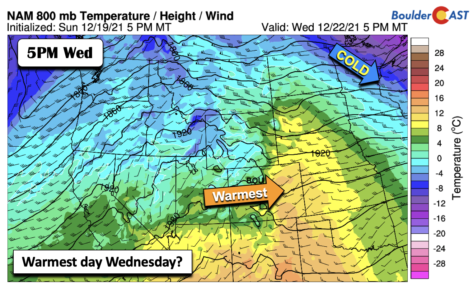
By Wednesday, the downslope flow further strengthens, with possibly our warmest day during this time. Highs in the low to middle 60s appear quite favorable. Record highs are not likely Wednesday or any day this week as our those are mainly in the lower 70s.
Gusty downslope winds possible Tue/Wed/Fri
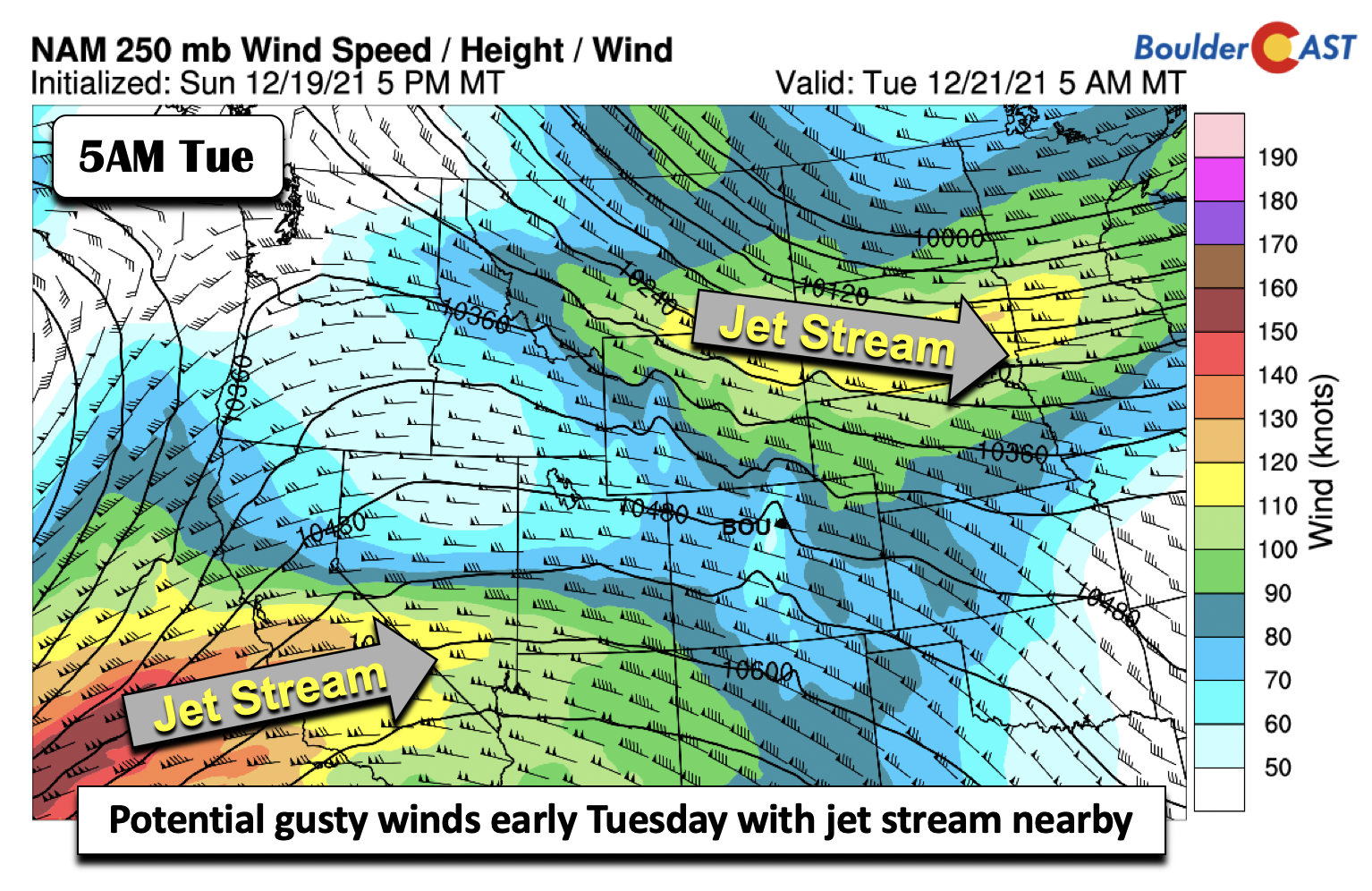
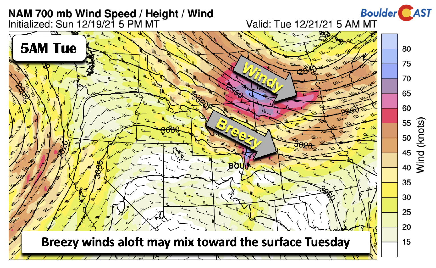
Interspersed between the downslope warming will be some periods of gusty winds due to the location and track of the upper-level jet stream. Shown below is the early Tuesday morning jet stream forecast, with a northern stream jet over the Dakotas and Wyoming. While the jet does not get that far south, a decent height gradient sets up as a result of the flow increasing.
Thus, breezy winds develop aloft (5,000 feet up) above the surface early Tuesday. The latest model guidance shows that most of these windy conditions will stay over the Foothills. However, from a pattern recognition standpoint, it bears watching, with at the very least westerly flow seeing gusts of 20-35 mph at times on Tuesday.
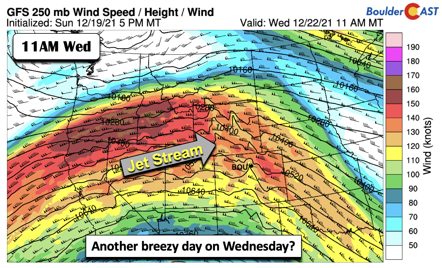
A second possible gusty downslope event may take shape early Wednesday. As a mid-level ridge starts to encroach on the area midweek, the upper-level jet stream moves over the area. This is also in response to a very strong storm system setting up for the mountains later in the week. Early guidance also shows that these higher winds aloft won’t reach the Denver area, but it also bears watching for some gusty surface winds Wednesday.
Heavy mountain snow late in the week…some for the Plains?
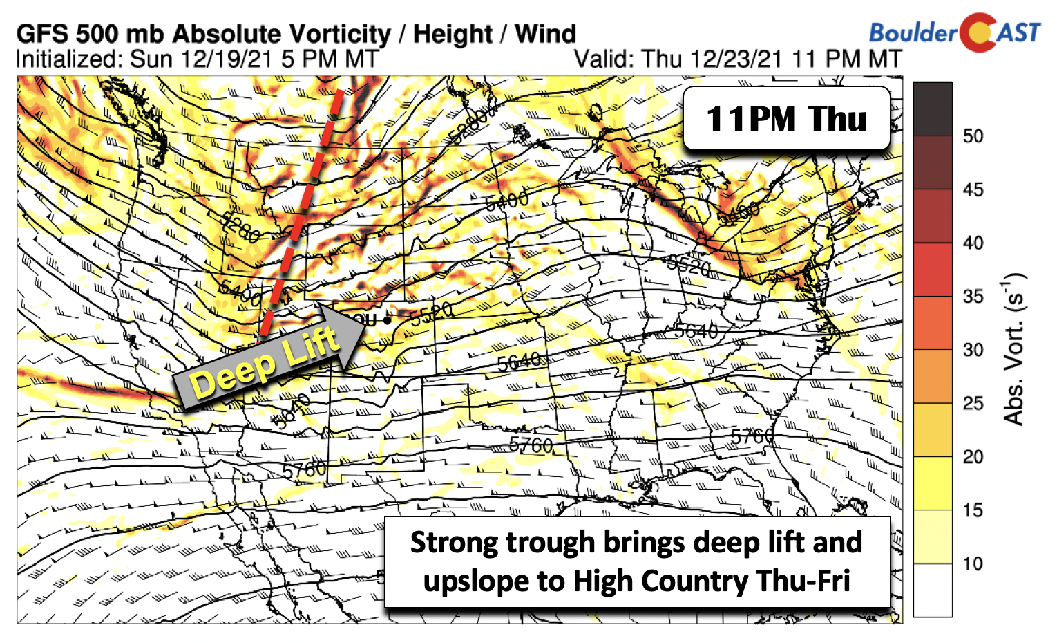
As we get into the latter part of the week, the models are in very good agreement that a strong Pacific storm system will penetrate inland Thursday and track through the northern Rockies Thursday through Friday. The details are not fully known but the synoptic pattern screams heavy snow for the High Country, just what the doctor ordered for Christmas season skiers.
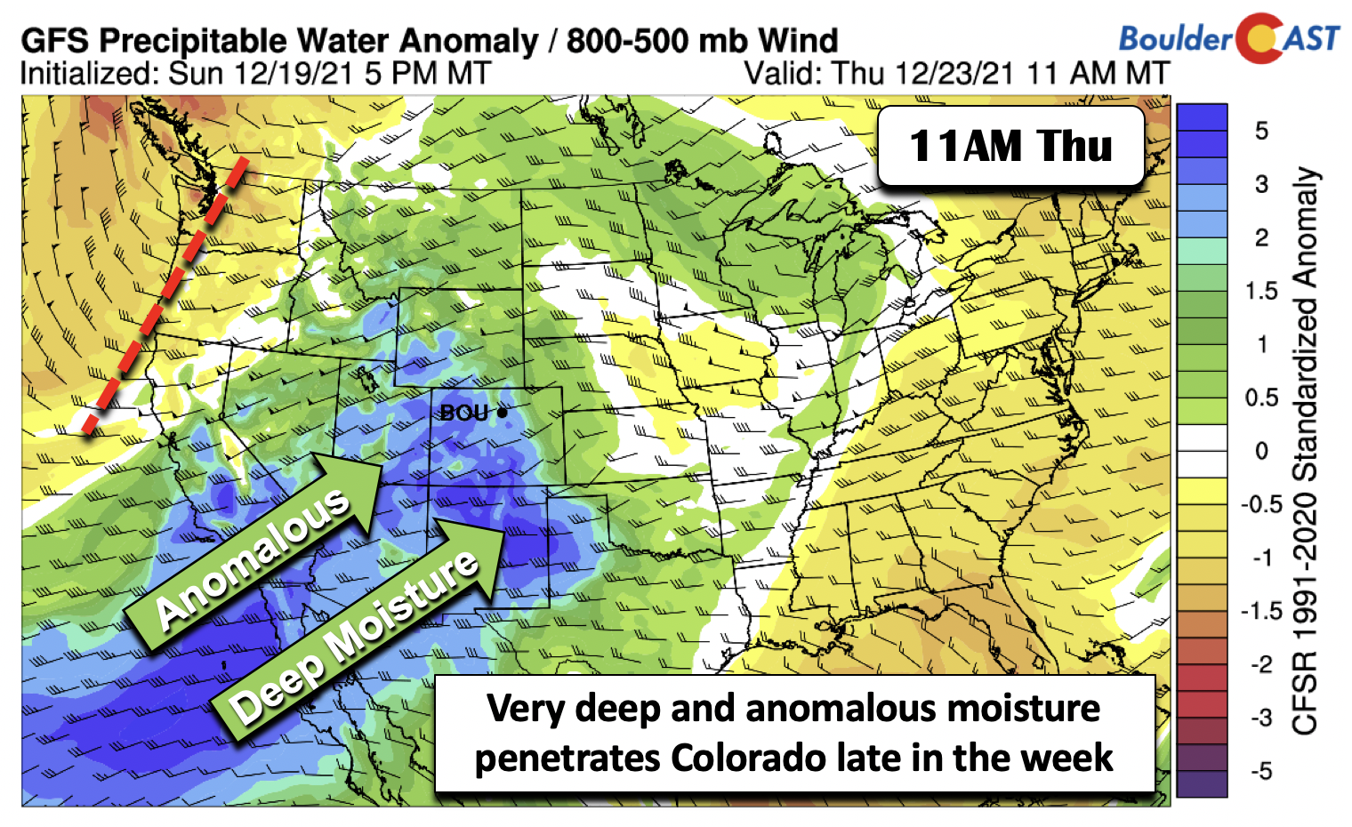
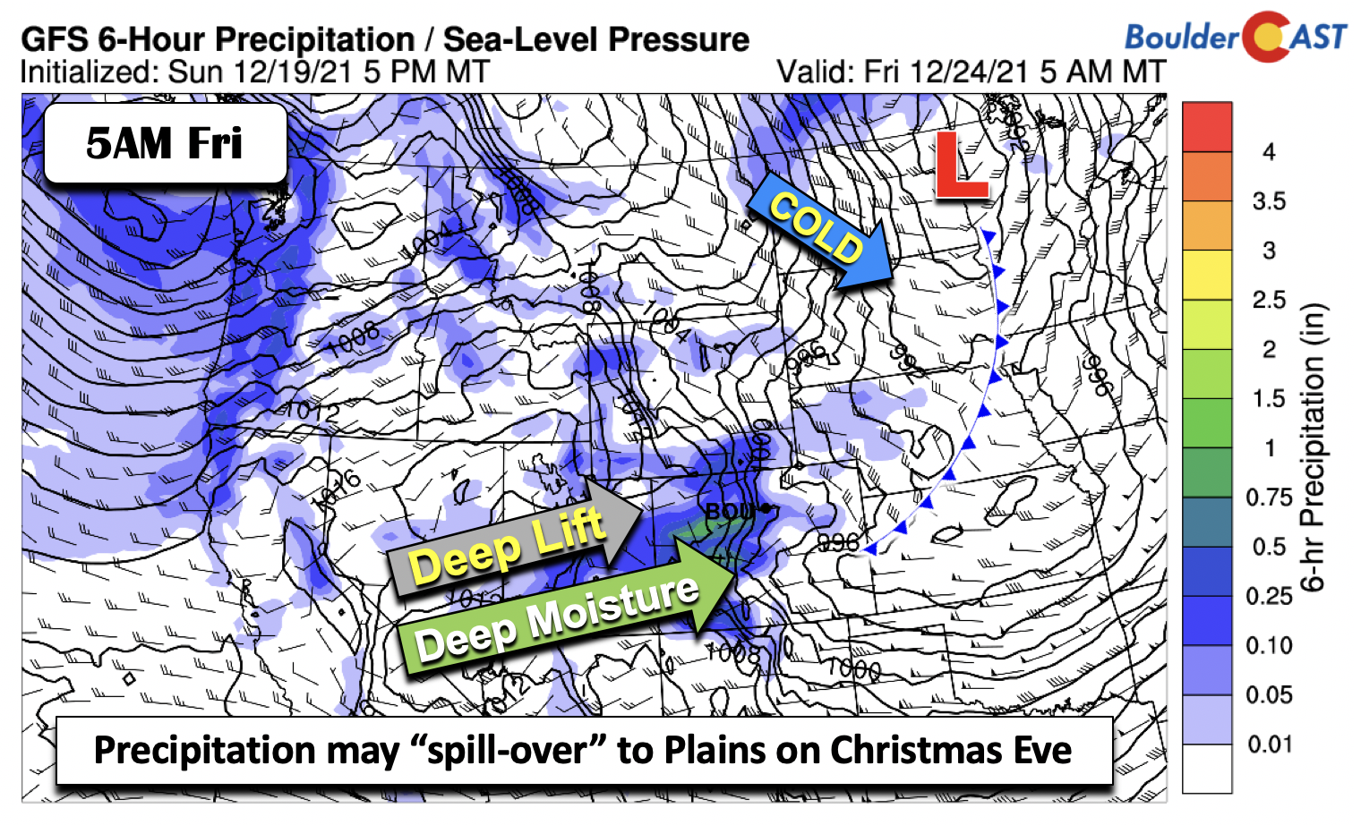
Highs will likely stay warm on the Plains Thursday, but clouds will be on the increase as very deep and anomalous moisture penetrate the southwestern US and into Colorado (below). We are talking precipitable water values between 3 and 5 standard deviations above normal!
This vigorous storm system, while its track is not exactly known at this point, should usher in strong, deep lift, as well as orographic lift for the higher terrain in Colorado. The operational runs of the GFS indicate the possibility of heavy snowfall rates near Aspen Thursday night into Friday. As the storm system tracks eastward, a surface area of low pressure will form over the upper Midwest, bringing a cold front through the Plains sometime Friday. That should favor a trend toward cooler but still above average highs in the lower 50s or upper 40s. The deep moisture may spill over onto the Plains early Christmas Eve Friday to bring a chance of rain or snow, but this pattern usually favors dry downslope. However, it bears watching, especially if the track deviates between now and the end of the week. This late-week system may also bring gusty winds to the Plains yet again.
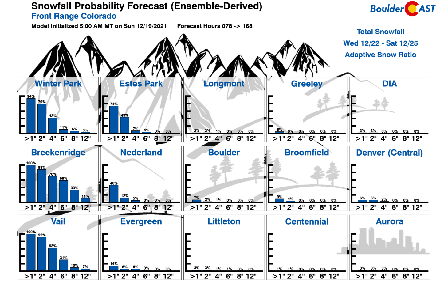
The ensemble snowfall probabilities further show that the main impact from the late-week system would be for the mountains, with high probabilities for snow at Winter Park, Breckenridge, and Vail, but little in the way for areas east of the Continental Divide. The chance of a white Christmas in Boulder or Denver this year is essentially zero at this point… a fitting end to a season with nearly no snow so far.
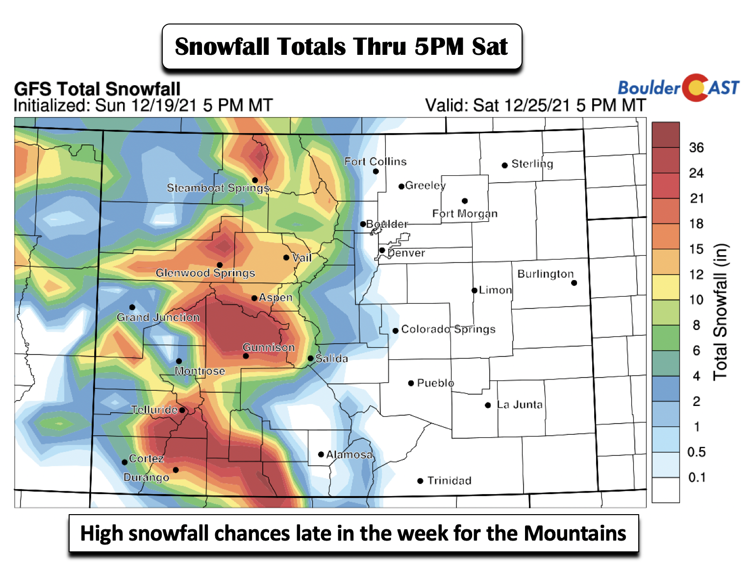
A quick look at the GFS model total snowfall ending Saturday shows the high-end snow potential for the Mountains. These amounts will likely be refined in later forecast runs, but several ski locations could easily see a foot or more!
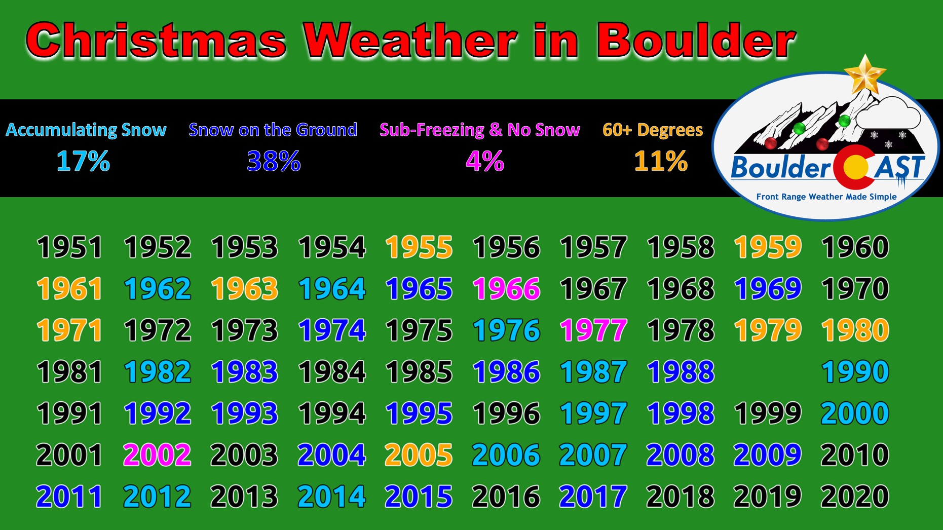
That’s all for now. Check back for updates on the late-week Mountain snow and some fun White Christmas climatology. It’s definitely not looking good any snow this year. Have a blessed and safe week leading up to the holidays!
Stay up to date with Colorado weather and get notified of our latest forecasts and storm updates:
We respect your privacy. You can unsubscribe at any time.
Forecast Specifics:
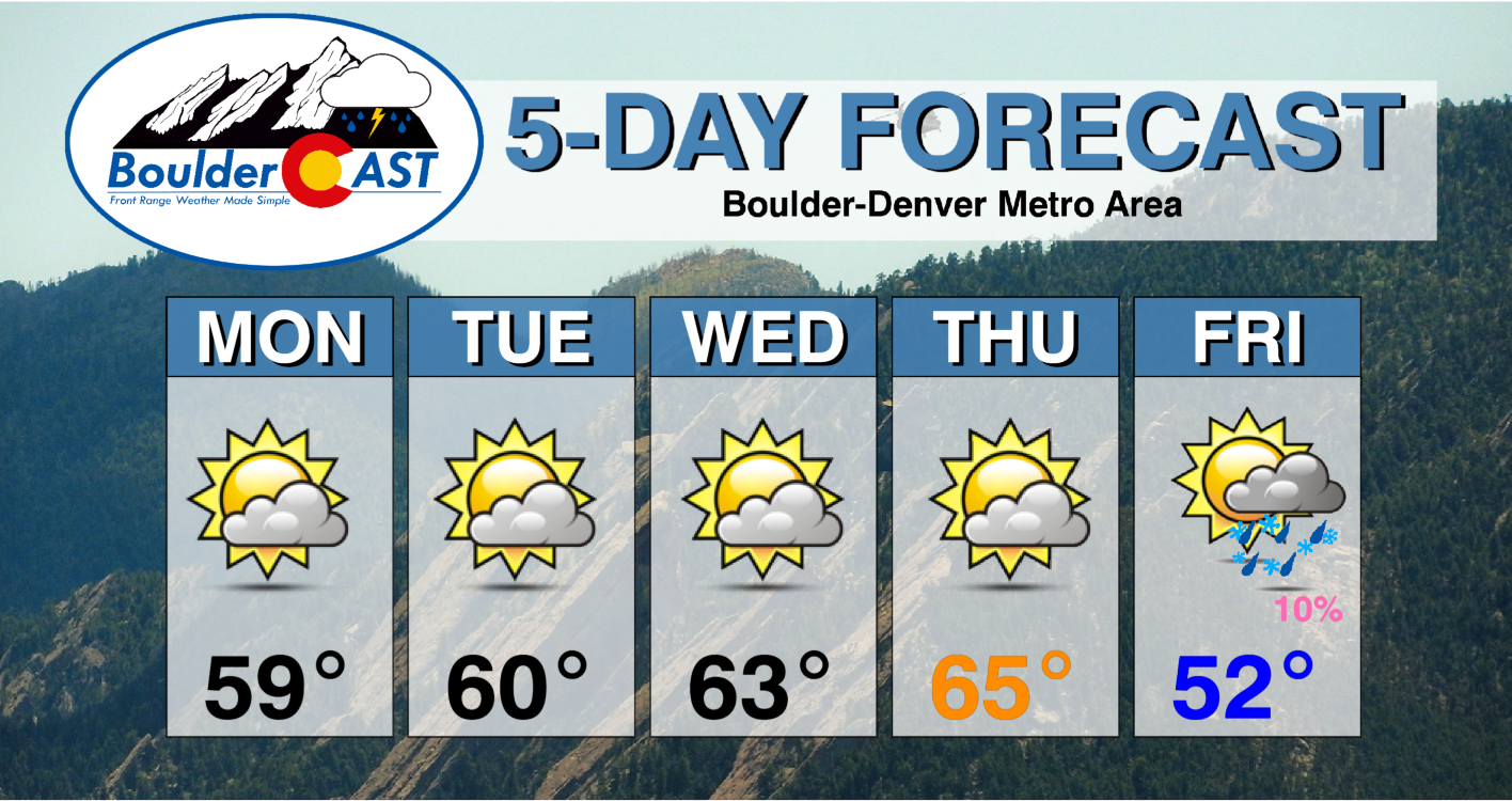
Monday: Mostly sunny and mild once again with highs in the upper 50s on the Plains and lower 50s in the Foothills.
Tuesday: Gusty downslope winds possible in Boulder. Otherwise, partly cloudy with highs in the lower 60s in the Plains and lower 50s in the Foothills.
Wednesday: Warm, gusty, and partly sunny with highs in the lower to middle 60s on the Plains and lower 50s in the Foothills.
Thursday: Increasing clouds and mild with highs in the lower to middle 60s on the Plains and lower 50s in the Foothills.
Friday: Cooler, breezy, and a slight chance of rain/snow with highs in the lower 50s or upper 40s for the Plains and lower 40s in the Foothills.
Mountains: It will be relatively quiet through midweek for the mountains, outside of some gusty winds at times, especially at mountain-top level. A very strong storm system late in the week Thursday and Friday will bring likely snowfall to portions of the High Country, along with windy conditions. Skiing on or around Christmas Day could be excellent!
Help support our team of Front Range weather bloggers by joining BoulderCAST Premium. We talk Boulder and Denver weather every single day. Sign up now to get access to our daily forecast discussions each morning, complete six-day skiing and hiking forecasts powered by machine learning, first-class access to all our Colorado-centric high-resolution weather graphics, bonus storm updates and much more! Or not, we just appreciate your readership!
Spread the word, share the BoulderCAST forecast!




You must be logged in to post a comment.