Warm and gusty weather will kick off the week before a cold front arrives Tuesday evening bringing primarily light Mountain snow to the state. 60’s and 70’s will transition to 30’s by Wednesday. There is also a few outside chances for snow across the Denver Metro area this week, but nothing to get excited about. Both Boulder and Denver are rapidly closing in on the record for the latest first accumulating snowfall of the season. At this point, those records are definitely in jeopardy of getting eclipsed.
This week’s highlights include:
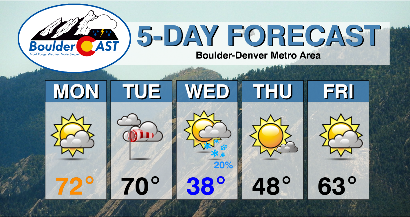
- Monday & Tuesday will be mild and breezy ahead of a passing storm system with highs in the 60’s and 70’s
- A cold front arrives Tuesday night bringing mainly Mountain snow
- Low clouds and a few spotty snow showers possible in the Denver area early Wednesday morning
- Drier weather and a warming trend to close out the week
- With meager chances for snow this week and beyond, the odds of breaking the latest first snowfall record are high
DISCLAIMER: This weekly outlook forecast is created Monday morning and covers the entire upcoming week. Accuracy will decrease as the week progresses as this post is NOT updated. To receive daily updated forecasts from our team, subscribe to BoulderCAST Premium.
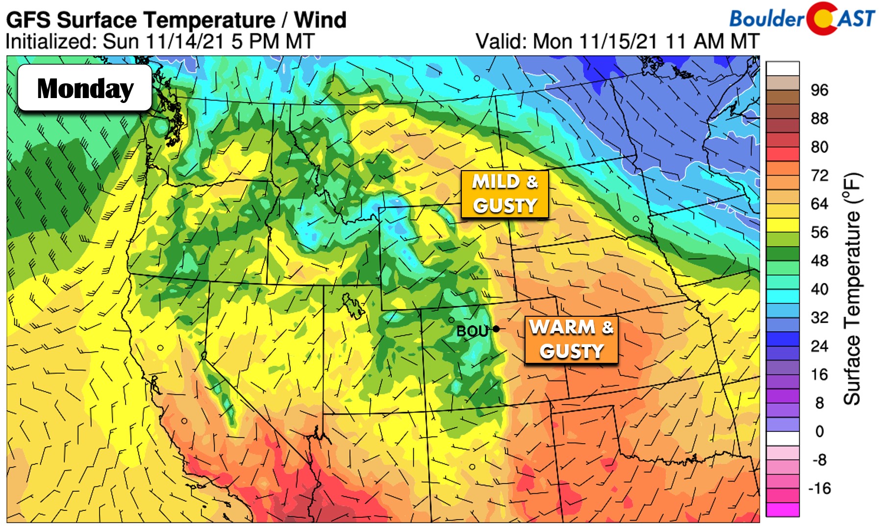
Warmest on Monday
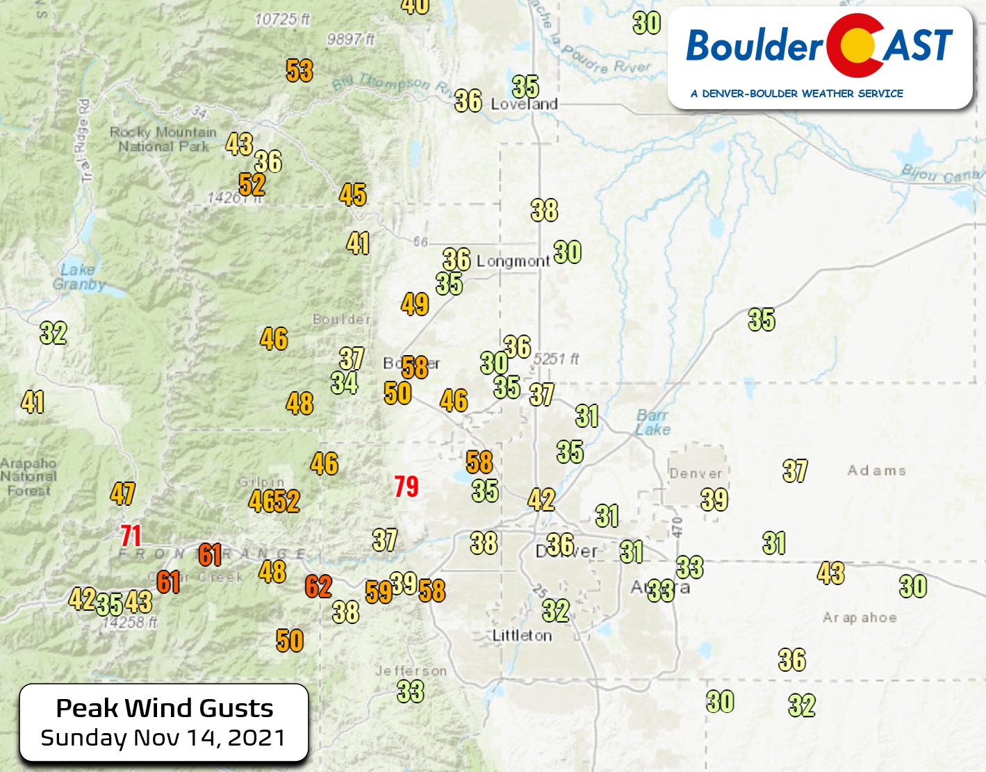
This past weekend was mild and gusty across the area as northwest flow remained locked over Colorado with intermittent mountain wave amplification. Gusts of 35 to 55 MPH were common on Sunday, with normally windy spots along Highway 93 reporting a few hurricane force gusts as well.
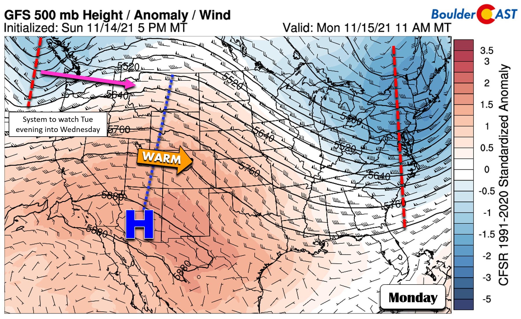
This northwest flow pattern will transition to a more westerly one on Monday as a ridge axis pushes across the Rockies. A deep and chilly trough is located across the entire East Coast. Another Pacific storm system will come ashore into Washington state late Monday and will be a player for our weather Tuesday into Wednesday this week. More on that later.
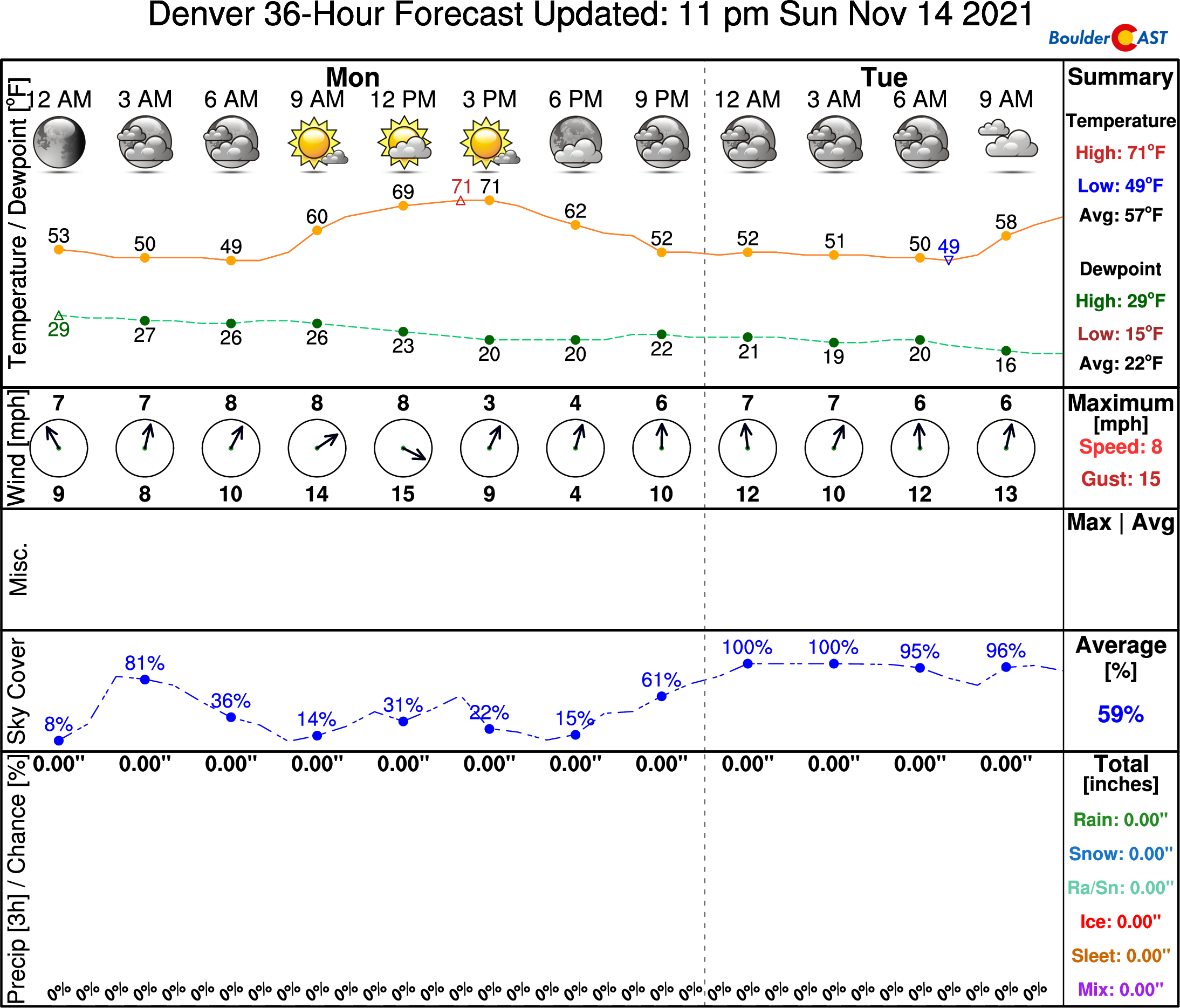
For Monday, there will be a notably warmer airmass pushing in from the west with continued wave cloudiness across the region. High temperatures will be the warmest of the week in the low to middle 70’s. Areas that see the most extensive wave clouds may stay in the upper 60’s.
Tuesday will be another warm day as a cold front bears down on the region from the north. It will be working southward across Wyoming through the day and eventually is forecast to reach the Denver Metro area during the evening hours. This will spell out another warm day overall on Tuesday as highs reach into the upper 60’s, with perhaps a few locations touching 70 again.
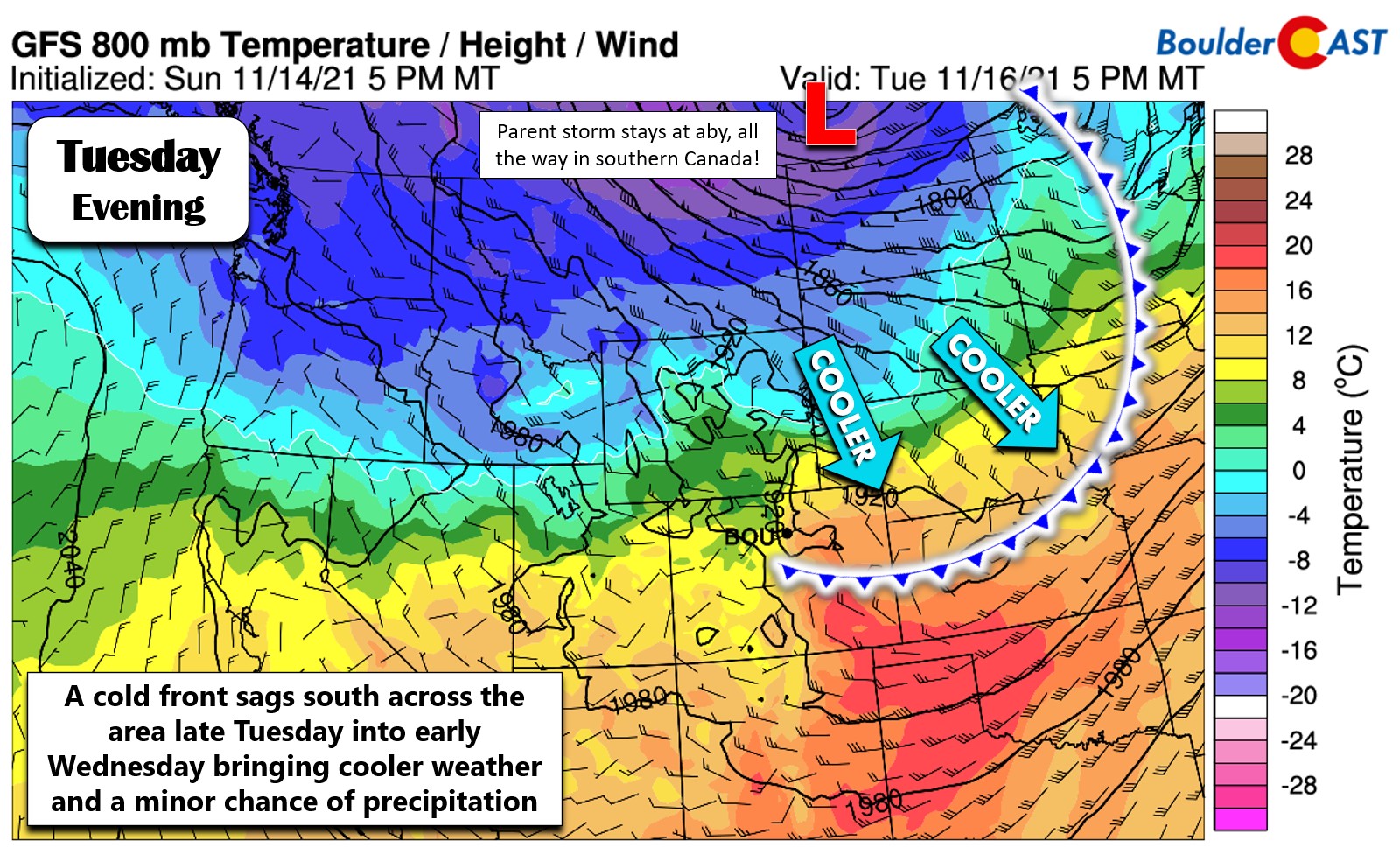
Will it snow Tuesday night into Wednesday?
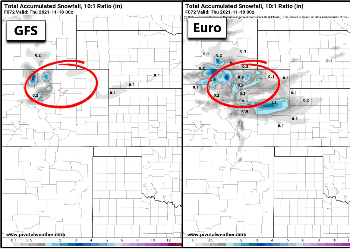
As we see in the graphic above, like so so many times already this autumn season, the strong parent storm system with this trough will remain way north of our area across southern Canada. Only the trailing cold front will reach the Front Range. Lift and moisture will be limited with this front with light snow possible mainly in the Mountains (up to 2″ in the highest peaks). Though there might be a light coating of snow, mid-week temperatures will plummet so plan accordingly if heading up to the High Country.
There are a few models showing very light snow showers across the Plains as well, mainly late Tuesday night into Wednesday morning. The European model is the most enthusiastic with potential snow amounts right now with portions of the Denver Metro area and Foothills possibly seeing a dusting to 1″ of snow. No other models really have any accumulation with this feature, but it is still something to watch given just how consistent the Euro model has been over the last couple days. Right now we’ll include a slight chance of snow but accumulation potential is quite low. More than likely most of us would see nothing at all up to a trace of snow. One consideration: the overnight timing could help potential accumulation if there were to be any meaningful snowflakes.
In the wake of the cold front, Wednesday will be quite chilly across the lower elevations with temperatures largely hovering in the 30’s. There will be some low clouds and possibly a few lingering light snow showers around in the morning hours, but skies should clear a little with sunshine taking over at some point in the day.
Quiet for the back half of the week
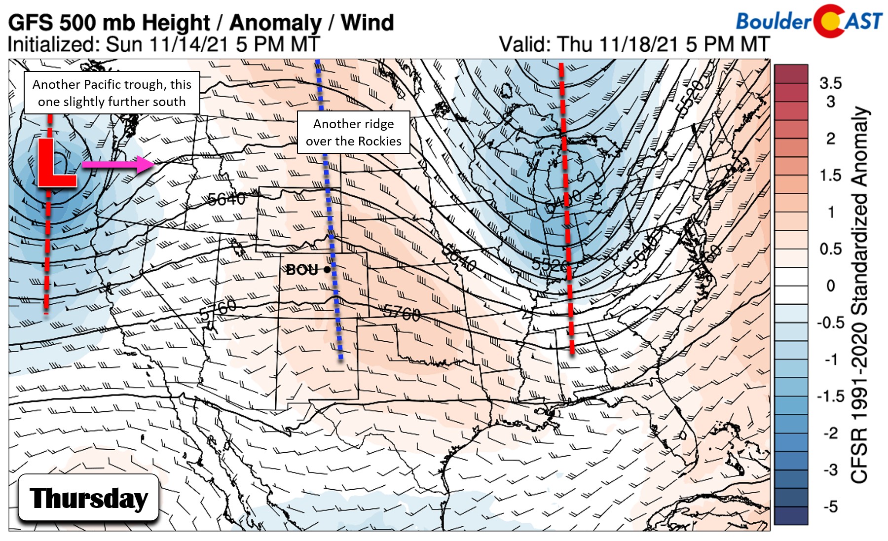
The 500mb height forecast map below for Thursday looks a lot like Monday actually. Another ridge axis will stretch again across the Rockies, and yet another storm will be coming ashore into the Pacific Northwest. This next Pacific trough is advertised to have a more southern track slamming into Oregon and northern California. Ultimately the track predicted by the models still takes a bulk of the energy from this trough north of the Denver-Boulder area. It is slightly more favorable than the mid-week trough for Mountain snow. The northern Mountains could see several inches late Friday through Saturday.
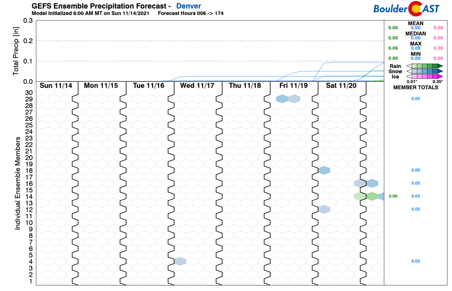
There may also be a chance of snow across the lower elevations sometime over the upcoming weekend with this trough. It’s only a small, outside chance but we will continue to monitor this system. For temperatures, look for 50’s on Thursday and 60’s on Friday. The weekend ahead will likely be seasonal to below normal following yet another cold frontal passage.
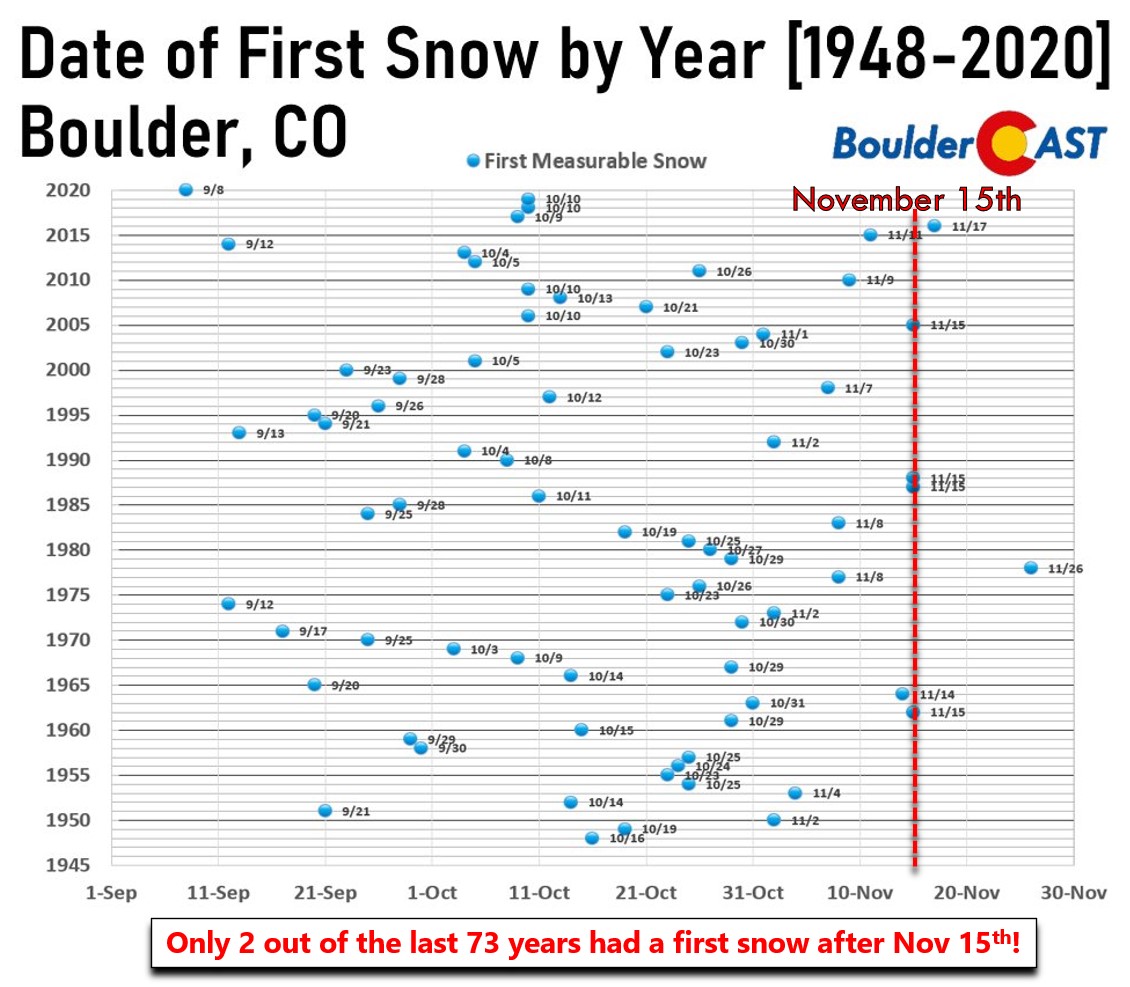
The odds of accumulating snow in Boulder or Denver this week remain very low (but non-zero) as the date of our latest ever “first snow” creeps ever-closer. As a reminder, the least punctual first snow observed in Boulder was November 26, 1978. In Denver, the most belated first snow was on November 21, 1934. Given the extended forecast, it’s becoming highly possible that one or both cities will break the record this year. Denver has until Sunday to get snow. Boulder has until next Friday!
Stay up to date with Colorado weather and get notified of our latest forecasts and storm updates:
We respect your privacy. You can unsubscribe at any time.
Forecast Specifics:
Monday: A little breezy with lots of wave clouds mixed in with some sunshine. Highs around 70 degrees on the Plains and near 60 degrees in the Foothills.
Tuesday: Mostly cloudy, mild and gusty with temperatures reaching into the upper 60’s on the Plains with middle 50’s in the Foothills. Winds will gust 25 to 35MPH across the area, with up to 50 MPH in the Foothills.
Wednesday: Gloomy in the morning and a chance of spotty snow showers, then decreasing clouds through the day. Highs in the upper 30’s on the Plains with upper 20’s in the Foothills.
Thursday: Mostly sunny and seasonal with some late-day clouds. Temperatures warm nicely into the lower 50’s across the Plains and into the upper 30’s in the Foothills.
Friday: Warmer, partly cloudy and dry with temperatures returning to the 60’s across the Plains and to the upper 40’s in the Foothills.
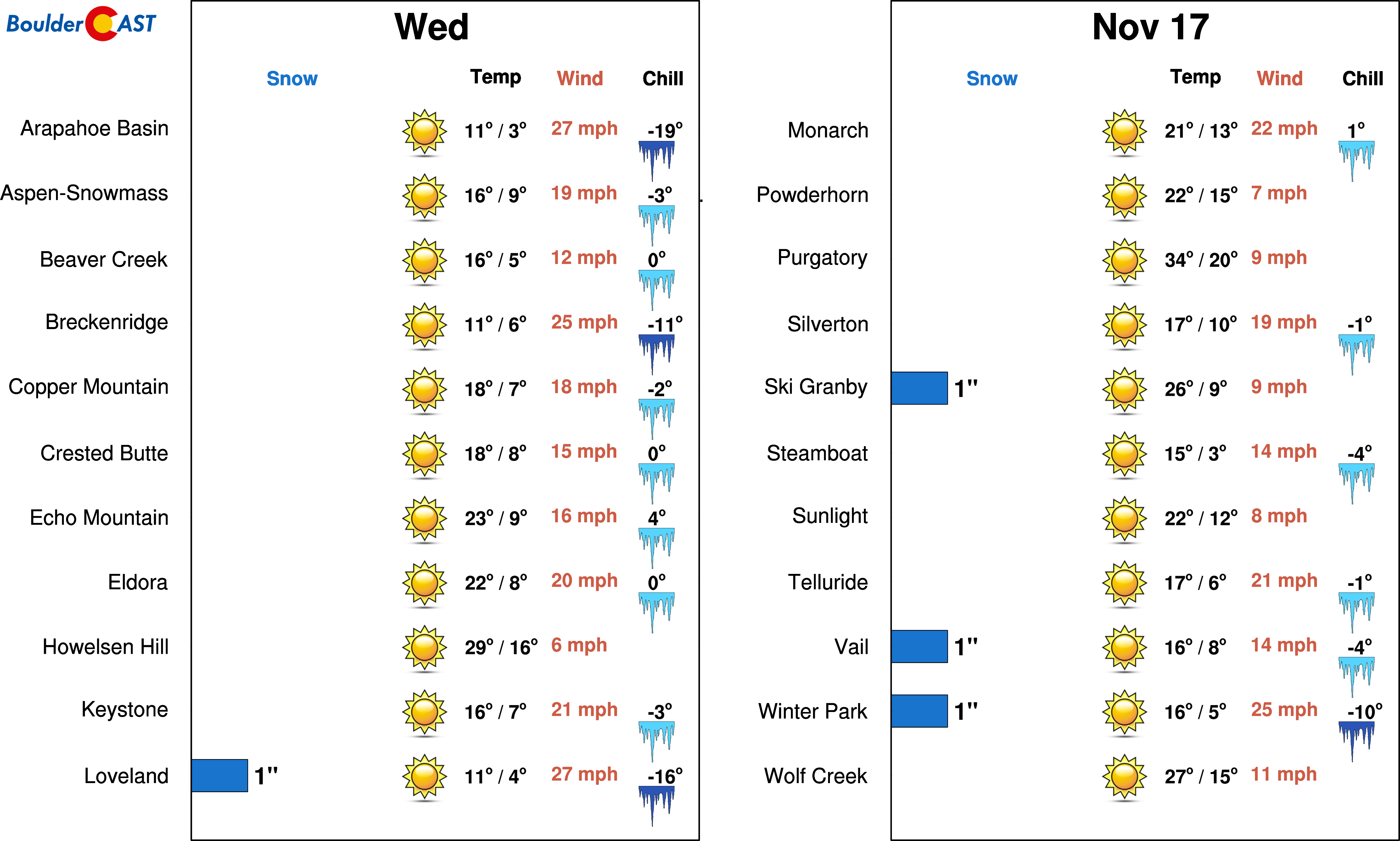
Mountains: Mild and dry weather will exist in the Mountains on Monday and Tuesday, but it will be windy with strong westerly flow aloft over the state of Colorado. The first trough passage Tuesday night into Wednesday will produce light snow in the Mountains along and north of Interstate 70, but accumulations should be 2″ or less. Wednesday will be very cold, but temperatures moderate Thursday and beyond. The next trough on Saturday looks to produce another round of Mountain snow, though early indication is that it will be on the lighter side, too.
Help support our team of Front Range weather bloggers by joining BoulderCAST Premium. We talk Boulder and Denver weather every single day. Sign up now to get access to our daily forecast discussions each morning, complete six-day skiing and hiking forecasts powered by machine learning, first-class access to all our Colorado-centric high-resolution weather graphics, bonus storm updates and much more! Or not, we just appreciate your readership!
.
Spread the word, share the BoulderCAST forecast!
.




You must be logged in to post a comment.