With moist northwest flow present across Colorado for the next few days, a cooler start to the week with popcorn storms is expected. Late in the week, we are watching for a slow-moving, more organized Pacific weather system to reach our area. This could bring cooler and more unsettled conditions just in time for the weekend. We also discuss the latest on the summer monsoon.
This week’s highlights include:
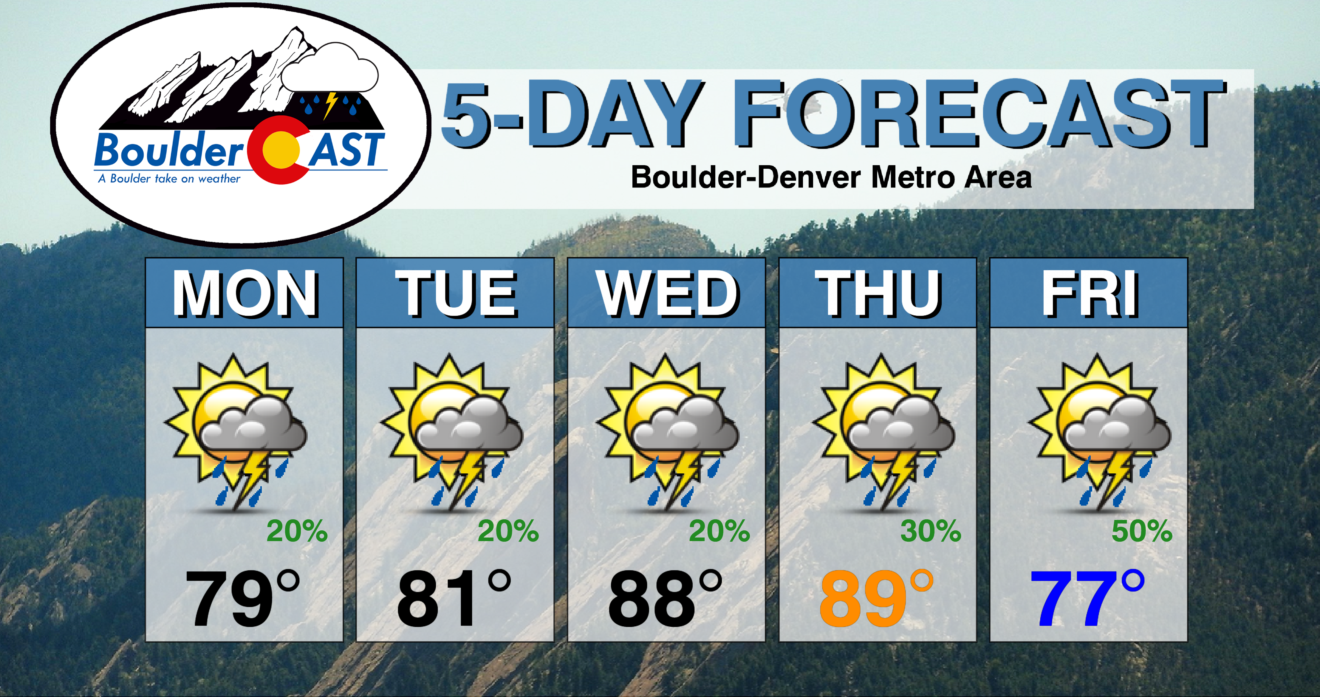
- Moisture-laden northwest flow will lead to a slight chance of storms through Wednesday with moderating temperatures
- We’re tracking a late-week storm system that is poised to bring cooler temperatures and potentially widespread rainfall to the area
- Will July be a hot one for Colorado and where is the monsoon?
DISCLAIMER: This weekly outlook forecast is created Monday morning and covers the entire upcoming week. Accuracy will decrease as the week progresses as this post is NOT updated. To receive daily updated forecasts from our team, subscribe to BoulderCAST Premium.
Spotty late-day storms through Wednesday
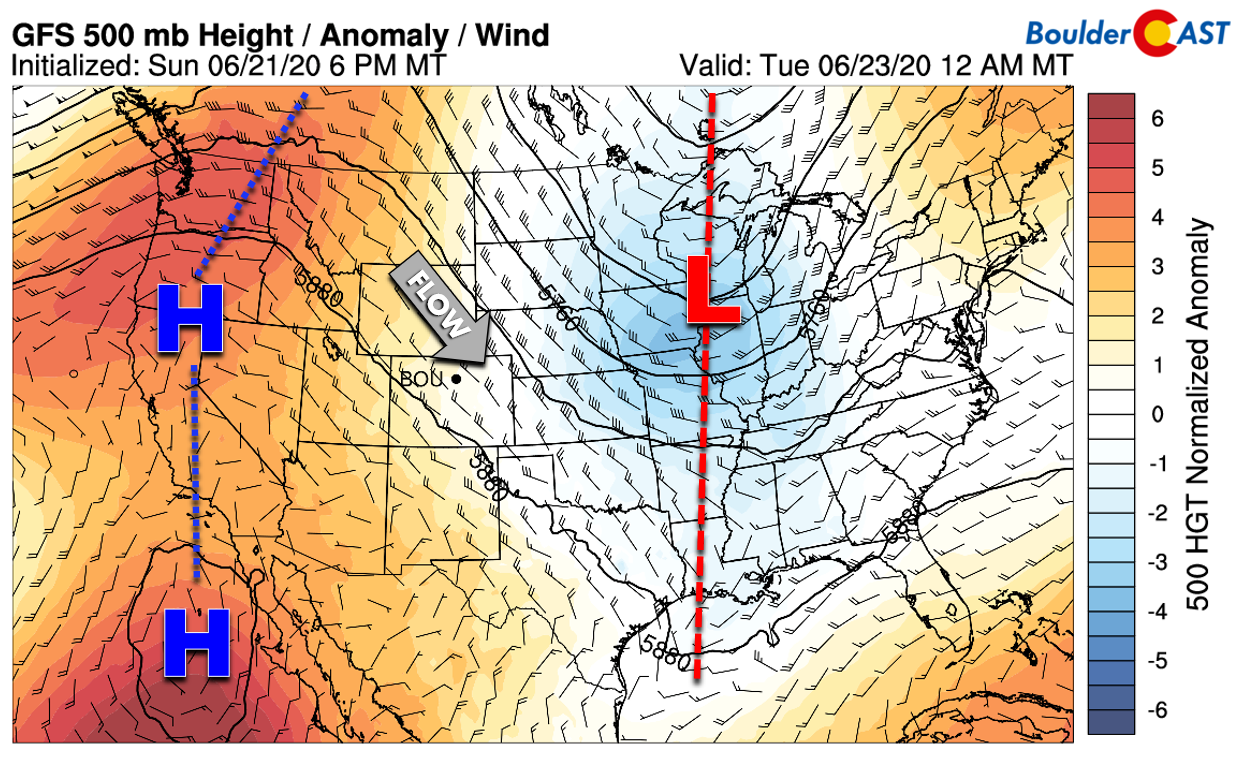
The first half of the week will entertain northwest flow over our area as Colorado will rest between a deep trough in the Great Lakes and a ridge across the West Coast. The large-scale weather set-up on Monday is depicted below.
A weak cold front moved through Sunday night so we will start the first week of summer on the cooler side…nothing like what we saw last week. The continued northwest flow will facilitate gradually warming temperatures through Wednesday with highs climbing from the upper 70’s to the upper 80’s during this time.
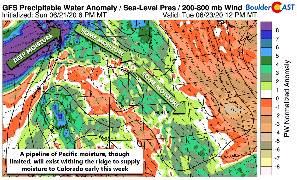
There isn’t a lot of moisture available, but it will be above normal these next few days. The GFS precipitable water anomaly forecast map for Tuesday shows the source of our moisture will be the northwest flow itself, with a long pipeline tracing back to the Pacific Northwest. Most of this moisture will be elevated, with drier air closer to the ground over Denver and Boulder.
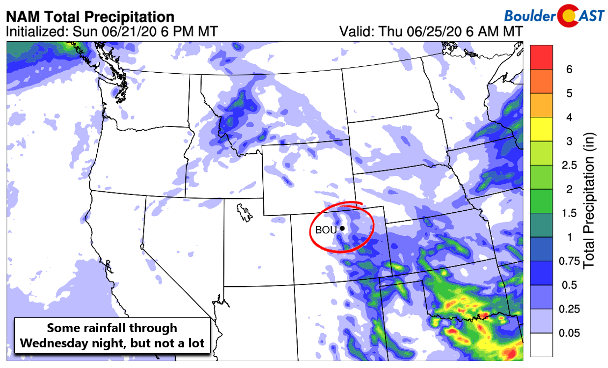
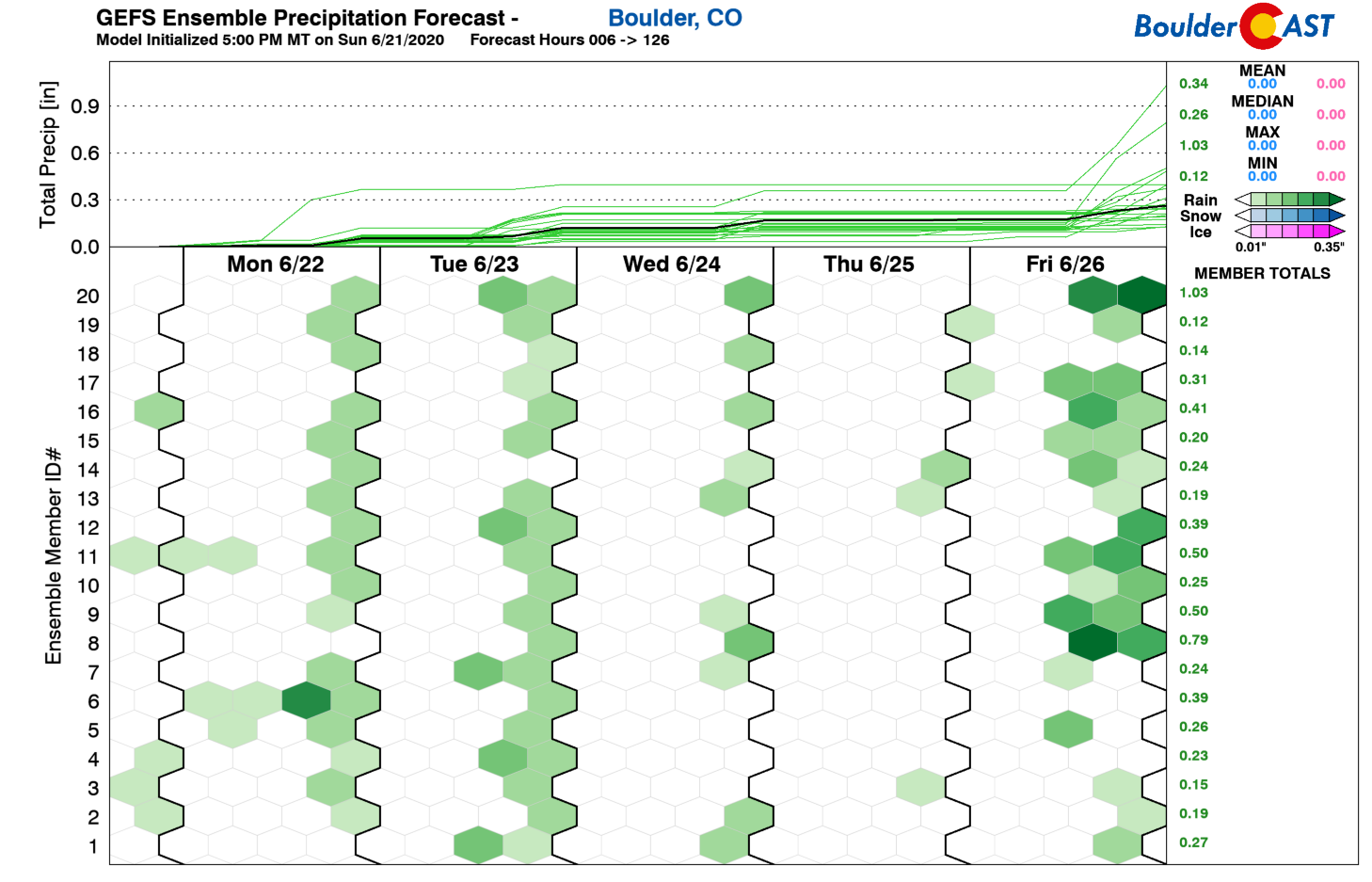
However, with the summer solstice just passing, afternoon solar heating is near its annual maximum. There will also be a few weak waves of atmospheric energy progressing through in the northwest flow. The result will be a slight chance of rain across the area each day. Expect sunshine in the mornings to give was to late-day clouds and a few showers and storms rolling off the higher terrain. The chance of rainfall through Wednesday will be fairly low, just 10-20% each afternoon and evening. A good chunk of the Front Range may see little to no precipitation during this time.
Tracking a late-week storm system
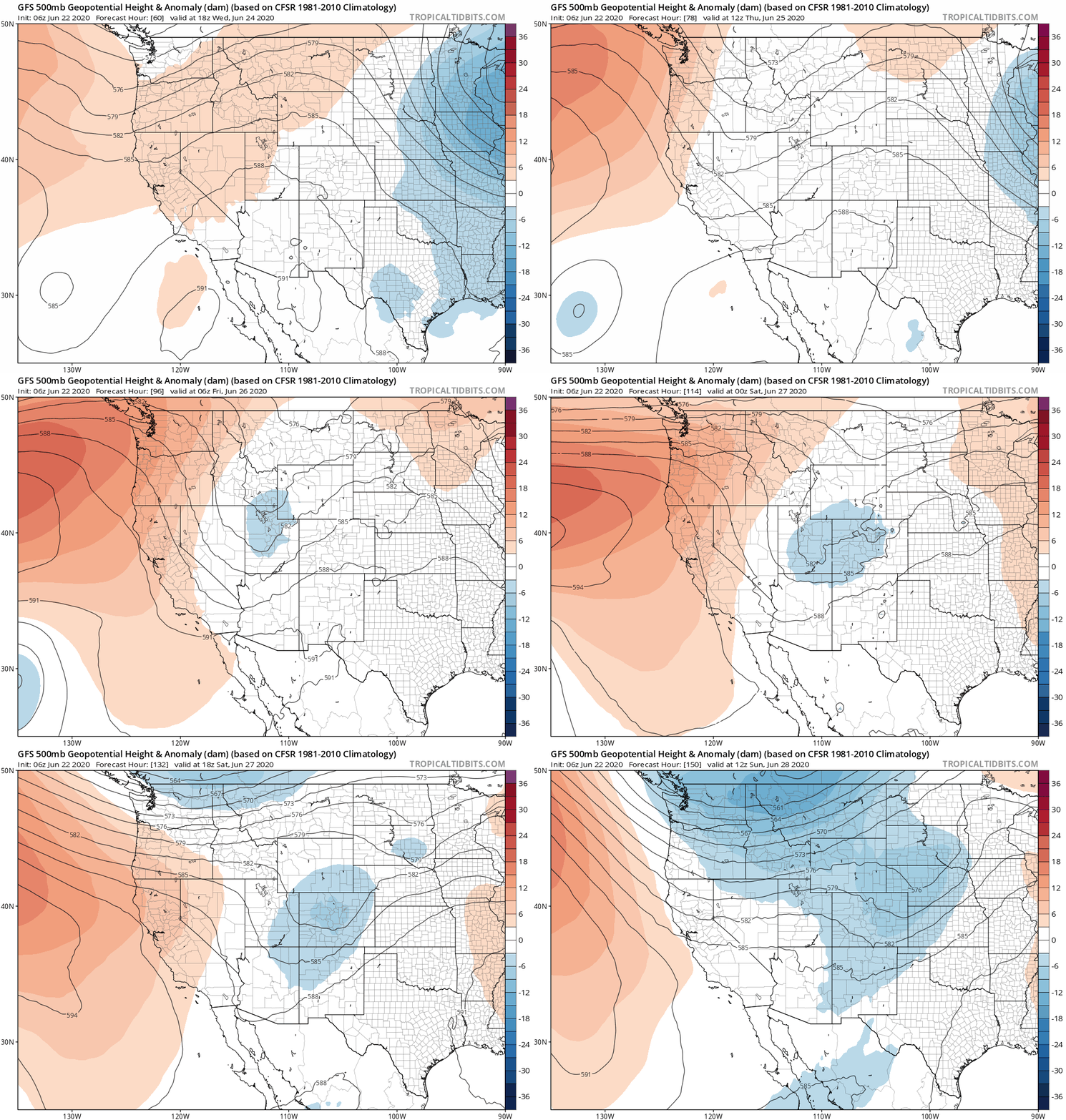
As we head into the latter part of the weak, the weather models are indicating good agreement for an unsettled weather pattern to develop across much of the northern Rockies, including Colorado. Weak riding and northwest flow will be replaced by a slow-moving trough and possibly even a cut-off low pressure system. The GFS 500 mb height anomaly forecast animation below spans from Wednesday evening into Sunday. Watch as the trough digs southward with a small cut-off storm possibly developing over Colorado on Friday.
Before the trough arrives, we should see a day of warmer and moisture-rich southwest flow take hold on Thursday across the state of Colorado. This will translate into a better chance of storms and temperatures remaining warm to hot in the upper 80’s to lower 90’s.
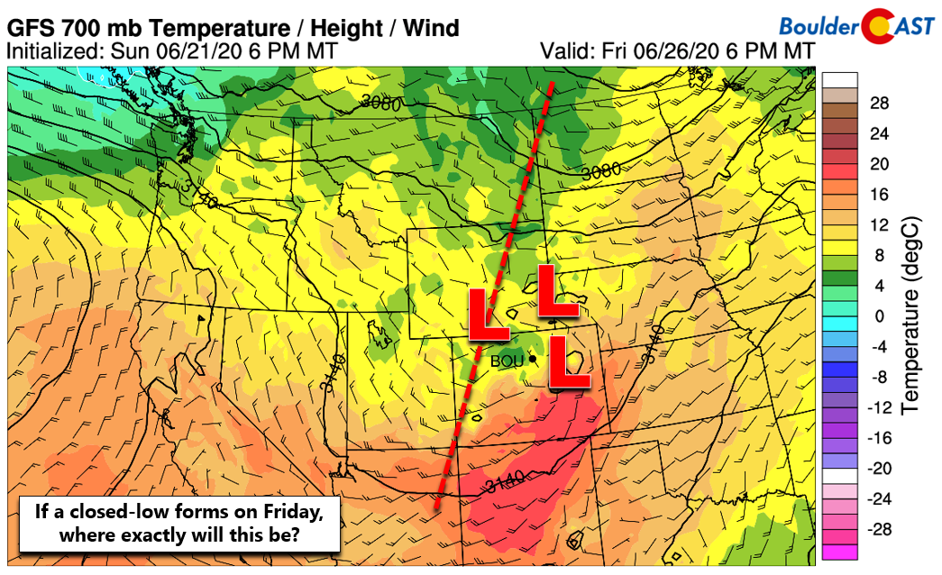
While there is definitely some uncertainty as to what will transpire later this week, models are currently advertising the potential for a weak cut-off low to develop across northern Colorado or southern Wyoming sometime on Friday (see below). This would bring noticeably cooler temperatures temperatures to the area with widespread clouds and rainfall as well. We’re probably looking at 70’s for highs on Friday. Furthermore, a cold front will be draped somewhere across eastern Colorado and may help act as a focus for severe thunderstorms. It’s way too far out right now for that type of discussion, though.
Things could change a good deal between now and Friday, but for the time being, expect a cooler and wetter end to the week and start to the weekend.
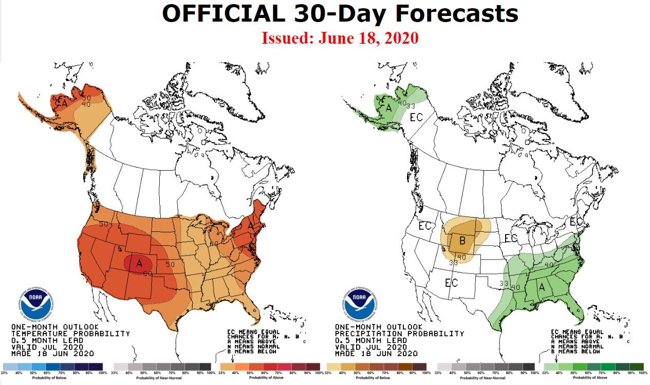
The latest July outlook from the Climate Prediction Center paints a red bullseye across Colorado with a greater than 60% chance of above normal temperatures for our area, the highest odds of anywhere in the United States.Hope you like the heat! There is also a slightly elevated chance of drier than normal conditions for northern Colorado specifically. This time of year, we should start to see the monsoon moisture beginning to creep northward from Mexico into Arizona in the extended weather models. We’re not yet seeing any of signs of this. This isn’t concerning at this point. Typically monsoon season will begin in early July in Arizona and closer to mid-July in Colorado.
Forecast Specifics:
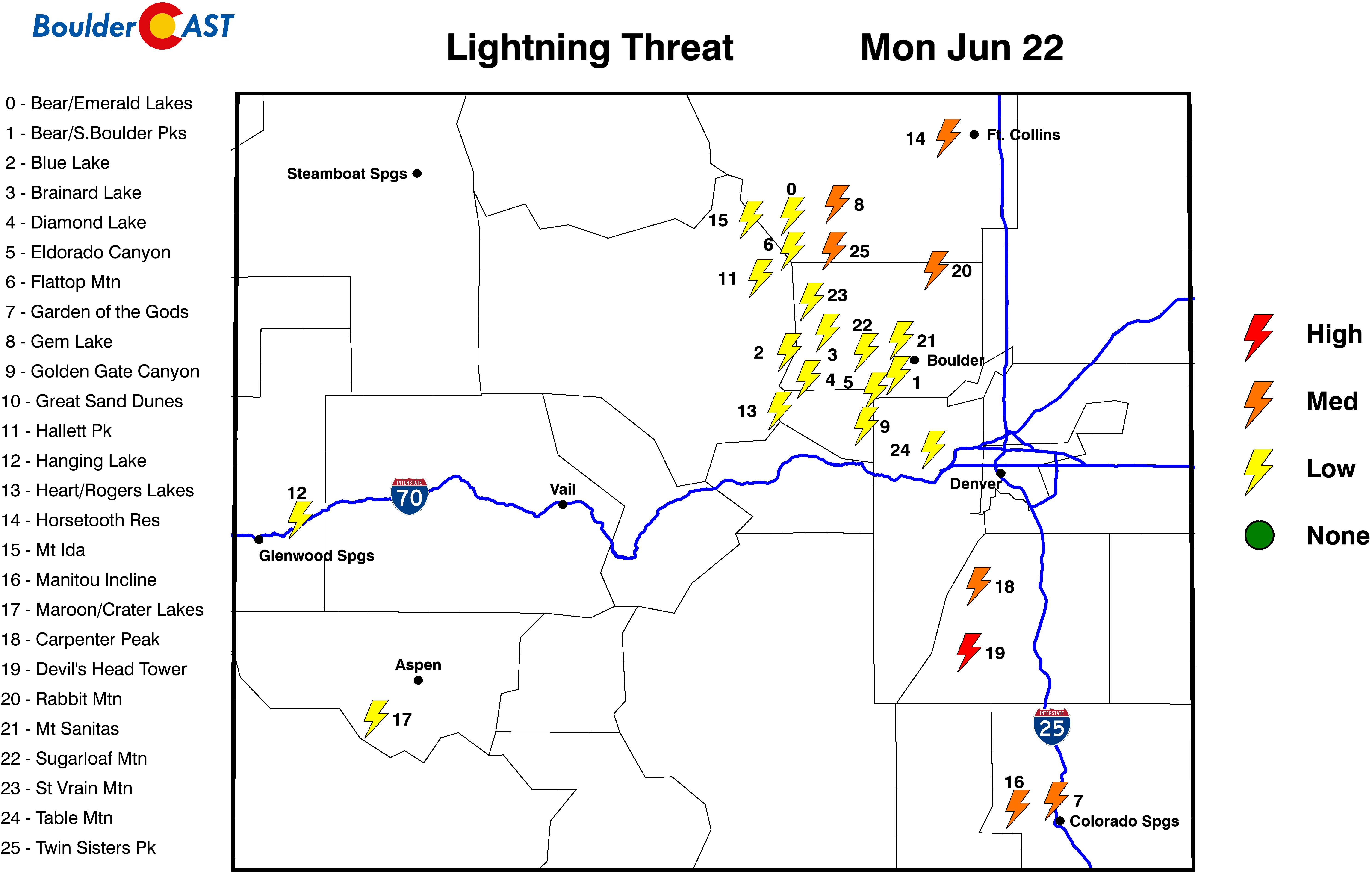
Monday: Mostly sunny turning partly cloudy with widely scattered showers and storms developing during the afternoon and evening. Pleasant with highs near 80 degrees on the Plains and upper 60’s in the Foothills.
Tuesday: Morning sunshine with increasing clouds and a slight chance of late-day storms. High temperatures in the lower 80’s on the Plains and lower 70’s in the Foothills.
Wednesday: Morning sunshine giving way to increasing clouds and a slight chance of late-day storms. High temperatures in the upper 80’s on the Plains and middle 70’s in the Foothills.
Thursday: More clouds but still hot with widely scattered afternoon and evening storms. Highs near 90 degrees on the Plains and in the upper 70’s in the Foothills.
Friday: Possibly some morning sun, but scattered to widespread showers and storms developing late afternoon through the evening. Cooler with highs in the middle 70’s to lower 80’s on the Plains and in the middle 60’s in the Foothills.
High Country: The forecast will be rinse and repeat across the Mountains through Thursday this week with near or slightly above normal temperatures and morning sun giving way to clouds/spotty storms each afternoon and evening. A Pacific cold front will move through Friday with cooler temperatures expected and more widespread storms. Check SummitCAST for daily updated forecasts for more than 120 mountain hiking destinations across Colorado.
We discuss Boulder and Denver weather every single day on BoulderCAST Premium. Sign up today to get access to our daily forecast discussions every morning, complete six-day skiing and hiking forecasts powered by machine learning, access to all our Front Range specific weather models, additional storm updates and much more!
.
Spread the word, share the BoulderCAST forecast!





You must be logged in to post a comment.