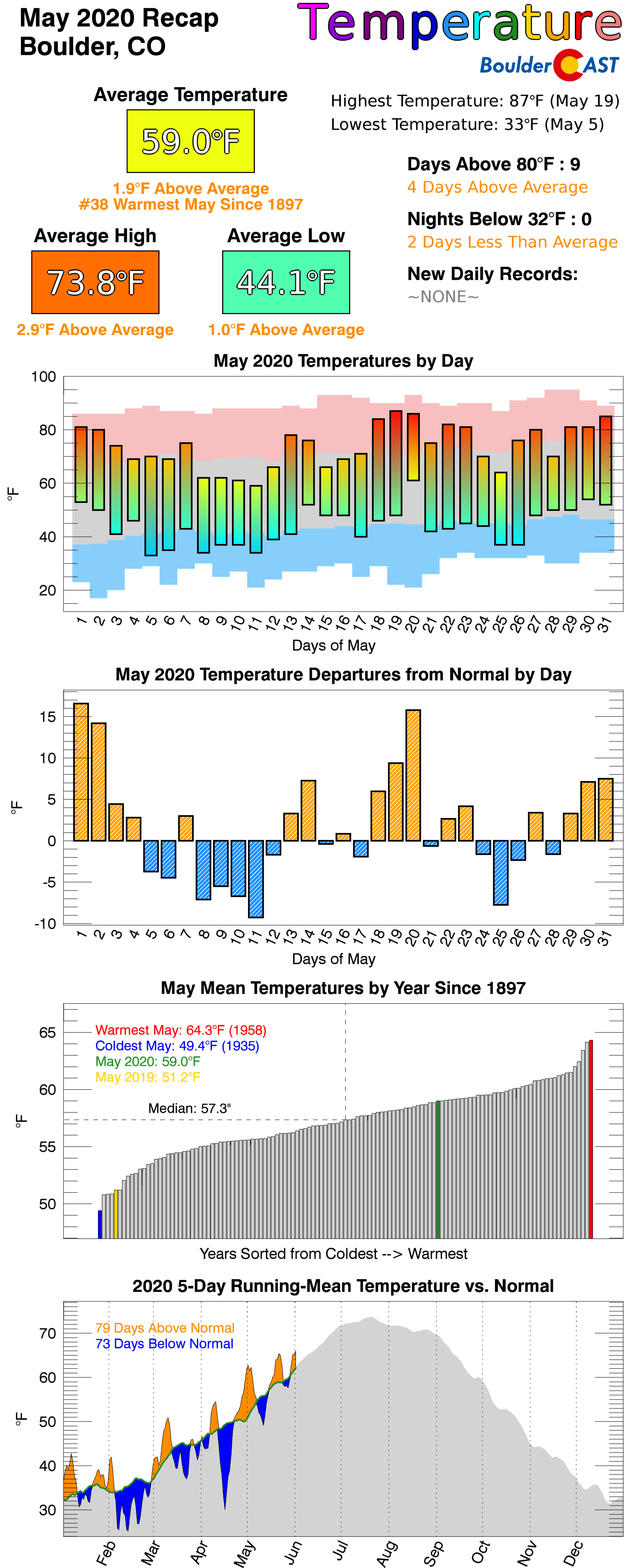
May 2020 had pockets of interesting weather mixed in with atypically longer dry periods. Here’s a quick and colorful recap of our weather during the month of May and how it relates to climatology.
Top Weather Highlights of May 2020:
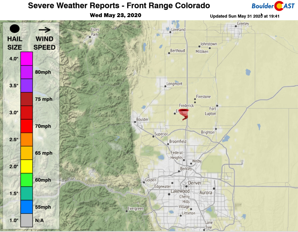
- Isolated severe weather broke out May 19 through May 23 with multiple weak tornadoes touching down in Weld County. There was even a funnel cloud sighting in Broomfield.
Possible landspout tornado seen from Broomfield. Hard to tell if it's attached to the cloud for one, or touching the ground for two, but I'd say spout. Photo is courtesy of Nick Kliebenstein #9wx #COwx pic.twitter.com/LpftL0t3zr
— Cory Reppenhagen (@CReppWx) May 23, 2020
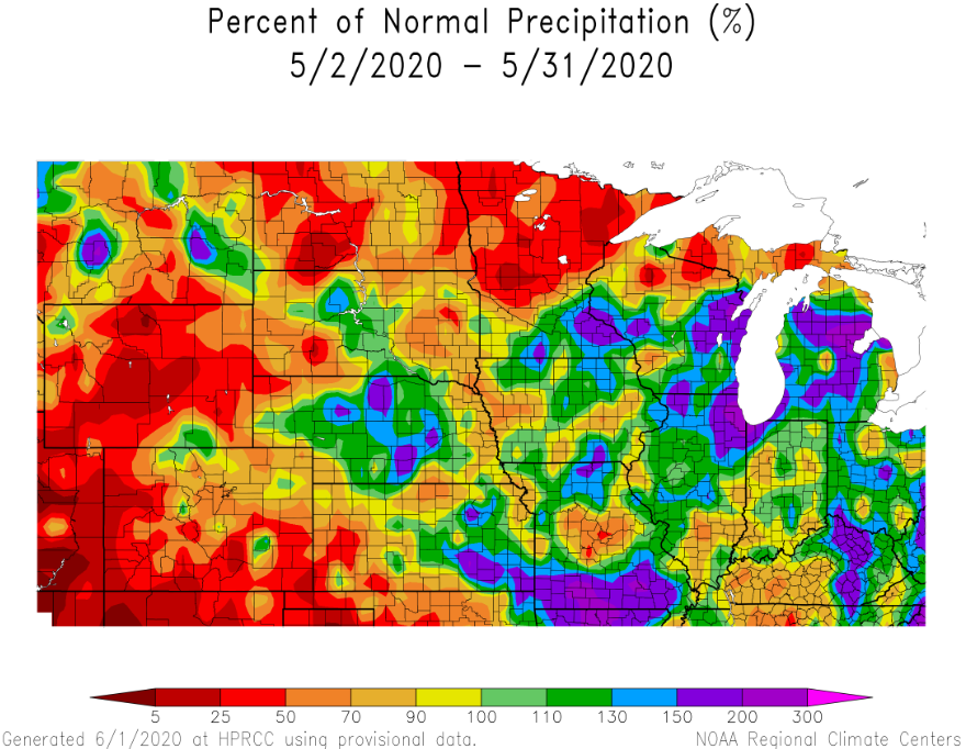
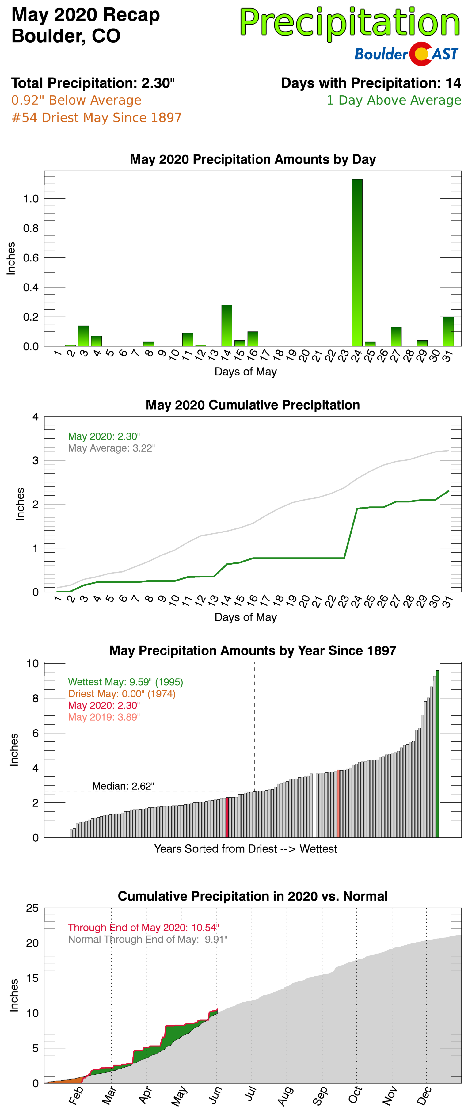
- More than half of Boulder’s precipitation during the month of May fell from a single chilly rain event on May 24th. Outside of this, there were no real storm systems to produce widespread spring rainfall. It was mostly just spotty showers and storms with limited coverage across our area. Not surprisingly, drought has intensified and now reaches further north in Colorado


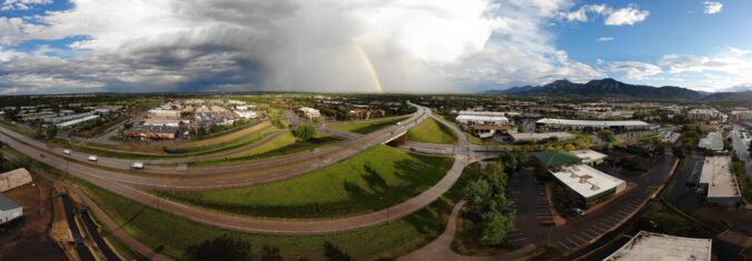
- A handful of rainbows were observed on May 27th as a few small-scale passing showers scooted through the area.
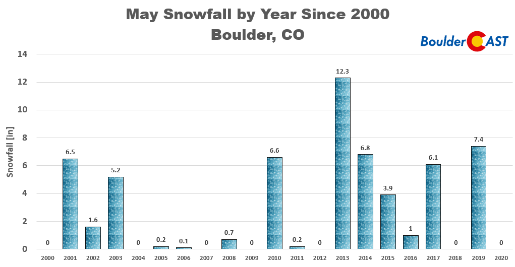
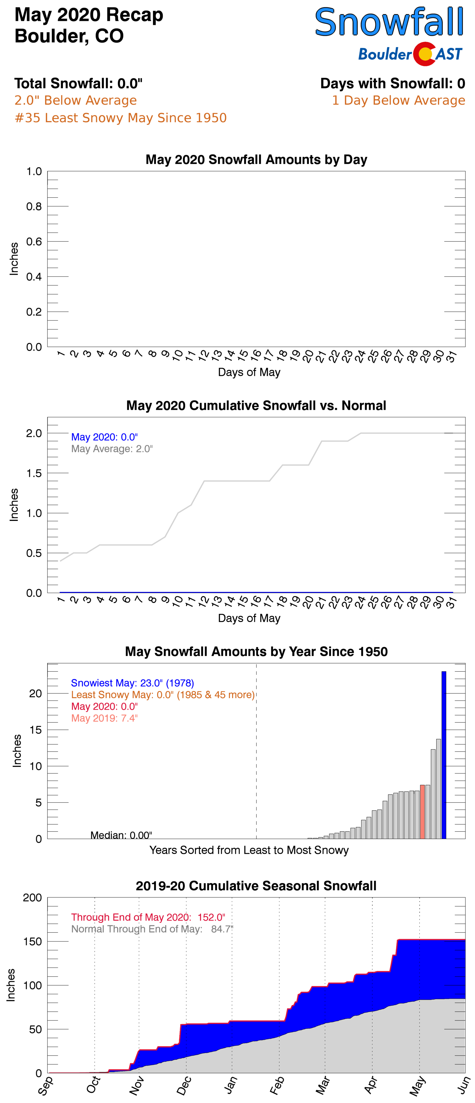
- For only the third time in the last eleven years, Boulder ended the month of May with no snow. The stars just didn’t align properly!
May 2020 Recap Graphics:
Spread the word, share Colorado weather:
Feature image of the rainbow taken by Reddit user shrinkingmedic.
We discuss Boulder and Denver weather every single day on BoulderCAST Premium. Sign up today to get access to our daily forecast discussions every morning, complete six-day skiing and hiking forecasts powered by machine learning, access to all our Front Range specific weather models, additional storm updates and much more!




You must be logged in to post a comment.