Skiers rejoice! A persistent influx of sub-tropical moisture associated with a developing atmospheric river event will bring a prolonged period of light to moderate snow to the Mountains in the coming days.
T
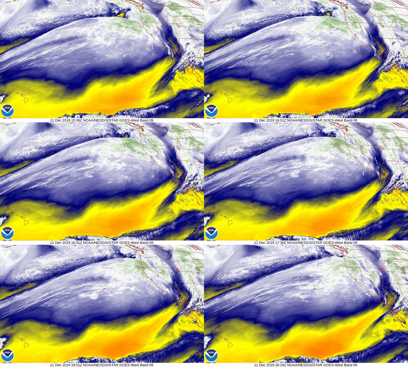
he initial surge of deep moisture associated with an atmospheric river has begun to enter Oregon and northern California this afternoon. This is visible in the GOES-West water vapor satellite animation below. The moisture will head inland across the Great Basin and into the central Rockies by Thursday afternoon.
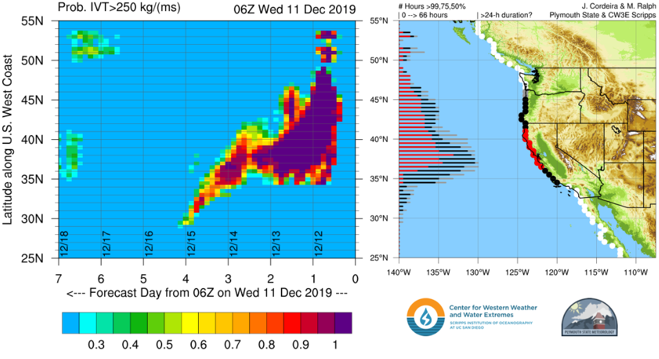
The UC-San Diego forecast graphic below indicates an 80+% chance of atmospheric river conditions existing in Oregon and California through Friday night. This forecast is derived from the GFS ensembles.
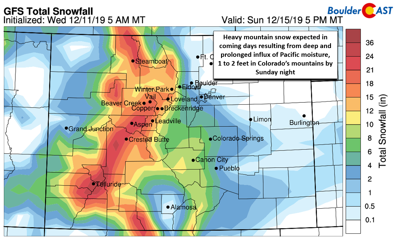
The aforementioned influx of sub-tropical moisture will help spread light to moderate mountain snow from California into Colorado over the coming days. Initially the worst of the snow will be located across the mountains of northwest Colorado on Thursday and Friday. From Friday afternoon into Sunday morning, the focus will shift to include the San Juans as well. A widespread dumping of 1 to 2 feet of snowfall is expected in the High Country statewide primarily due to the prolonged duration of the moisture streaming into the region (more so than shear intensity of the falling snow). Snow levels will remain between 6500 and 7500 feet elevation until Saturday when colder air arrives, so the valleys will mainly see rain or a rain/snow mix until then.
Just about every ski slope will do well from this atmospheric river event. Remember, the snow won’t be falling all at once. Most resorts are looking 4 to 8″ per day for several consecutive days. Here are some of the latest totals predicted by PowderCAST through Sunday night:
- Aspen-Snowmass: 23″
- Telluride: 21″
- Steamboat: 19″
- Vail: 19″
- Copper: 18″
- Breckenridge: 15″
- A-Basin: 15″
- Winter Park: 15″
- Eldora: 12″
Travel over ANY of the mountain passes will become difficult throughout this period. If you do head up to catch the fresh “champagne” powder, plan for hazardous winter road conditions and possible closures due to the combination of heavy snow and strong winds.
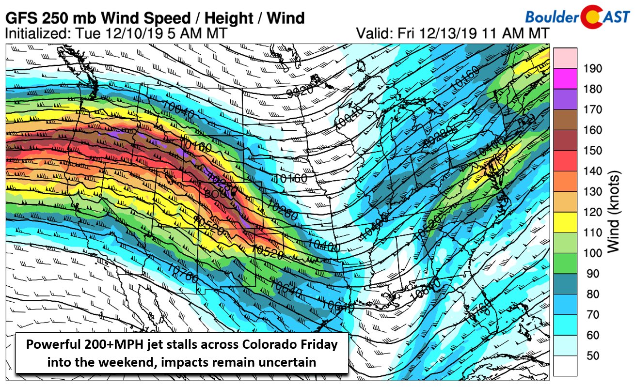
For Boulder and Denver, precipitation chances are considerably lower resulting from an unfavorable large-scale downslope pattern overall during this time. Still a small chance of rain/snow (Friday) and all snow (Saturday/Sunday) will be with us through the weekend thanks mainly to several surges of shallow upslope backing into eastern Colorado. The first cold front will spread into the area Friday night, with a second colder one to follow on Sunday. Overall the snow accumulation potential appears rather low east of the Continental Divide, but the combination of the overhead jet and elevated moisture from the atmospheric river does bear watching for a stray inch or two across the Metro area. We’ll also need to be on-guard for strong downslope winds, particularly early Friday morning and through the day.
.
Spread the word, share this snow forecast:
.




You must be logged in to post a comment.