We hope you were able to make it outside to enjoy what was a beautiful Saturday! Unfortunately, winter is only a handful of hours away. We discuss a few changes that will ultimately lead to a boost in snow totals across the Front Range. Read on for details.
We believe snow totals will be a bit higher than we discussed in our preliminary forecast yesterday. The main factors contributing to these changes are….
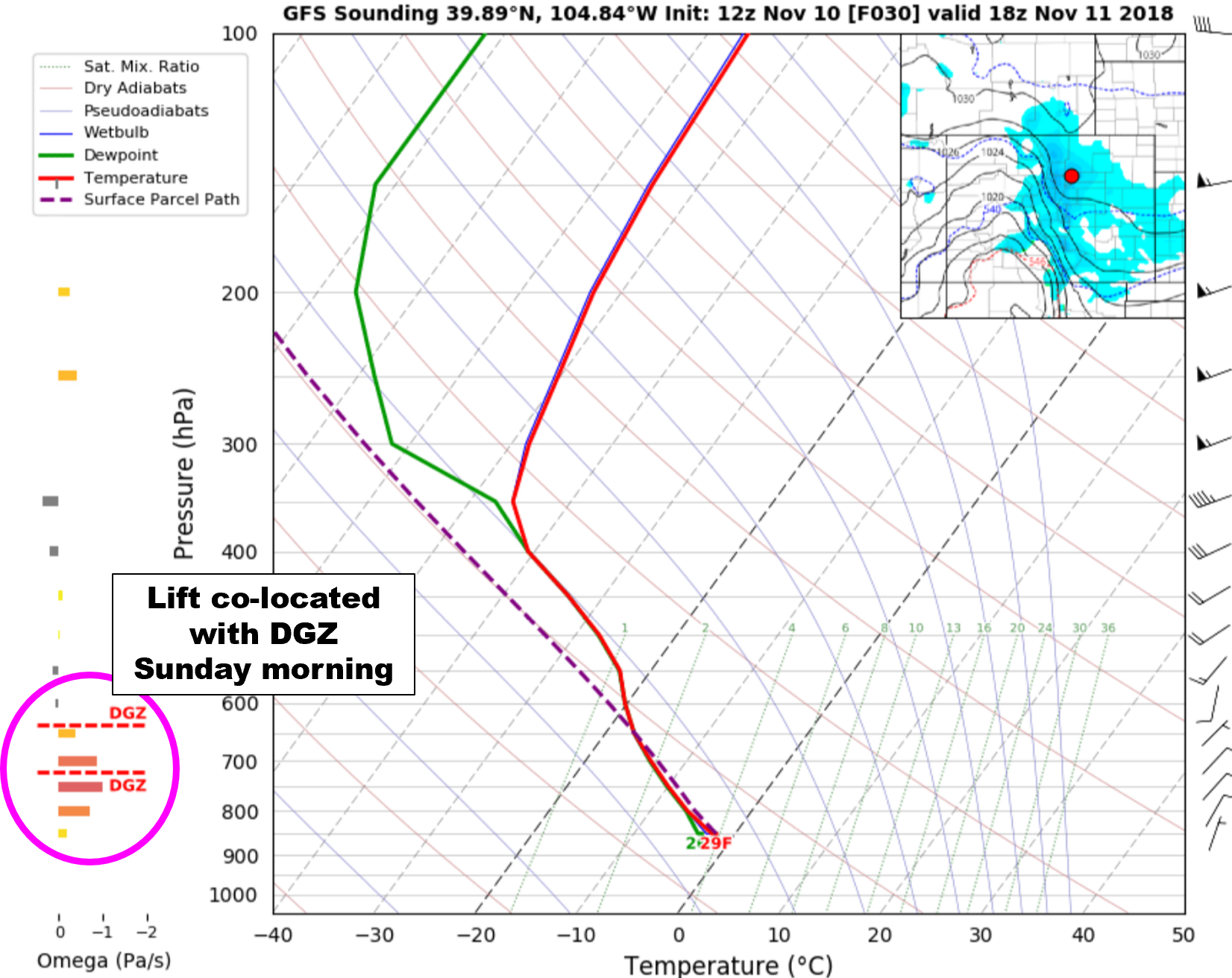
MORE PUNCH: Models came in about 50% wetter today across the board, including the high-resolution models that currently cover the first half of the event. The change in the model QPF is subtle overall, but looks to be tied to stronger lift and a deeper saturated layer overhead as a result of more mixing. The storm’s center will move into western Colorado and Utah tonight (see below).
The GFS has swayed towards 0.3 to 0.5″ of liquid in Boulder, and around 0.2 to 0.3″ in Denver. This is about 50% higher than the previous few days. We’ve also seen these amounts hold steady in the last three runs.
END TIME OF SNOW: You will notice in the ensemble plumes above that most, if not all, members keep light snow going in and around Boulder into Sunday evening, and possibly late Sunday night. This will especially be true in the western and southwestern portions of the Metro area where light upslope will linger alongside slight forcing from the trough. We still expect the heaviest snow to occur between midnight Saturday night and noon Sunday, but light and persistent show showers will linger into Sunday evening and night. Longer snowfall means more snow accumulation.
SNOW RATIOS: The type of snow crystals that fall play an important role in snow accumulation, too! We knew this particular event would have some fluffy powder (15:1), but given that strong lift appears imminent to overlap the growth zone for dendrites Sunday morning (layer of atmosphere around -15degC), we may even do a little better. Some areas in the Foothills could see snow ratios closer to 20:1…true champagne powder!
The key take-aways are….
- Snow could begin as early as midnight across the northern Metro area, including Boulder. It will then spread southward through the early morning hours and should be snowing everywhere by sunrise Sunday.
- Snow will generally be light throughout the event, but snowfall bordering on moderate will be possible Sunday morning as the best large-scale lift passes by.
- We’re not expecting any jet-forced snow bands. Sorry, no white out conditions!
- This will be a longer duration storm, not wrapping up in Boulder until Sunday evening or overnight. Areas further east and north will end sooner.
- COLD! The air behind the cold front tonight will be noticeably Canadian. Highs Sunday will be in the 20’s, falling well into the teens Sunday night.
- Our snow totals have INCREASED. It is almost a certainty that Boulder will see at least 4″ and Denver at least 2″. This storm is one where if there is a busted forecast at all, it will be higher not lower!
Here is our updated and final snowfall forecast map. Enjoy the powdery snow and stay warm!
Share this forecast:
.


You must be logged in to post a comment.