The winds are shifting and the smoke will soon be departing our region. Read on for details.
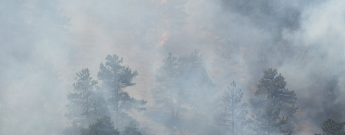
Monday’s cold front brought thick smoke into Colorado that originated from several massive (and many small) fires currently burning in Oregon, Washington, Idaho, and Montana. The smoke was thickest Monday evening when the visibility dropped below 2 miles in some locations across the Denver Metro area.
Since then, heavy smoke has lingered across the region thanks to easterly flow in the lower levels of the atmosphere, and a constant replenishment of smoke via northwesterly mid-level flow. While conditions have improved slightly today, the smoke still lingers. Here is the latest weather observation and camera from BoulderCAST Station:
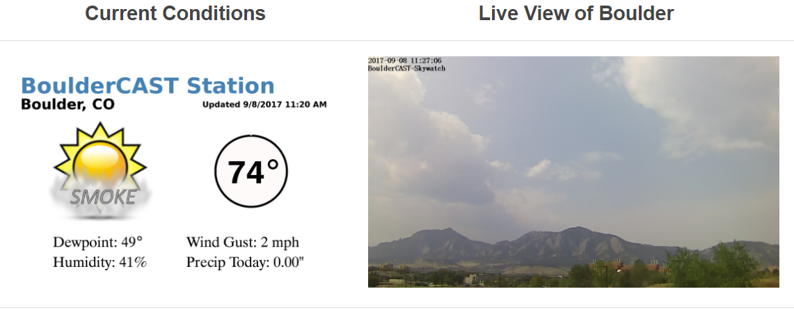
Current conditions in Boulder, as of 11:20 AM
This all changes tomorrow as our winds finally take on a more southwesterly component (see below).
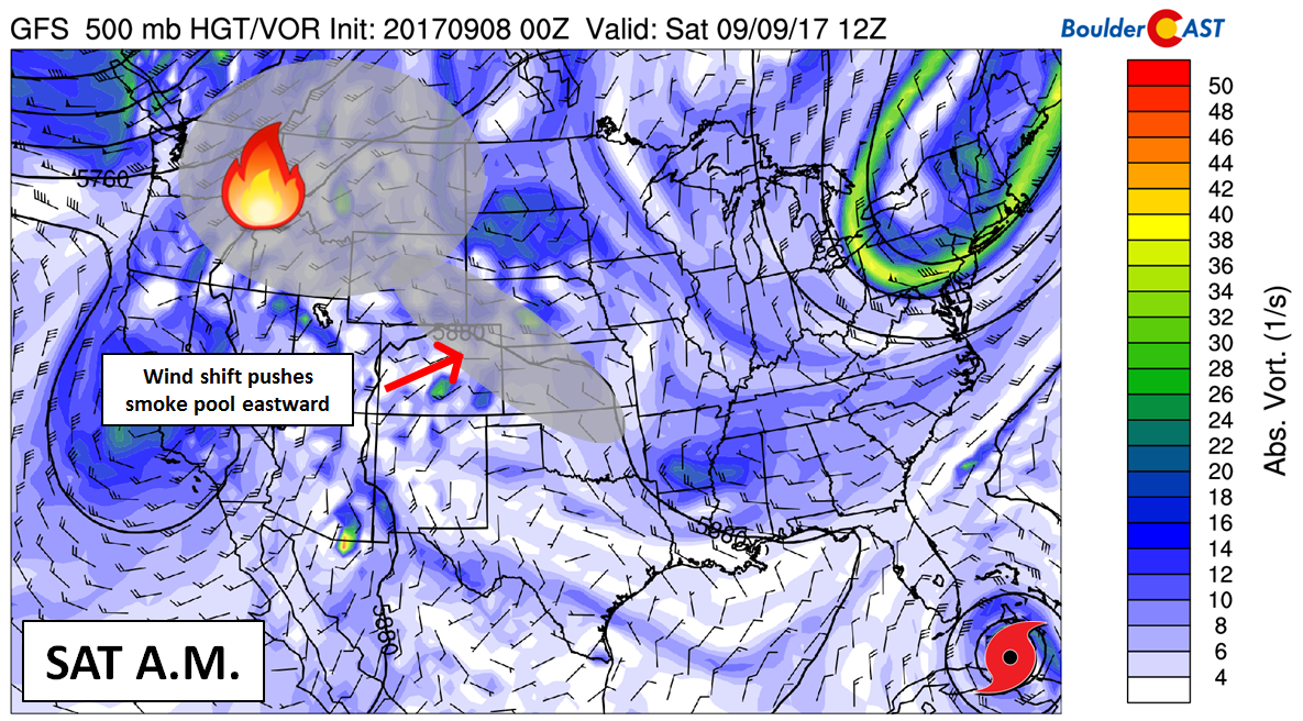
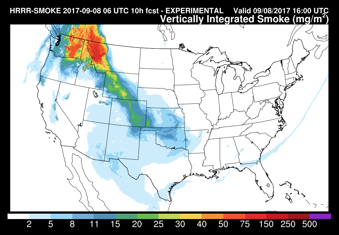
A great resource to track/forecast the smoke content of the atmosphere is NCEP’s experimental HRRR-Smoke dispersion model. It only forecasts 30 hours, however. Environment Canada (Canada’s pseudo-equivalent of NOAA) has a smoke model called FireWork that forecasts 48 hours out.
Today’s vertically integrated smoke content forecast from HRRR-Smoke is below. This is a measure of the total amount of smoke particles through the depth of the atmosphere. Values in northern Colorado today peak around 15 to 25 milligrams per square meter (mg/m2). Despite the impact, this is meager compared to the 50 to 150 mg/m2 currently shrouding Montana and Washington.
Following the wind shift tonight/tomorrow, this narrow tongue of smoke in Colorado will push eastward. The smoke forecast for Saturday at 12PM:
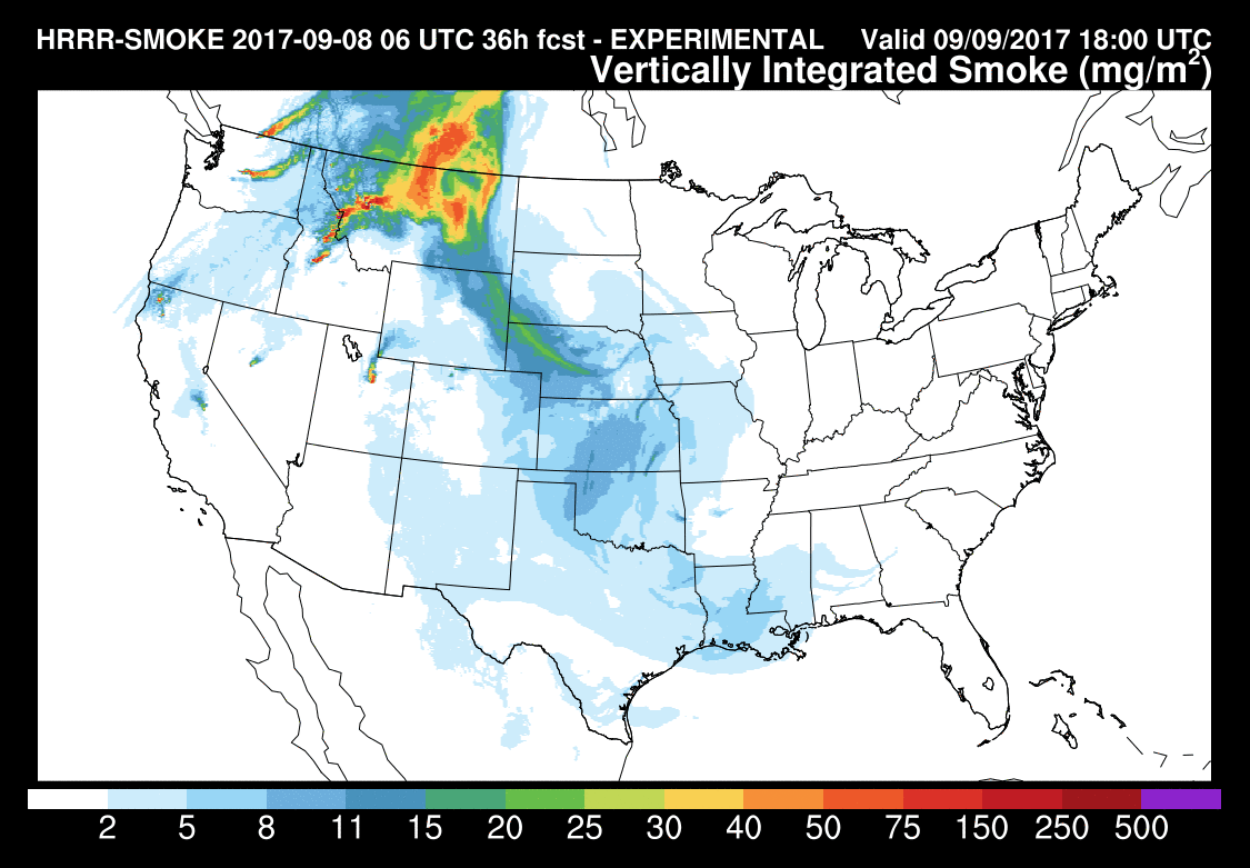
Visibility and air quality will drastically improve by tomorrow afternoon and especially on Sunday!
The weekend looks warm across the Front Range with southwesterly flow and a large ridge building across the western United States. Expect temperatures Saturday and Sunday near 90 degrees on the Plains, with a 20 to 30% chance of afternoon and evening storms. Temperatures look to remain above normal through next week with slight chances of storms a few days. More on this in our weekly outlook on Monday.
Have a good weekend and let’s hope Hurricane Irma is merciful upon landfall Sunday morning…
.



You must be logged in to post a comment.