An impressive atmospheric river event currently hammering California moves onshore this week leading to gusty winds as well as rain and snow for Colorado Tuesday through Wednesday. Prior to that, warmth will abound to start the week with perhaps one final 80-degree day in the works. A quieter patten takes shape for the late week period and upcoming weekend which should make for excellent holiday activities.
This week’s highlights include:
- Warmest day on Monday with strong southerly flow ahead of cold front Tuesday, but not quite record breaking
- Atmospheric river storm system reaches Colorado Tuesday with mainly mountain rain/snow and a slight chance for rain on the Plains
- Breezy conditions late Tuesday and Wednesday on the Plains and Foothills
- More seasonal temperatures midweek with a return to above average conditions come Friday
- The upcoming weekend pattern favors quieter and mild weather
DISCLAIMER: This weekly outlook forecast is created Monday morning and covers the entire upcoming week. Accuracy will decrease as the week progresses as this post is NOT updated. To receive daily updated forecasts from our team, subscribe to BoulderCAST Premium.
The impressive Atmospheric River Event out west and its impact on Colorado
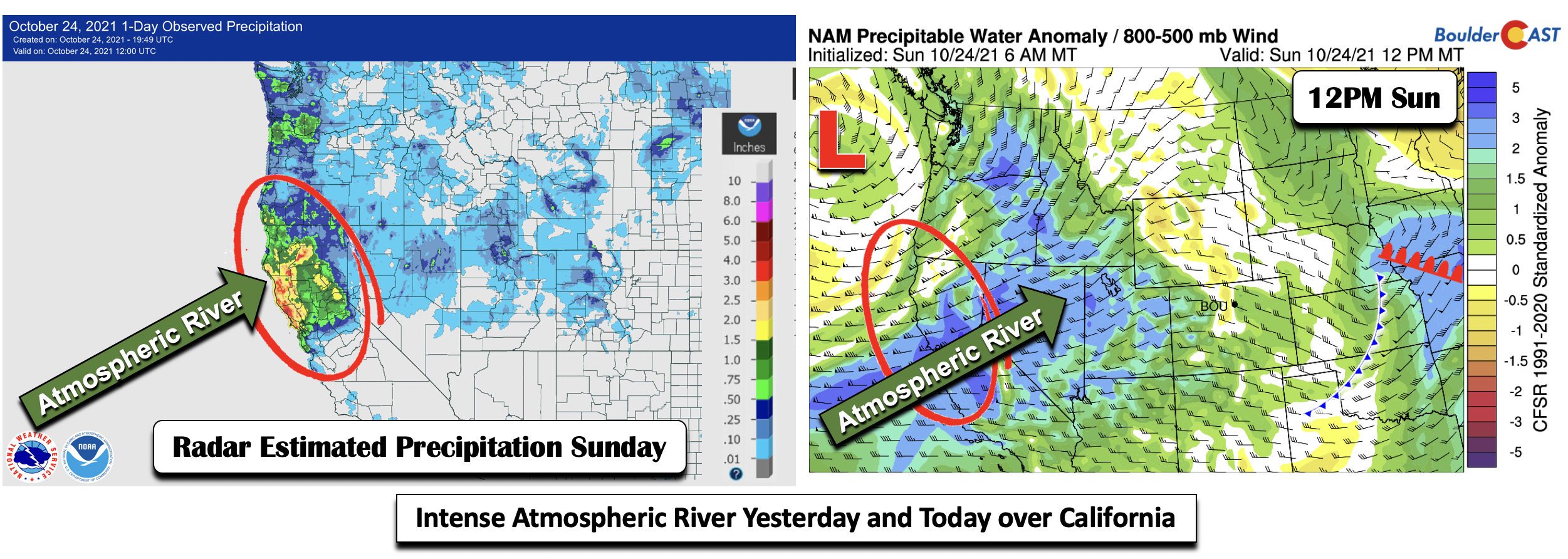
An impressive atmospheric river event has and continues to effect central and northern California. This event started Sunday. The radar estimated precipitation from NOAA using weather radar is shown on the bottom left through midday Sunday. Northern portions of the state have seen upwards of 4″ of rainfall. The atmospheric river was well identifiable yesterday using our precipitable water anomaly map (below right), where deviations were upwards of 3 and above over central California. More rainfall and heavy Sierra snowfall is forecast over the central part of the state today.
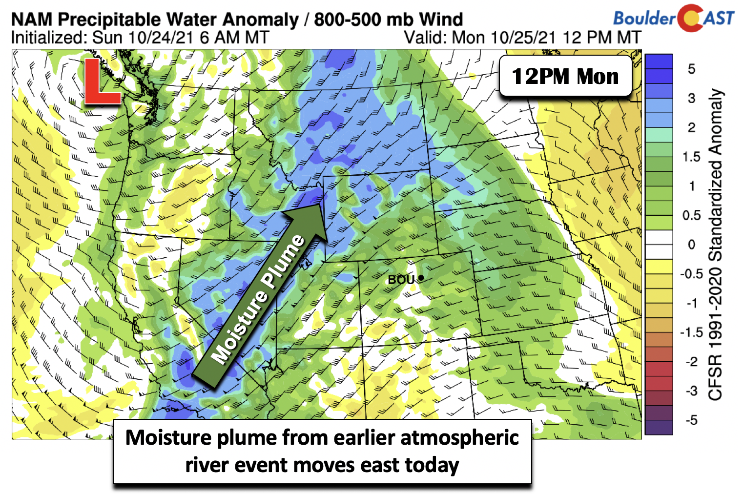
On Monday the atmospheric river event becomes an elongated moisture plume stretching from California into Montana (below). Broad west-southwest flow will be in place across Colorado, spelling out dry conditions and welcomed warmth.
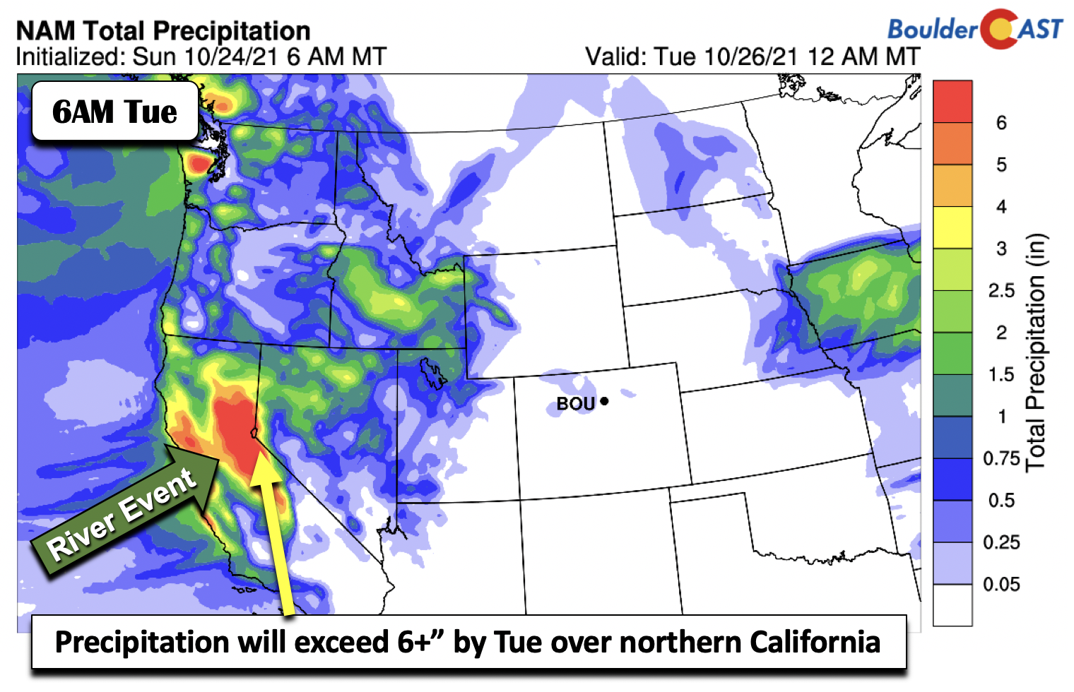
The deep moisture impinging upon the Sierra Nevada mountains of California will lead to a few feet of snow today, equivalent to almost 6+” of precipitation by early Tuesday. Torrential rainfall is likely below 8,000 feet. Flash Flood Watches and Winter Storm Warnings are in effect for these areas as a result. The pattern will favor mudslides, rockslides, and debris flows, along with a fresh blanket of snow on the higher peaks.
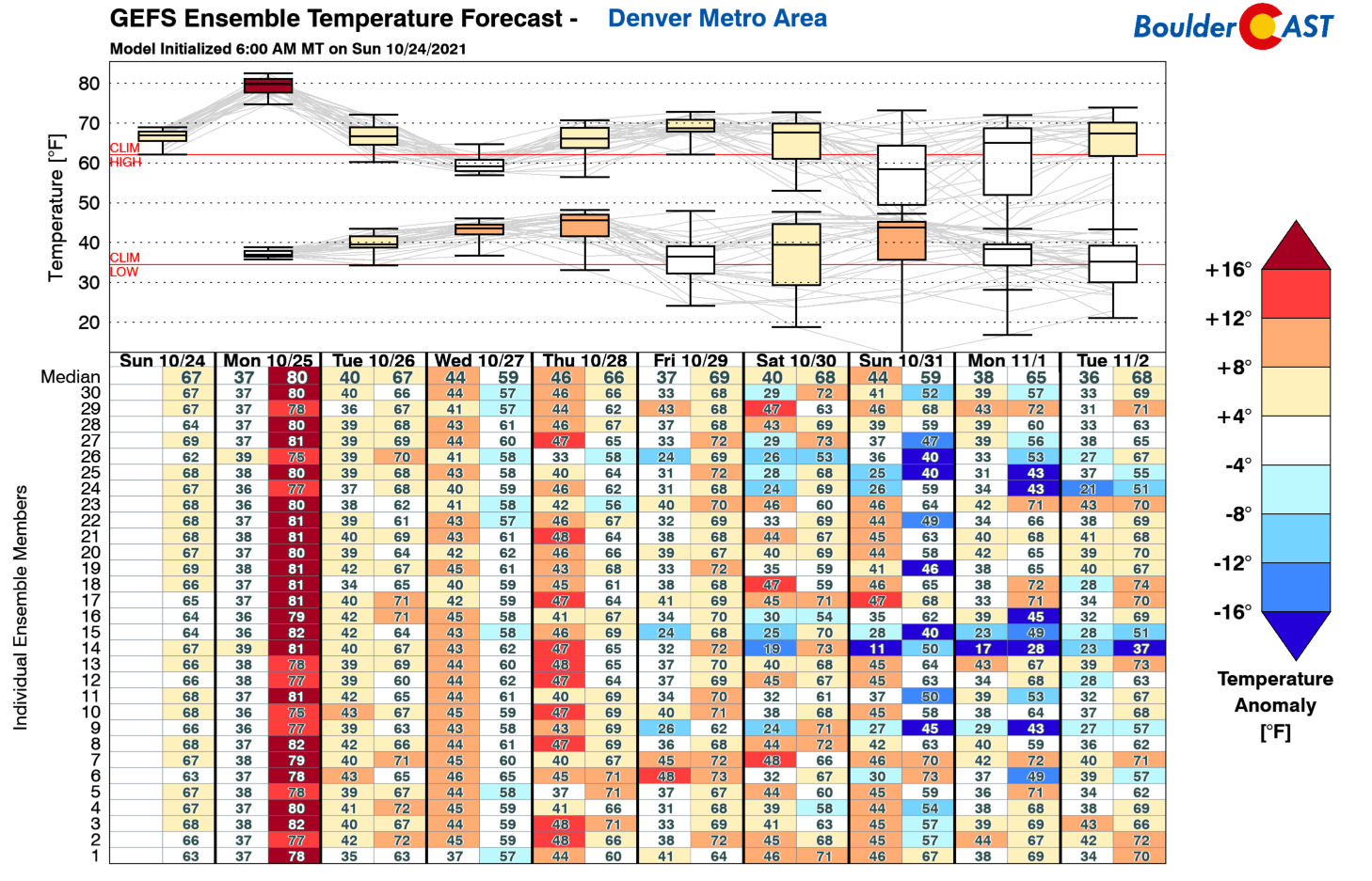
Why are we mentioning California and what impact does it have for us in Colorado? Glad you asked as this same system will reach our area on Tuesday and more or less influence our pattern through Thursday, before finally exiting to the eastern United States by late week. The pattern in terms of the overall temperatures (below) will largely stem from the impact of this atmospheric river system and the eventual rebuilding of high pressure in the latter part of the week. As a result, we are expecting the highest temperatures on Monday, followed by a decline to more seasonal weather midweek and a rebound to above average in the latter part.
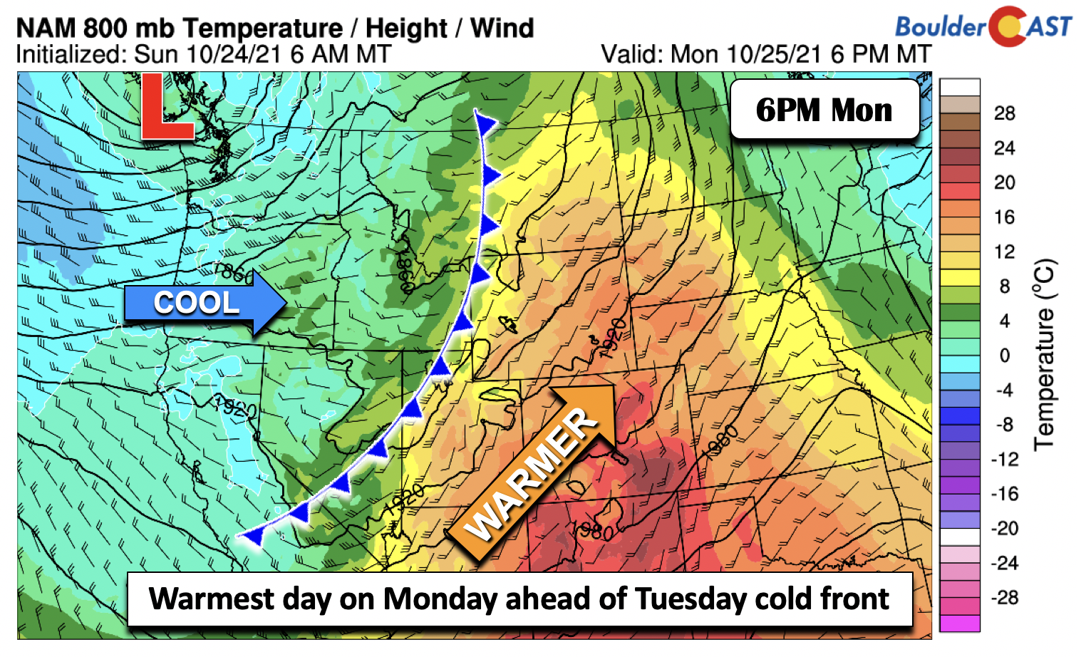
Today, as the system offshore moves into the Intermountain West, a cold front will edge east into Nevada and Idaho (below). Southerly flow and above average temperatures in the lower levels of the atmosphere over Colorado will send our highs this afternoon some 10+ degrees warmer today from Sunday in the upper 70’s. A few spots may even touch 80 degrees, but this will still be below record criteria. The record high today in Boulder is 85 set all the way back (pun intended; 4 years ago) in 2017. A fair amount of sun is forecast today but mid and high-level wave clouds will increase in coverage as the day progresses.
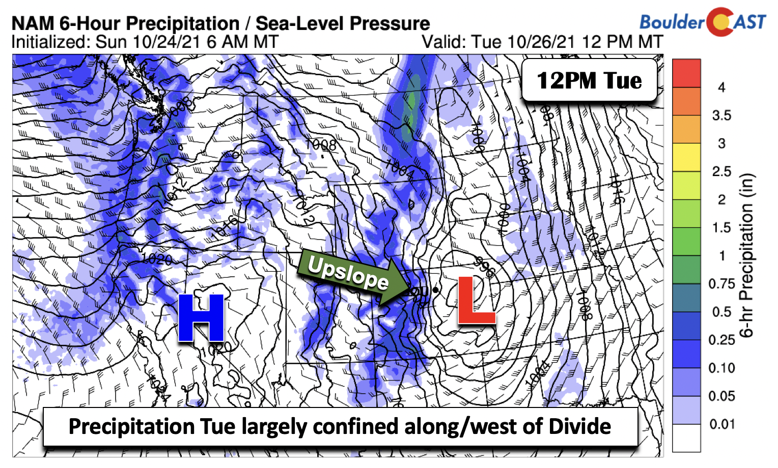
On Tuesday, the atmospheric river system becomes an elongated trough stretching from eastern Montana into New Mexico. The track of this trough, similar to the past week or so, does not favor good precipitation chances on the Plains. On the contrary, it continues to advertise a high likelihood over the Mountains along and west of the Divide.
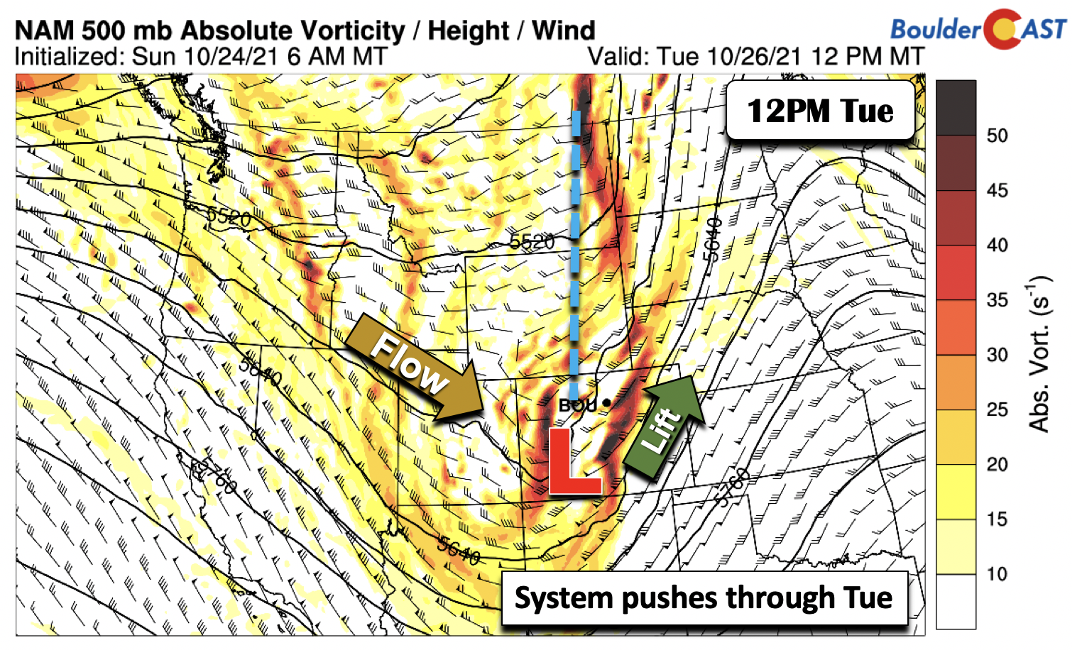
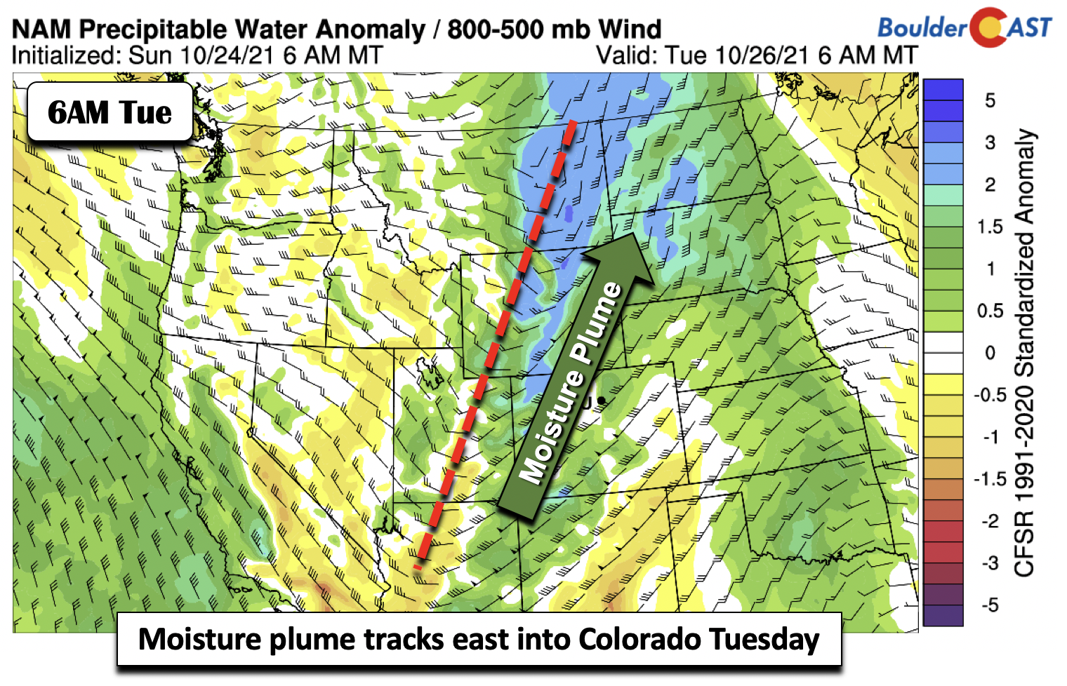
The moisture plume will be more or less aligned with the trough axis (below) on Tuesday. Broad southwest flow in the anomalous moisture over western Colorado will lead to deep lift over the High Country throughout the day into Wednesday morning.
As for the Plains, cloudy skies will be in place as downslope flow will ensue much of the day. The precipitation, though will largely remain west of Boulder and Denver in the Foothills and mountains, may briefly skirt the Denver Metro area during the afternoon/evening as low pressure develops. Amounts though will be less than a tenth of an inch and be isolated in nature. Thus, only a 20% chance is forecast with highs in the upper 60s.
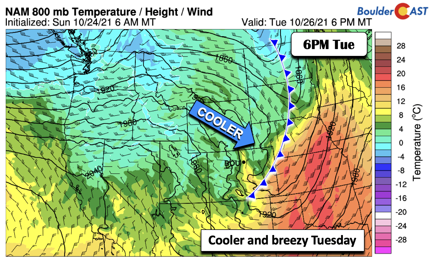
The downslope flow, especially behind the front (below) in the evening on Tuesday, will lead to gusty winds, perhaps exceeding 40 MPH in some places and 50 MPH or so in the Foothills. Temperatures will fall Tuesday night behind the cold frontal passage with highs on Wednesday landing closer to average in the upper 50s.
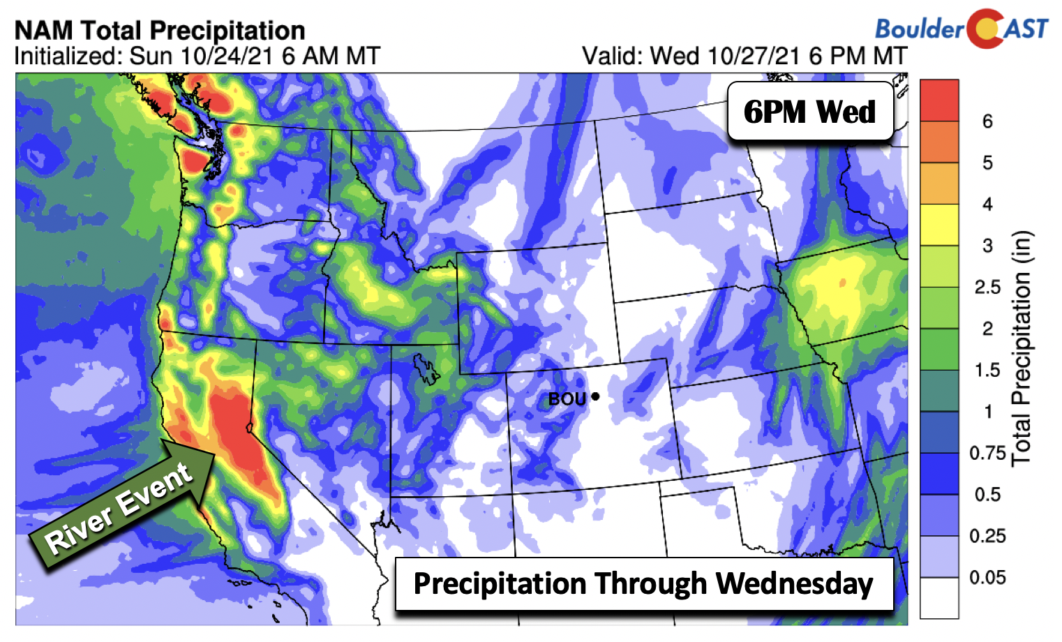
The total precipitation through Wednesday from the NAM model (below) shows that most of the precipitation will reside in the mountains, with only a small sliver over the northeast part of the state.
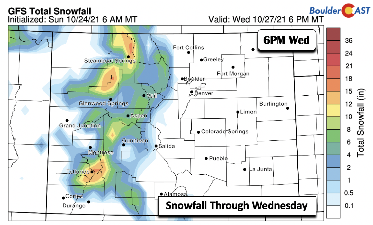
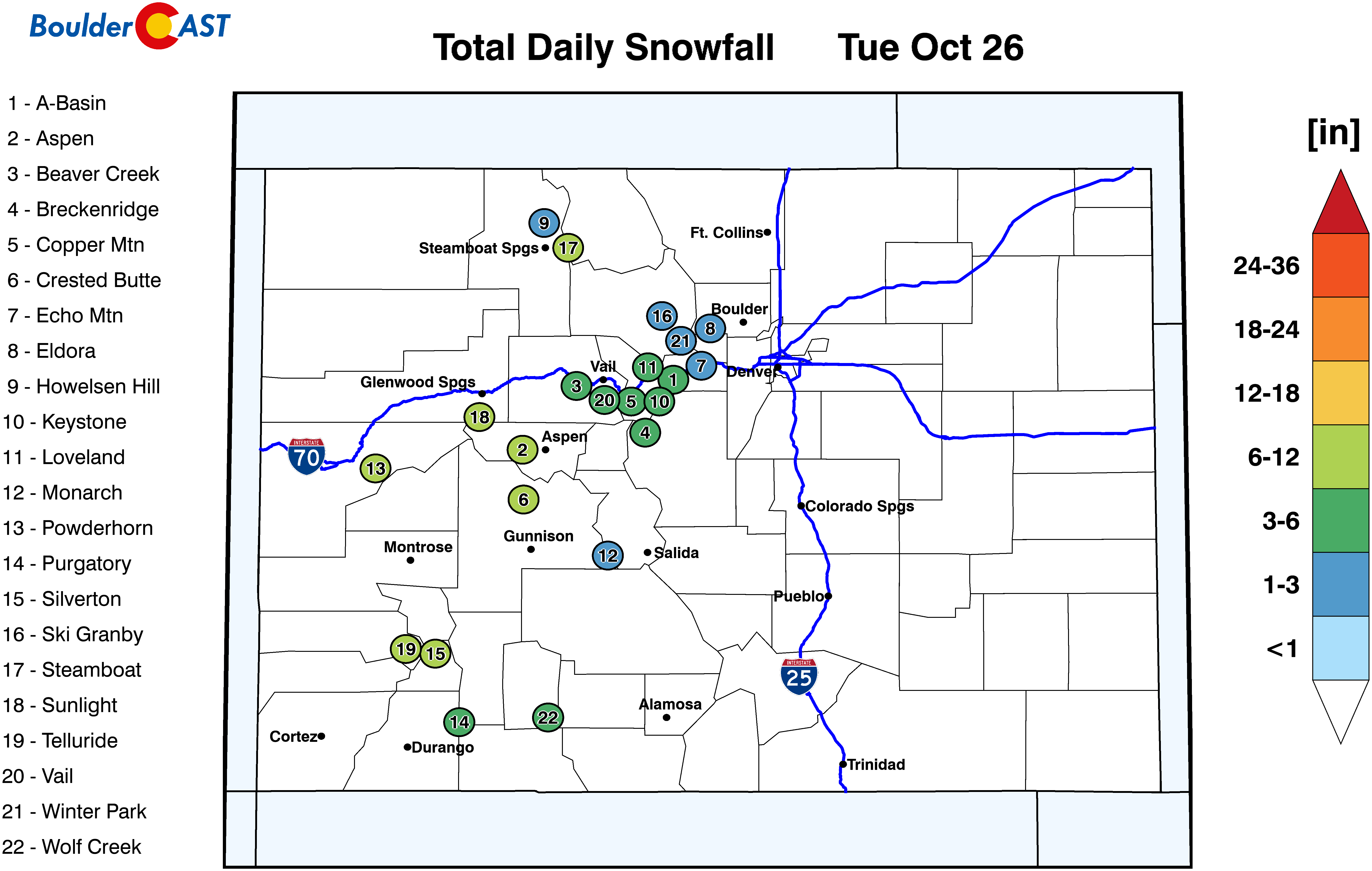
A portion of that precipitation will fall in the form of snow over western Colorado. Similar to past events over the last week, several ski resorts will see between 3 and 9 inches of new snow, with locally higher amounts favored near Steamboat under a continued west-northwest upslope flow there.
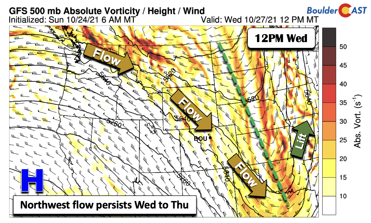
By Wednesday, the system which brought precipitation from California into Colorado will largely move east into Kansas and Oklahoma (below). However, the flow will remain out of the northwest as the region will still be under the influence of the trough to our east.
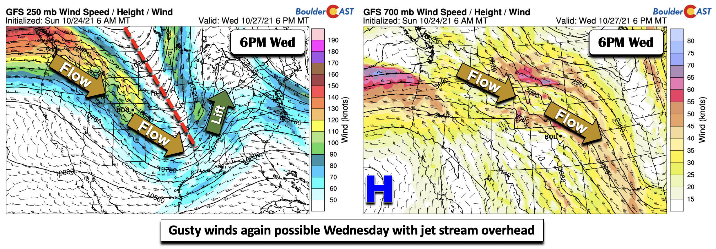
Similar to Tuesday, another period of gusty winds appears favored on Wednesday across the Plains and Foothills. As the trough digs into the Midwest, a strong upper-level jet streak oriented from northwest to southeast (below left) will extend from the Pacific Northwest into southeastern Colorado. While the details are likely to change as the models get a better handle on the midweek pattern, the location of the jet streak relative to the mountain range of the Rockies will favor another period of downslope winds on the Plains, perhaps exceeding 35 mph (below right).
More tranquil conditions return late in the week
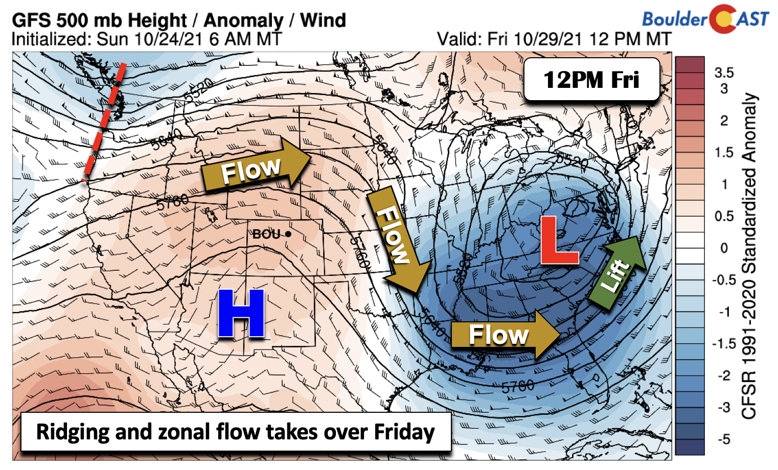
There is fairly good agreement in the weather guidance that the system over the Midwest will strengthen and close off into a mid-level low pressure system over the eastern U.S. come Friday. As the system pushes east Thursday, the northwest flow will ease a tad and allow more tranquil weather to develop. High pressure is poised to shift into the area by Friday, if not a tad sooner (below). In terms of our sensible weather, a trend from the lower 60s Thursday will rise to near 70 degrees to end the work week on Friday.
As for the upcoming weekend, though some uncertainty is always a concern that far out, there is fair agreement in the model guidance that zonal flow will be in place. This will favor a mild start to the weekend, along with the potential for a cold frontal passage late Saturday into Sunday as the zonal flow gets replaced by a southward moving trough. A few solutions are showing a shot of cold rain or possibly snow accompanying this front early Sunday but the jury is out on that one. Both Friday or Saturday should be seasonal and pleasant for any spooky activities… Enjoy!
Stay up to date with Colorado weather and get notified of our latest forecasts and storm updates:
We respect your privacy. You can unsubscribe at any time.
Forecast Specifics:
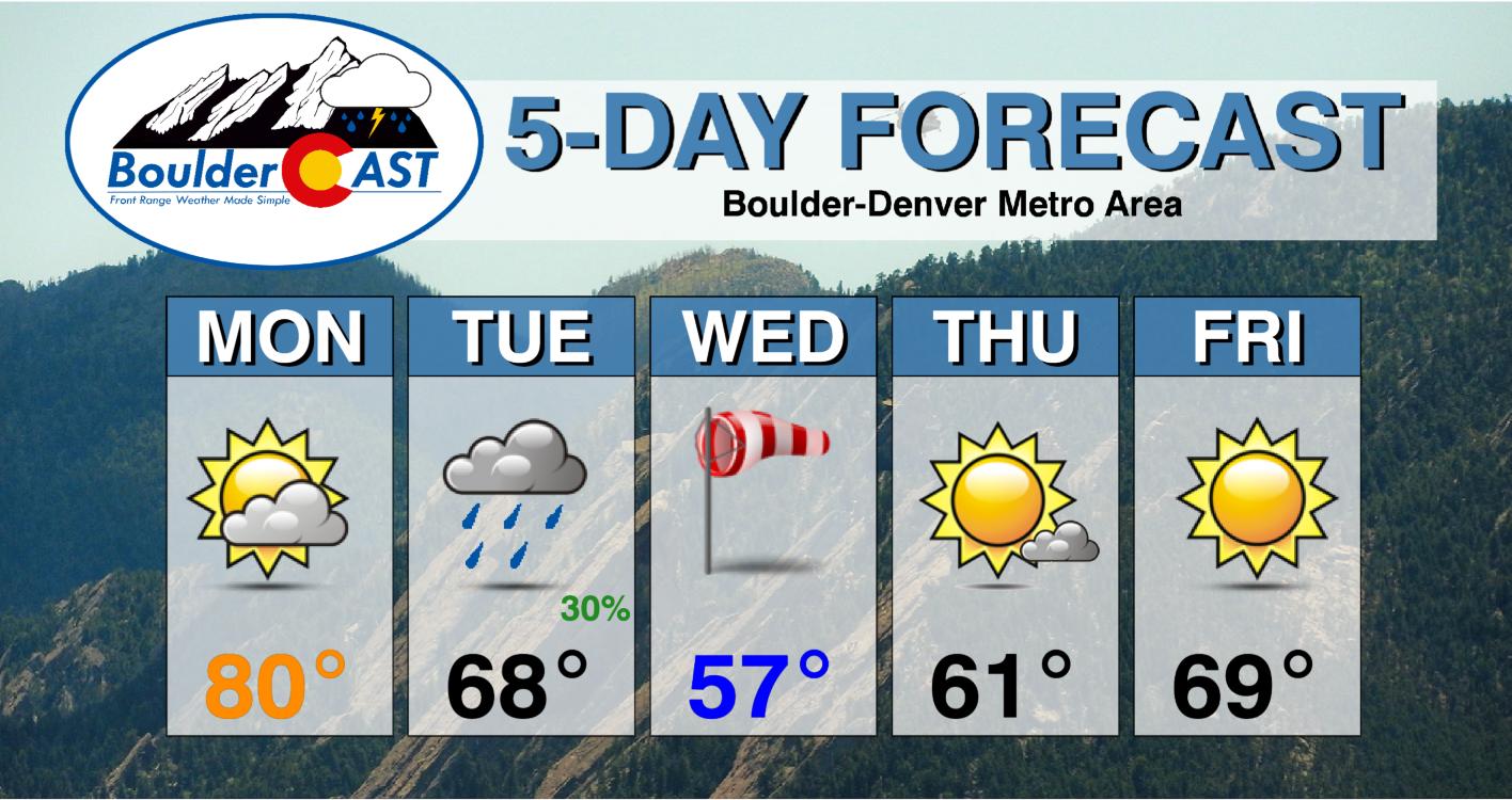
Monday: Partly cloudy skies becoming mostly cloudy. Quite warm with upper 70s to perhaps 80 on the Plains and upper 60’s in the Foothills. Gusty winds at times with high fire danger from Denver southward.
Tuesday: Mostly cloudy, breezy, and cooler with scattered rain showers in the afternoon and early evening. Highs in the upper 60’s on the Plains and middle 50’s in the Foothills. Light snow is possible over the Foothills with little to no accumulation expected. Winds may gust over 40 MPH.
Wednesday: Much more sunshine with highs closer to normal in the upper 50’s on the Plains and upper 40’s in the Foothills. Winds may gust over 35 MPH.
Thursday: Partly cloudy and quieter with highs right around average in the lower 60s on the Plains and lower 50’s in the Foothills.
Friday: Mostly sunny and warmer with upper 60’s on the Plains and upper 50’s in the Foothills.
Mountains: After a warm Monday, mountain snowfall will ensue late Monday night through about midday Wednesday, especially over the north-central and northwest part of the state. Snowfall amounts will be in the 3 to 7″ range, but locally higher amounts are also possible in the San Juans and near Steamboat. Gusty winds are likely Tuesday through Thursday with the jet stream draped across our state. A more tranquil pattern takes shape Friday and Saturday.
Help support our team of Front Range weather bloggers by joining BoulderCAST Premium. We talk Boulder and Denver weather every single day. Sign up now to get access to our daily forecast discussions each morning, complete six-day skiing and hiking forecasts powered by machine learning, first-class access to all our Colorado-centric high-resolution weather graphics, bonus storm updates and much more! Or not, we just appreciate your readership!
.
Spread the word, share the BoulderCAST forecast!
.





You must be logged in to post a comment.