The month of May will end with several days of highs in the 80s. This warmth will be felt largely into midweek as ridging extends into the Front Range area. Although the chance of showers and storms will exist early in the week, the better chances crops up from Wednesday onward as a closed low pressure lifts into the region. This system may linger into the early part of the weekend and there could be some risk of excessive rainfall. Read on for our full outlook of this abbreviated holiday work-week.
This week’s highlights include:
- 80s start out the week and to close out May
- Slight chance of storms on this Memorial day, but nothing that will ruin a BBQ!
- Increasing chances of storms Wednesday through Friday as the main storm system of the week approaches
- Temperatures fall back a tad by late-week with increasing storm chances and clouds
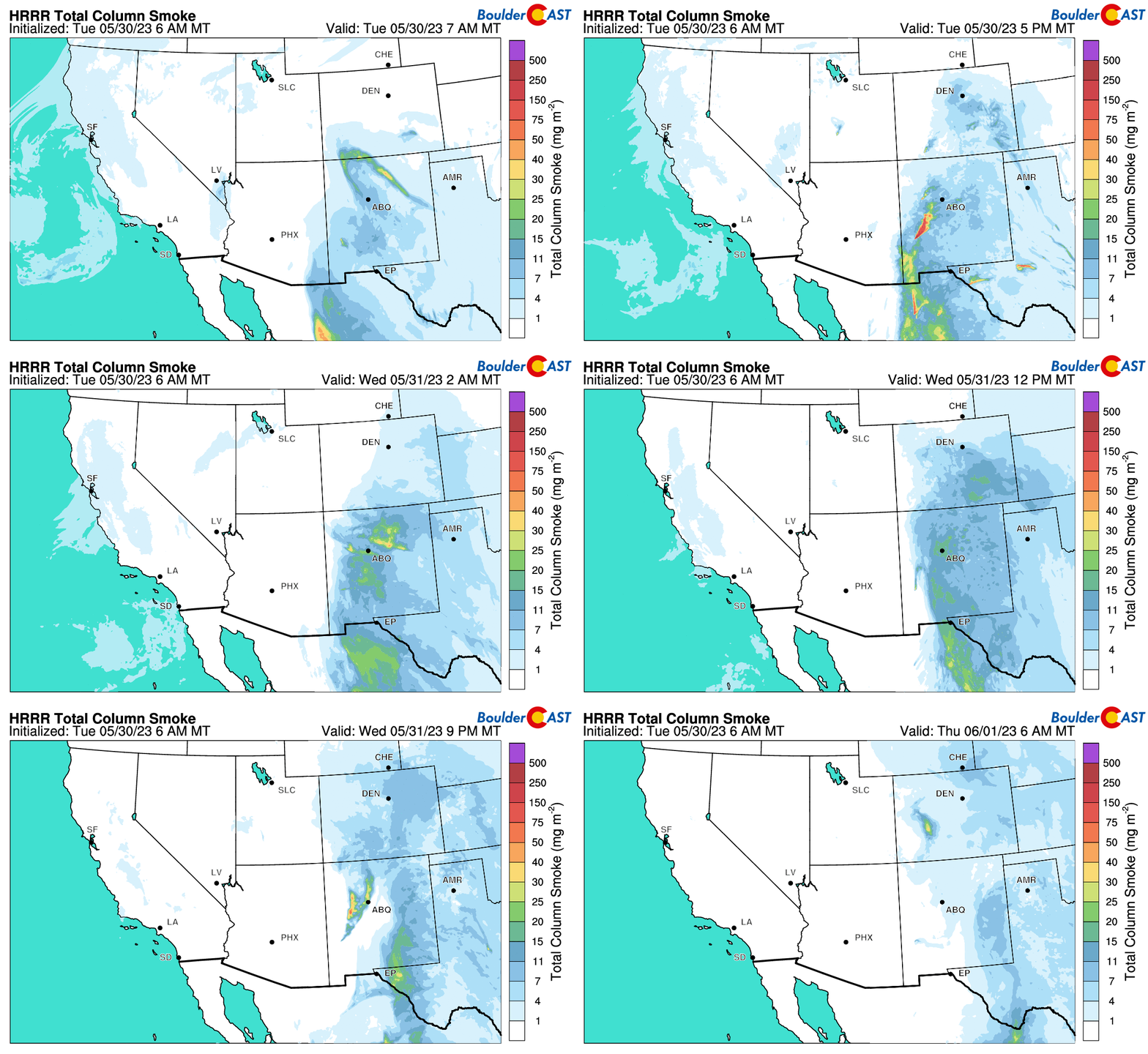
- No signs that smoke will return from Canada this week
DISCLAIMER: This weekly outlook forecast is created Monday morning and covers the entire upcoming week. Accuracy will decrease as the week progresses as this post is NOT updated. To receive daily updated forecasts from our team, among many other perks, subscribe to BoulderCAST Premium.
Daily Forecast Updates
Get our daily forecast discussion every morning delivered to your inbox.
All Our Model Data
Access to all our Colorado-centric high-resolution weather model graphics. Seriously — every one!
Ski & Hiking Forecasts
6-day forecasts for all the Colorado ski resorts, plus more than 120 hiking trails, including every 14er.
Smoke Forecasts
Wildfire smoke concentration predictions up to 72 hours into the future.
Exclusive Content
Weekend outlooks every Thursday, bonus storm updates, historical data and much more!
No Advertisements
Enjoy ad-free viewing on the entire site.
Warm & largely dry to start the week
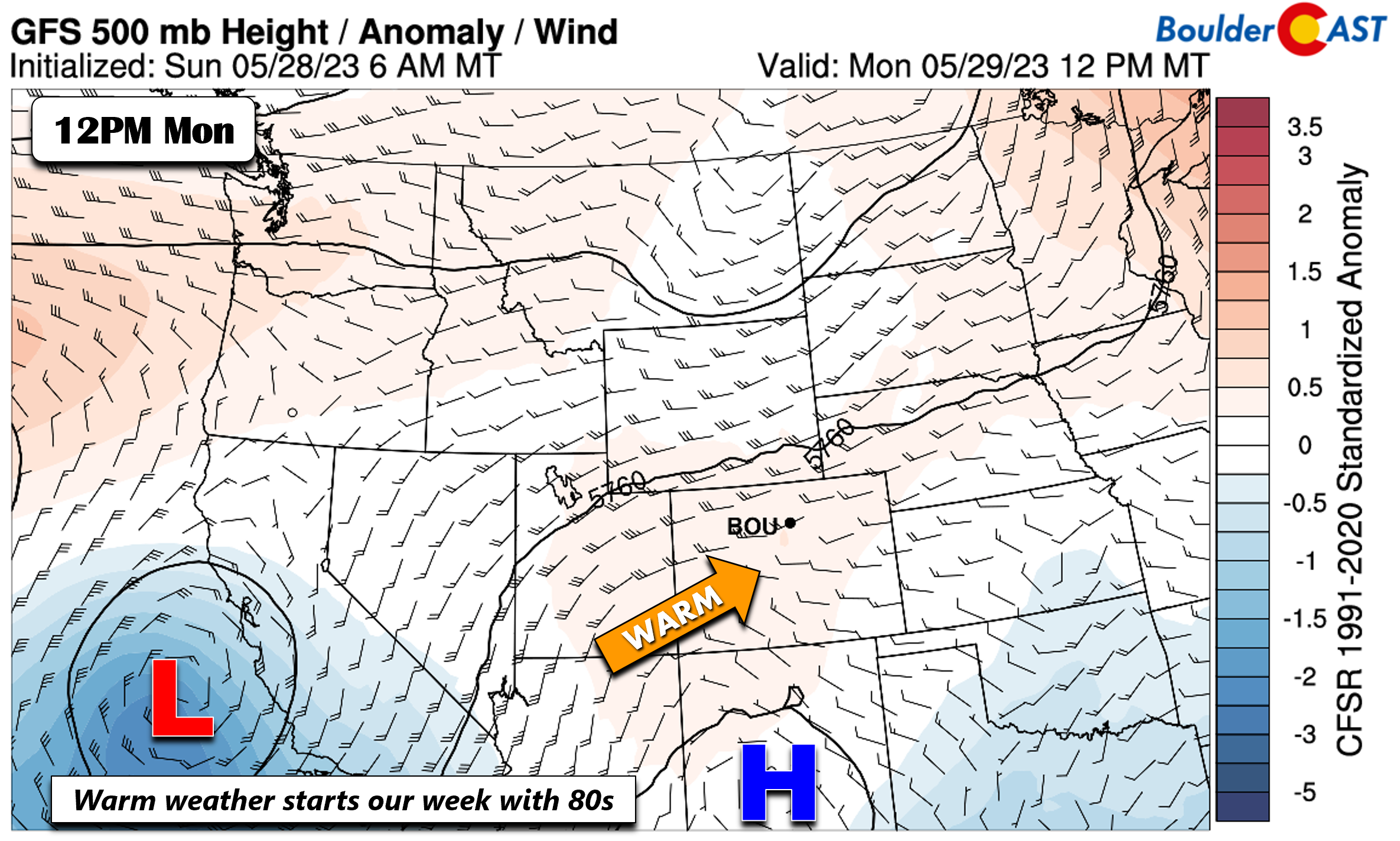
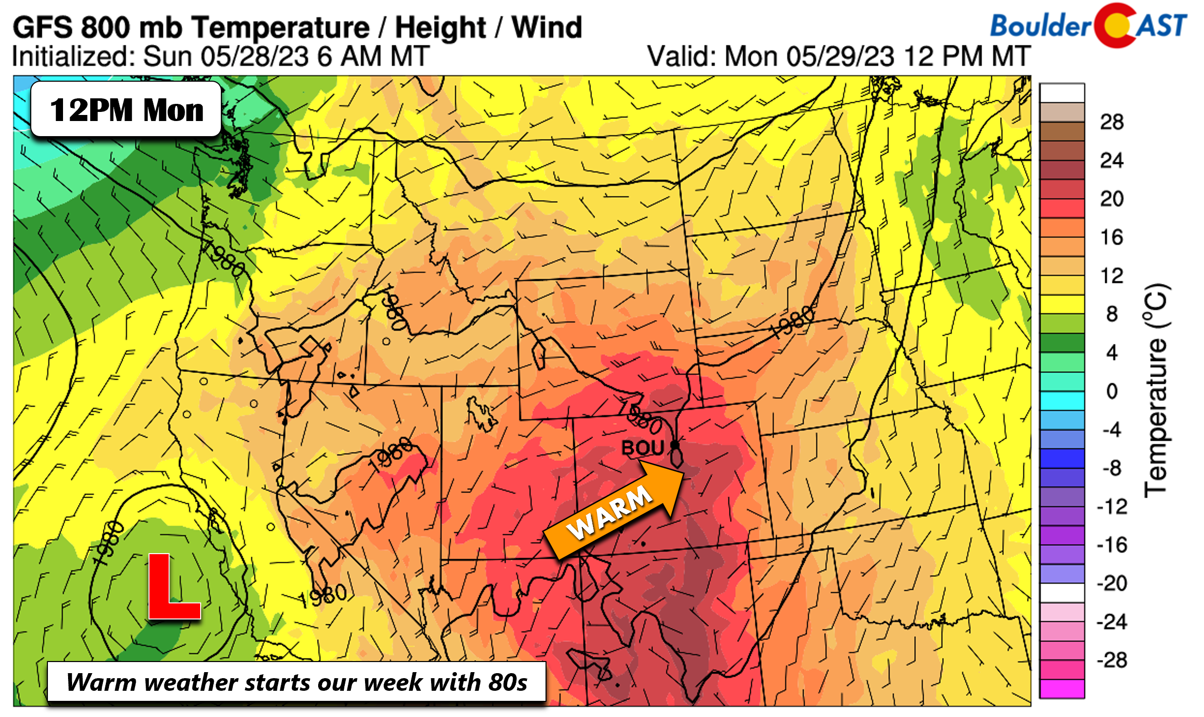
The last few days of May will end with highs in the low to middle 80s. A ridge of high pressure over south-central New Mexico will allow for mostly sunny skies on Memorial Day. There is a chance of some isolated afternoon/evening storms, but most activity should reside over eastern Colorado and the central Plains. Also on the map below is a closed upper-low offshore from central California. This system will be a weather-maker for us during the mid- to late-week period. The month of June will begin with better wet weather chances.
The airmass for the next few days will be quite warm, enough to push us into the low to middle 80s for high temperatures both Monday and Tuesday. If you are grilling something for the Memorial Day holiday, you should have no real weather issues!
For those participating in the 2023 Bolder Boulder 10K Monday morning, the weather wll be ideal for running, though it will be warming up quickly for the later runners/walkers!
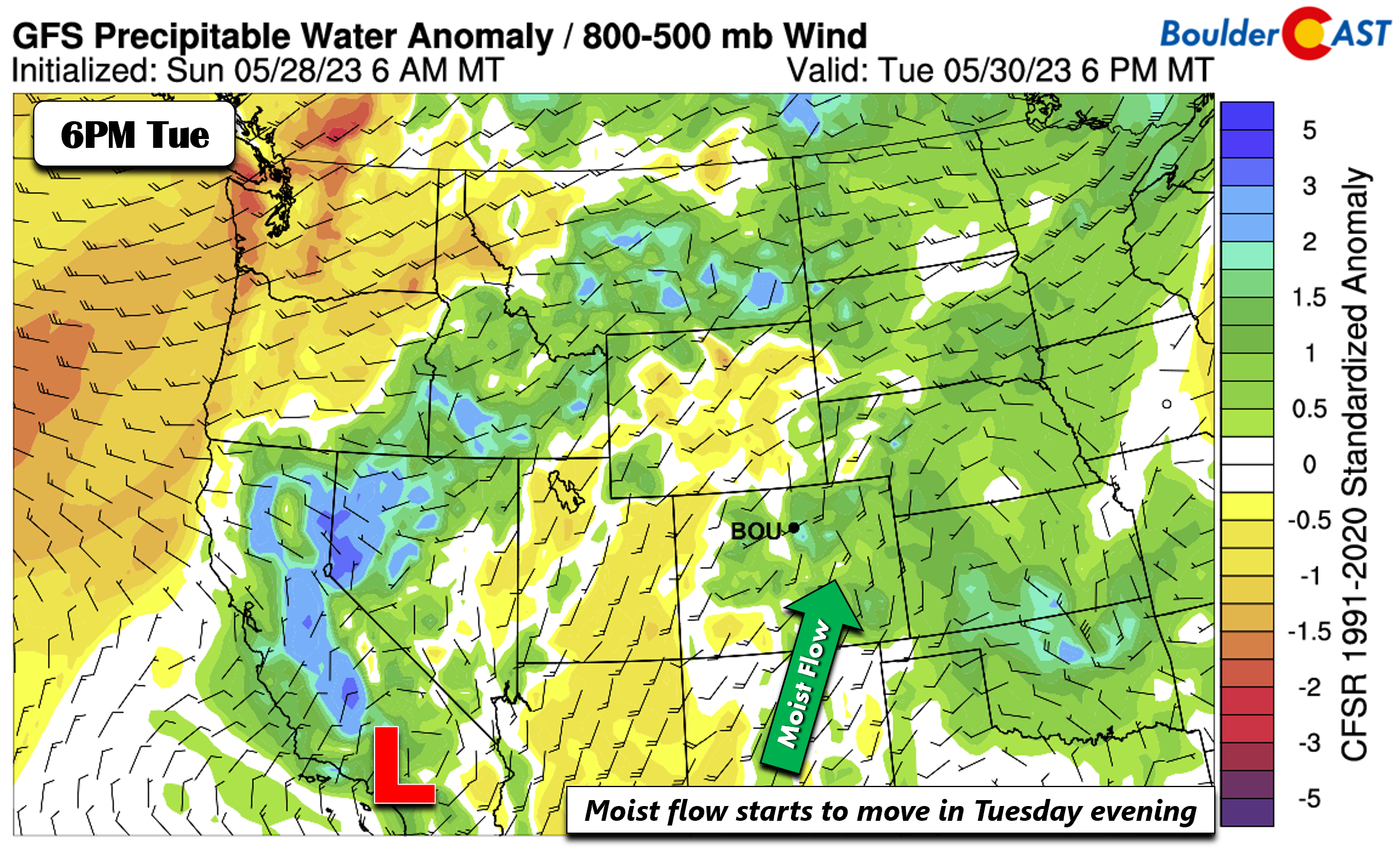
By Tuesday afternoon/evening, moisture from the closed low to our southwest will start to partially move into the area. This should favor an uptick in storm chances Tuesday at about 20%.
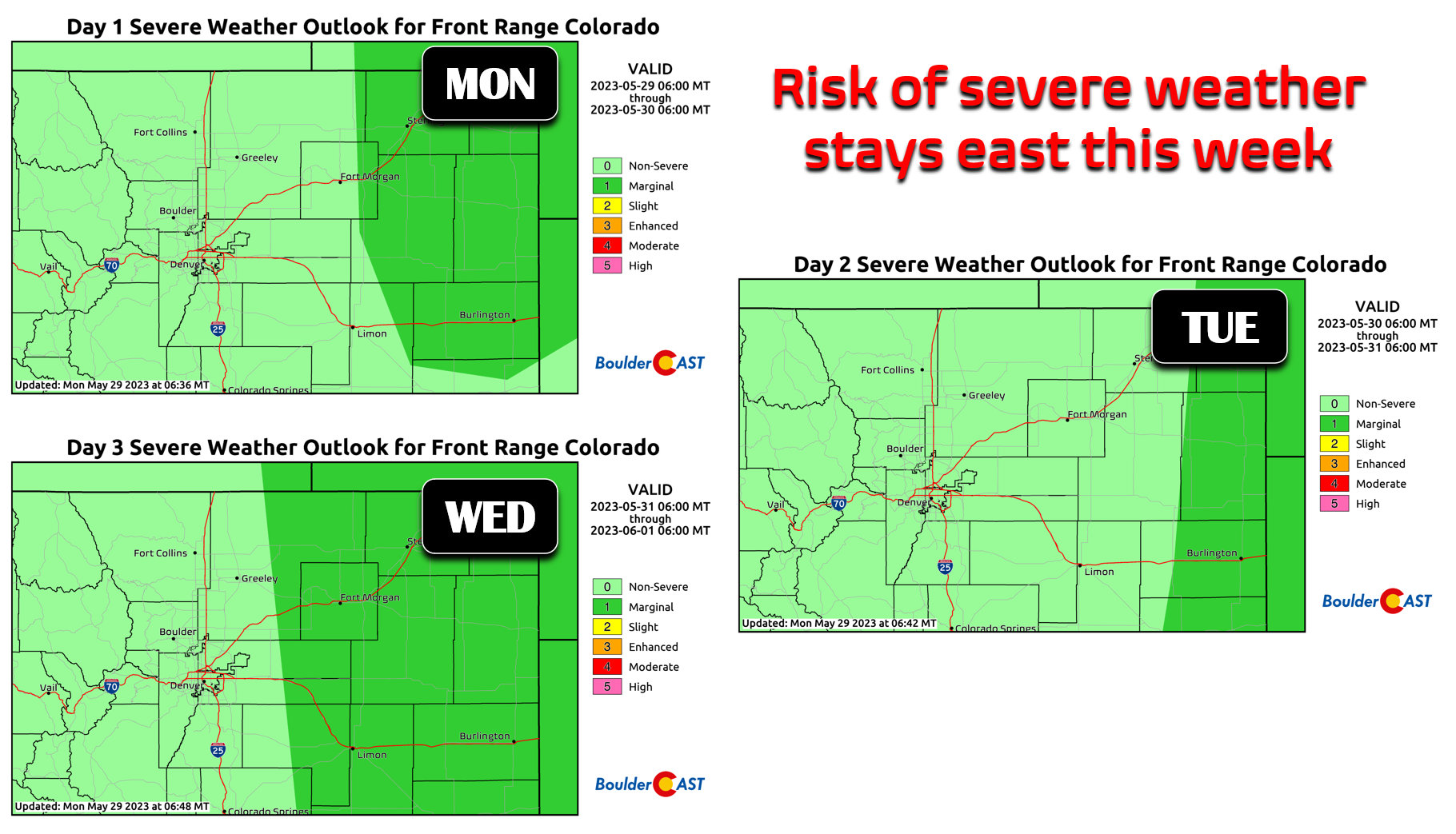
There is a minor severe threat but that will stay east of the Denver Metro for the most part. The Storm Prediction Center currently highlights portions of northeast Colorado for a Slight Risk of severe storms each day through Wednesday. Denver and Boulder are currently not included in this risk.
Increasing chances of unsettled weather Wednesday onward
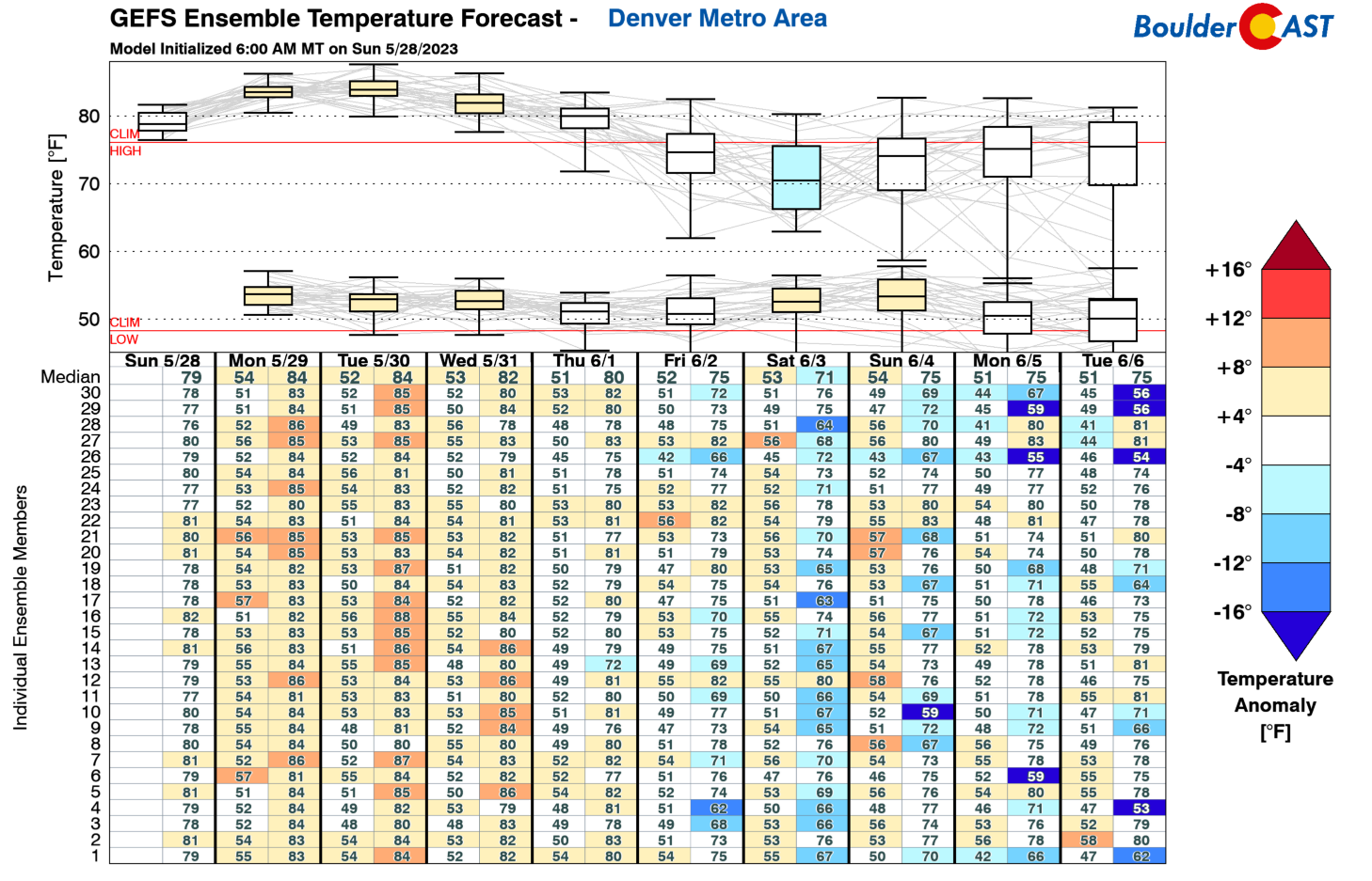
Going into midweek and into early June, there will be a slow downward trend of highs from the 80s into the low/middle 70s come Friday.
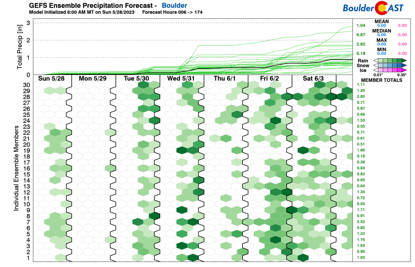
The reason for the slow downward jog in highs is the uptick in storm chances and clouds. Though, looking at the GEFS, there is still a fair bit of uncertainty given that several members are still somewhat dry. Part of this uncertainty may be from the impact that surface downslope flow could play in limiting storm chances.
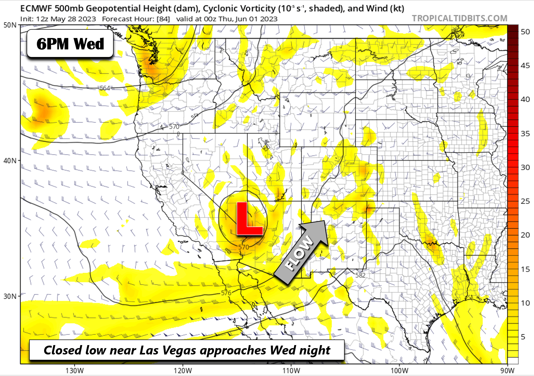
The closed low to our southwest will be making its way into the Intermountain West come Wednesday, seen below over Las Vegas by Wednesday evening. This further east location from Monday will increase moisture overall to bump up our storm chances.
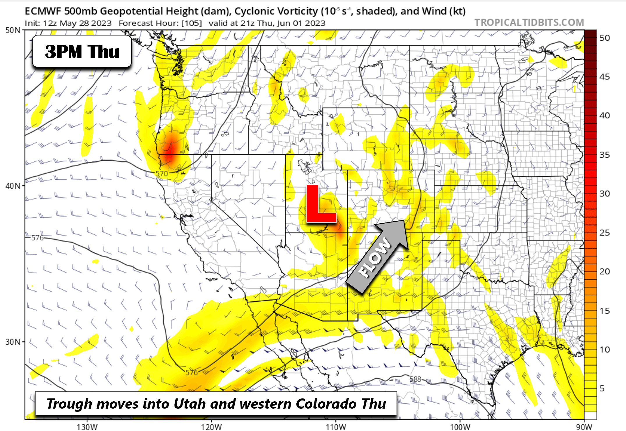
By Thursday, the system becomes an open wave and weakens slightly, but is expected to be centered over southeast Utah — a decent blob of lift/moisture will be over the state of Colorado.
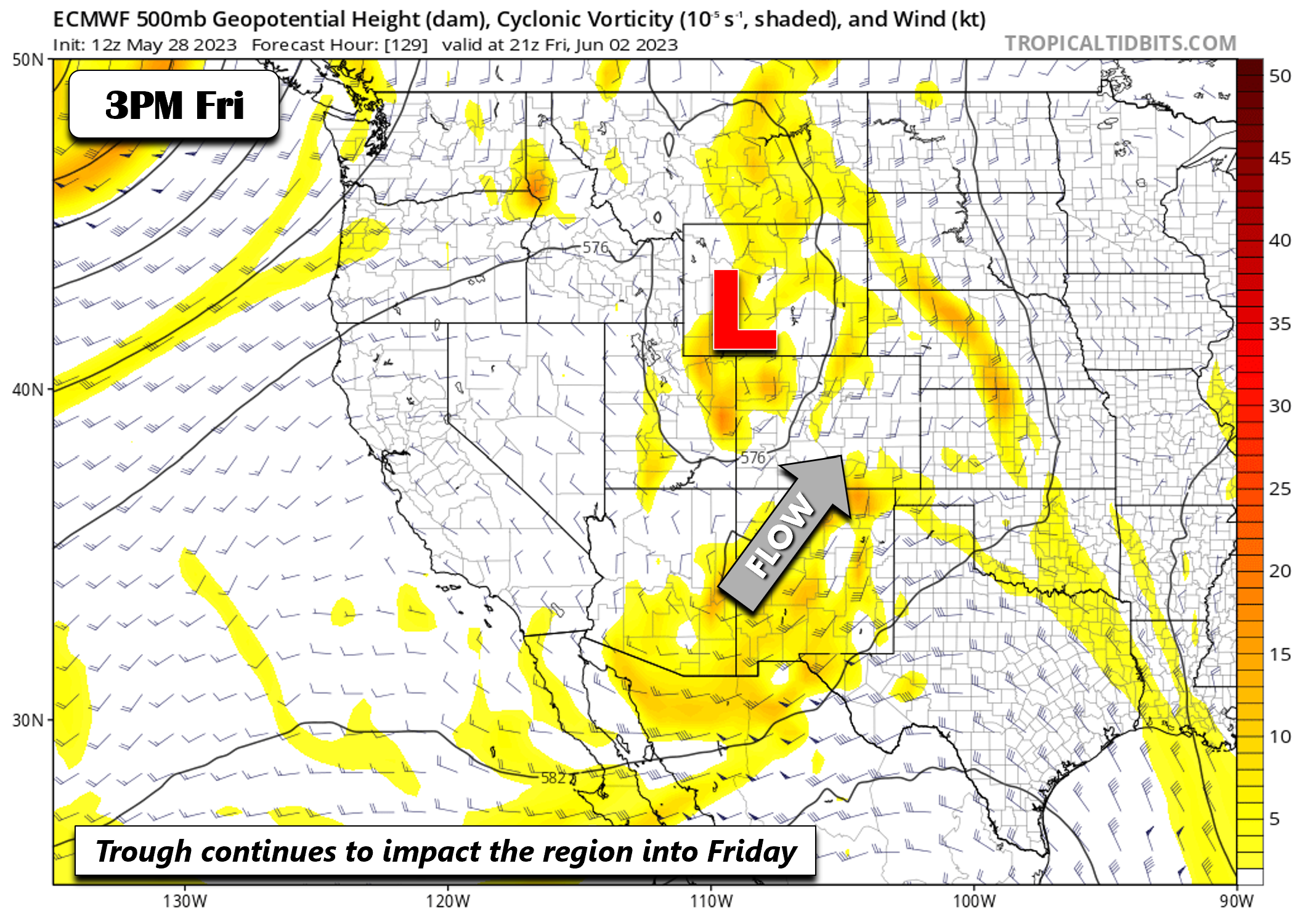
By Friday, though its track at this point more uncertain, the system may be someplace near southwest Wyoming. While the moisture surge is still there, there is some uncertainty as to whether downslope flow will limit storm chances in the Front Range.
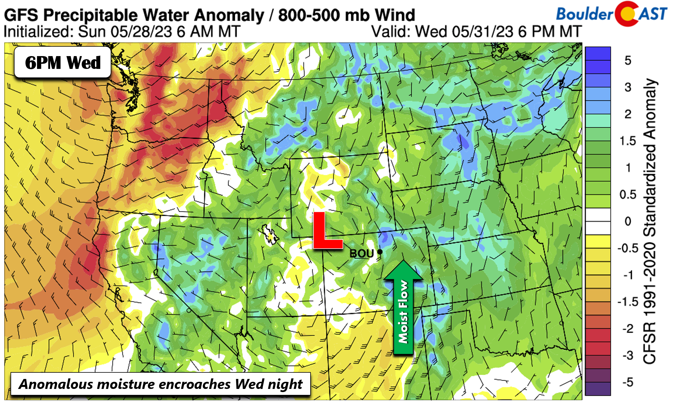
Now let’s look at the precipitable water (moisture) anomalies. The corresponding pattern for the approach of the system will be as follows. Come Wednesday night, with the system getting closer, an increased flux of moisture will build into the state.
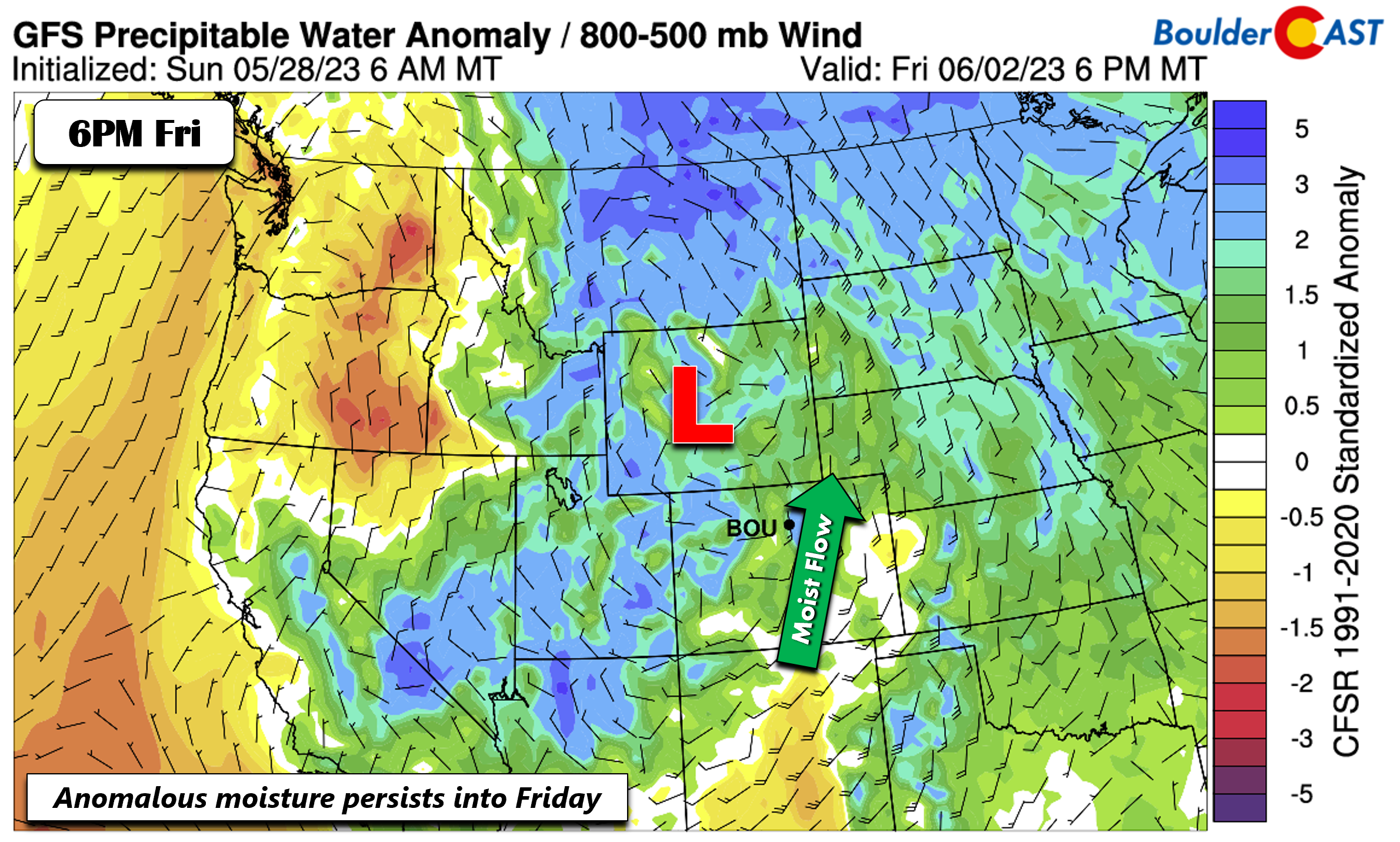
That moisture flux persists Thursday, but may eventually focus primarily to our north and east come Friday night, though some models are slower than the GFS below.
The overall impact from this cutoff low from Wednesday into Friday will be the increased probability of afternoon/evening scattered showers and storms alongside more clouds and cooler temperatures. Although downslope flow may limit our storm chances to some degree, we still expect chances of rain during this time in the 30 to 50% range. This persistent deep surge of southerly winds this week will also help to keep the Canadian wildfire smoke away from Colorado. We’re not expecting any return of (Canadian) smoke in our extended.
Enjoy the short week!
Forecast Specifics:
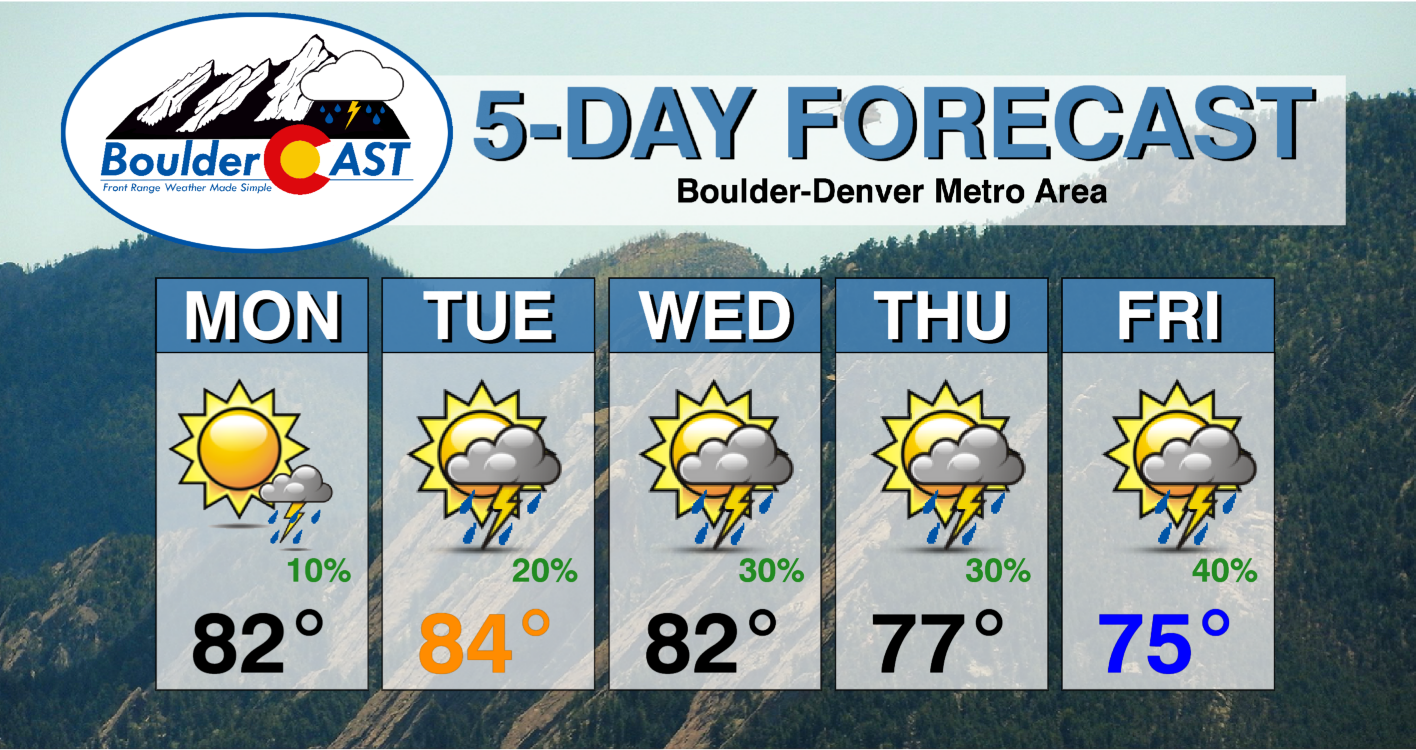
Monday: Mostly sunny, then a very slight chance of afternoon/evening isolated storms, mainly north of Boulder. Highs in the low to middle 80s for the Plains and low 70s in the Foothills.
Tuesday: Partly cloudy, then a chance of isolated/ to widely scattered afternoon/evening storms. Highs in the middle 80s on the Plains and lower 70s in the Foothills.
Wednesday: Increasing clouds with a 30-40% chance of afternoon/evening scattered storms. Highs in the lower 80s on the Plains and near 70 in the Foothills.
Thursday: Partly sunny with a 30-40% chance of afternoon/evening scattered storms. Highs in the upper 70s on the Plains and upper 60s in the Foothills.
Friday: Partly sunny with a 40% chance of scattered showers and storms and highs in the mid to upper 70s for the Plains and middle 60s in the Foothills.
DISCLAIMER: This weekly outlook forecast is created Monday morning and covers the entire upcoming week. Accuracy will decrease as the week progresses as this post is NOT updated. To receive daily updated forecasts from our team, among many other perks, subscribe to BoulderCAST Premium.
Daily Forecast Updates
Get our daily forecast discussion every morning delivered to your inbox.
All Our Model Data
Access to all our Colorado-centric high-resolution weather model graphics. Seriously — every one!
Ski & Hiking Forecasts
6-day forecasts for all the Colorado ski resorts, plus more than 120 hiking trails, including every 14er.
Smoke Forecasts
Wildfire smoke concentration predictions up to 72 hours into the future.
Exclusive Content
Weekend outlooks every Thursday, bonus storm updates, historical data and much more!
No Advertisements
Enjoy ad-free viewing on the entire site.
Get BoulderCAST updates delivered to your inbox:
Enjoy our content? Give it a share!






You must be logged in to post a comment.