After a cool and wet weekend, this week starts out with a trend toward the drier and warmer side as a departing trough will give way to ridging across the Rockies. While chances of showers and storms will exist each and every day, the best chance won’t arrive until later in the week as a cold front and deep trough dig down from the north on Thursday. This front could also bring the threat of heavy rainfall, flash flooding, and a slight risk of severe weather to eastern Colorado. Temperatures will tumble back below normal to end the week.
This week’s highlights include:
- Warmer and drier for the most part to begin the week
- Chances of rain/storms will exist each day, in the extended but the best chances are favoring Thursday and Friday
- The threat of excessive rainfall and sever weather will exist Thursday with a strong cold front entering the picture
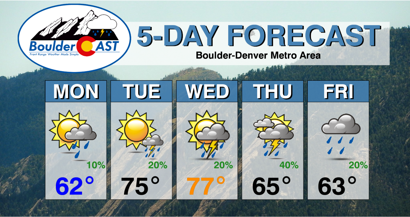
- Highs in the 60s to start the week, followed by 70s to near 80 by midweek, then trending cooler by Friday back into the 60s
DISCLAIMER: This weekly outlook forecast is created Monday morning and covers the entire upcoming week. Accuracy will decrease as the week progresses as this post is NOT updated. To receive daily updated forecasts from our team, among many other perks, subscribe to BoulderCAST Premium.
Daily Forecast Updates
Get our daily forecast discussion every morning delivered to your inbox.
All Our Model Data
Access to all our Colorado-centric high-resolution weather model graphics. Seriously — every one!
Ski & Hiking Forecasts
6-day forecasts for all the Colorado ski resorts, plus more than 120 hiking trails, including every 14er.
Smoke Forecasts
Wildfire smoke concentration predictions up to 72 hours into the future.
Exclusive Content
Weekend outlooks every Thursday, bonus storm updates, historical data and much more!
No Advertisements
Enjoy ad-free viewing on the entire site.
Warmer and somewhat drier to start the week
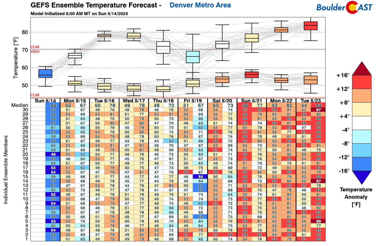
Awarmer trend is in store for the beginning of the week . We will have to get past Monday to see the true warmth, but it’s on the way nonetheless. The image below shows the GEFS temperature trend for the Denver Metro area. After another day of below normal temps today in the 60s, we should see a nice warm-up into the upper 70s to maybe even lower 80s Tuesday/Wednesday. A return to cooler weather comes by late in the week as a cold front slides down into the area from the north.
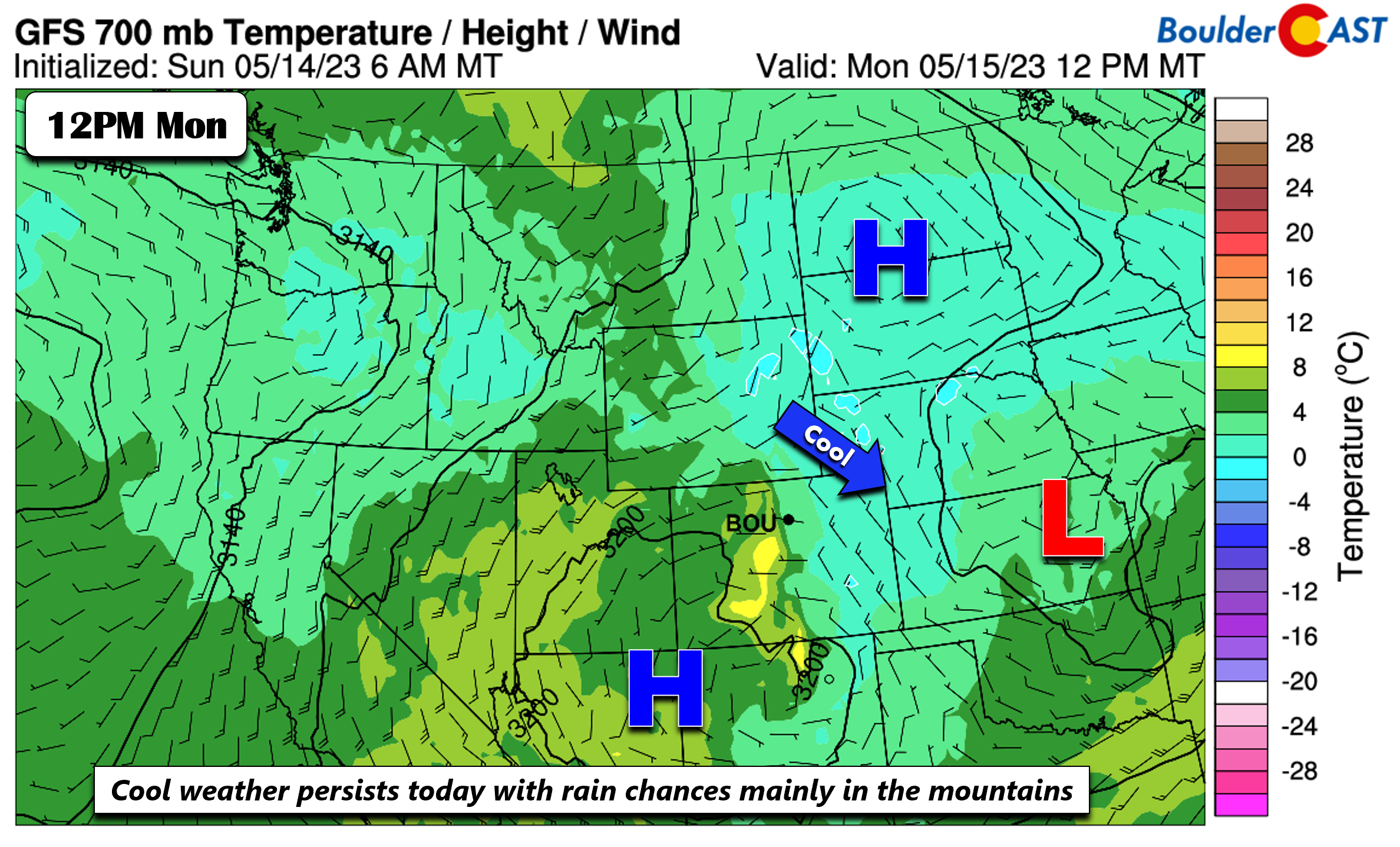
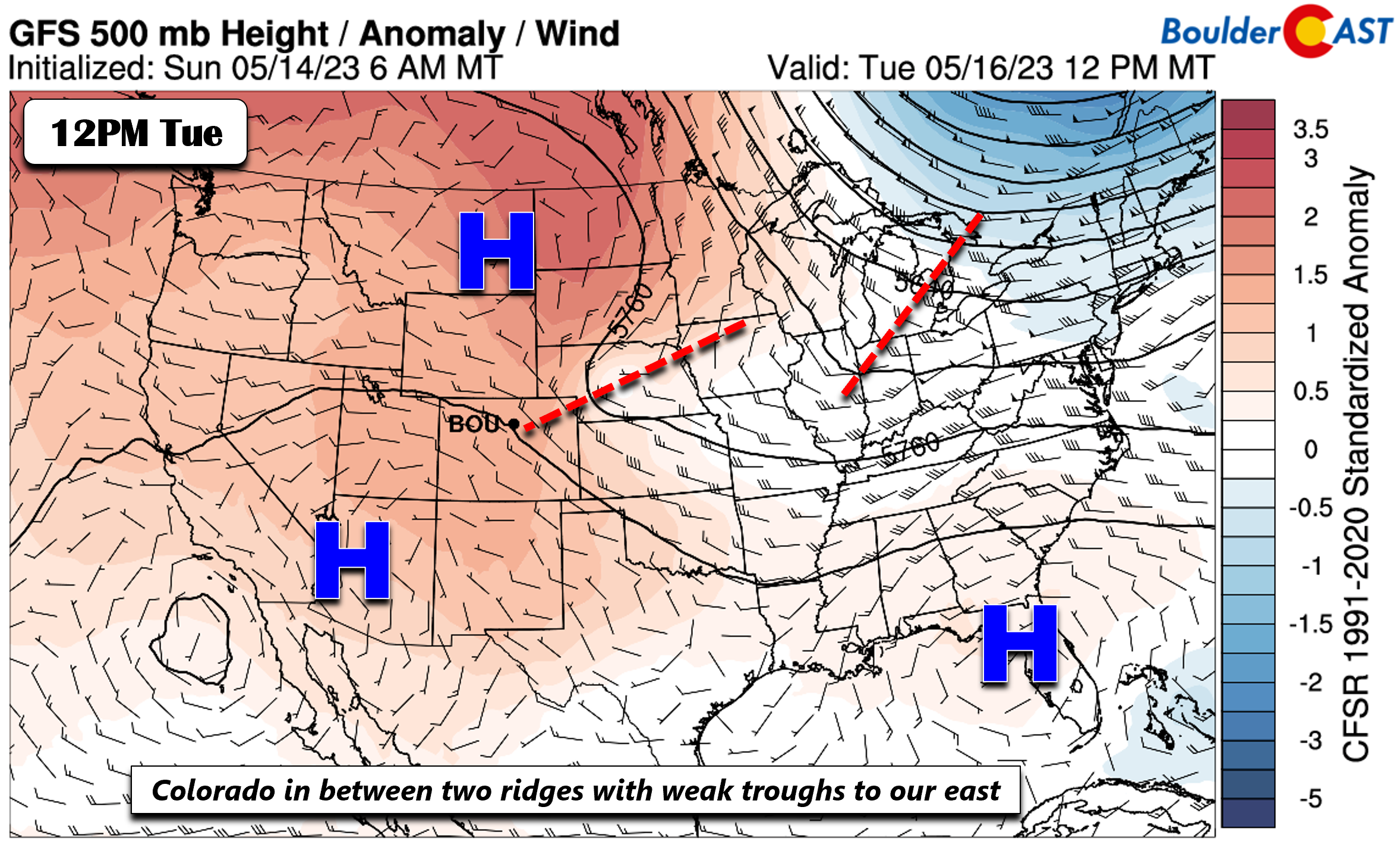
Monday will feature that pesky trough which brought us rain Sunday and overnight. It has weakened and is currently located over Kansas. In its wake as it slides east again today, high pressure will flank Colorado over the Dakotas and the Four Corners. A weak downslope flow will ensue with time, favoring some drying and increasingly sunny skies Monday. While there is a threat of some showers in the afternoon/evening (and fog/drizzle in the morning), the main activity will stay largely over the higher terrain where the instability is greatest. Monday’s rain chances are about 20%.
The ridge to our north and also to our southwest Monday will largely stay in place through Tuesday. However, a weak trough axis will drift southeast during the afternoon hours. Afternoon showers/storms will again persist in the higher terrain and could drift on the Plains Tuesday afternoon/evening in the northwest flow aloft. However, instability will also remain limited such that storm chances for us will hover near 20% again. Despite this continued rain chance, we’ll see a nice warm-up into the 70s for Tuesday.
Trending cooler with increasing rain/storm chances by late-week
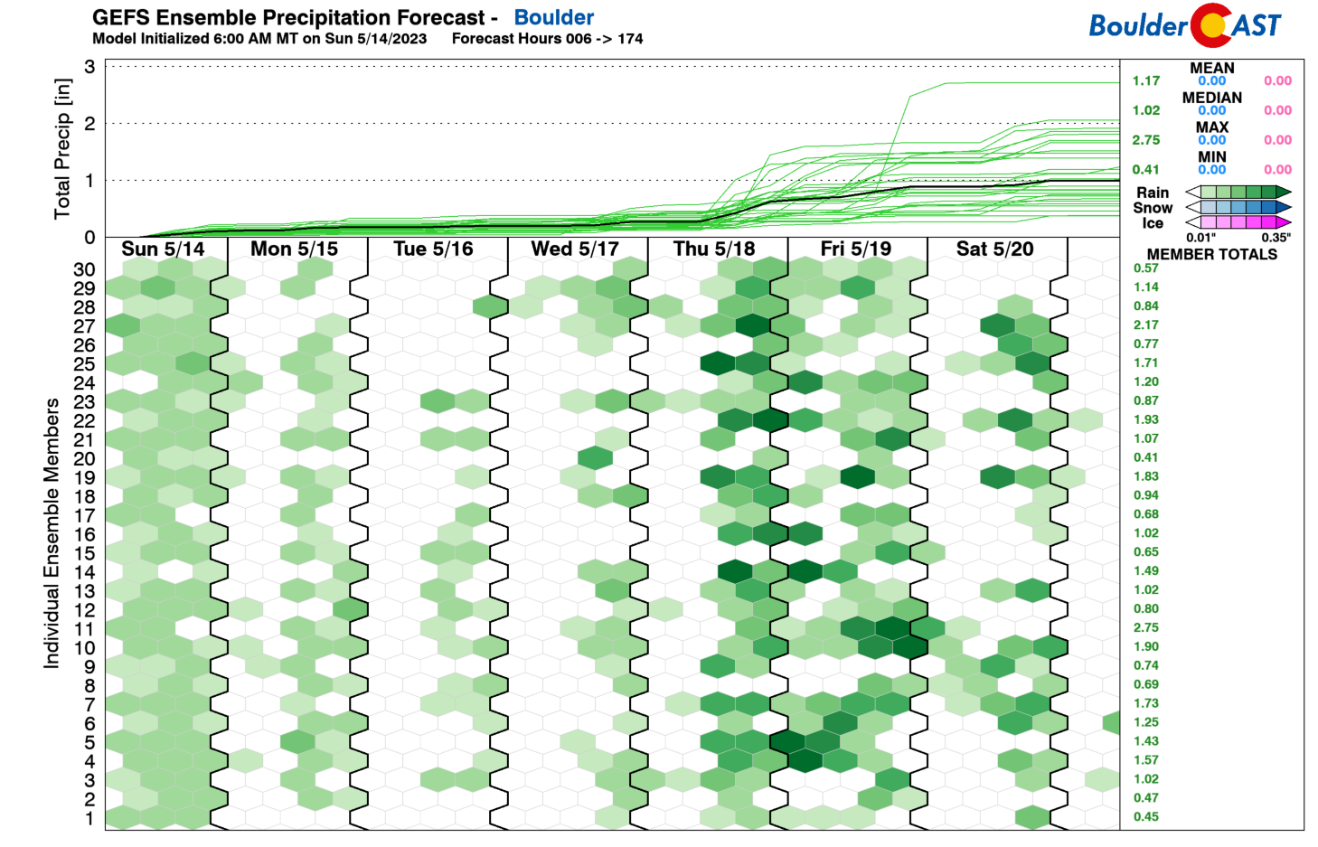
The warmer weather continues Wednesday, but rain chances increase, even more so Thursday and potentially Friday as well. The ensemble data from a collection of the GEFS and Euro members show that rain and storm chances appear highest Thursday and Friday, although Wednesday will see a slight uptick as well. Let’s break it down why that is the case…
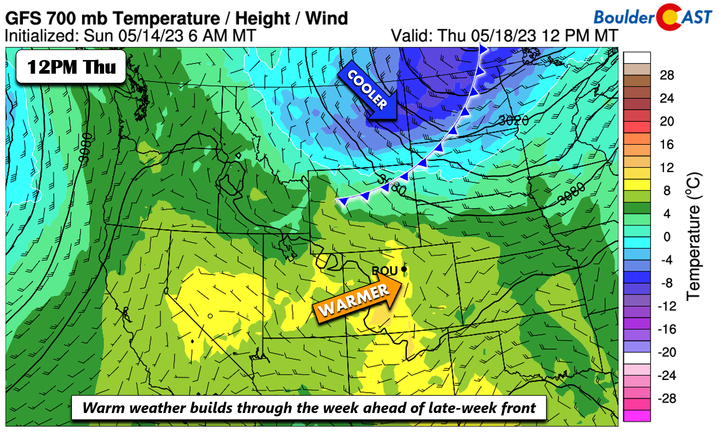
High temperatures on Wednesday could be our warmest day with upper 70s to some lower 80s. A 20-30% chance of afternoon/evening showers/storms will exist but again most storm activity should reside in the Foothills and Mountains. Come Thursday, most model guidance shows a cold front over Montana and Wyoming that will start to approach Thursday night.
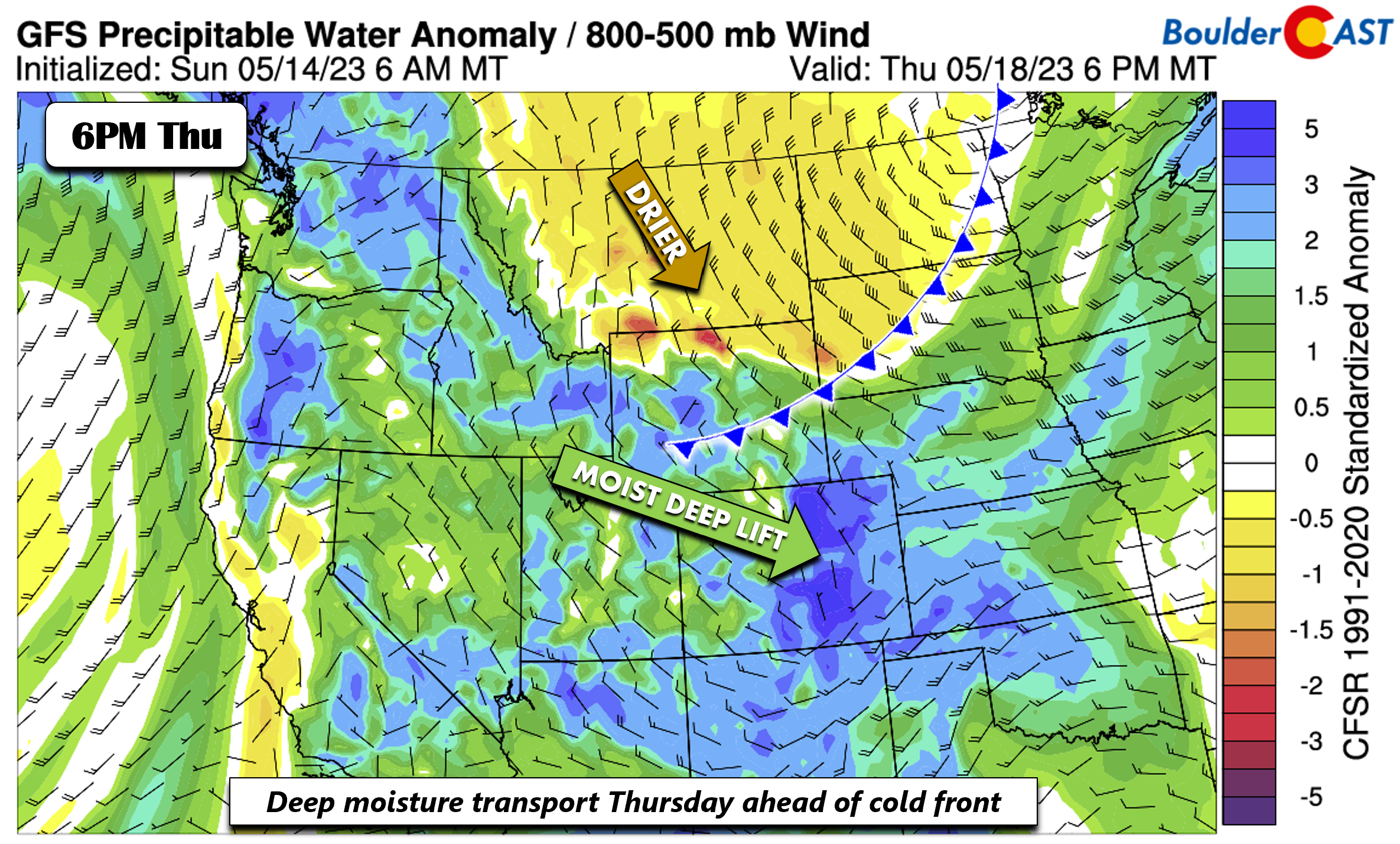
Ahead of the front, deep moisture transport and precipitable water values exceeding 4-5 standard deviations above normal will be present over eastern Colorado.
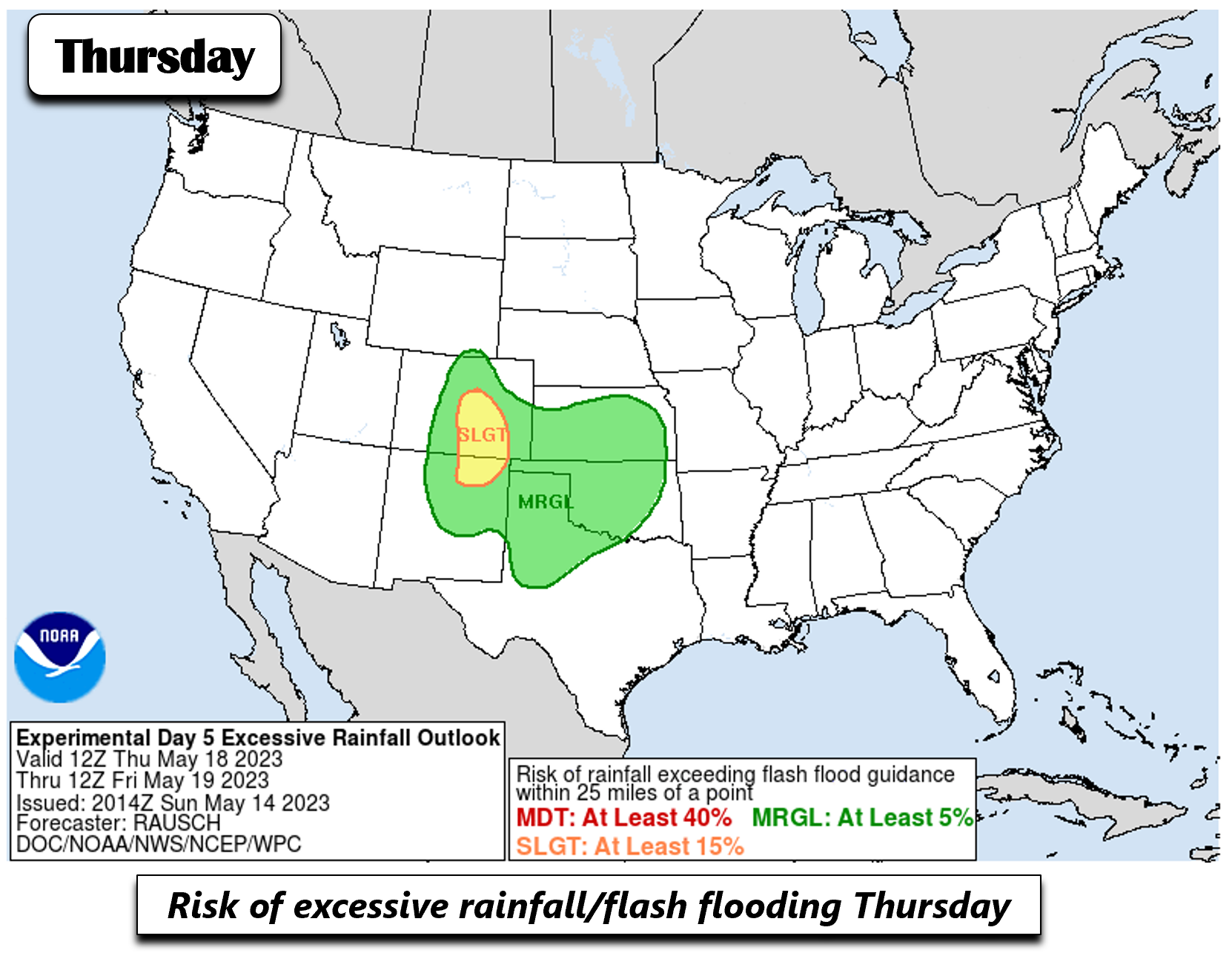
The setup will make for a good threat of showers and storms. As is no surprise then, the Weather Prediction Center has introduced a slight risk of excessive rainfall and flash flooding from Denver southward through Pueblo Thursday into early Friday with the deep moisture, lift, instability and forcing ahead of the front. We’ll need to watch this closely as the week progresses. Things can still change, but this will likely be our main weather impact day this week!
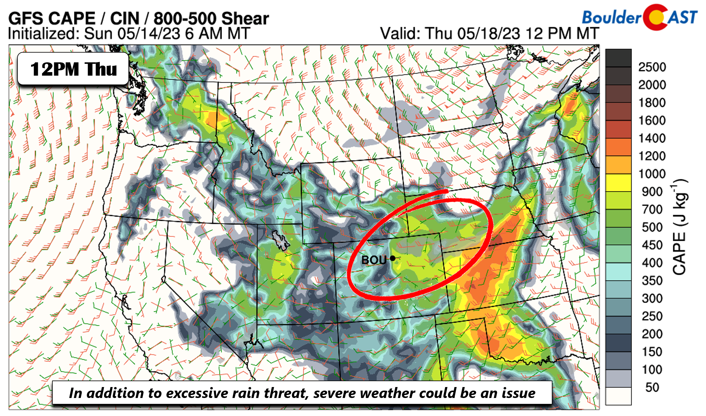
In addition to the potential flash flood risk on Thursday, there could also be a severe threat with instability values approaching 1000 J/kg of CAPE. Shear is rather marginal but we would not be surprised if some stronger storms could produce strong downdrafts and 1″ hail.
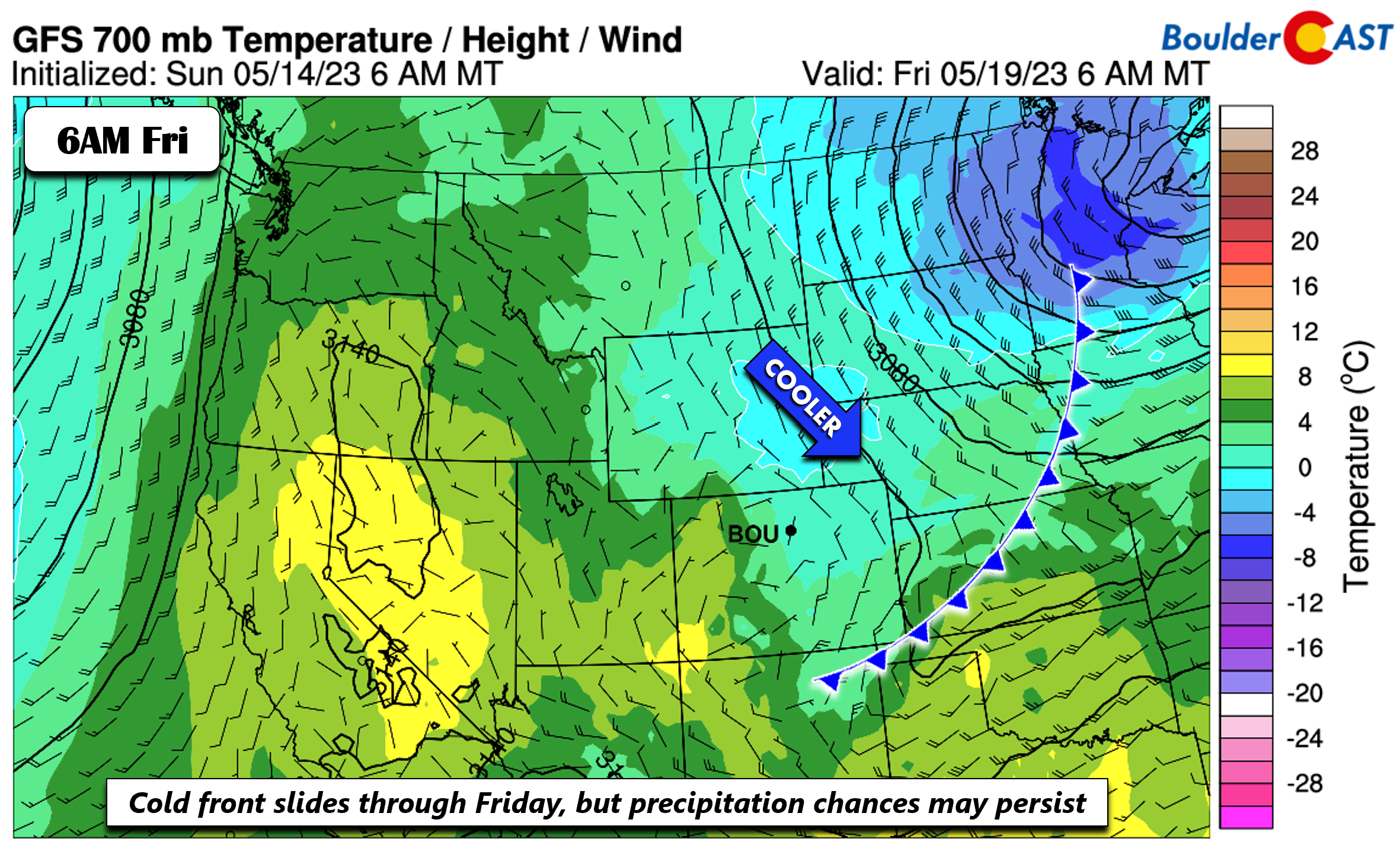
We should see low to mid 70s Thursday ahead of the front, but the passage of the cold front, currently slated in the models for early Friday, would favor a trend to below normal by week’s end in the middle 60s. Even with the passage of the front Friday, surface upslope and moisture could still favor a chance of afternoon/evening showers, though we would not be surprised if the end of the week trends drier — with the best chance of rain again being over the High Country.
Forecast Specifics:
Monday: Morning fog and drizzle, the partly sunny with isolated afternoon/evening showers or storms redeveloping, mainly over the higher terrain. Highs in the low to middle 60s for the Plains and lower 50s in the Foothills.
Tuesday: Mostly sunny with a widely scattered chance of afternoon/evening showers and storms, mainly across the higher terrain. Highs warmer in the middle to upper 70s for the Plains and middle 60s in the Foothills.
Wednesday: Increasing clouds with a widely scattered afternoon/evening scattered storms. Highs in the upper 70s to near 80 for the Plains and upper 60s in the Foothills.
Thursday: Partly to mostly cloudy with a scattered to widespread showers and storms in the evening, mainly south and southwest of Denver. Storms could produce heavy rainfall, gusty winds, and hail. Highs in the middle 60s for the Plains and middle 50s in the Foothills.
Friday: Mostly cloudy with widely scattered afternoon showers. Highs in the low to middle 60s for the Plains and low to middle 50s in the Foothills.
DISCLAIMER: This weekly outlook forecast is created Monday morning and covers the entire upcoming week. Accuracy will decrease as the week progresses as this post is NOT updated. To receive daily updated forecasts from our team, among many other perks, subscribe to BoulderCAST Premium.
Daily Forecast Updates
Get our daily forecast discussion every morning delivered to your inbox.
All Our Model Data
Access to all our Colorado-centric high-resolution weather model graphics. Seriously — every one!
Ski & Hiking Forecasts
6-day forecasts for all the Colorado ski resorts, plus more than 120 hiking trails, including every 14er.
Smoke Forecasts
Wildfire smoke concentration predictions up to 72 hours into the future.
Exclusive Content
Weekend outlooks every Thursday, bonus storm updates, historical data and much more!
No Advertisements
Enjoy ad-free viewing on the entire site.
Get BoulderCAST updates delivered to your inbox:
Enjoy our content? Give it a share!




You must be logged in to post a comment.